Bald Knob Road - FS 152
Total Miles
2.7
Technical Rating
Best Time
Spring, Summer, Fall, Winter
Trail Type
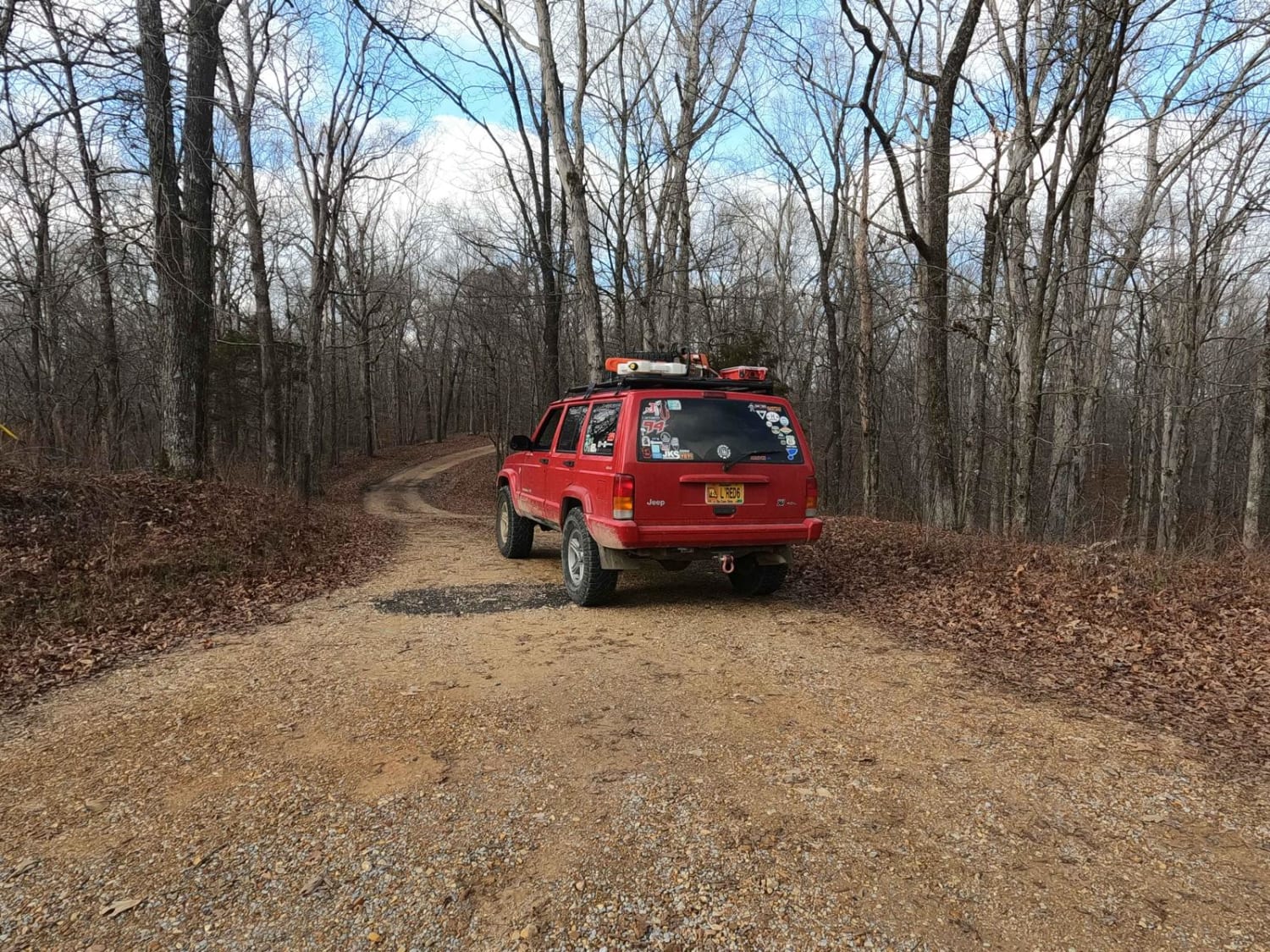
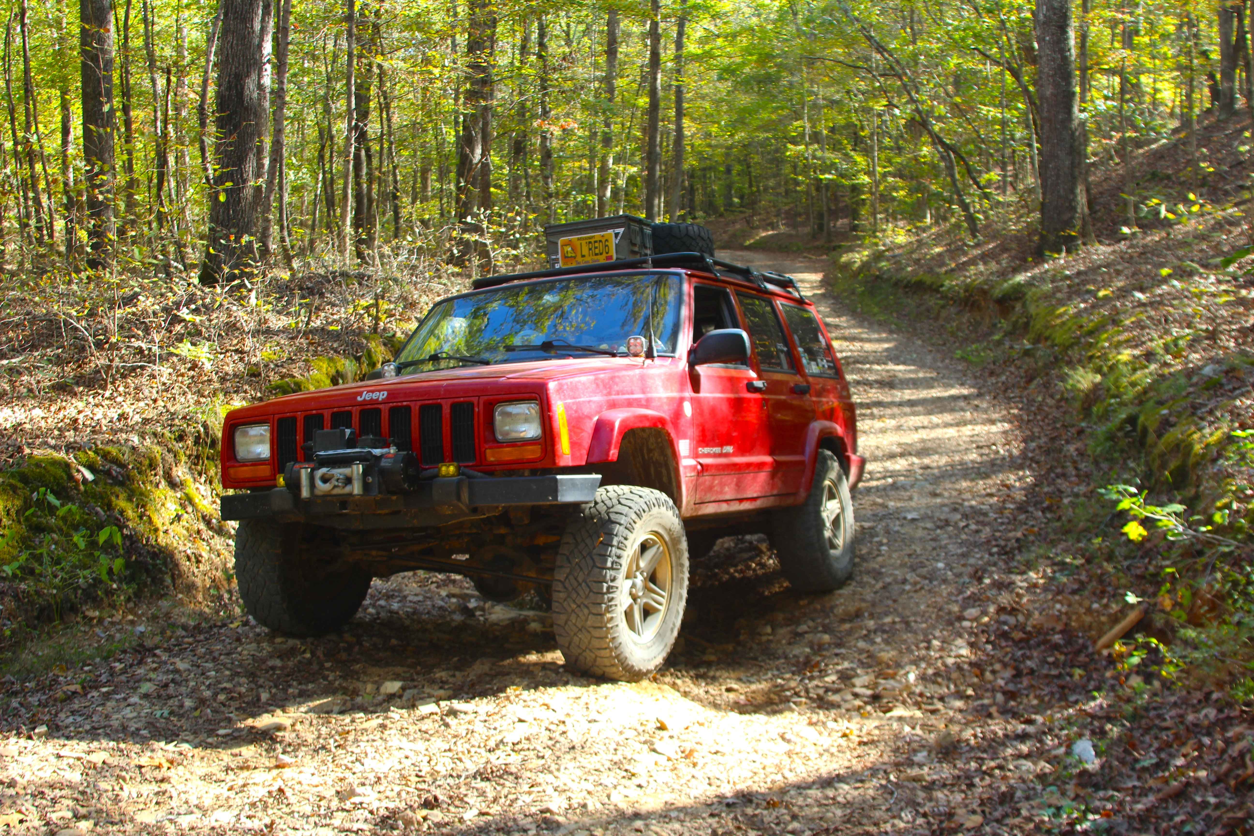
Full-Width Road
Accessible By
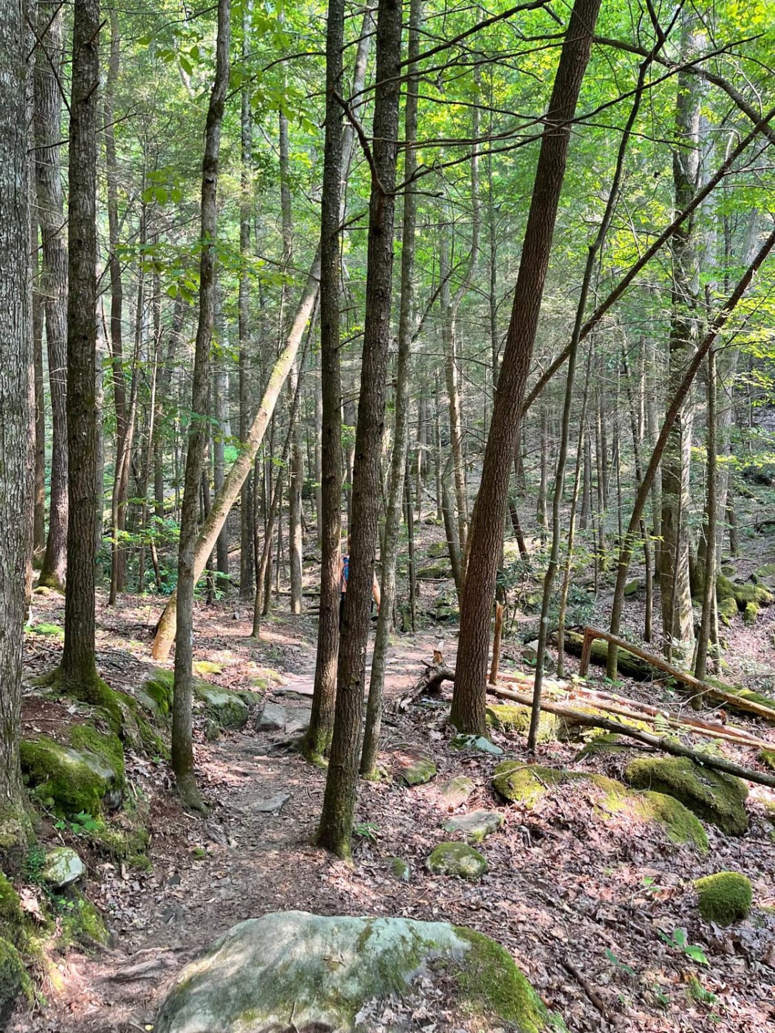
Trail Overview
Bald Knob Road FS 152 is a natural forestry route through the center east Kentucky section, Lake Barkley side, of the Land Between the Lakes National Recreation Area. The route at its foundation is coarse natural gravel over a dirt base trail, featuring consistent up-and-down mild-graded hills with water collection and mud holes in the valleys and flats with mild erosion ruts on the grades. In some sections, the trail surface turns to solid dirt, which when wet turns to clay-like surface mud. The namesake and former use of this trail come from the high elevation point called Bald Knob, found at 36.82479, -88.02972. At one point in time, the Bald Knob fire tower was placed right off the trail at 36.82521, -88.02986, where foundation piers can still be seen, but the tower itself has since been moved and reconstructed near Golden Pond Visitor Center in central LBL. Overall, it's a fun little trail that was formerly used for a functional purpose, versus the recreation and historical sense that is now enjoyed.
Photos of Bald Knob Road - FS 152
Difficulty
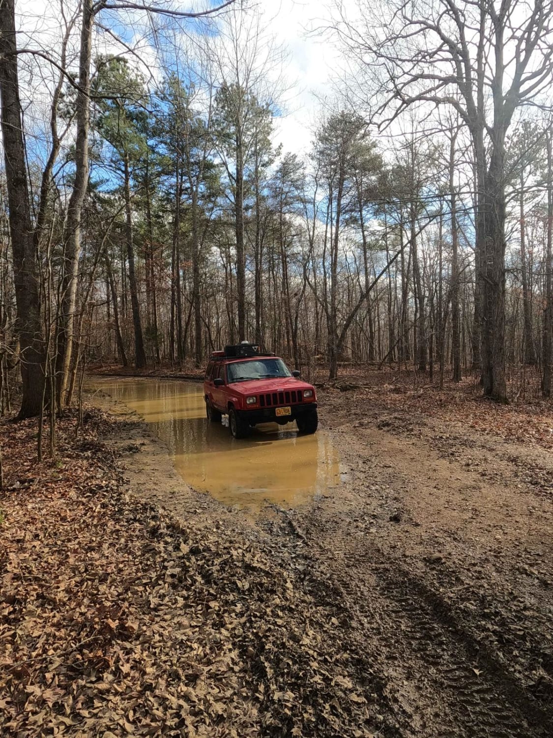
Bald Knob Road features an upper easy track, with portions that will ride like a 2/10, especially if it is dry. In a more average state, it is given a base rating of a low-medium demanding 3/10, due to having medium-elongated water collection and mud holes around 12-16 inches in depth, and mild 12-inch-deep erosion ruts along the mild graded hills, potentially forcing the driver to take a wise choice of line with a low-clearance vehicle. Small loose cobbles (rocks less than 6 inches in diameter, some rarely bigger) may be exposed and randomly laying in the path of the trail, especially on the hills. The coarse natural gravel can fade to dirt in sections and have the potential then to turn to deeply rutted clay mud in wet conditions. Difficulty can increase in times of wet conditions, inclement weather, and heavy use. The water holes and nearby debris show signs of water being at greater depths. If the road was to be mended, it would yield a lower rating.
History
The original use of this trail surrounded the Bald Knob Fire Tower, also known as the Wildland Tower #2. The tower was built by the CCC in 1937, on the then Kentucky Woodlands National Wildlife Refuge, to be managed by a state forestry division. The Tower is an 80-foot Aermotor tower with a 7-foot x7-foot metal cab. Around 1964, the tower was taken down from Bald Knob Road, moved, and reconstructed, right off US-68 at 36.78011, -88.05795 nearby to Golden Pond Visitor Center where it has remained since (as of February 2024). On November 3rd, 2009, the tower was registered in the National Historic Lookout Register, as US 831, KY 7.
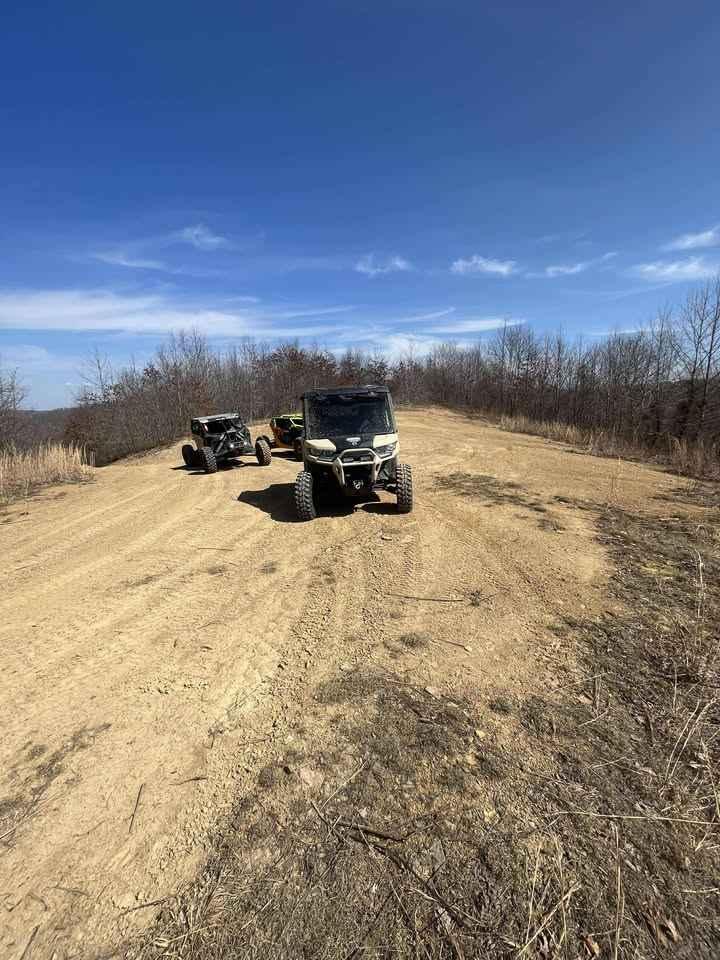
Bald Knob Road - FS 152 can be accessed by the following ride types:
- High-Clearance 4x4
- SUV
Bald Knob Road - FS 152 Map
Popular Trails
Scout Trail - FS 141
Dog Slaughter (FSR 195)
The onX Offroad Difference
onX Offroad combines trail photos, descriptions, difficulty ratings, width restrictions, seasonality, and more in a user-friendly interface. Available on all devices, with offline access and full compatibility with CarPlay and Android Auto. Discover what you’re missing today!