Champlin's Challenge
Total Miles
0.2
Technical Rating
Best Time
Spring, Summer, Fall
Trail Type
Full-Width Road
Accessible By
Trail Overview
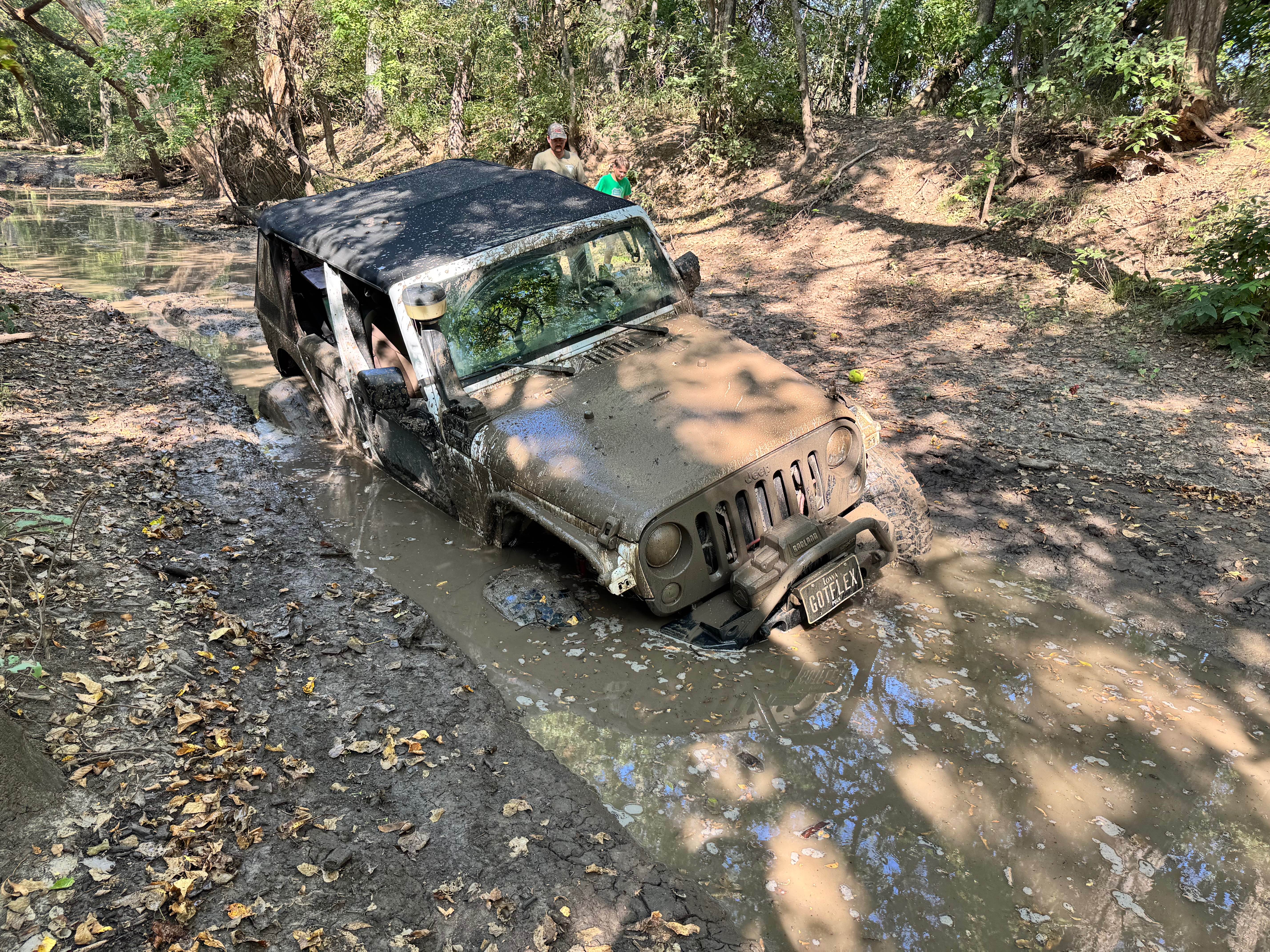
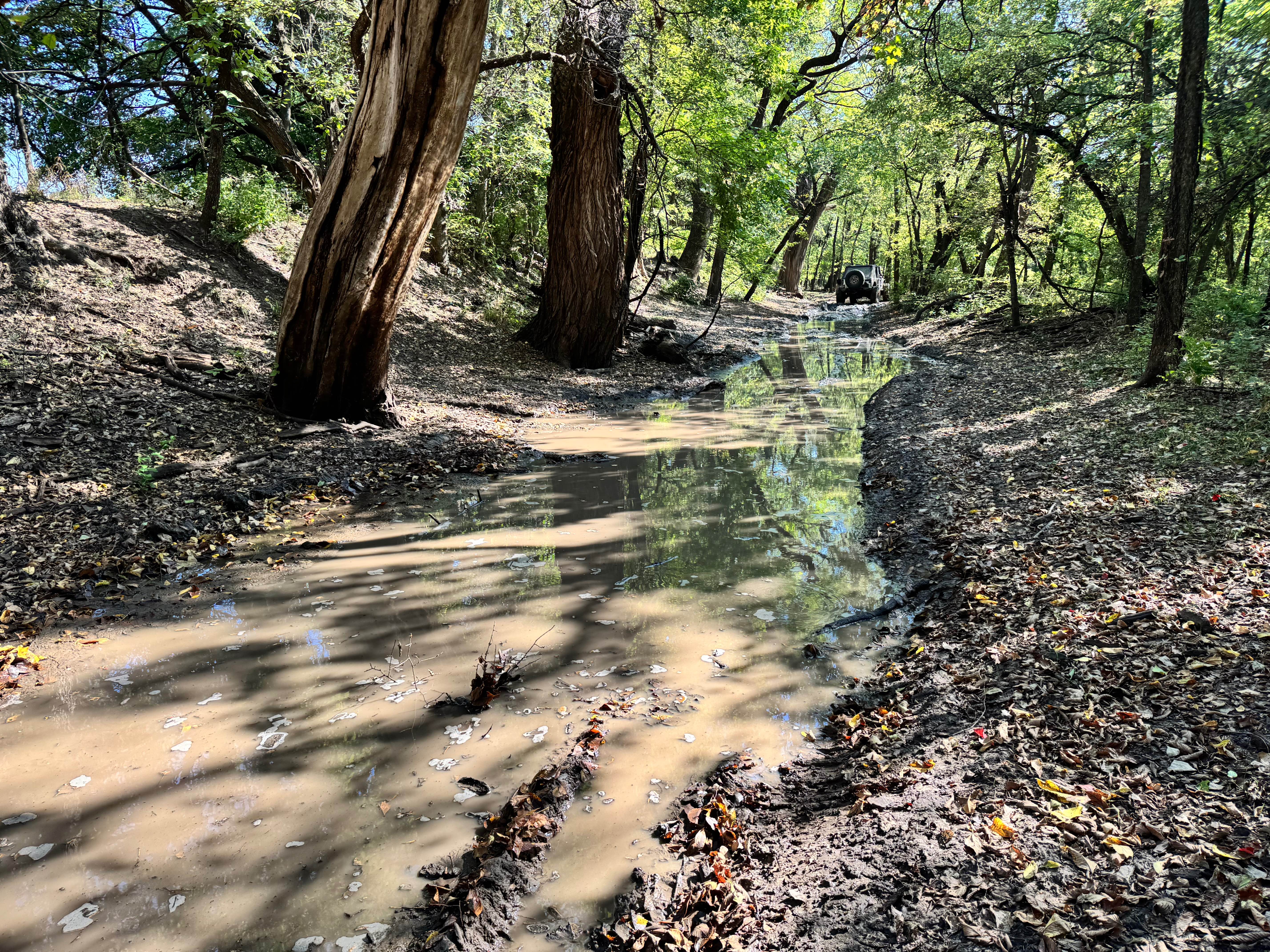
This trail, formally known as BJ Hole, has earned its reputation for a reason. While it might look straightforward at first glance, it features a mud hole capable of swallowing 40-inch tires without hesitation. These deep, thick holes are the primary reason for its higher difficulty rating. The good news is that there are plenty of sturdy trees nearby, providing solid anchor points for self-recovery if things go sideways. There are no hidden rocks lurking in the mud, so some drivers may choose to hit it with speed and see if they can power through. However, caution is still advised, as the mud holes are slightly off-camber, which can throw a rig off balance. This trail is all mud, all commitment.
Photos of Champlin's Challenge
Difficulty
Champlin's Challenge is rated high due to its deep, off-camber mud pits capable of swallowing 40-inch tires. While there are no rocks, the sheer depth and risk of getting buried to your vehicle's axle demand seriously tall tires, traction, horsepower, and recovery gear. This trail is for committed rigs and experienced drivers only.
History
This park was formerly known as Sandy Bottoms, and longtime visitors may still refer to it by that name. The access road and staging area have evolved over time, but it remains a well-known local spot for off-road events and community rides.
Status Reports
Champlin's Challenge can be accessed by the following ride types:
- High-Clearance 4x4
- SUV
- SxS (60")
Champlin's Challenge Map
Popular Trails

Little Blue
Socket Set Spur

Right Out

Foosball
The onX Offroad Difference
onX Offroad combines trail photos, descriptions, difficulty ratings, width restrictions, seasonality, and more in a user-friendly interface. Available on all devices, with offline access and full compatibility with CarPlay and Android Auto. Discover what you’re missing today!