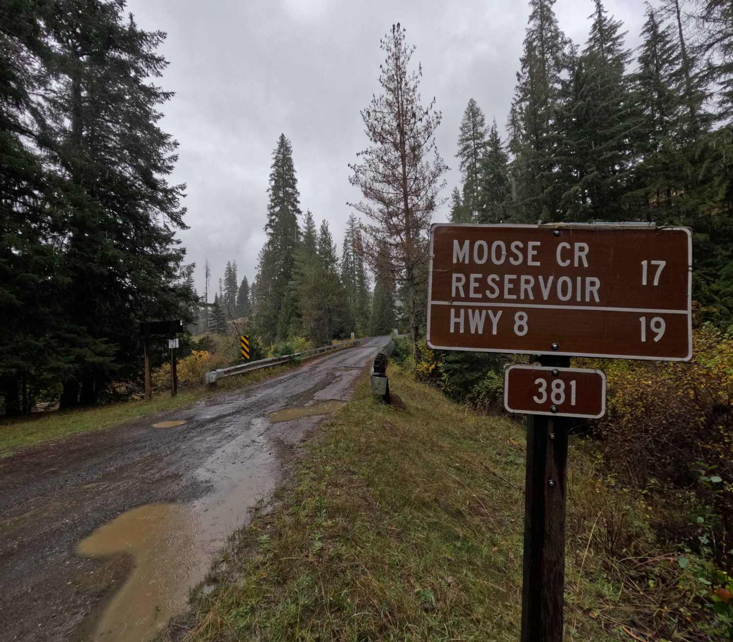
Moose Creek - FS 381
Total Miles
17.8
Technical Rating
Best Time
Spring, Summer, Fall, Winter
Trail Type
Full-Width Road
Accessible By
Trail Overview
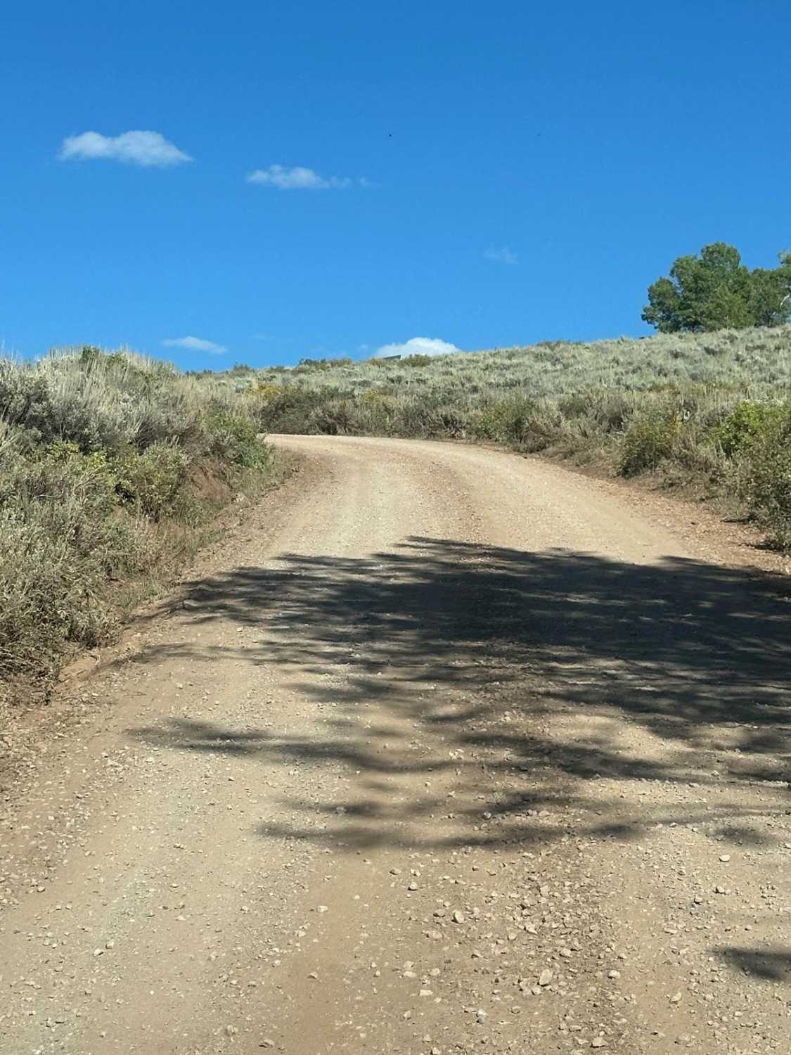
381 Moose Creek is a 17.9-mile point-to-point gravel road. Starting from the west side, Moose Creek begins at an intersection with 447 Palouse River, 4.2 miles east of ID6. Moose Creek is well-traveled and well-maintained, with dozens of dispersed campsites. Beginning at mile 6.5, the trail has some tight switchbacks as it climbs up and over a small pass. The road winds for the next 5.5 miles before widening back out just before mile 12. At mile 12.8, there is an open skills area for dirtbikes, quads, SxS, and 4 Wheel Drives. At mile 16 (or 2 miles west of the intersection with ID3), Moose Creek goes along the bank of Moose Creek Reservoir. The reservoir features several docks, a campground, vault toilets, and garbage receptacles. After leaving the reservoir, Moose Creek continues for two miles before ending at an intersection with ID3. Moose Creek is open year-round.
Photos of Moose Creek - FS 381

Difficulty
Moose Creek is an easy gravel road through the southern Hoodoo Mountains. There may be some shallow ruts and narrow switchbacks. As with any trail in north Idaho, snowfall can vary trail conditions significantly, and always bring a chainsaw or equipment to move fallen logs.
Status Reports
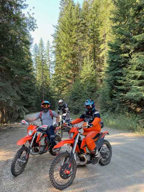
Moose Creek - FS 381 can be accessed by the following ride types:
- High-Clearance 4x4
- SUV
- SxS (60")
- ATV (50")
- Dirt Bike
Moose Creek - FS 381 Map
Popular Trails

Trail Hollow #3368
Hell's Canyon
Arco Pass to Horsethief Spur #5
The onX Offroad Difference
onX Offroad combines trail photos, descriptions, difficulty ratings, width restrictions, seasonality, and more in a user-friendly interface. Available on all devices, with offline access and full compatibility with CarPlay and Android Auto. Discover what you’re missing today!