Middle Fork Shoshone Creek
Total Miles
3.6
Technical Rating
Best Time
Summer, Spring, Fall
Trail Type
Single Track
Accessible By
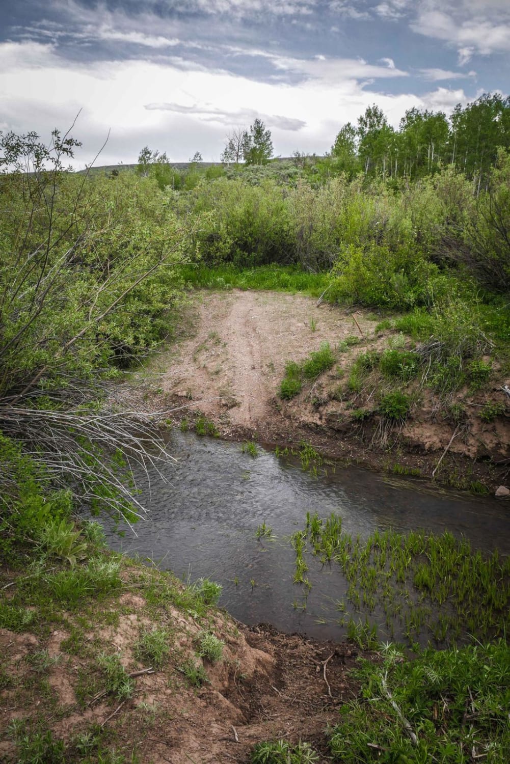
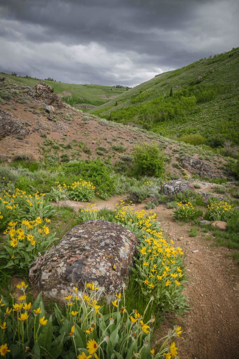
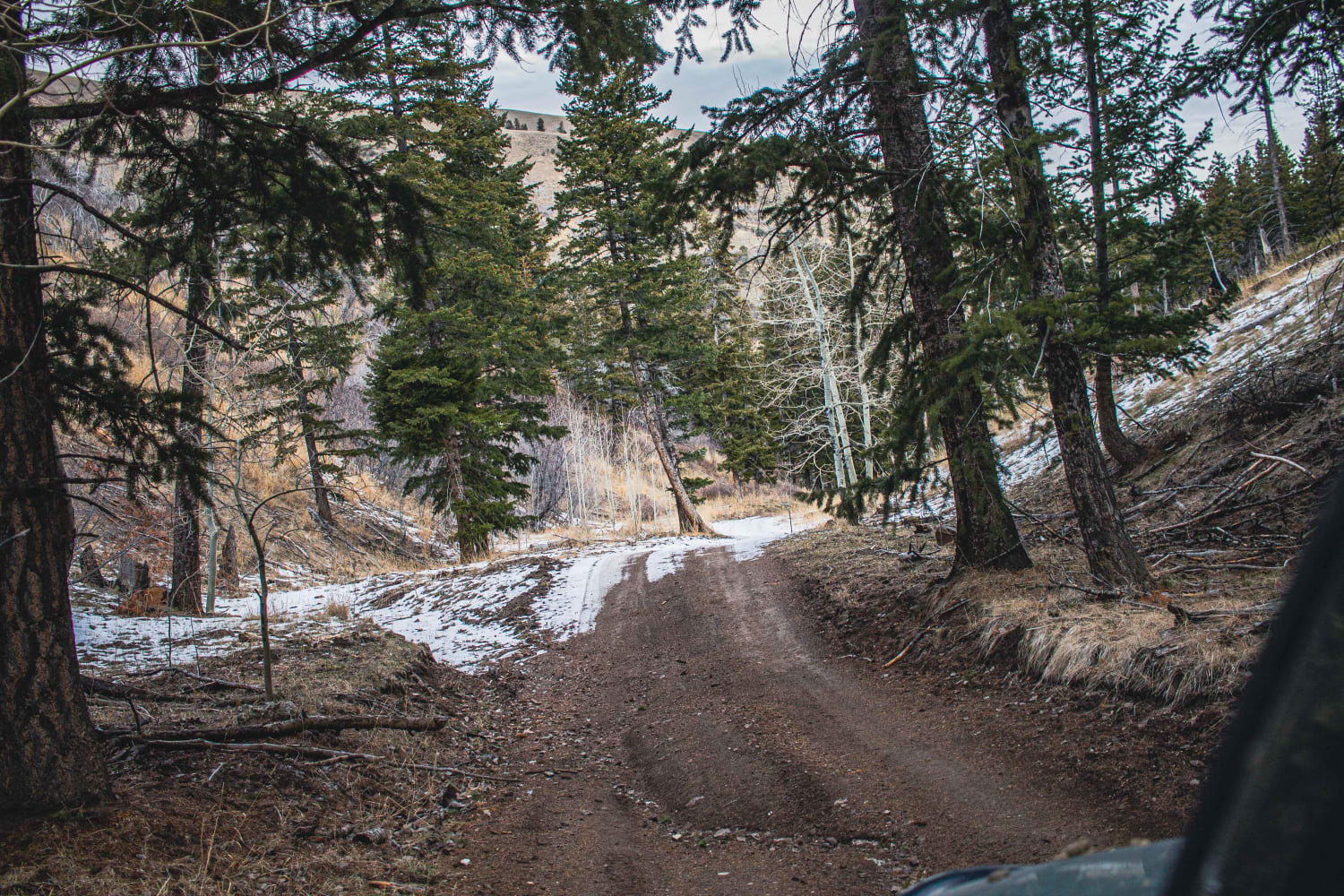
Trail Overview
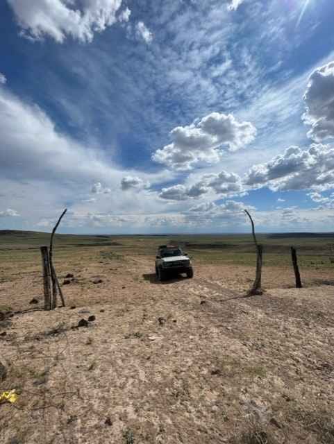
This is a low alpine single track in the Sawtooth National Forest south of Twin Falls, Idaho with fantastic views, moderate challenges, and several creek crossings, making for a really fun ride. The west entrance of the trail is unmarked on S. Fork Shoshone Road and requires an immediate creek crossing down a small embankment. There looks to be a couple of options for where to cross the creek where the embankment is the least steep, but the creek itself was shallow and smooth and easy to cross. It goes along a fence line on a narrow trail through leafy aspen trees. There are lots of low branches and overgrowth here to watch out for, and a couple spots where the trail goes between two trees that are barely handlebar width. It goes along the creek for a while and you have to cross it again several times, all of which are easy crossings with probably less than a foot of water, even in late spring. As you parallel the creek, there is one notable spot of exposure to watch out for, where the trail is washed out above the creek. The first half of the trail is mostly smooth dirt with a few rocks, while the second half has several more rocks including a couple of small ledge obstacles. One of these is like a slab rock face covered in loose dirt. You are surrounded by really beautiful scenery, riding underneath Bald Mountain, with black-colored boulders and yellow wildflowers and green rolling hills. There are several spur trails off of this trail, and not all of them are marked, so a GPS is helpful here. This is an awesome trail with fantastic scenery and can be ridden in connection with several other forested single track in the area.
Photos of Middle Fork Shoshone Creek
Difficulty
The difficulty is due to a narrow trail with spots of exposure and a couple of moderate rock obstacles.
Status Reports
Middle Fork Shoshone Creek can be accessed by the following ride types:
- Dirt Bike
Middle Fork Shoshone Creek Map
Popular Trails

Slate Creek To Robinsons Bar
Black Pine Canyon
Dead Horse and Tea Kettle Caves with Connector
The onX Offroad Difference
onX Offroad combines trail photos, descriptions, difficulty ratings, width restrictions, seasonality, and more in a user-friendly interface. Available on all devices, with offline access and full compatibility with CarPlay and Android Auto. Discover what you’re missing today!