Ditch Creek
Total Miles
5.8
Technical Rating
Best Time
Spring, Summer, Fall
Trail Type
Single Track
Accessible By
Trail Overview
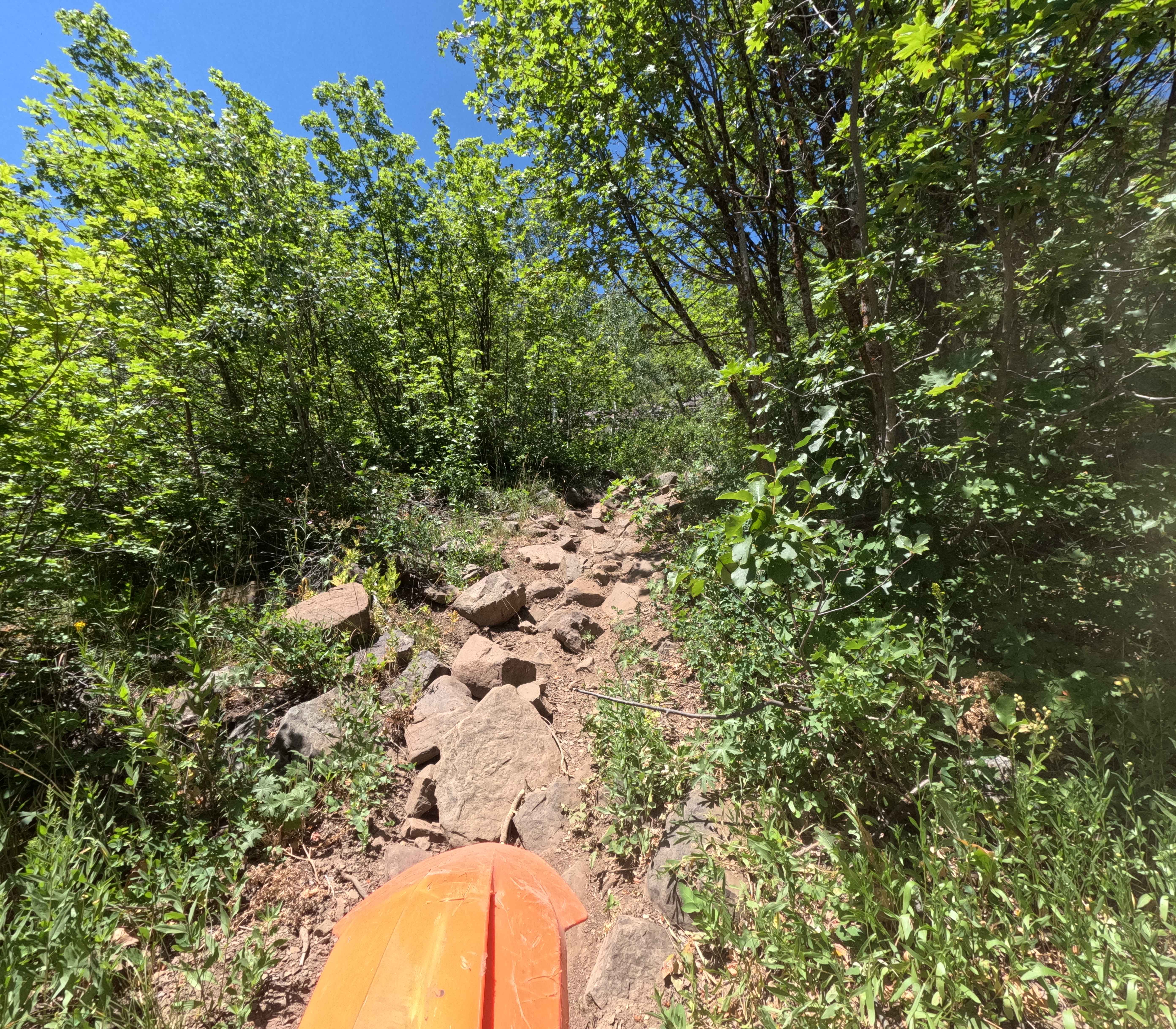
Ditch Creek, a 6-mile-long single track, starts on FS Road 60202 and ends at the Divide NRT single track. This is a difficult trail due to constant embedded rocks, challenging switchbacks, significant exposure, and steep hill climbs. In the beginning, it goes through a lush forest of aspens, overgrown bushes, and pines, on a skinny singletrack with lots of embedded rock. It starts climbing up and side-hilling, getting rockier as you climb up. There are big boulders in the trail, roots, and chunky round embedded rocks. Even though there aren't any huge ledges, the embedded rock is pretty relentless, making for a jarring ride and getting pinged around a lot, although it's a fun challenge. There's a creek crossing that is a bit rocky, but not too deep. You'll ride across scree fields, and likely have to go over some downed logs. Most of the logs have been cut or will likely be cut by locals and the Forest Service by summer. As you go north, the trail has some challenging switchbacks with rocks and ruts, that are tight and troughed with embedded rock. The trail gets close to 9,000 feet in elevation, so there can still be snow on the trail in mid-June. The trail goes past Allan Lake near the top, which is a small alpine lake that is a really scenic viewpoint. There are some really steep rocky sections after the lake, and more steep and tight switchbacks near the top before it connects to the intersection with Ax Park Cutoff.
Photos of Ditch Creek
Difficulty
This is a difficult trail due to relentless embedded rocks, challenging switchbacks, significant exposure, creek crossings, and steep hill climbs.
Status Reports
Ditch Creek can be accessed by the following ride types:
- Dirt Bike
Ditch Creek Map
Popular Trails
Appendicitis Hill WSA Spur #7

Beason Meadow No. 228 (Part 1)
Nicholas Ridge
The onX Offroad Difference
onX Offroad combines trail photos, descriptions, difficulty ratings, width restrictions, seasonality, and more in a user-friendly interface. Available on all devices, with offline access and full compatibility with CarPlay and Android Auto. Discover what you’re missing today!

