Cow Creek Shortcut
Total Miles
0.5
Technical Rating
Best Time
Spring, Summer, Fall
Trail Type
Single Track
Accessible By
Trail Overview
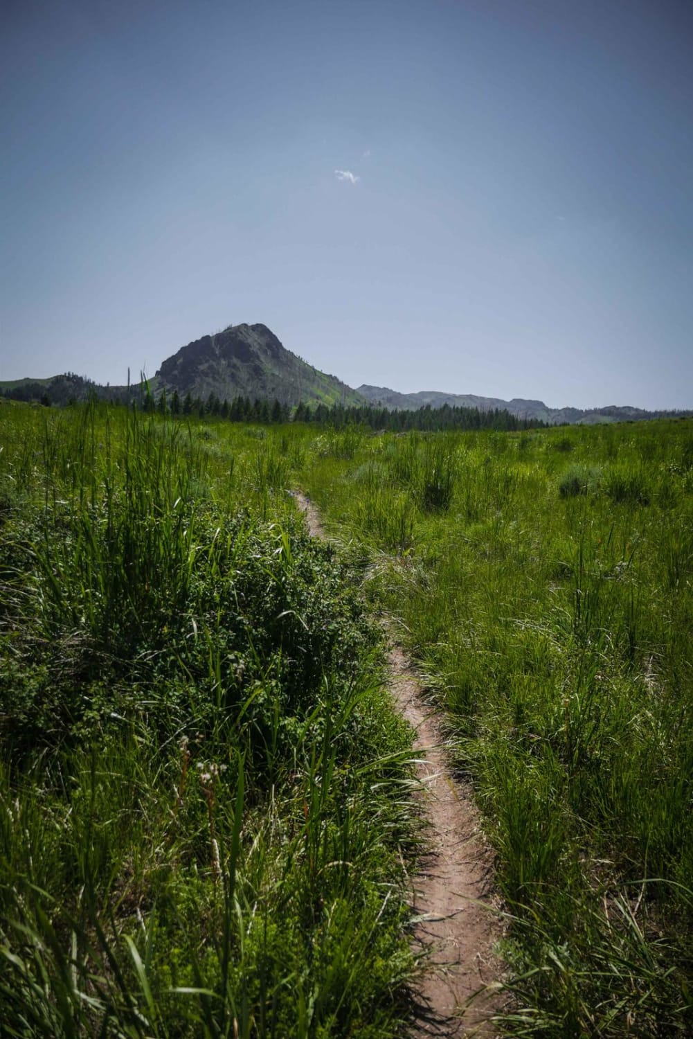
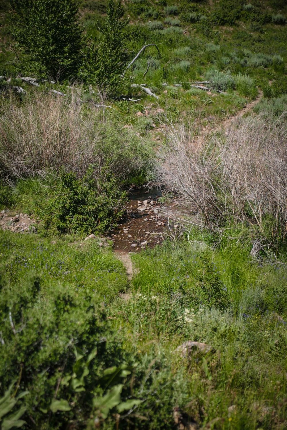
This shortcut meanders through meadows and forest on a narrow dirt trail with embedded rocks, connecting Cow Creek to Mahoney Ridge. It has a shallow creek crossing with bony rocks sticking up that is lined with a bunch of dead bushes. The trail goes in and out of aspen trees for short sections, but otherwise doesn't have much shade as it mostly goes up and over the rolling hillsides. This is a good connector trail that isn't too difficult and cuts off a decent portion of the Cow Creek trail. Although short, this trail has incredible scenery through these mountains with wildflowers and underneath jagged mountain peaks.
Photos of Cow Creek Shortcut
Difficulty
This is an easy connector trail with a rocky creek crossing, narrow sections, and embedded rock.
Status Reports
Cow Creek Shortcut can be accessed by the following ride types:
- Dirt Bike
Cow Creek Shortcut Map
Popular Trails

Ramsey Mountain Road

Grandad Road (Elk River to Dworshak Reservoir)
West Nicholson Road
Prairie Dog Lane
The onX Offroad Difference
onX Offroad combines trail photos, descriptions, difficulty ratings, width restrictions, seasonality, and more in a user-friendly interface. Available on all devices, with offline access and full compatibility with CarPlay and Android Auto. Discover what you’re missing today!