Cheatbeck #3350
Total Miles
1.4
Technical Rating
Best Time
Summer, Fall
Trail Type
50" Trail
Accessible By
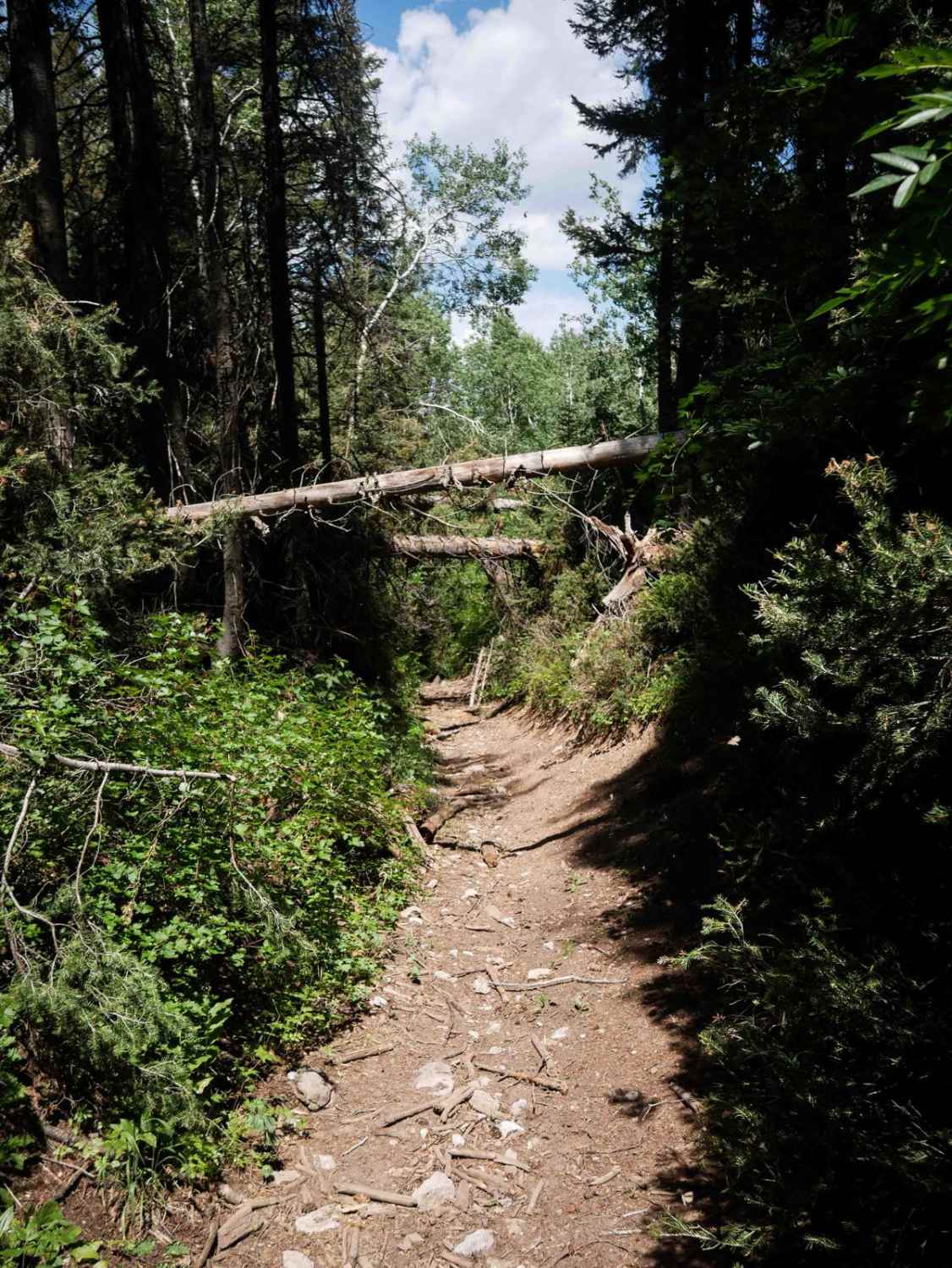
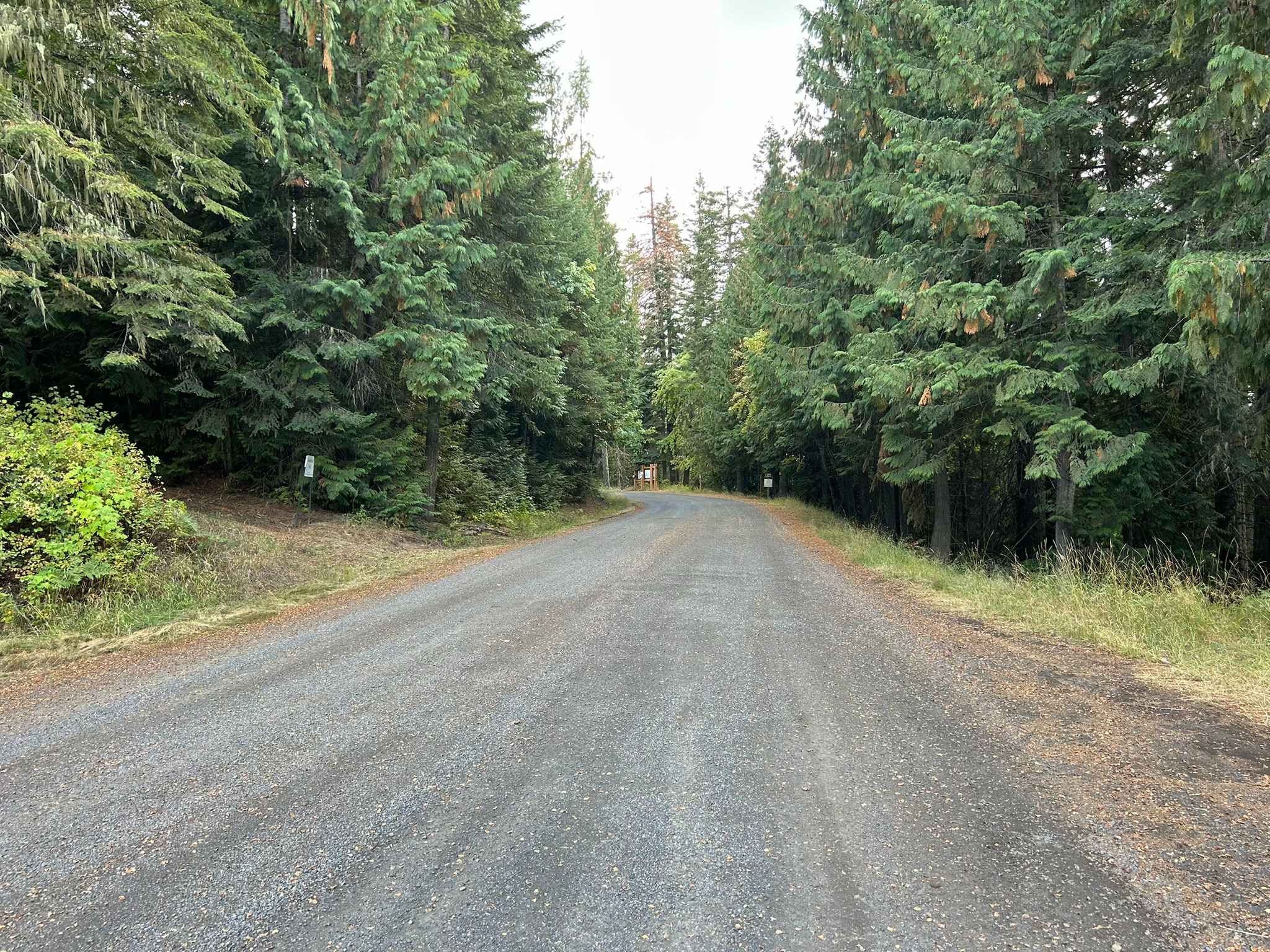
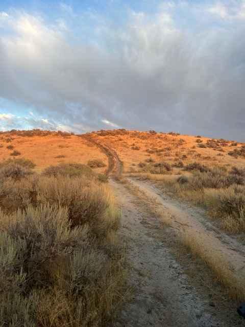
Trail Overview
Cheatbeck #3350 is a 1.5-mile-long ATV trail that begins on the east side as a wide path through a pine forest corridor with shallow ruts, scattered stick debris, and small loose rocks. As it continues west, the trail becomes grassier and more overgrown, with a few downed trees still across the path, including some suspended high overhead that riders pass beneath. The route becomes increasingly rocky on a steep descent, where loose rock fills the ruts and larger embedded rocks appear. The vegetation also closes in, with leafy bushes lining the narrower path. In its second half, the trail follows a tight ravine filled with loose rock, maintaining a rough and rocky character until it reaches the boundary with BLM land. There wouldn't be much room in the ravine to turn an ATV around. The designated Forest Service trail officially ends at this point, though the ravine continues into the BLM area.
Photos of Cheatbeck #3350

Difficulty
This is a moderate trail, with the east half being more mild and the west half becoming a bit rougher, steeper, and tighter. The rocky descent, overgrowth, and tight ravine sections contribute to the increased challenge toward the west end.
Status Reports
Cheatbeck #3350 can be accessed by the following ride types:
- ATV (50")
- Dirt Bike
Cheatbeck #3350 Map
Popular Trails
Palouse Divide East - FS 377
Blue Heart Overlook and Access

Deadwood Creek

Pete Creek Trail
The onX Offroad Difference
onX Offroad combines trail photos, descriptions, difficulty ratings, width restrictions, seasonality, and more in a user-friendly interface. Available on all devices, with offline access and full compatibility with CarPlay and Android Auto. Discover what you’re missing today!