Mill Creek Overlook - FS-630A
Total Miles
0.7
Technical Rating
Best Time
Spring, Summer, Fall
Trail Type
Full-Width Road
Accessible By
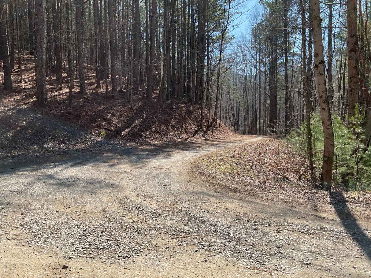
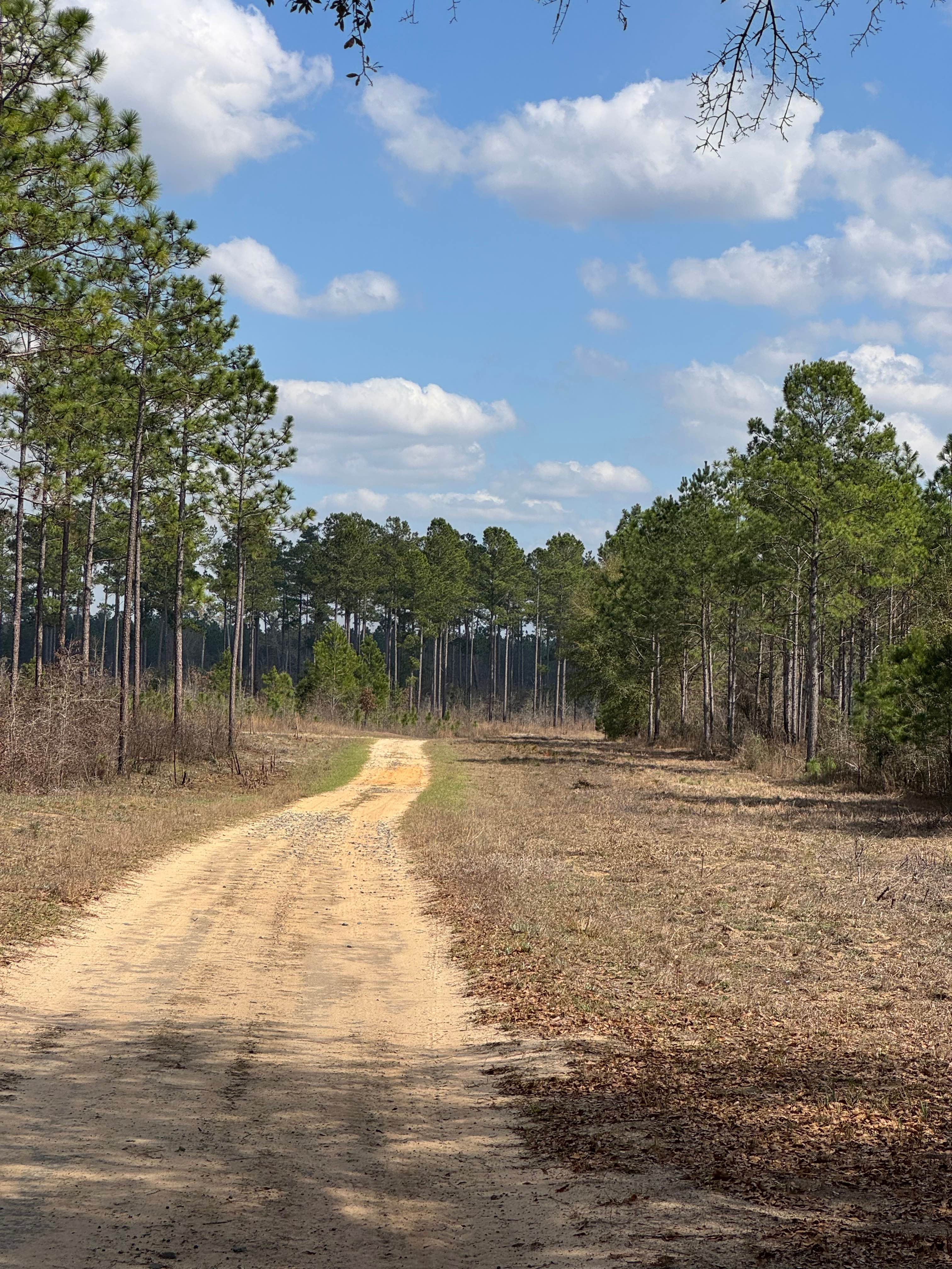
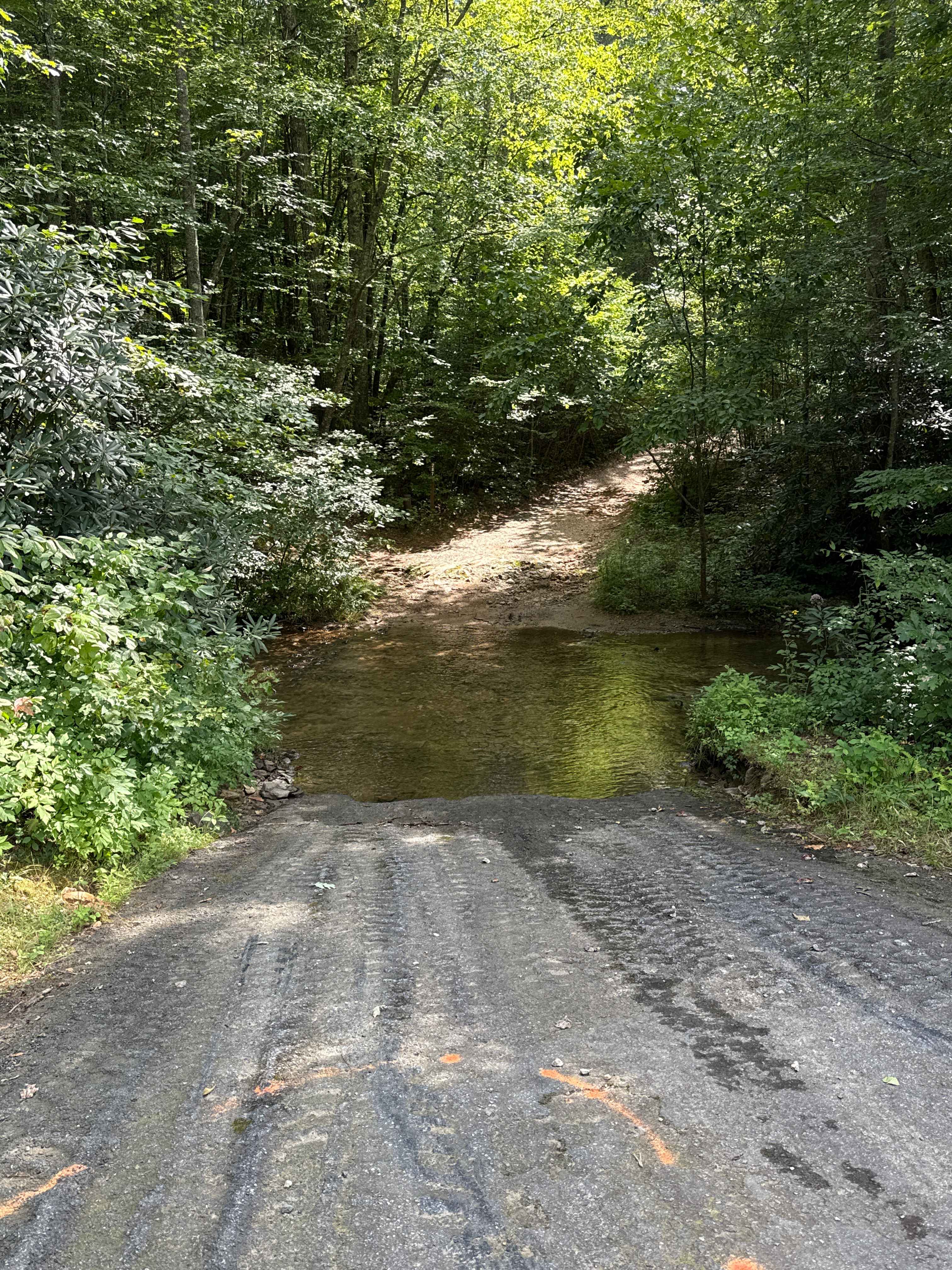
Trail Overview
Trail FS-630A, Mill Creek Overlook, is a relatively short spur off of FS-630 but holds a jewel at the trail's end. The trail head is located at the intersection of FS-630 and FS-630C (Lacky Knob). The trail has a water crossing within the first 1/4 mile and does require water fording capabilities of a minimum of 12 inches and 4WD to exit the opposite side of the stream. FS-630A is a mix of dirt and stones with occasional standing water and ruts. A legally tagged and registered vehicle is required to access FS-630A. The round trip is less than an hour. Plan for another hour to hike the overlook path at the trail's end. The area is closed during winter months and reopens the first week of March.
Photos of Mill Creek Overlook - FS-630A

Difficulty
FS-630A is a relatively easy trail with a single water crossing approximately 12 inches deep.
History
The Cohutta Wilderness is the largest wilderness area east of the Mississippi and is located in Georgia and partially in Tennessee. The Forestry Service has many managed wildlife food plots scattered throughout the wilderness that draw in wildlife. Expect to see plenty of deer and wild fowl in the area. The area was previously home to Native Americans of the Cherokee and a part of the Trail of Tears.
Status Reports
Mill Creek Overlook - FS-630A can be accessed by the following ride types:
- High-Clearance 4x4
- SUV
Mill Creek Overlook - FS-630A Map
Popular Trails
East Side Loop

Bow Creek - FSR 955F
Gillespie Branch - FS 287

Hickorynut Gap - FSR 797
The onX Offroad Difference
onX Offroad combines trail photos, descriptions, difficulty ratings, width restrictions, seasonality, and more in a user-friendly interface. Available on all devices, with offline access and full compatibility with CarPlay and Android Auto. Discover what you’re missing today!