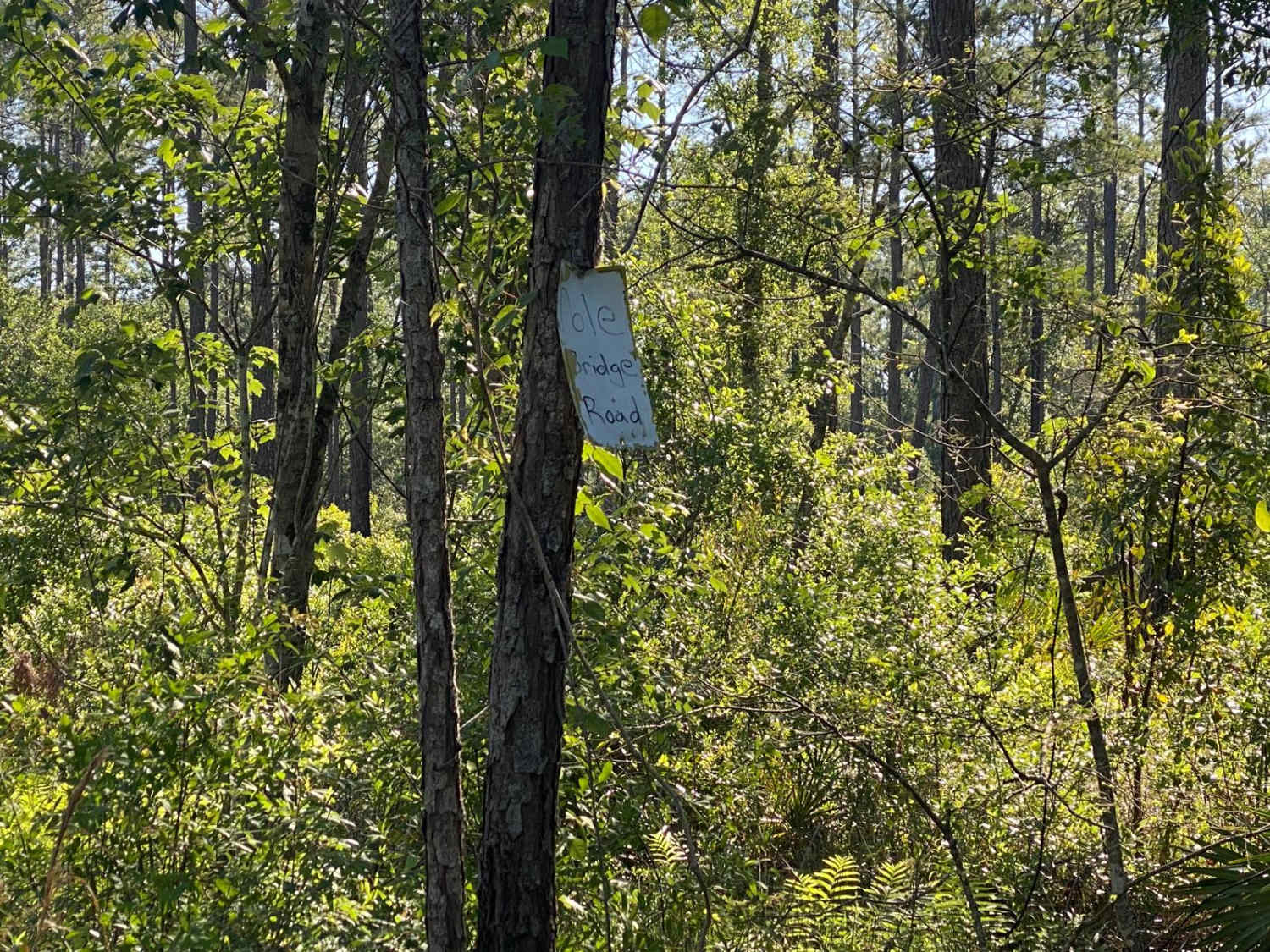
Pole Bridge Road
Total Miles
1.5
Technical Rating
Best Time
Spring, Winter
Trail Type
Full-Width Road
Accessible By
Trail Overview
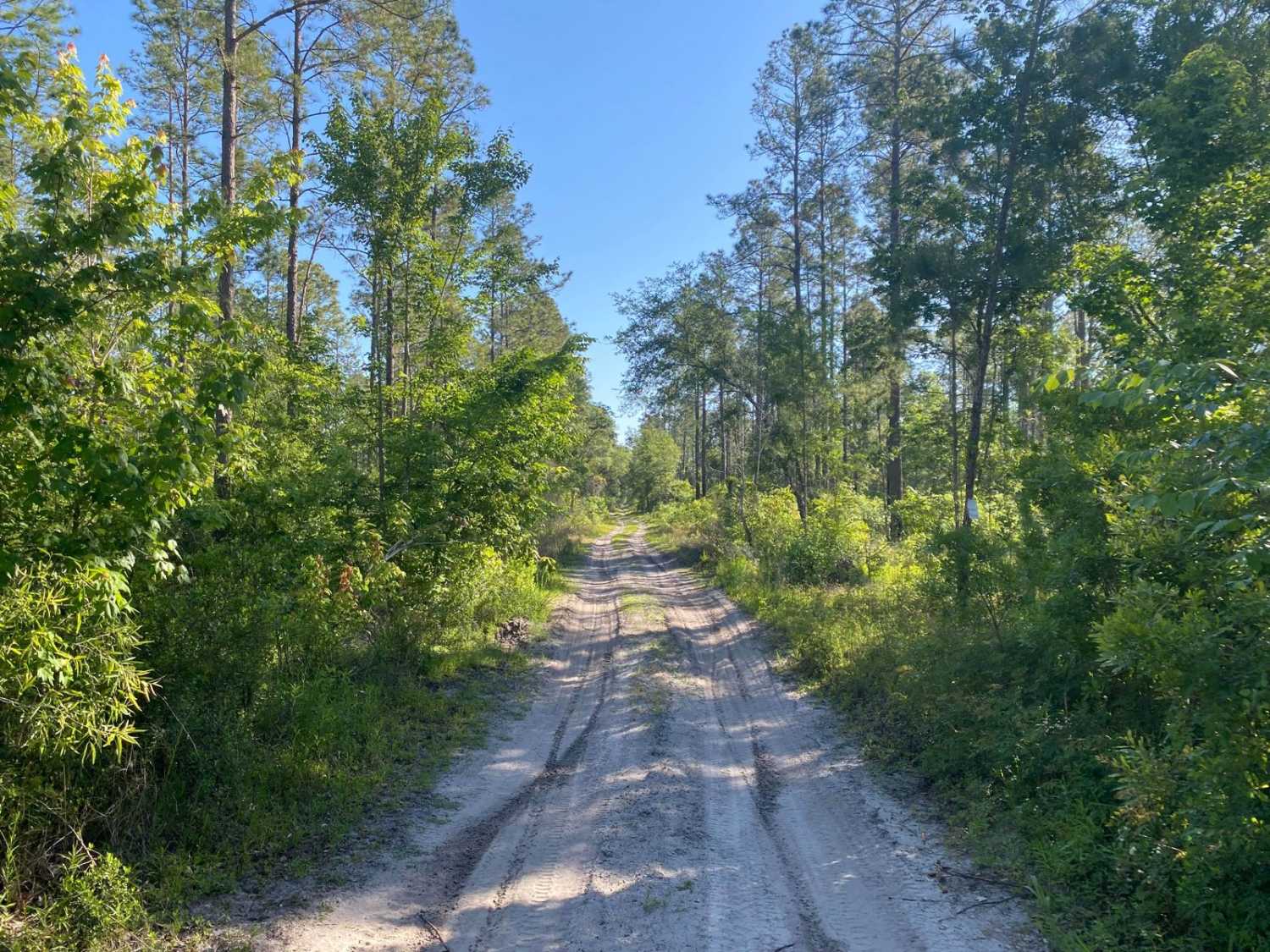
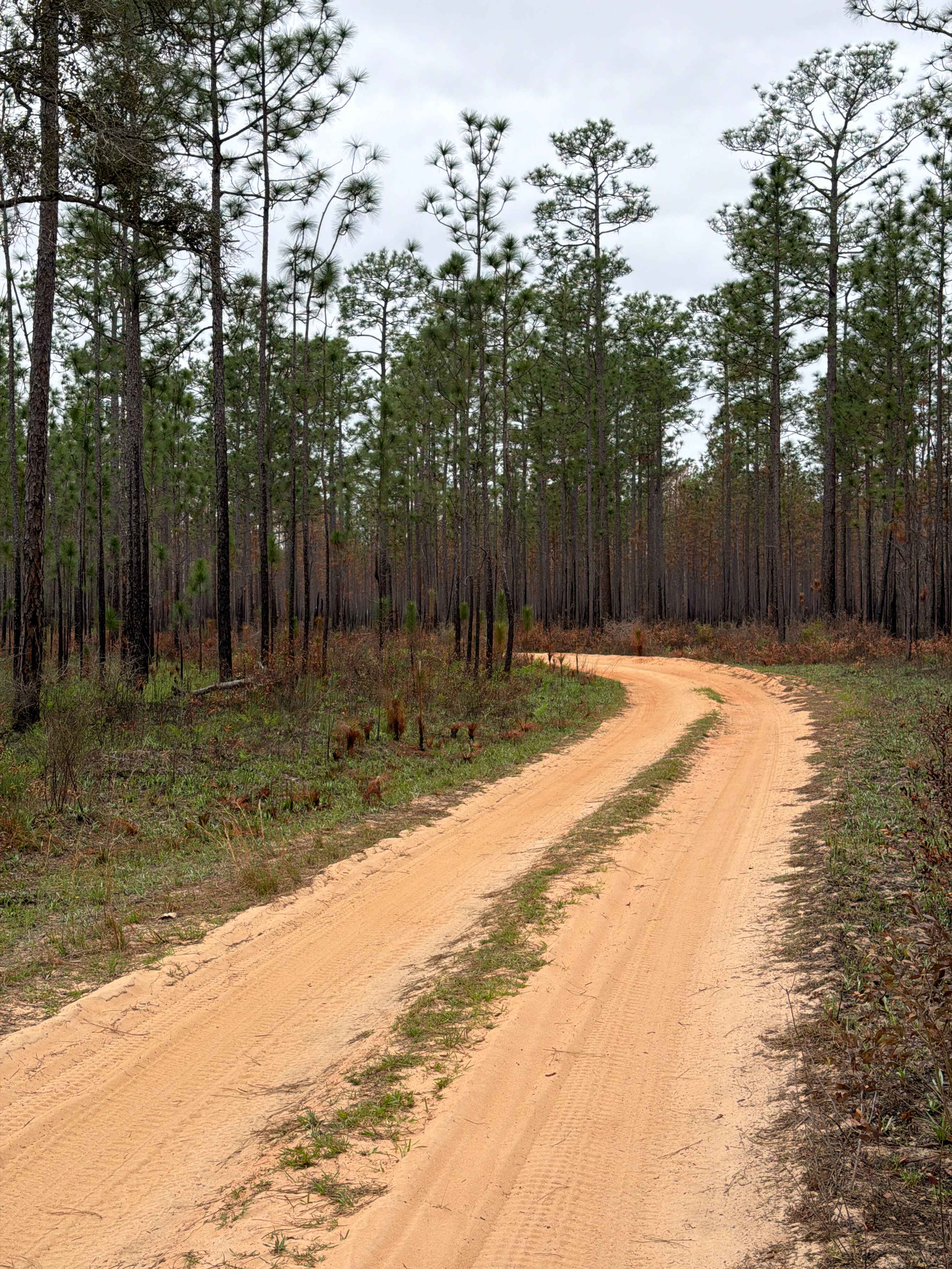
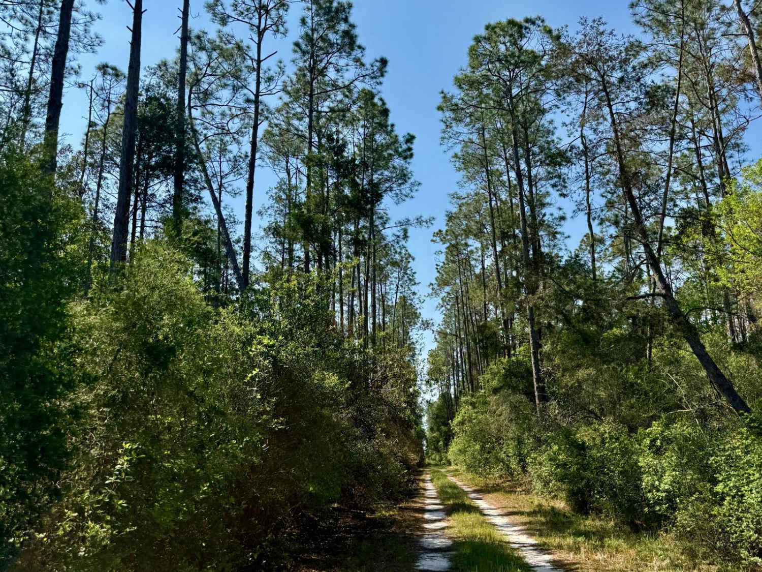
This trail is located within the Florida Fish and Wildlife Commission's (FWC) Richloam Wildlife Management Area (WMA), which is one of seven tracts that compose Withlacoochee State Forest. The Richloam tract consists of 58,000-plus acres crossing over four counties in north-central Florida. Public access is open year-round to all forms of off-roading. Class 1 electric bicycles may be operated according to rules for traditional, non-motorized bicycles. All other electric bicycles may be operated only on named or numbered roads open to motorized vehicles. The trails traverse across a variety of wildlife habitats ranging from cypress swamps, strand bottomland hardwoods, pine land flats, and oak hammocks. The FWC WMA brochure defines this trail as an improved road/trail. The trail is a dirt/mud or soft sand trail that varies as it crosses through a variety of habitats. The trail is primarily one vehicle wide, having lots of tight corners and rolling inclines. These tight corners and inclines will exercise an individual's wheeling skills. Pull-off areas for passing are limited, those locations are often on shoulder areas that are soft soils or mud. The trail has numerous deep, muddy ruts and potholes. During the wet season, expect the trail to be sticky with numerous mudholes. Potential water crossings greater than 12 inches and washes could be expected. Trail obstacles such as rocks, large tree roots, or fallen trees greater than 12 inches in diameter are possible. Plenty of potential for undercarriage snags or dents and paint stripping along the trail. Following rain or storm events, maintenance of the trail may be limited to only removing debris that is impeding or blocking trail access and may not occur immediately. This trail is marked with a small tin sign with hand lettering, which is not visible from the adjacent road, unless one is aware of the trail's upcoming and is looking for the signage 50 feet away from the intersection. Many of the other area trails are signed similarly or marked via blazed trees. Watch for horseback riders, dirt bikes, ATVs, and SxS, which can abruptly appear around corners or at intersecting trails. Wildlife observation opportunities abound. There is a possibility of observing a variety of wildlife. This is an active WMA and preservation area; several open hunting seasons start late summer and extend through Spring.
Photos of Pole Bridge Road
Difficulty
The FWC WMA brochure defines this trail as an improved road/trail. The trail is a dirt/mud or soft sand trail that varies as it crosses through a variety of habitats. The trail is primarily one vehicle wide, having lots of tight corners and rolling inclines. These tight corners and inclines will exercise an individual's wheeling skills. Pull-off areas for passing are limited, those locations are often on shoulder areas that are soft soils or mud. The trail has numerous deep, muddy ruts and potholes. During the wet season, expect the trail to be sticky with numerous mud holes. Potential water crossings greater than 12 inches and washes could be expected. Trail obstacles such as rocks, large tree roots, or fallen trees greater than 12 inches in diameter is possible. Plenty of potential for undercarriage snags or dents and paint stripping along the trail. Following rain or storm events, maintenance of the trail may be limited to only removing debris that is impeding or blocking trail access and may not occur immediately.
Status Reports
Pole Bridge Road can be accessed by the following ride types:
- High-Clearance 4x4
- SUV
- SxS (60")
- ATV (50")
- Dirt Bike
Pole Bridge Road Map
Popular Trails

Blackwater North Bypass Route

Blu 4 Trail
SFR 21 North
The onX Offroad Difference
onX Offroad combines trail photos, descriptions, difficulty ratings, width restrictions, seasonality, and more in a user-friendly interface. Available on all devices, with offline access and full compatibility with CarPlay and Android Auto. Discover what you’re missing today!