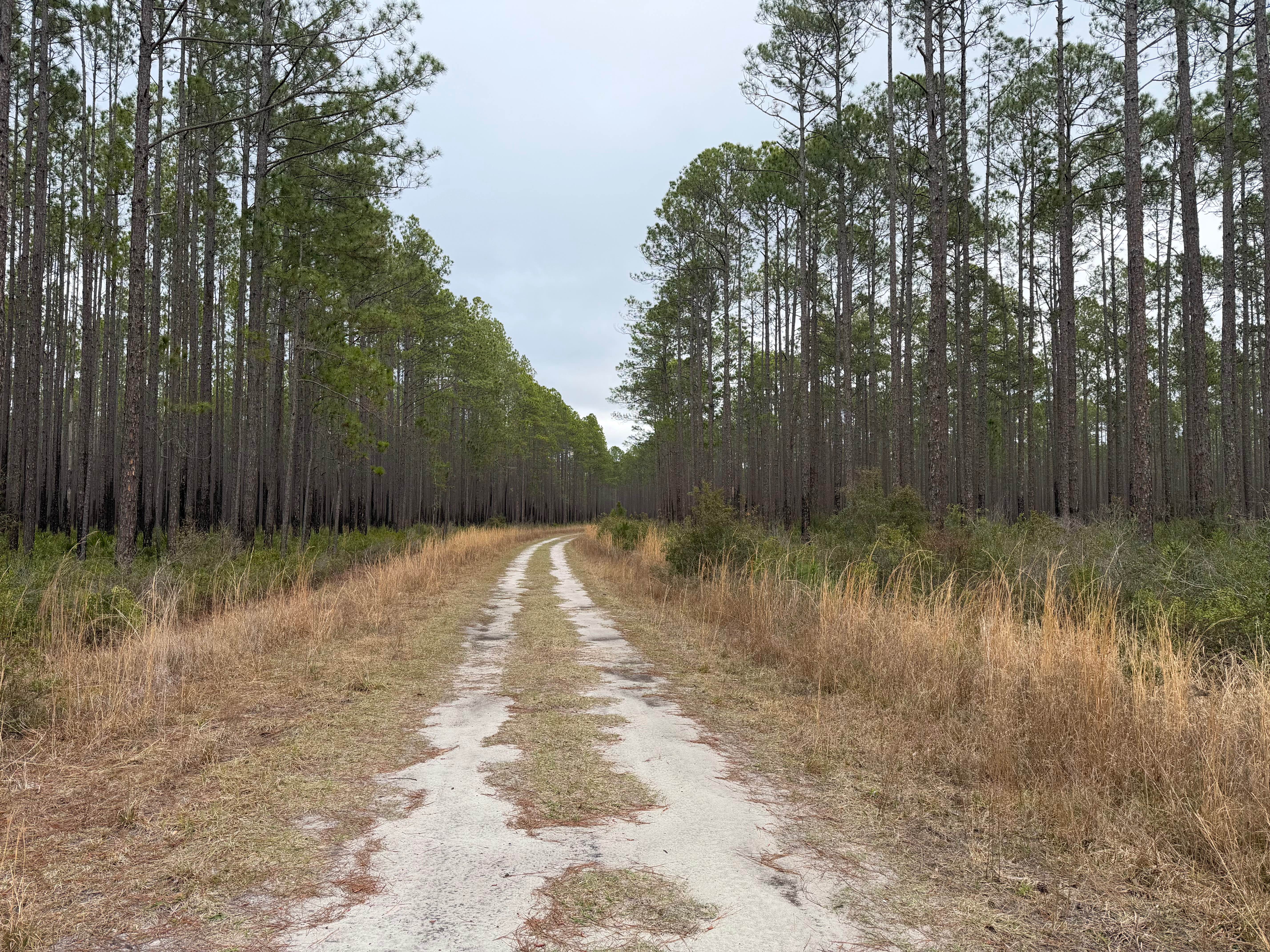
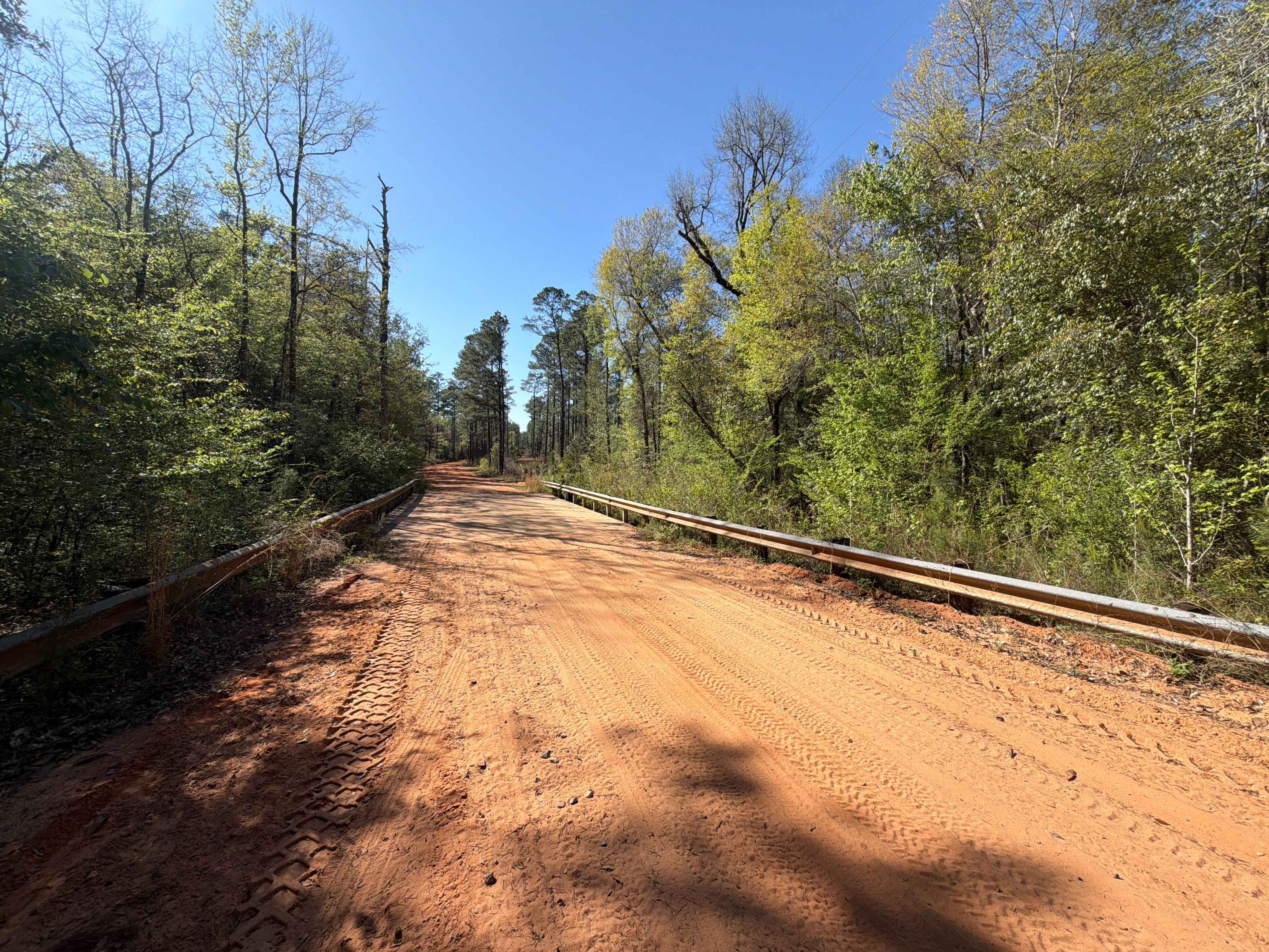
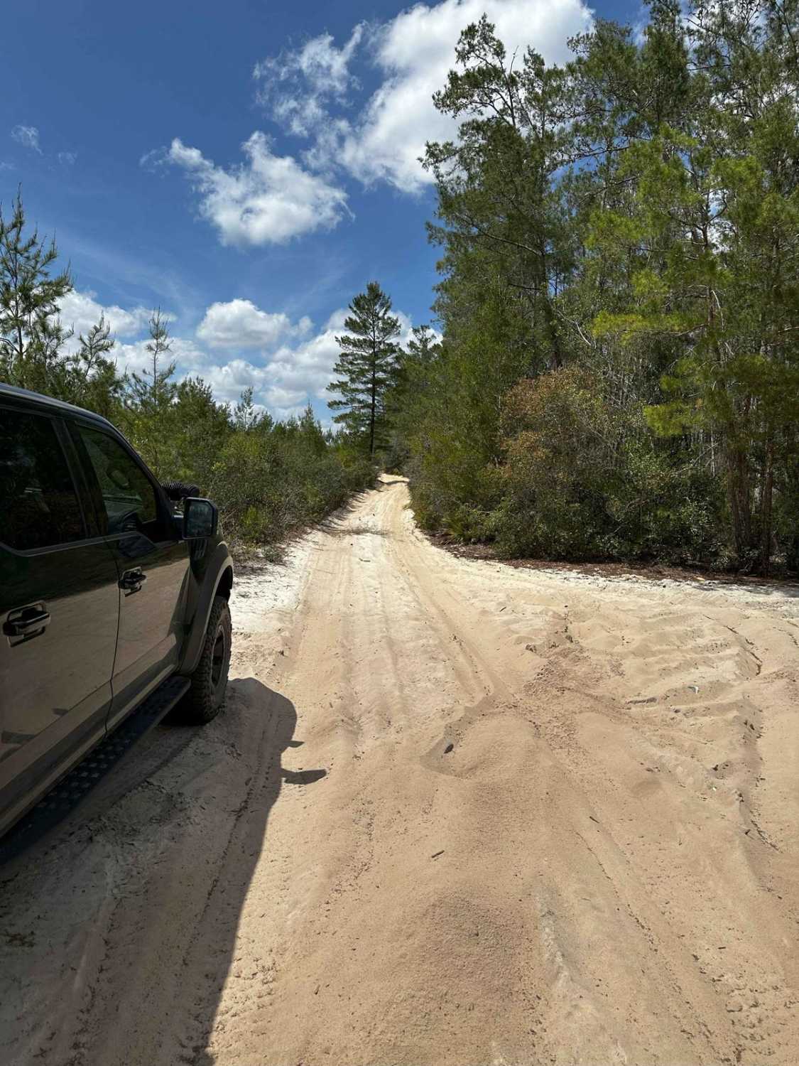
Pine Log Road
Total Miles
6.7
Technical Rating
Best Time
Winter, Fall, Spring
Trail Type
Full-Width Road
Accessible By
Trail Overview
Pine Log Road takes you from north to south through the east part of Tate's Hell State Forest. You will find the Pine Branch OHV Trailhead and staging area on the trail's south end and at Boundary Road at the north end. You are crossing Rock Landing Road, which gives you access to the primitive campsite #22. The road conditions are a mixture of packed sand, loose sand, and deep holes that can turn into 2 feet deep mud holes after rainy days. Some sections might require 4WD. Off-highway vehicles (OHVs) are only permitted in designated areas and require proper titling and a State Forest OHV Permit. Tate's Hell is a large patchwork of flatwoods and savannahs with an intricate web of creeks and wetlands. The forest features the unique dwarf cypress that only reaches a mature height of about 15 feet, with some trees estimated to be over a century old. Pitcher plant prairies hold a diverse mixture of carnivorous plants, wildflowers, and grasses. The carnivorous plants include glistening sundews, butterworts, bladderworts, and several pitcher plants that trap insects in their erect trumpet-shaped leaves. Tate's Hell is home to a rich array of wildlife, including deer, turkey, black bear, alligators, and many resident and migratory birds. The forest offers the visitor space, solitude, and unique natural beauty.
Photos of Pine Log Road


Difficulty
The trail is usually well maintained. Please use caution as some roads require four wheel drive during wet or extremely dry weather conditions.
History
Local legend has it that in 1875, a farmer by the name of Cebe Tate, armed with only a shotgun and accompanied by his hunting dogs, journeyed into the swamp in search of a panther that was killing his livestock. Tate became lost in the swamp for several days, was bitten by a snake, and was drinking from the murky waters. Finally he came to a clearing near Carrabelle, living only long enough to murmur the words, "My name is Cebe Tate, and I just came from Hell!" Since then the area has been known as Tate's Hell. In the early 1950s, under ownership of private forest production companies, attempts were made to drain Tate's Hell swamp in order to grow trees. They later learned that draining the freshwater from the swamp into East Bay seriously affected the marine condition of the Bay and its estuaries. In 1994 the first land was purchased by the state to help protect the aquatic and estuarine resources of East Bay by securing the watersheds and upland buffers of the Tate's Hell Swamp.
Status Reports
Pine Log Road can be accessed by the following ride types:
- High-Clearance 4x4
- SUV
- SxS (60")
- ATV (50")
- Dirt Bike
Pine Log Road Map
Popular Trails

Mattie Kennedy Road
ONF Trail 9-5.2
The onX Offroad Difference
onX Offroad combines trail photos, descriptions, difficulty ratings, width restrictions, seasonality, and more in a user-friendly interface. Available on all devices, with offline access and full compatibility with CarPlay and Android Auto. Discover what you’re missing today!