Hard Rock
Total Miles
2.9
Technical Rating
Best Time
Spring, Summer, Fall, Winter
Trail Type
Full-Width Road
Accessible By
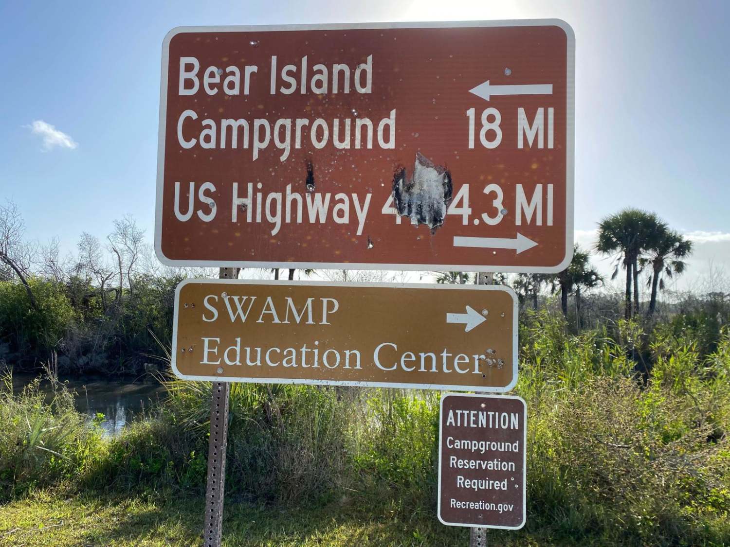
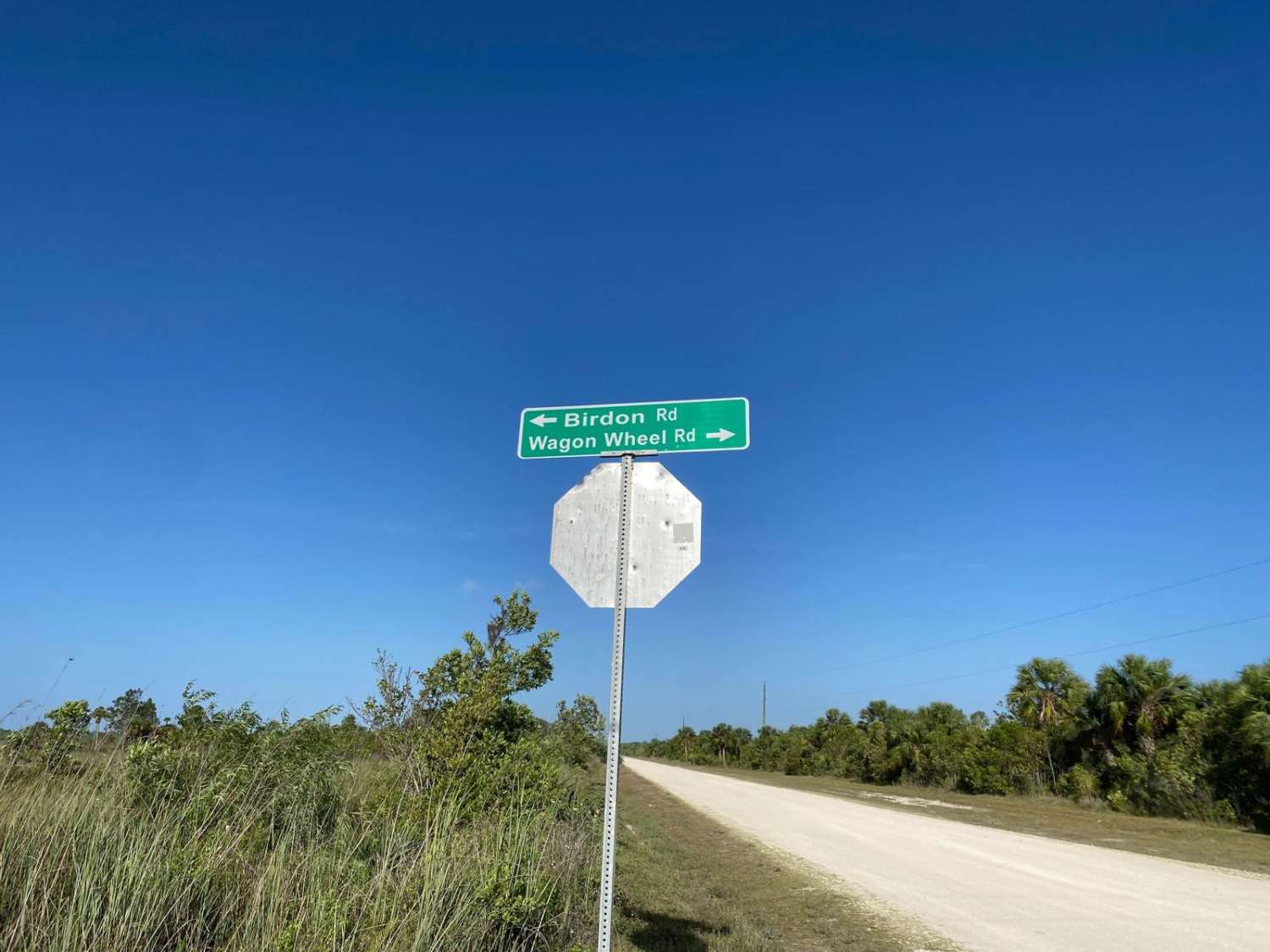
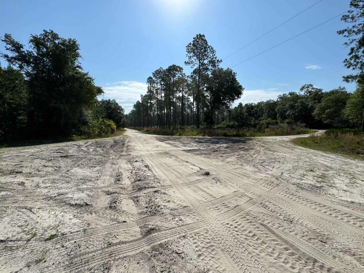
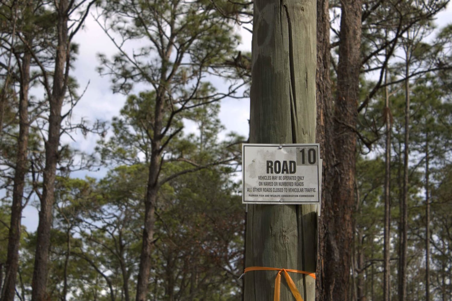
Trail Overview
This trail is open year-round to those who have purchased an Off-Road Vehicle (ORV) permit from the NPS. The ORV permit requires passing a quiz testing knowledge of treading lightly and off-road etiquette and passing an ORV inspection. Rangers will look for 4WD capability, tire width and size, and axle clearance, to name a few items. These are required as once in the backcountry, conditions can change rapidly, and recovery assistance may not be available or long in coming. Vehicles are required to be equipped with working 4-wheel drive. The annual permit is $100; reinspection is done every few years. Access is open year-round. However, the use of motorcycles is prohibited. Class 1 electric bicycles may be operated according to rules for traditional, non-motorized bicycles. The trail leads through the WMA, where there are a variety of pine/oak Hammocks and wetland/marsh areas. The trail varies in width. Narrower areas may have steep, short grades that fall into the swamp. The trail is dirt/gravel with minor rutting, washboard effects, loose rock, and/or ungraded sections. There may be obstacles, such as fallen tree branches or debris, that may be encountered. Following rains and storms, the trail may remain unmaintained for some time. Wildlife observation opportunities abound. This area is part of the Black Bear and Florida Panther habitat. Observing various wildlife (e.g., Whitetail Deer, Wild Hogs, Panthers, Bears, Coyote, Bobcats, Cranes, Storks, Water Birds, Bald Eagles, snakes, etc.) is possible. This active preserve has several open hunting seasons starting late summer and extending through Spring.
Photos of Hard Rock
Difficulty
The trail varies in width. Narrower areas may have steep short grades that fall off into swamp. The trail is dirt/gravel that has areas of minor rutting, washboard effects, loose rock and/or ungraded sections. There may be obstacle, such as fallen tree branches or debris, that may be encountered. Following rains and or storms the trail may go unmaintained for a period of time.
History
The Calusa people had an extensive presence in the area when Europeans arrived. Big Cypress was historically occupied by various cultures of Native Americans. Currently members of the Miccosukee and Seminole Tribe of Florida occupy and use the preserve for traditional purposes and business. In the early 1900's oil exploration led to exploring for oil deposits in Florida. In the 1940's one of only two landmass oil deposits, the Sunniland Deposit, was discovered in Big Cypress. Oil production continues to modern day but is limited to a few select locations. In the 1960's the land was being considered for the Miami-Dade Jetport Airport. Through a collaborative effort between Native Tribe members, outdoorsmen and conservationists, this 729,000 acre parcel was earmarked as preserve land. This allowing it to be used for traditional activities, such as hunting, fishing, wood harvesting, and occupancy by the Miccosukee and Seminole Tribes, as well as existing non-native property owners.
Status Reports
Hard Rock can be accessed by the following ride types:
- High-Clearance 4x4
- SUV
- SxS (60")
- ATV (50")
Hard Rock Map
Popular Trails
Fish Camp Road South - Lochloosa WMA West

Briar Patch Road - FS 123 North
Citrus Wildlife Management | Trail 10

Telephone Trail South - ONF 69
The onX Offroad Difference
onX Offroad combines trail photos, descriptions, difficulty ratings, width restrictions, seasonality, and more in a user-friendly interface. Available on all devices, with offline access and full compatibility with CarPlay and Android Auto. Discover what you’re missing today!