Long Park Mine Tour
Total Miles
21.1
Technical Rating
Best Time
Fall, Summer, Spring
Trail Type
Full-Width Road
Accessible By
Trail Overview
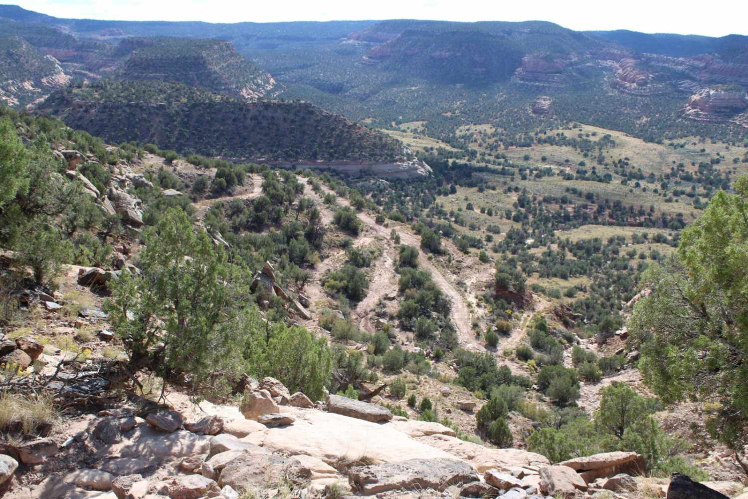
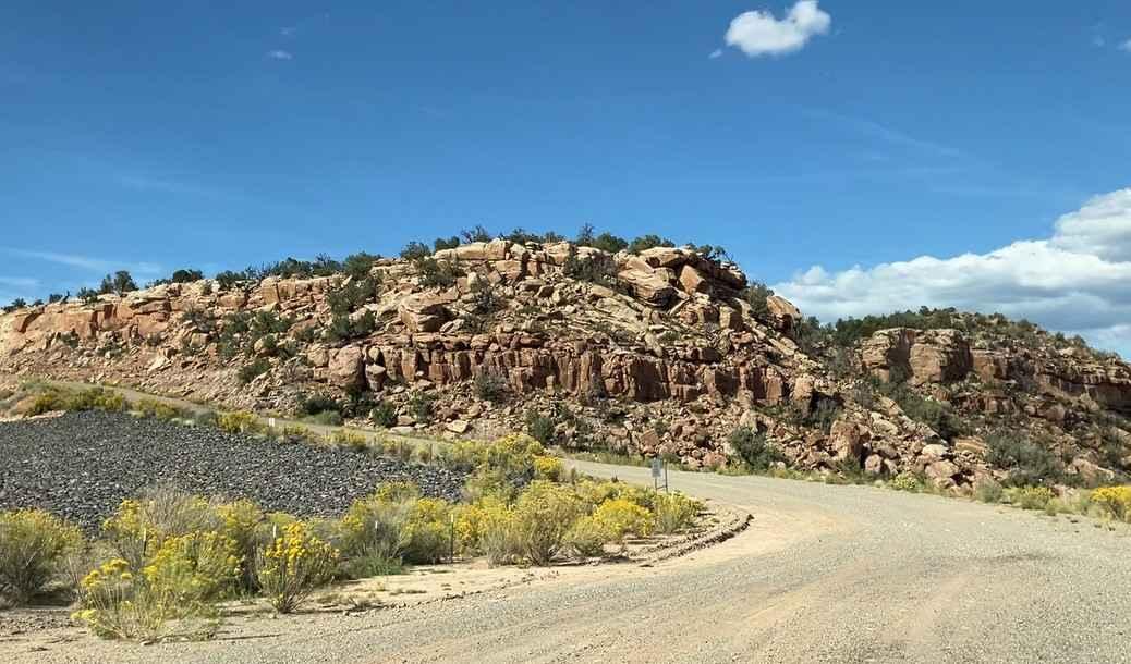
This is an optional sightseeing route of historic Radium, Uranium, and Vanadium mines off the main Rimrocker trail in the Uravan area. It generally has a graded dirt or gravel surface but short stretches of rutted, rocky, and deteriorated dirt roads. The trail surface can become muddy and slick with rain, making it difficult to navigate where the route becomes steep and curved. If entering the trail from Uravan, the road ascends the canyon wall quickly. It will pass by the "graveyard", which is a super-fund cleanup site where radioactive waste from Uravan, the VCA Mill in Naturita, and mill tailings from numerous dwellings in both Nucla and Naturita were shredded, encased in concrete, and buried under rock. The trail then turns to the right and runs high along the rim of the Saucer Basin, where the Dolores River can be seen running through down below. The La Sal mountains in Utah are also visible from this vantage point. This section is the most challenging part of the route, with several rocky areas and small slick rock ledges that must be carefully navigated. The trail is also narrow here, with few places to pass another vehicle. After leaving Saucer Basin, the trail returns to a graded dirt road. Many side trails and optional loops can be taken along the way to see the remains of dozens of mines. Detailed information about important historic mines along this tour route can be found on the rimrockertrail.org website under the Side Trails tab. The trail will end at State Highway 90, which can take you to Paradox or Naturita. Restrooms are available at the Ball Park campground in Uravan. Colorado law requires all unlicensed motor vehicles, including those registered in other states, to display a current Colorado OHV registration or permit. If traveling on designated motorized trails, cars with a license plate must have an OHV permit. OHV registration and permits can be purchased directly from hunting and fishing license vendors, online through the Colorado State Parks website, some OHV dealerships, and some National Forest offices.
Photos of Long Park Mine Tour
Difficulty
This trail primarily consists of a graded dirt road that may have ruts and some deterioration depending on weather conditions. There are short sections with loose or embedded rocks and a few small slickrock ledges that will require higher clearance to navigate easily.
History
Gold prospectors trickled into this region in the 1860s igniting a rich mining history. Twenty years later another yellow mineral was discovered that set a new course for these early miners. This was Carnotite (also called Colorado Yellowcake), the raw ore that contains Radium, Uranium, and Vanadium.
Long Park Mine Tour can be accessed by the following ride types:
- High-Clearance 4x4
- SUV
- SxS (60")
- ATV (50")
- Dirt Bike
Long Park Mine Tour Map
Popular Trails
Little Cimarron Creek

East Animas Road

Burnt Mountain Road - FR651
The onX Offroad Difference
onX Offroad combines trail photos, descriptions, difficulty ratings, width restrictions, seasonality, and more in a user-friendly interface. Available on all devices, with offline access and full compatibility with CarPlay and Android Auto. Discover what you’re missing today!