Gunnison Tunnel
Total Miles
11.9
Technical Rating
Best Time
Summer, Fall
Trail Type
Full-Width Road
Accessible By
Trail Overview
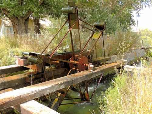
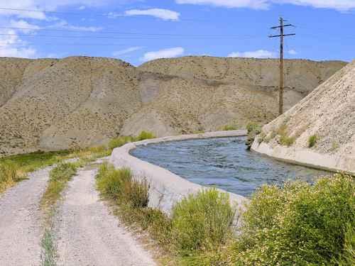
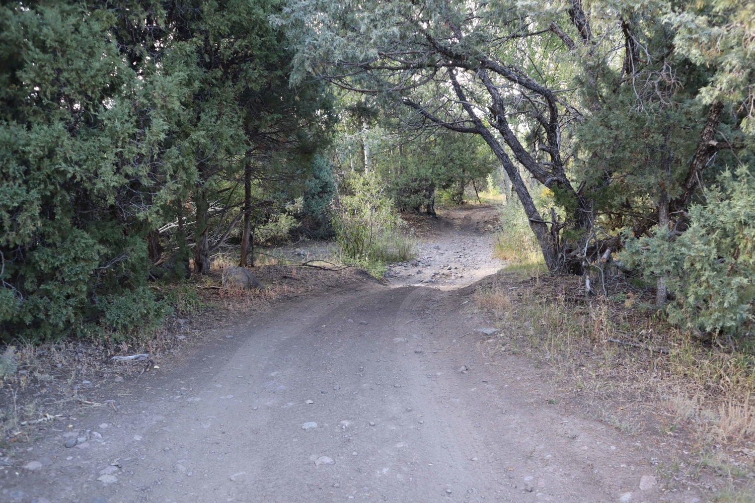
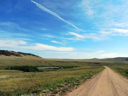
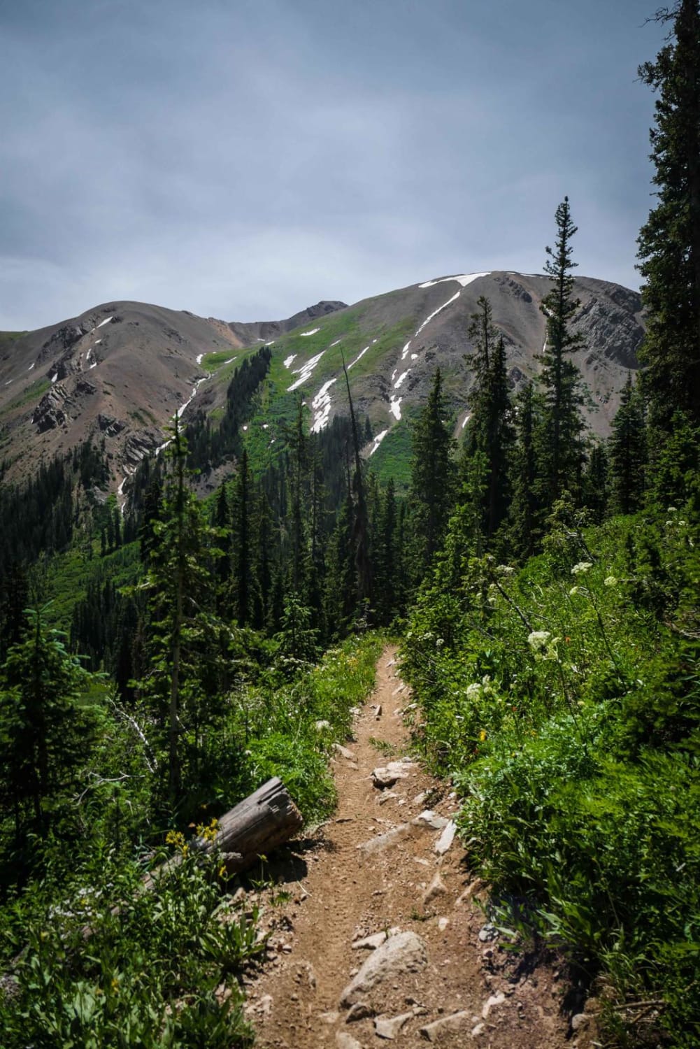
In 2020 a locked gate was placed near the west portal (west of the canal dipper) which prevents running the complete trail. The trail can be run from the Uncompahgre River east to the gate but you can not reach the west portal. If you want to see the west portal and the canal dipper you must enter this trail from Hwy. 50.The Gunnison Tunnel is a 5.8-mile irrigation tunnel constructed between 1905 and 1909 by the Bureau of Reclamation to divert water from the Gunnison River to the Uncompahgre. At the time of its completion, it was the longest irrigation tunnel in the world. It only runs water during the irrigation season.The tunnel's West Portal opens up into the South Canal which both produces hydroelectric power and delivers water as part of the Uncompaghre Project. The South Canal extends from the end of the Gunnison Tunnel generally southwest 11.4 miles to the Uncompahgre River. Part of the canal is concrete lined and part is unlined. The South Canal includes 3 additional tunnels, 3 hydroelectric stations, and numerous branch canals. This trip takes you along the upper part of the canal so you can see the lined and unlined portions, the tunnels, and the hydroelectric stations. A short trip that can be done by most vehicles.This canal dipper, for lack of a better term, rotates counterclockwise by canal current. The barrels pick up water and spill it into a trough. A pipe drains water from the trough into a small irrigation ditch. Just a short distance from US 50 at the north end of this trail.The West Portal of the Gunnison Tunnel emerges quite a bit below the natural surface of the ground. The canal drops 350' on its journey to the Uncompaghre, and this drop is harnessed to produce electricity.Hydroelectric stations absorb some of the elevation drops, but the rest is simply water running downhill. Small elevation drops are handled differently than large elevation drops.There are 3 tunnels included in South Canal. The canal road leaves each tunnel entrance then climbs the hills and drops back down to the tunnel exit.This track follows less than half of South Canal's length and then heads for Montrose. There is no public access to the canal road south of this point.
Photos of Gunnison Tunnel
Difficulty
Well maintained dirt road
Status Reports
Gunnison Tunnel can be accessed by the following ride types:
- High-Clearance 4x4
- SUV
- SxS (60")
- ATV (50")
- Dirt Bike
Gunnison Tunnel Map
Popular Trails
Schrader Creek
Bald Mountain
Countryside Tour
The onX Offroad Difference
onX Offroad combines trail photos, descriptions, difficulty ratings, width restrictions, seasonality, and more in a user-friendly interface. Available on all devices, with offline access and full compatibility with CarPlay and Android Auto. Discover what you’re missing today!