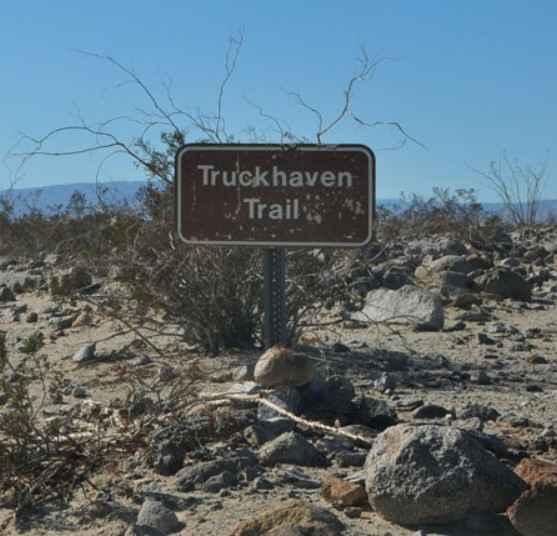
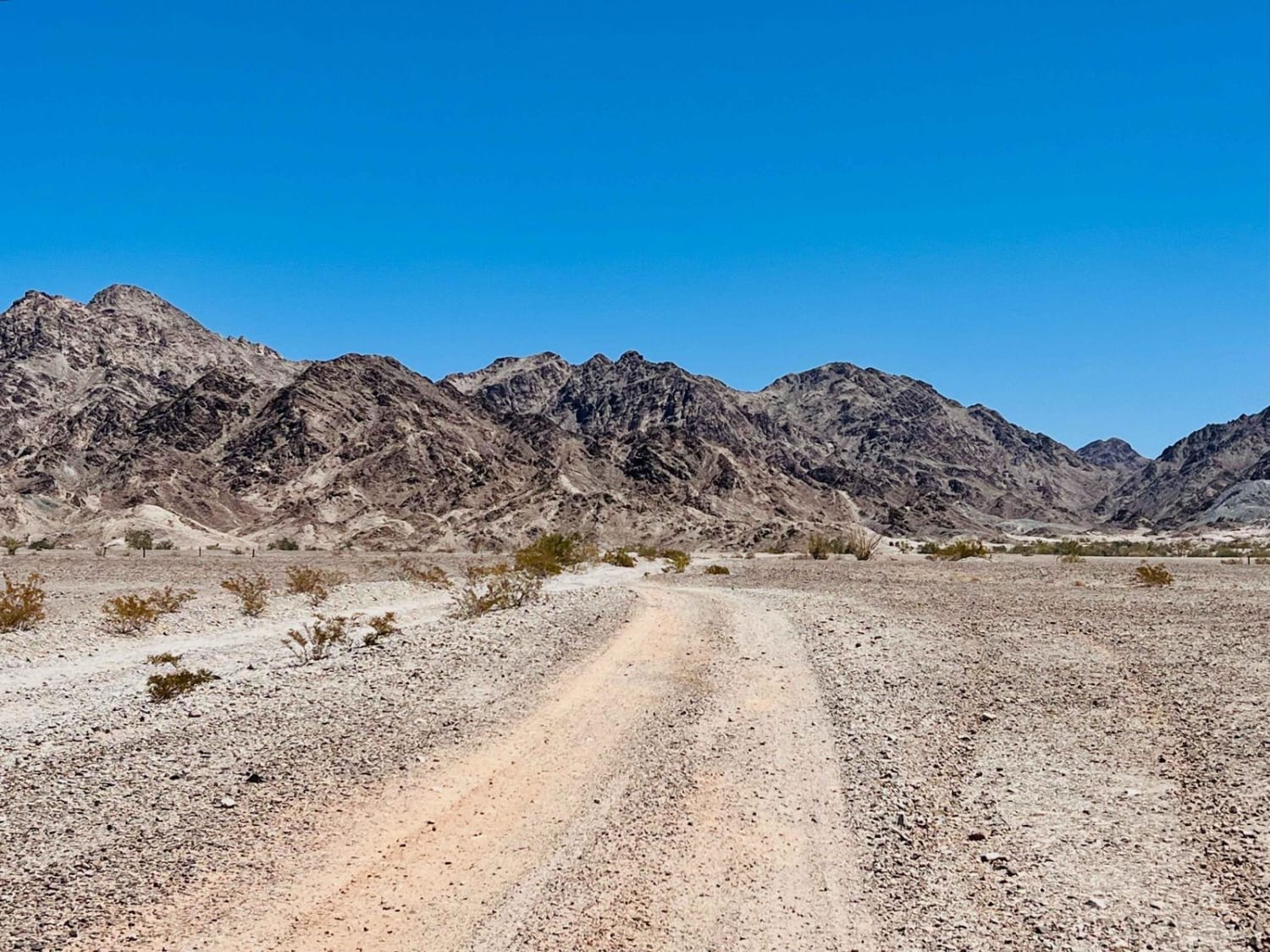
Truckhaven Trail
Total Miles
2.7
Technical Rating
Best Time
Spring, Summer, Fall, Winter
Trail Type
Full-Width Road
Accessible By
Trail Overview
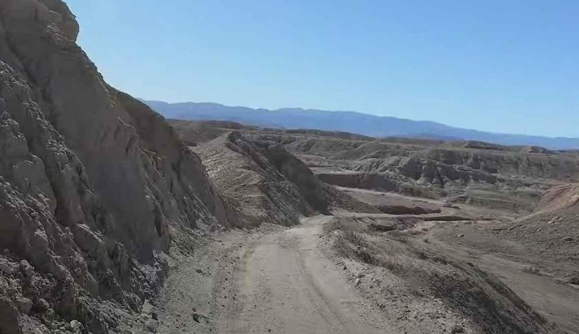
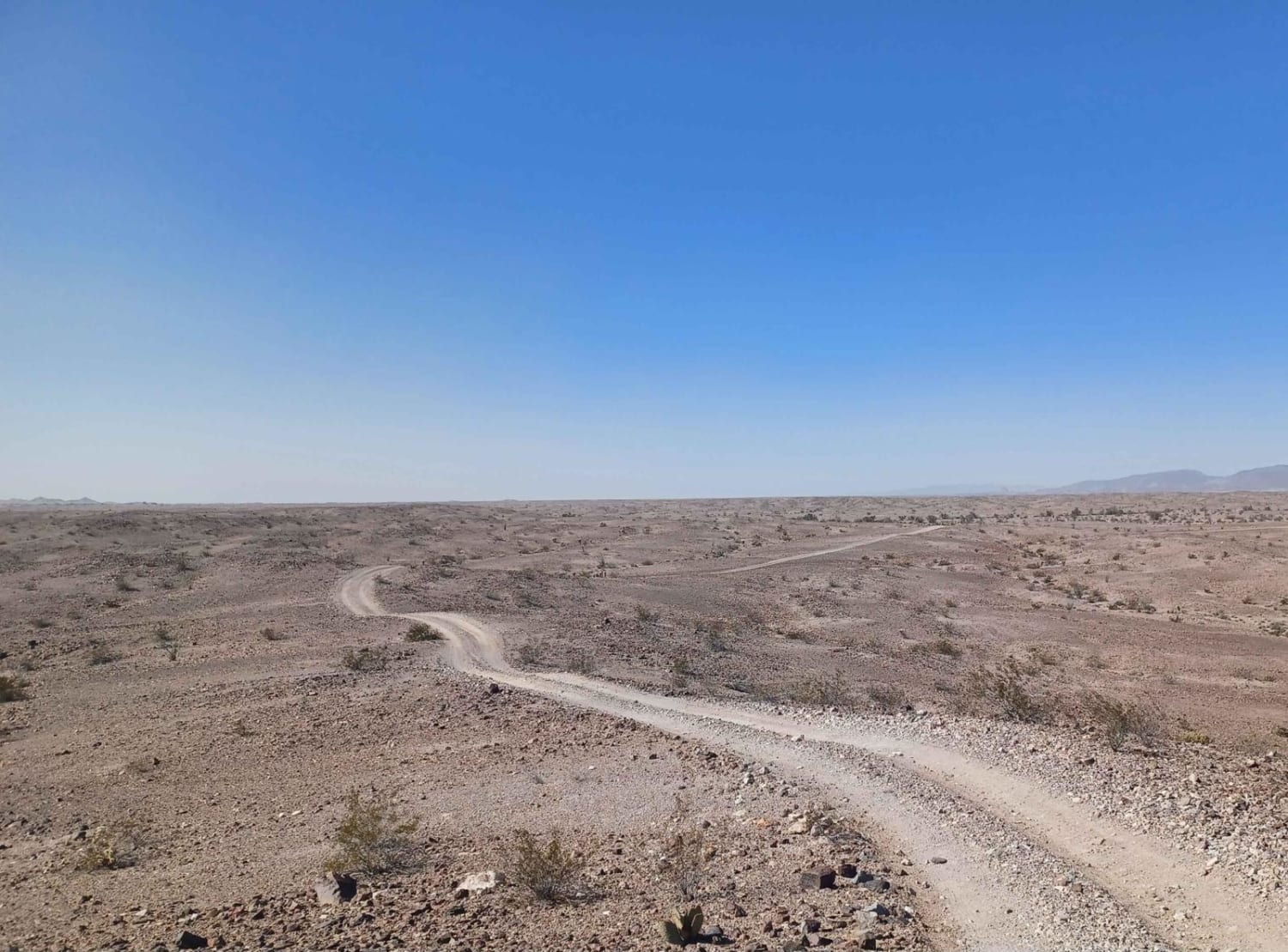
Truckhaven Trail is a 2.6-mile point-to-point trail rated 3 of 10 located within the California Anza-Borrego Desert State Park. The trail is restricted to street-legal vehicles. Truckhaven Trail trailhead is located on Highway S22 across the road from the Calcite Mine Trail. The trail may be identified on some maps as Calcite Mine South. The trail crosses the alluvial plain initially before crossing or entering several washes. As the trail crosses several washes, it is easy to deviate and end up in a different wash. Starting at S22, after the second major descent, come to an intersection of Truckhaven Trail and North Fork Arroyo Salado (unmarked intersection). Stay right--this section of trail is shared with the North Fork Arroyo Salado trail. After about three quarters of a mile at the next intersection, take a left and start the ascent out of the wash. This point is obvious as there is a "Not A Through Road" sign if you continue straight. This will take you to the end of the trail and the intersection with South Arroyo Salado trail. Cell phone coverage is available at the beginning of the trail, but as you drop into the washes, it becomes intermittent or non-existent. The nearest services are located in Borrego Springs.
Photos of Truckhaven Trail
Difficulty
The trail consists of loose rocks, dirt, and sand with some slick rock surfaces and mud holes possible. No steps are higher than 12 inches. 4WD may be required, and aggressive tires are a plus.
History
Anza-Borrego Desert State Park is a California State Park located within the Colorado Desert of southern California, United States. The park takes its name from 18th-century Spanish explorer Juan Bautista de Anza and the Spanish word borrego, which literally means "lamb" but is also used to describe the desert bighorn sheep. With nearly 600,000 acres, it is the largest state park in California as well as the 48 contiguous states. The park has varied topography that includes dry lake beds, badlands, and mountains that rise above 5,500 feet (1,675 meters). Two-thirds of the park's area is designated as wilderness, and cactus, yucca, and ocotillo are abundant throughout. Among the park's attractions are groves of California fan palms and a profusion of wildflowers that bloom in mid-to-late winter. Deer, kit foxes, iguanas, rattlesnakes, roadrunners, eagles, and the endangered desert bighorn sheep are all found within the park.
Status Reports
Truckhaven Trail can be accessed by the following ride types:
- High-Clearance 4x4
- SUV
Truckhaven Trail Map
Popular Trails
Miller Jeep Trail - 20W06
Tumco Townsite Loop
Forestdale Road
The onX Offroad Difference
onX Offroad combines trail photos, descriptions, difficulty ratings, width restrictions, seasonality, and more in a user-friendly interface. Available on all devices, with offline access and full compatibility with CarPlay and Android Auto. Discover what you’re missing today!