2 trails found in California
Which "rubicon trail" are you looking for?
We found 2 off-road trails in California matching your search. Pick the one you're looking for below.
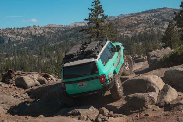
Rubicon Trail
Tucked deep in the Sierra Nevada mountains of Northern California lies one of the most iconic off-road trails in the world -- the Rubicon Trail. This rugged route is a rite of passage for 4x4 enthusiasts. With its technical rock crawling, breathtaking alpine scenery, and rich history, the Rubicon of...
Learn more about Rubicon Trail
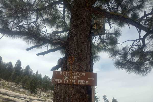
Rubicon Trail Foundation Access Road
The entrance to the Rubicon Trail Foundation Property is marked by a sign posted on a tree, leading you down into the trees. The trail is no more challenging than the Rubicon Trail sections you’ve already navigated to reach this point, but it’s not a walk in the park either. The trail is well-marked...
Learn more about Rubicon Trail Foundation Access Road