Gaging Station - FS 22396
Total Miles
1.0
Technical Rating
Best Time
Fall, Summer, Spring
Trail Type
Full-Width Road
Accessible By
Trail Overview
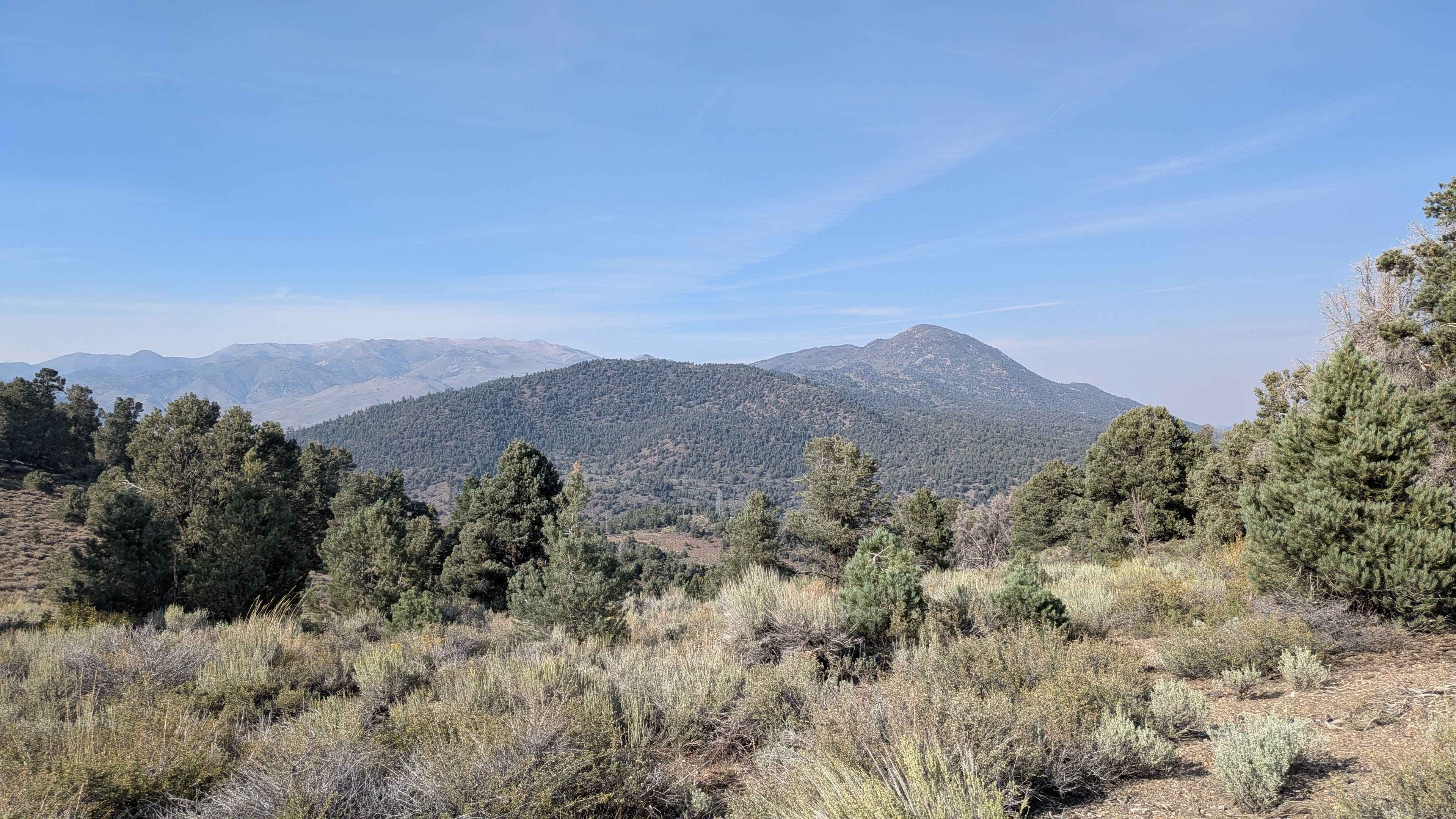
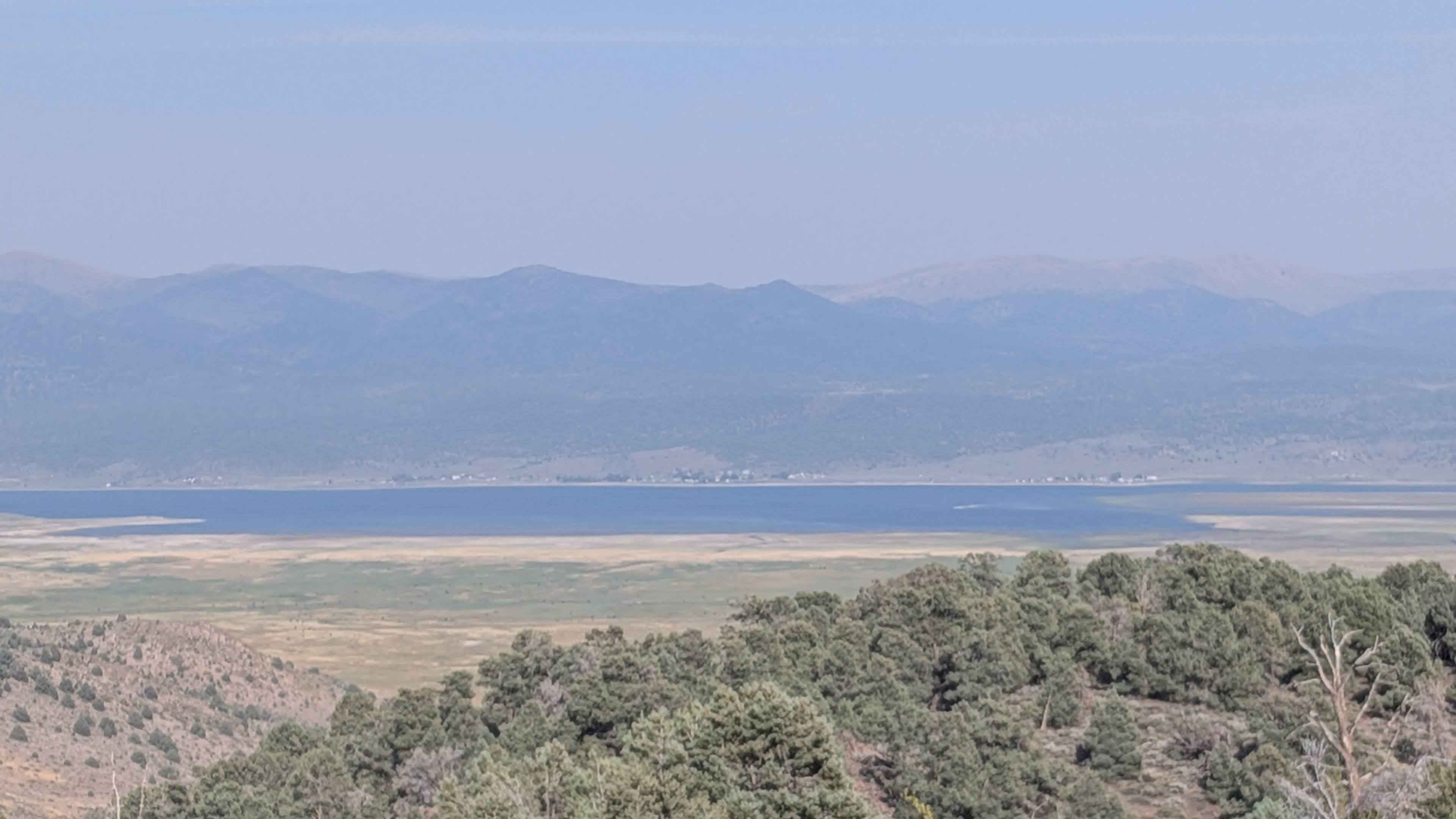
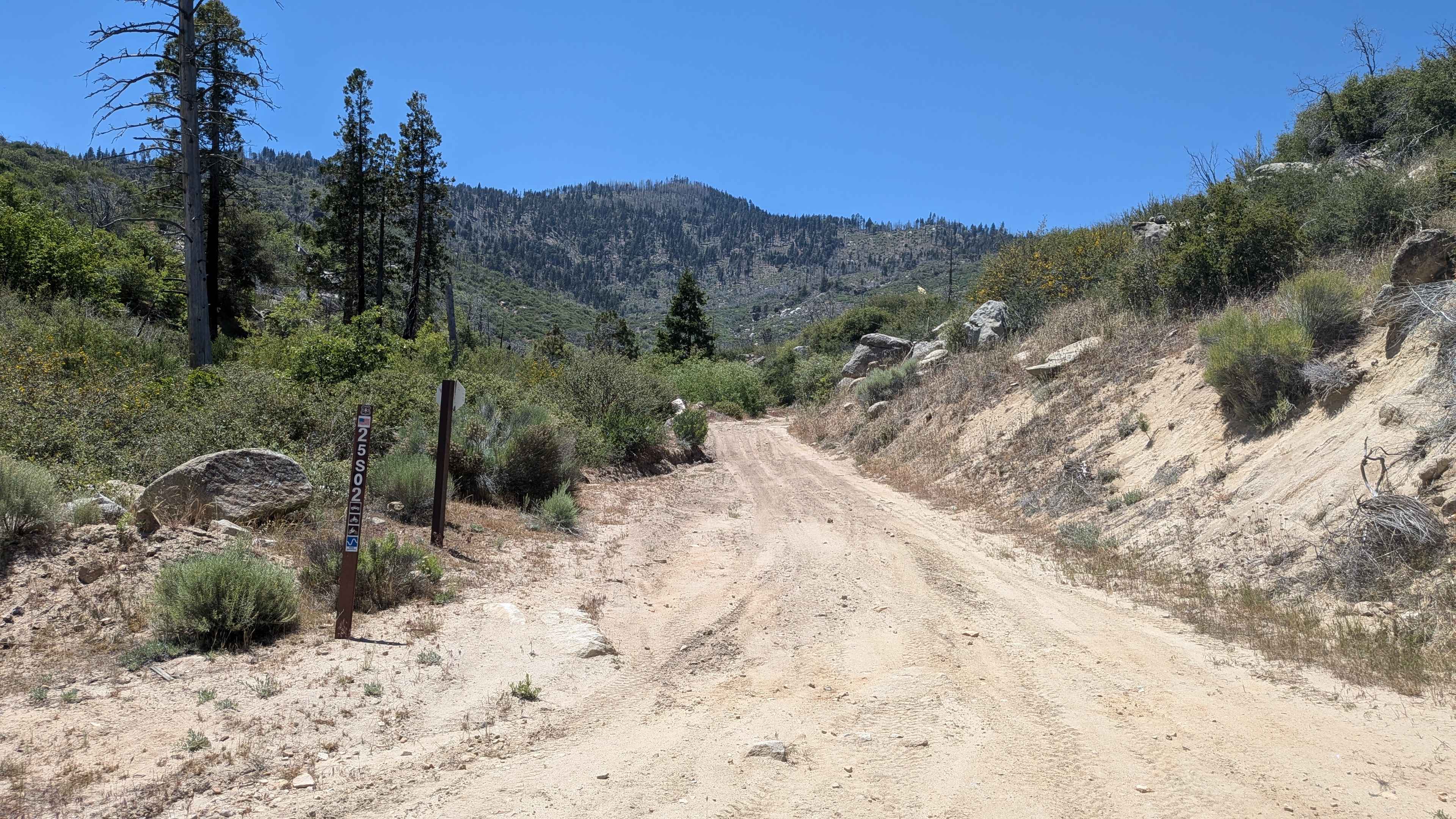
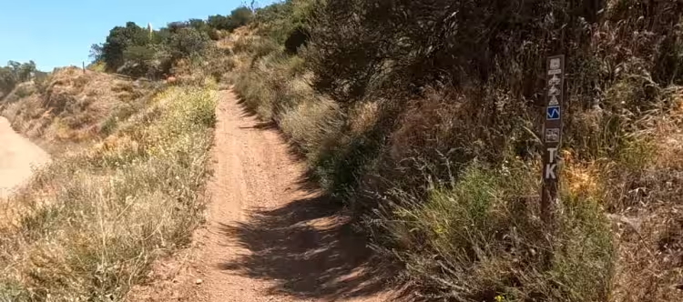
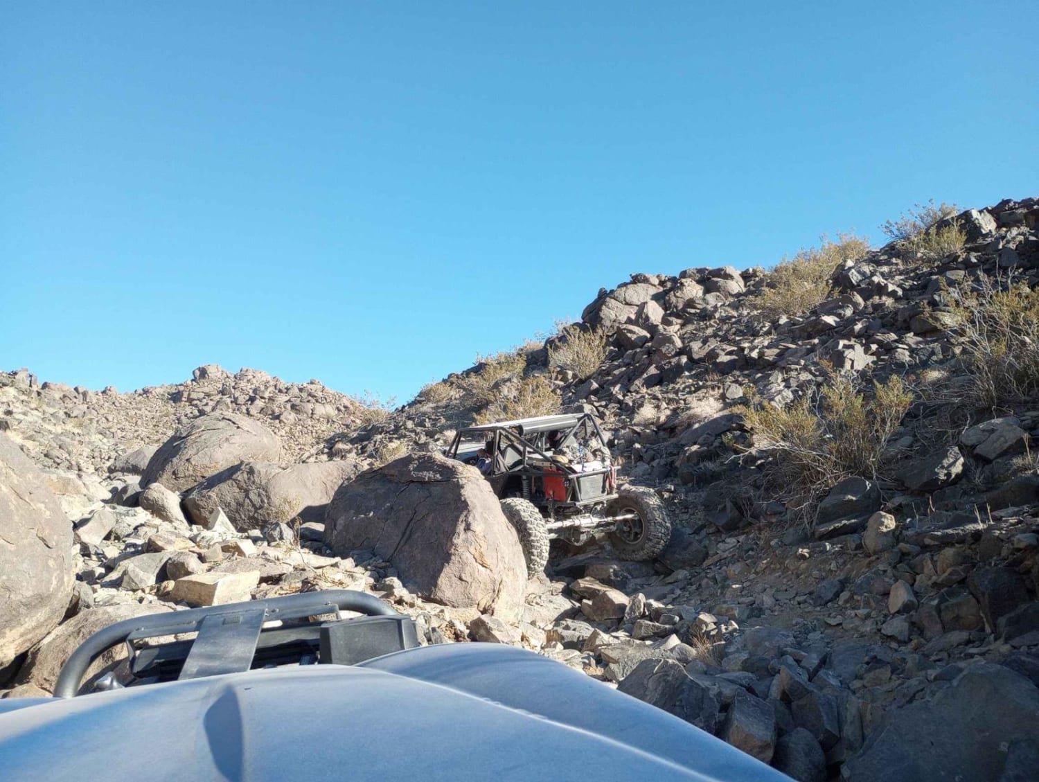
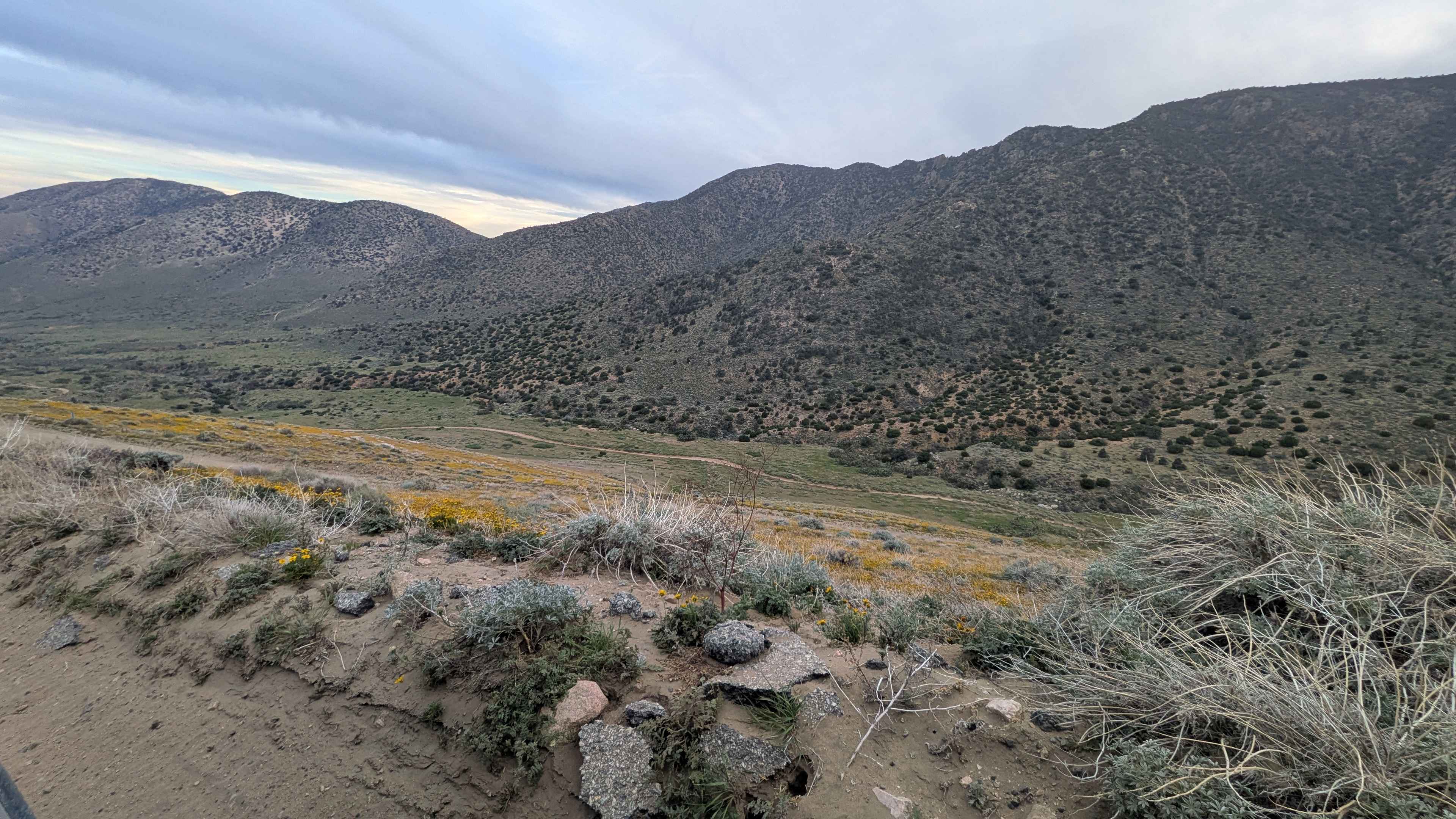
Gaging Station is a dirt trail that climbs over 600 feet in just over one mile, creating a steep and sustained ascent that challenges both vehicle and driver. The trail initially follows power lines, providing a clear navigation reference while ascending the mountainside. The route is lined with bushes and sparse pine trees scattered across the mountainside, creating a typical high desert landscape. Several off-camber sections and rutted areas from water runoff add technical challenges throughout the climb, requiring careful line selection and steady throttle control. At the half-mile mark, the trail diverges from the power lines and continues its steep climb up the hillside. Halfway up the ascent, spectacular views of the town of Bridgeport and the Bridgeport Reservoir emerge, providing a rewarding glimpse of the destination's scenic payoff. A couple of spur trails branch off from the main route, offering additional vantage points for those willing to explore short side excursions. The trail culminates at a summit that delivers an impressive 270-degree panoramic view of the surrounding hills and mountains, making the challenging climb worthwhile for the spectacular scenery.
Photos of Gaging Station - FS 22396
Difficulty
This trail receives a difficulty rating of 3, indicating moderate to challenging conditions that demand capable equipment and experienced driving. The steep 600-foot climb over such a short distance, combined with off-camber sections and water-carved ruts, makes 4x4 highly recommended. The technical nature of the ascent and descent requires confident vehicle control and familiarity with steep, loose terrain conditions.
Status Reports
Gaging Station - FS 22396 can be accessed by the following ride types:
- High-Clearance 4x4
- SUV
- SxS (60")
- ATV (50")
- Dirt Bike
Gaging Station - FS 22396 Map
Popular Trails
Blue Dot
Horse Mountain - FS 27S11
The onX Offroad Difference
onX Offroad combines trail photos, descriptions, difficulty ratings, width restrictions, seasonality, and more in a user-friendly interface. Available on all devices, with offline access and full compatibility with CarPlay and Android Auto. Discover what you’re missing today!