Burcham Flat Road North
Total Miles
10.2
Technical Rating
Best Time
Fall, Summer
Trail Type
Full-Width Road
Accessible By
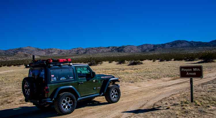
Trail Overview
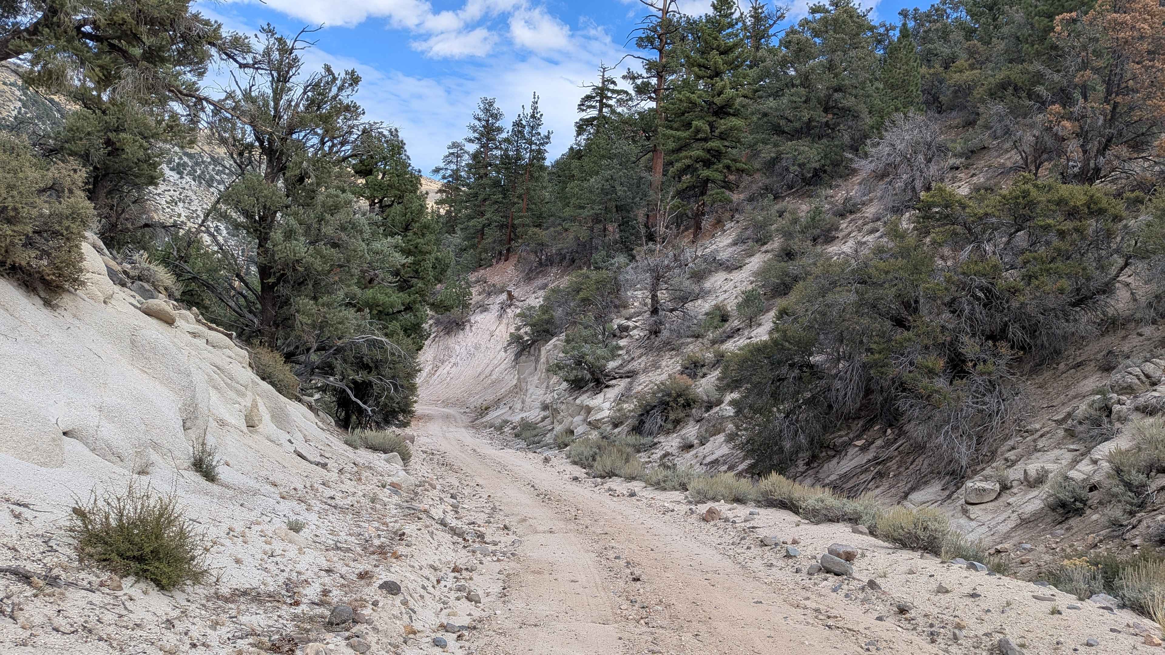
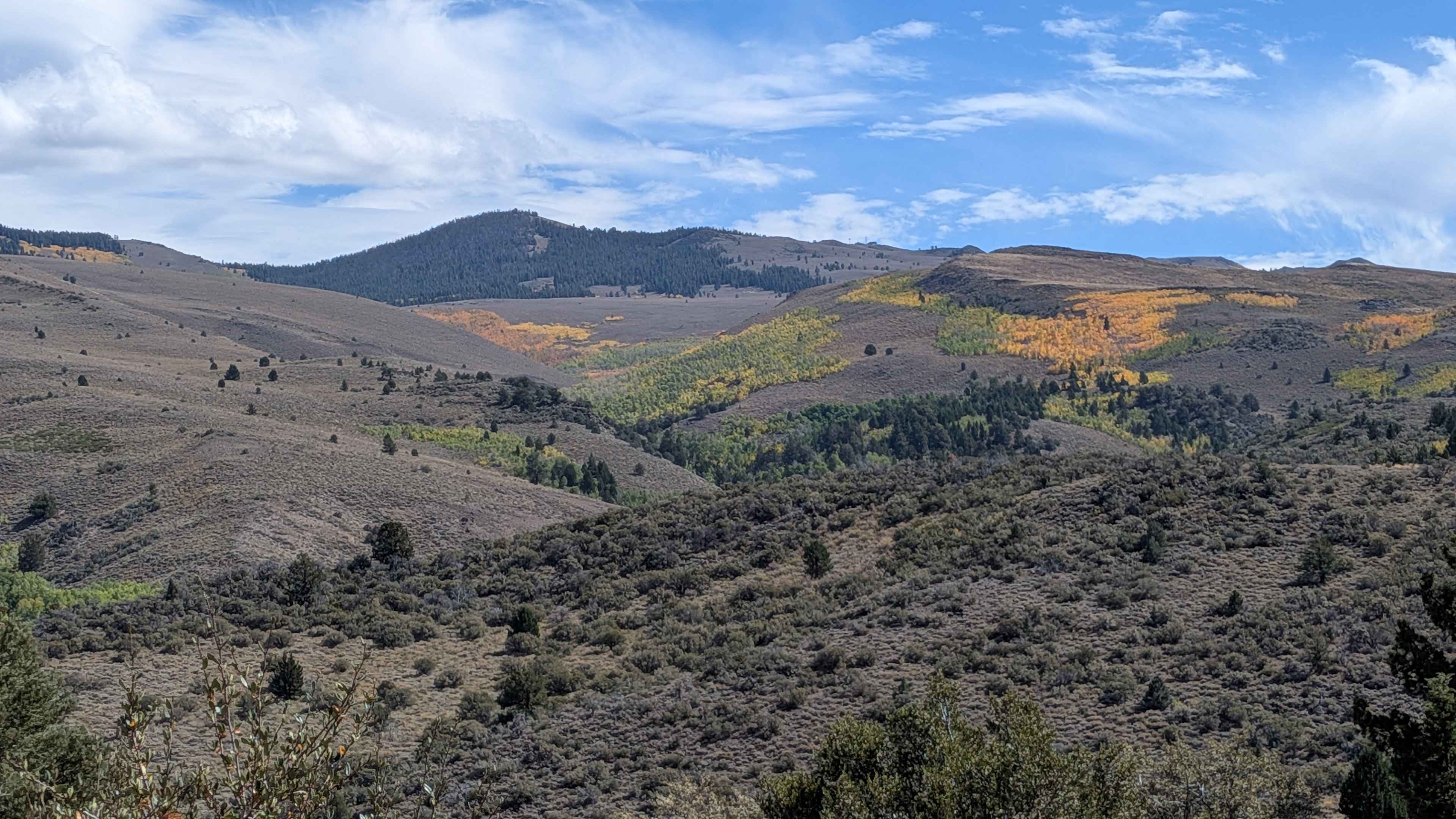
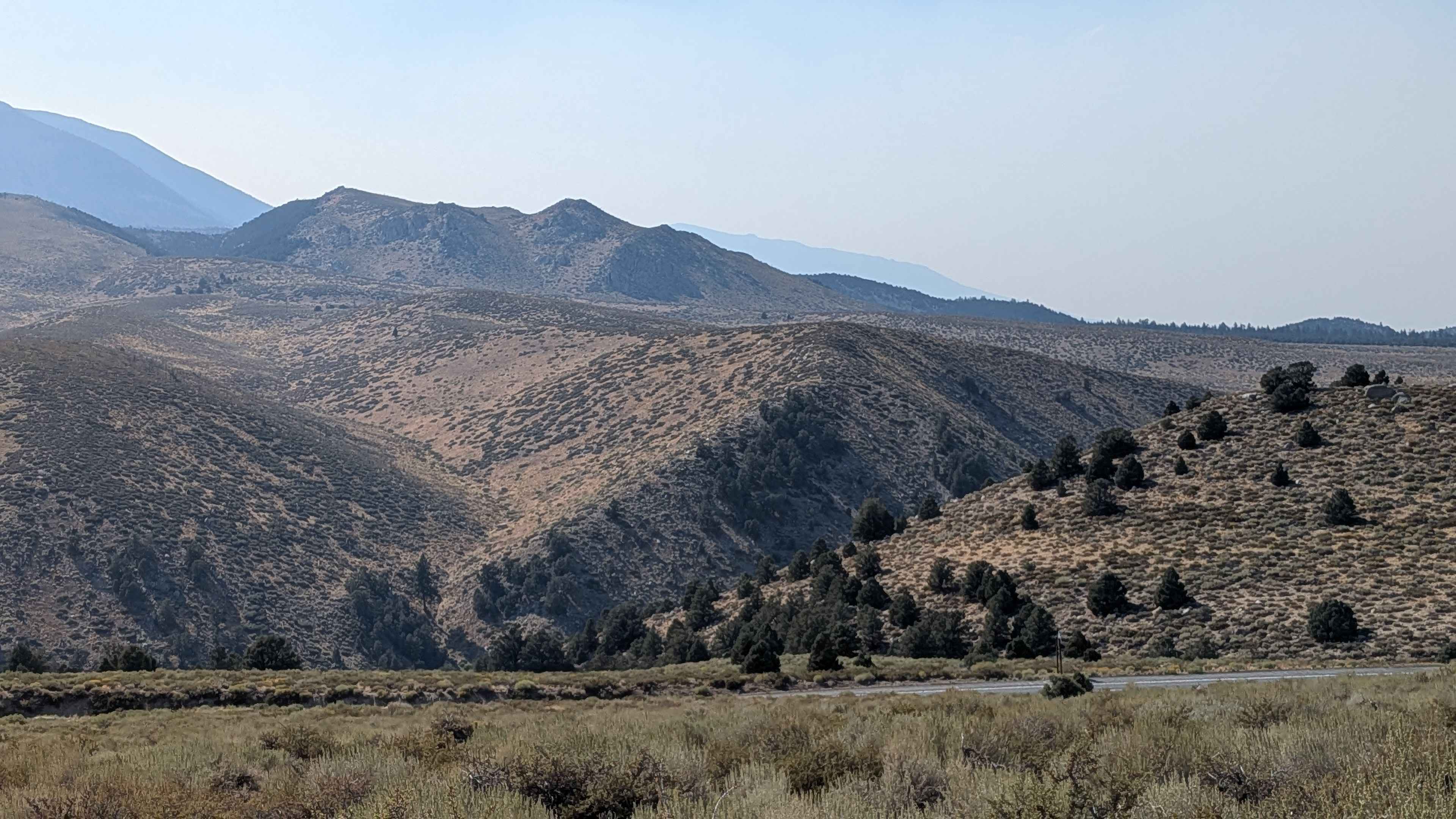
This trail can be accessed from the north off Camp Antelope Rd in Walker, California, or from the south off Highway 395 using Holy Climber Trail and Burcham Flat Road South. The northern approach features a dramatic descent of over 3,000 feet in just over 10 miles, creating an exciting elevation change with continuously evolving landscapes. The route runs parallel to and high above Highway 395, offering spectacular elevated views of the hills and mountains surrounding the area throughout its length. The trail begins as a sand surface that is typically graded and maintains a width of over two vehicles, providing comfortable initial driving conditions. At approximately mile 2 from the south, the trail slightly narrows and becomes rougher with some ruts from water drainage, introducing the first changes in surface character. Several spur trails branch off along the route, including Cottonwood Meadows (FS 32106), offering exploration opportunities. After mile 7 from the south, conditions become noticeably rougher with more gravel and small rocks appearing, though the stunning views continue to compensate for the increasingly challenging surface. At mile 8, the trail transitions to powdery dirt and becomes a shelf road positioned high above a canyon, winding through pine forest with some switchbacks requiring careful navigation. At mile 9, the landscape changes dramatically as you enter a valley filled with very large pine trees, creating an enclosed forest experience. After mile 10, the trail begins a slow climb on another shelf road overlooking a different canyon, providing dramatic views of the mountains just across Highway 395. The final descent begins, and at mile 11, drivers are rewarded with excellent views of the canyon and Highway 395 below, with mountains visible in the distance. Fall visitors will particularly enjoy the stunning displays of aspens changing color, adding seasonal golden hues to the already impressive mountain scenery.
Photos of Burcham Flat Road North
Difficulty
This trail has a moderate difficulty rating (2) based on the changing surface conditions, shelf road sections, switchbacks, and rougher terrain after mile 7. The primary challenges include managing the over 3,000-foot elevation change, navigating shelf roads high above canyons, handling increasingly rough surfaces with gravel and rocks in later sections, and coordinating turns through switchbacks, though the generally wide track and graded maintenance keep technical demands manageable.
History
The road's history is tied to this region's past use for cattle grazing, which was later replaced by wildlife conservation efforts following the Burcham & Wheeler Flats Wildlife Area's designation in 2014. The area was historically significant for the sage grouse, with remnants of old strutting grounds still visible, though the habitat has been impacted by past overgrazing and fire suppression.
Status Reports
Burcham Flat Road North can be accessed by the following ride types:
- High-Clearance 4x4
- SUV
- SxS (60")
- ATV (50")
- Dirt Bike
Burcham Flat Road North Map
Popular Trails
Forest Service Road 5S108

Blow Sand Canyon Road
North Pinyon Mountain Road
The onX Offroad Difference
onX Offroad combines trail photos, descriptions, difficulty ratings, width restrictions, seasonality, and more in a user-friendly interface. Available on all devices, with offline access and full compatibility with CarPlay and Android Auto. Discover what you’re missing today!