Highland Route - 216
Total Miles
3.3
Technical Rating
Best Time
Fall
Trail Type
High-Clearance 4x4 Trail
Accessible By
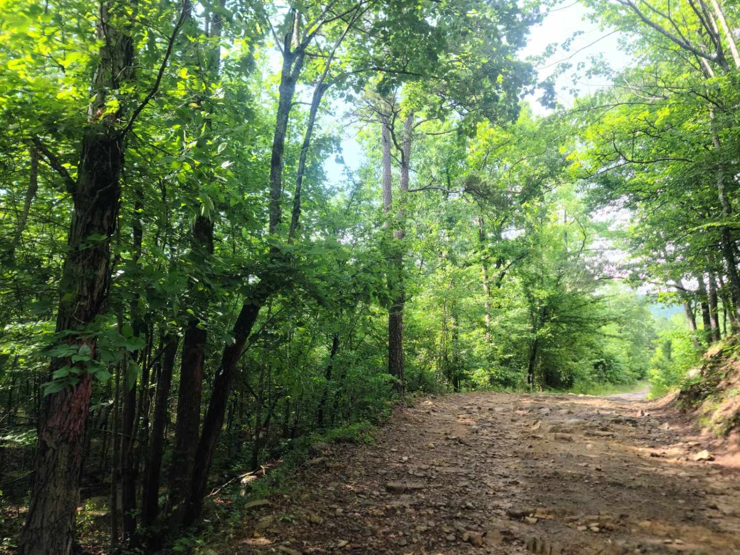
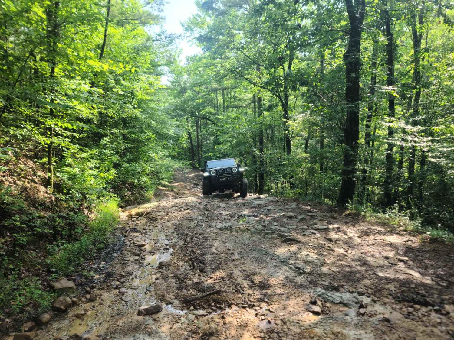
Trail Overview
The highland road is locally known as "the jeep trail" when asked by new people, and is one of the more difficult roads in this part of the Ouachita Mountains. This route was created in the 30s by the CCC but is no longer maintained. The route seems to get more difficult by the month due to erosion, and the one bad section seems to have now become the whole road. The Southern end is still the roughest portion by far, but is still easily doable by an experienced driver and a high clearance 4WD. I would no longer consider taking a stock 4WD any longer due to the off-camber sections and deep washes. Lockers are not required, but are helpful, of course. The Northern end of the trail is a bench on the road and has great views in the winter. The road can be narrow in locations, though meeting a vehicle along most of the length would be fine given the wide spots. This road is often used by some SxS traffic to transit from Wolf Pen Gap to Fourche Mountain Trails. It is also the more difficult trail utilized during the Ouachita Mountain Jeep Jam and is coupled with the nearby Buck Knob Trail.
Photos of Highland Route - 216
Difficulty
I would rate this somewhere between a 6 and a 7. This "road" has become more and more difficult by the month. The Southern end of the trail is by far the worst, though a large majority of the trail has ruts and off-camber driving. The southernmost end used to be considered a gatekeeper of sorts, but now has expanded in both directions. This portion is a steep rocky outcrop with a lot of erosion and is washed. This section is an elevation rise of probably 10-15 feet, though I am not sure it would meet the requirements of a 5-foot ledge. This section can be fairly difficult in the rain. The "gentle" portions of the trail are covered by smaller rocks. 4 low is highly recommended, and in the rougher portions of the trail, I ran with the sway bar disconnected and lockers engaged.
History
This road was constructed in the 30s by the Civilian Conservation Corps and was later utilized by the US Forest Service's Iron's Fork Experimental station research staff though the 40s. It is no longer maintainable due to the rock and heavy erosion.
Status Reports
Highland Route - 216 can be accessed by the following ride types:
- High-Clearance 4x4
- SxS (60")
- ATV (50")
- Dirt Bike
Highland Route - 216 Map
Popular Trails


McConnell Ridge
Prater Road 225
The onX Offroad Difference
onX Offroad combines trail photos, descriptions, difficulty ratings, width restrictions, seasonality, and more in a user-friendly interface. Available on all devices, with offline access and full compatibility with CarPlay and Android Auto. Discover what you’re missing today!