Mark Larmoyeux
Jul 13, 2026
2024 Toyota Tacoma
Open
Rough/Deteriorated
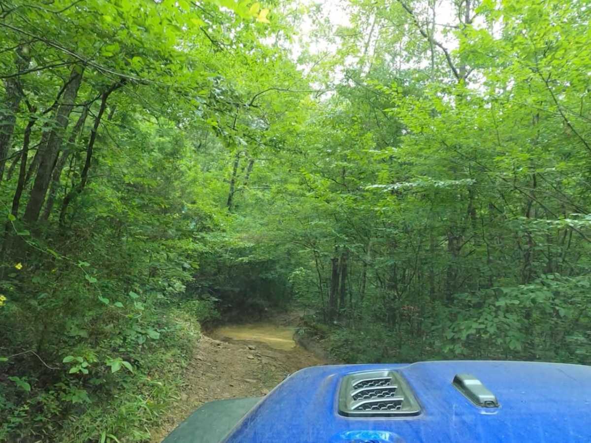
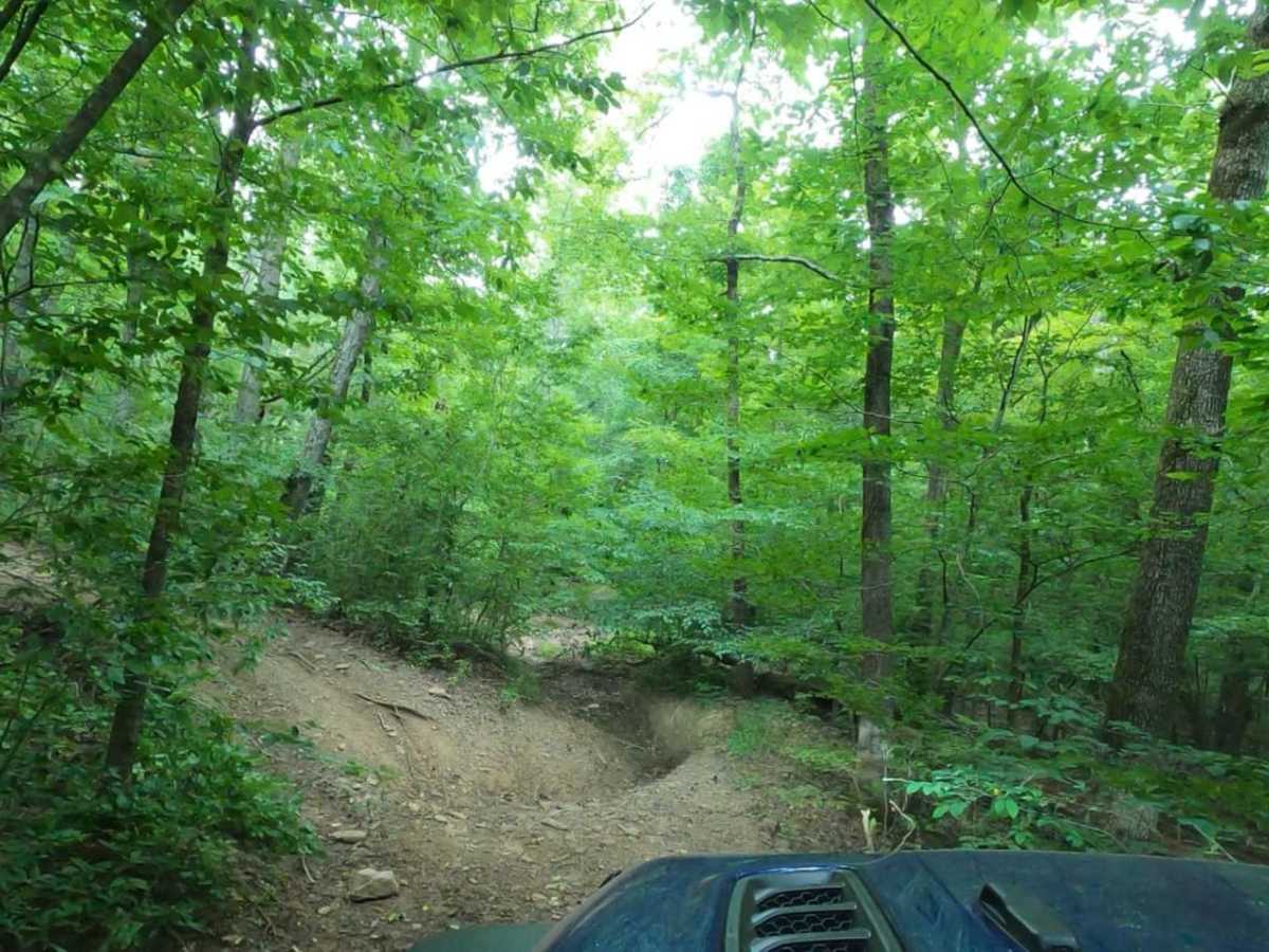
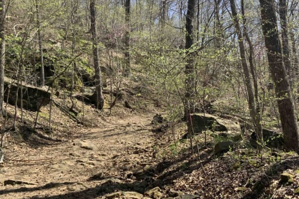
Entered from the west side. Made it to 35.76082, -94.02207 and encountered a washed out sectionthat has a large rock at the top of the wash that I could not get around. The large rock in the middle would be impossible to go over as it sticks up both below and above the rock. Looks like SxS's have gone around the rock on the left, but it was too narrow to get my truck around. Even getting my wheels high on the bank, my rails could not make it around the rock.
Joshua
May 16, 2026
Open
Dusty
Trail is pretty much open now, we cleard one downed tree. Some others still there but they have go arounds. Several good sized mud holes along the trail. A few steep spots that gave the guys infront of me in UTV's trouble. My KRX had no issues.
Adam brown
Jan 06, 2026
2020 Jeep Gladiator
Obstructed
Downed Tree
There are two large trees down across the road. They’re in a ravine area that allows side-by-side and such to go underneath but a full size jeep or truck cannot make it underneath it bring a chainsaw.
Jonathan Ramos
Dec 26, 2025
2023 Jeep Gladiator
Open
NormalMuddy/Wet
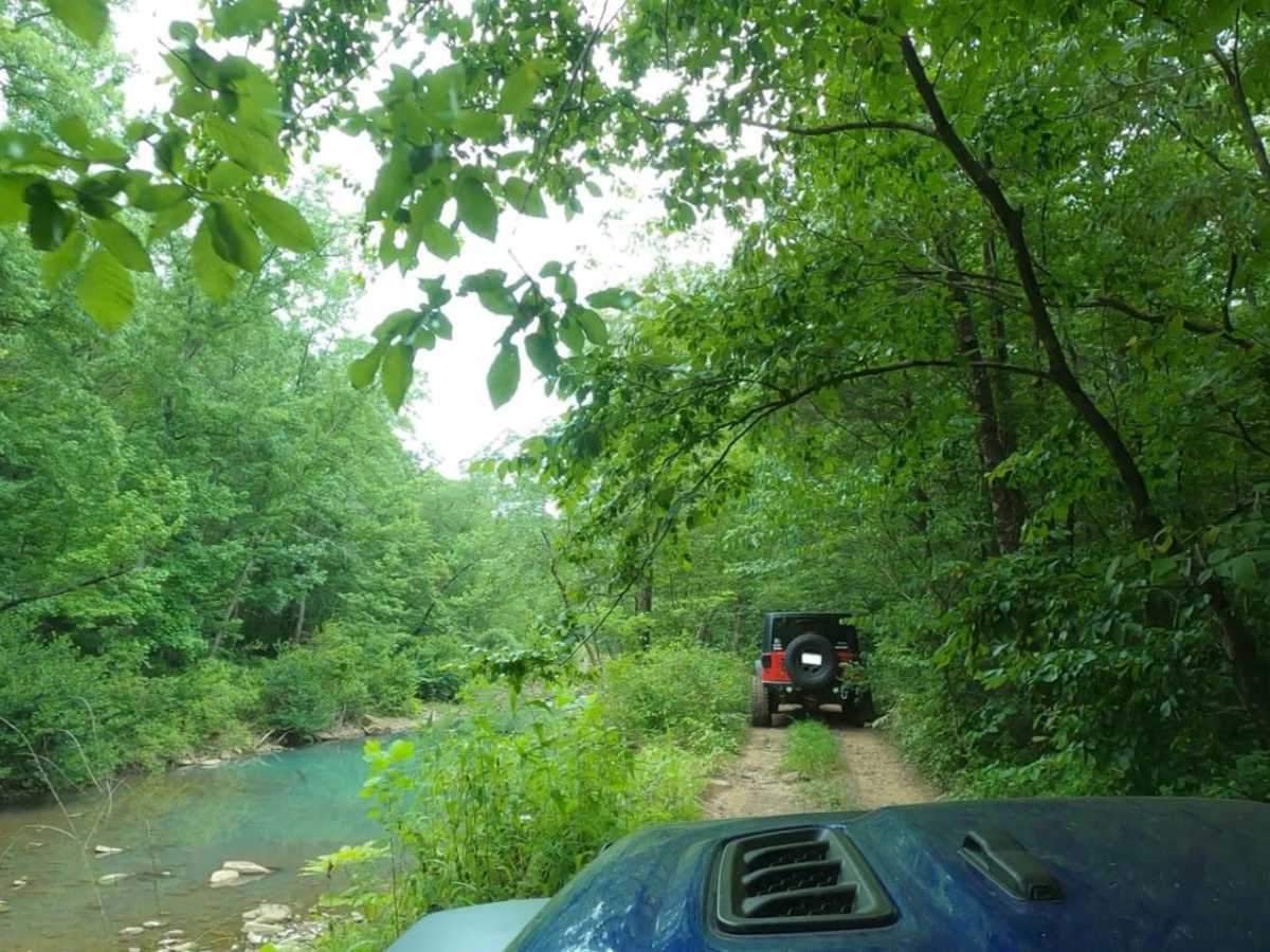
We ran from East to West and 50% of the trail is just Bumpy and Rocky, but when the challenging stuff starts its pretty much that for the next several miles. Stock vehicles would not make it. We have a Gladiator Mojave on 2in lift and 35s and we bottomed out a few times and scraped Rock Rail on that Big Famous Rock. One observation is for most of the trail GPS shows you on a different path but alongside the one on ONX. There are several overhanging trees that if to much lift would prob not make it. Also the bypass are very tight and if to wide will give you Body damage.
Ryan Wells
Nov 22, 2025
2003 Lexus GX
Open
NormalMuddy/Wet
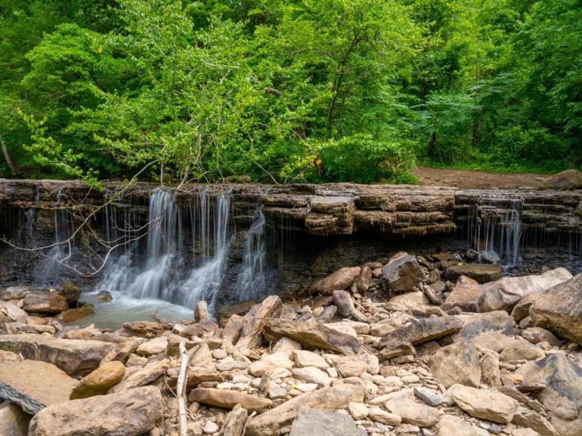
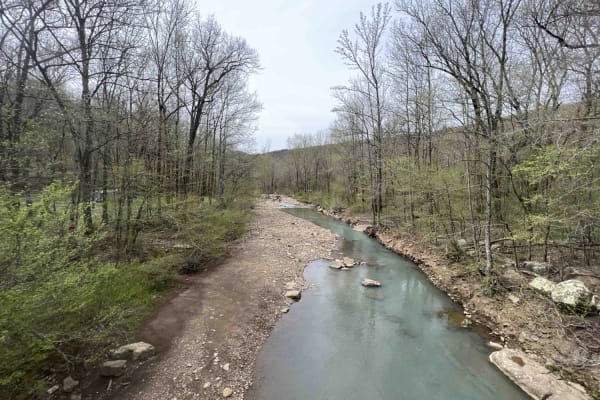
Frog Bayou is one of my favorite trails. Did it this time in my GX470 on a 3.5” lift and 35x12.5” tires. All while having my buddies Rough Country RTT on the roof. There were a few downed trees that we were able to go over pretty easy, even the two 4th gen 4 runners on 33s that were with us went over them. Due to my rig being so tall we had to clear out several trees that over hung the trail the top of the tent was just about 7ft high. So there was plenty of headspace for anything smaller. There is a section of the trail if you are traveling east, that is up hill towards the beginning that I would not recommend doing if you do not have sliders, but can be done with some rock stacking. A very fun trail, and even the downed trees that are too big to move, there are bypasses around them currently.
Ryan Curtis
Nov 18, 2025
Obstructed
Downed Tree
Sunny and in high 70’s. Frog Bayou trail intertwines with FS1705 at many places. The forest service road was in decent shape, but the trail had dozens of small downed trees. A few workarounds but don’t see how jeeps or other
Trevor Latham
Oct 04, 2025
2023 Jeep Wrangler
Obstructed
Downed Tree
Very large down tree that is completely impassable. 35.7582, -94.01266
Alex Richardson
Sep 11, 2025
Open
Rough/DeterioratedWashboard
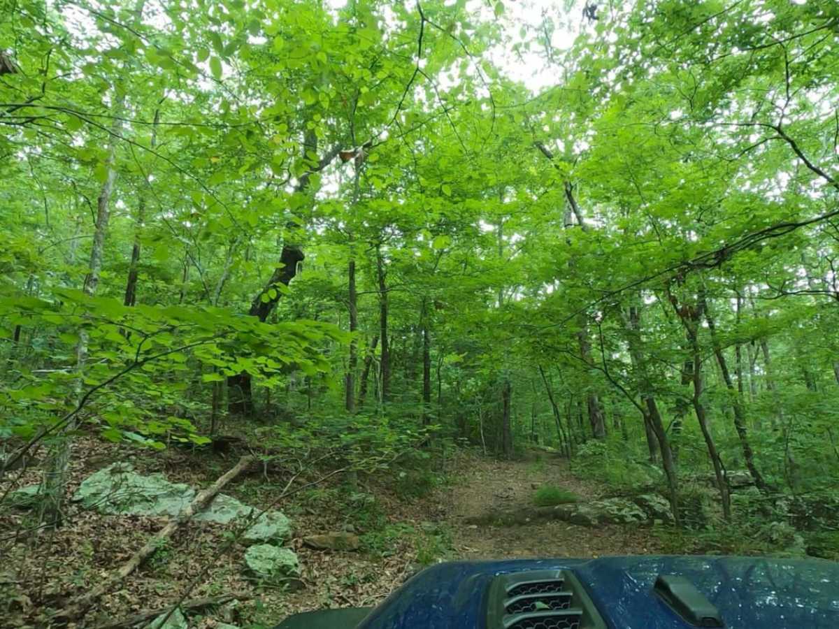
This trail duration is LONG. Expect your ride to take a minimum of 5-6 hours if you are going normal off-road pace. Lots of downed trees, bring a chainsaw. The alternative routes for the downed trees are far too rutted out or inaccessible due to the size of a mid size 4x4 truck. I had to create my own path for a sections. Enter this trail from the east, if you come in from the west you are due a very steep and rocky climb with boulders that can exceed axle height at the beginning. You would rather go down them. Not a whole lot of mountain views or breaks, this is a fully off-road trail. Would recommend bringing a friend.
Mike Mitchell
Jul 25, 2025
Open
Muddy/Wet
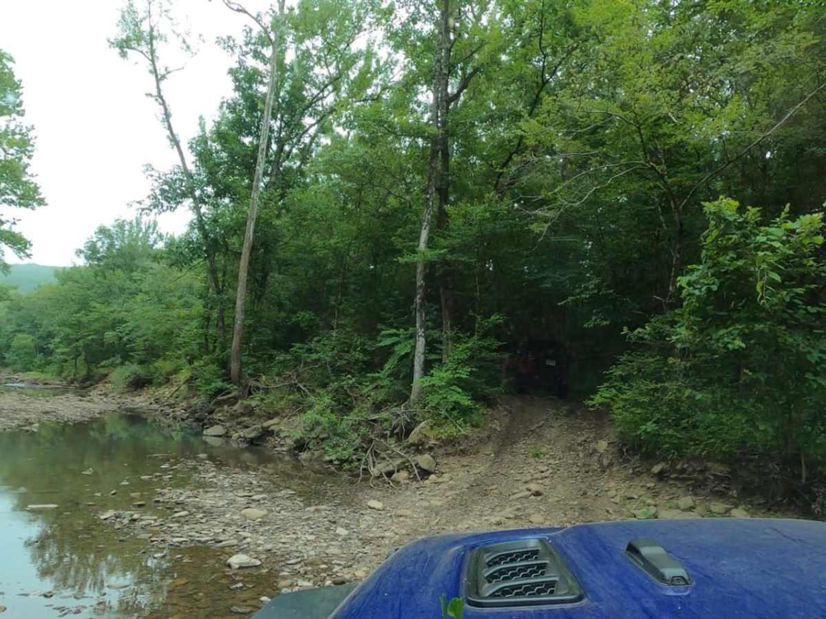
Came in from the West. Took us around 5.5 hours to drive the whole thing. Very rocky. Few mud holes but other than that it was dry. The most painful thing about the trail was the downed trees. There was always a way around them but it made it harder than it should have been. It’s definitely a trail, in its current state, that will keep you on your toes if you are in a 4x4. On a UTV you could knock it out in a couple hours easy.
mark poole
Jun 15, 2025
Open
Muddy/WetRough/Deteriorated
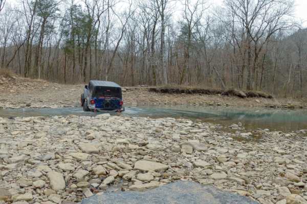
Recent heavy rain, started on the west end and got to the steep hill that’s washed out and a solid 7/10 difficulty. Located at 35.7592, -94.02067. Was about 2 3/4 miles in. There is room to turn around just before. Many water crossings up to 12” with gravel bottoms. The downed trees obstructing the trail have been cut and are tight but passable.My lifted RAV4 made it by driving around the really large rocks but bottomed out several times.
Ryan Hardin
Jun 08, 2025
2021 Ford F-Series Super Duty
Obstructed
Downed Tree
West of the falls trees are across the trail forcing turn around. It’ll take more than one person and saw to clear the storm debris
Brian Webb
Apr 26, 2025
Open
NormalMuddy/Wet
Nice trail with a couple of spots to work. Easier from east to west for sure.
Brian Webb
Apr 24, 2025
Open
Austin Johannes
Apr 15, 2025
Open
NormalMuddy/Wet
This was my 1st ever trail never went off road till now. That being said I did pretty good it pushed my limits and made it through in one piece. Didn’t have recovery gear. Rookie move. But I suggest you do just incase. But it was fun and long would probably do it again
Brian Gayley
Mar 22, 2025
2024 Jeep Wrangler
Open
OnX shows this trail open to all vehicles. There are large sections that have been diverted away from the all vehicle trail and take an OHV trail. We were in Jeeps and stopped by rangers who stated this is not a highway vehicle trail. OnX needs to be updated.