Safelite
Total Miles
5.1
Technical Rating
Best Time
Spring, Summer, Fall, Winter
Trail Type
Full-Width Road
Accessible By
Trail Overview
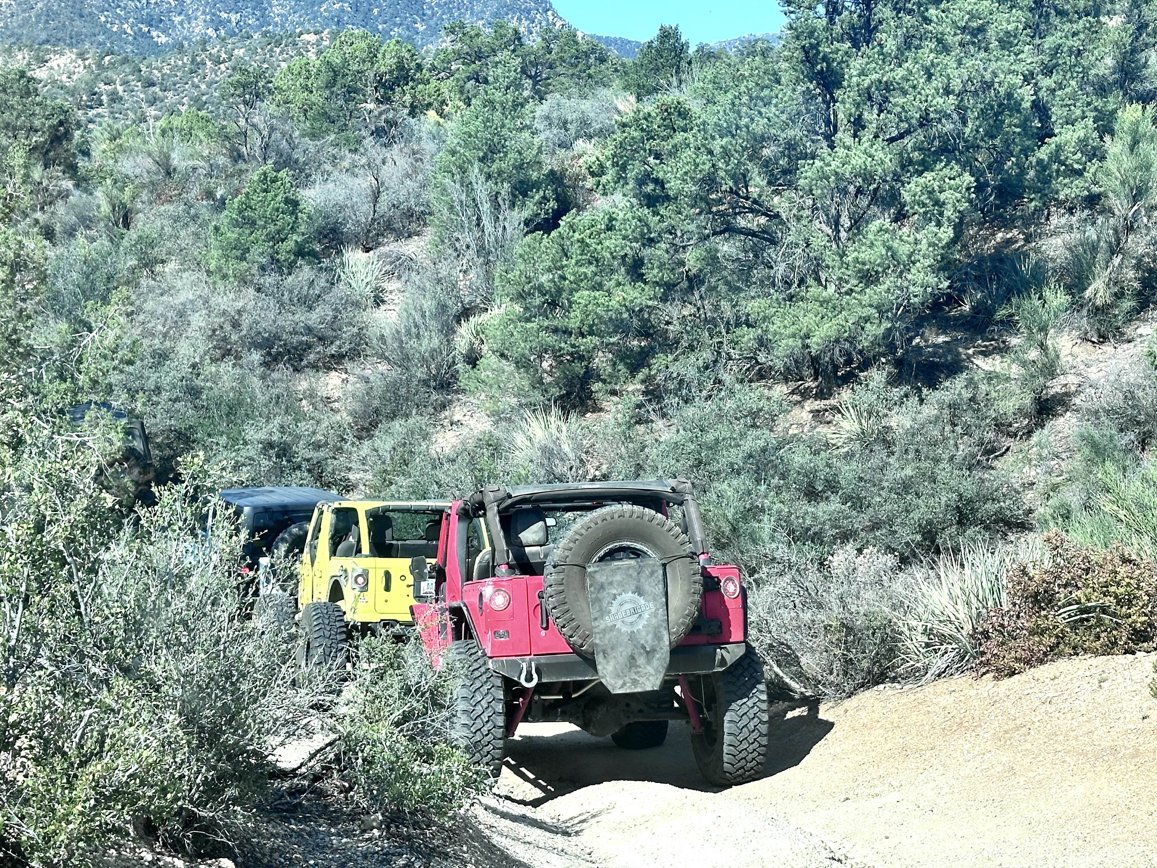
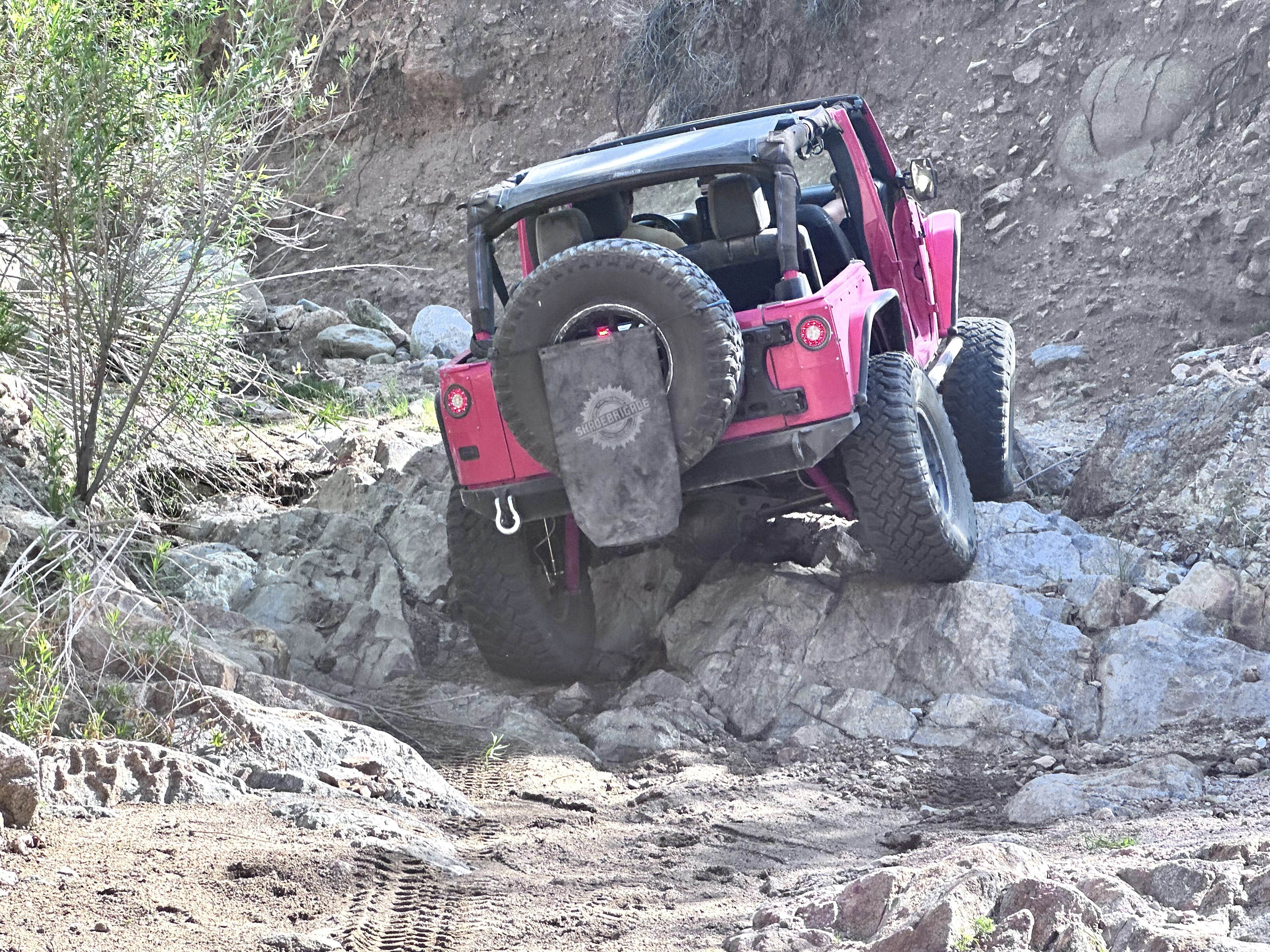
Safelite is a challenging 6.1-mile technical loop trail that begins from Blake Ranch Road in the Hualapai Mountain range. The trail meanders through scenic Pinyon-Juniper woodlands and Mojave Desert vegetation. While on this trail, keep a sharp eye out for the several old mining sites in this narrow canyon (do not attempt to enter any old mine shaft, extremely hazardous due to unstable rock and soil). This trail was named Safelite by the local Off-road clubs due to the number of broken windshields and mirrors that occur on this trail. The first section of the trail is a shelf road with erosion damage up to 12 inches in depth. The descent into the wash has loose rock and dirt. Once in the wash, the technical section of the trail begins. Starting with a loose sandy trail with scattered rocks between 12 to 20 inches in height. The first obstacle is a narrow ledge approximately 24 inches in height. Shortly after that is the first (optional) large waterfall that is 8 feet in height (this obstacle has a bypass to the left). After the waterfall, you will encounter several rocky ledges between 18 to 30 inches in height and boulders up to 36 inches in height to negotiate until you arrive at the second set of waterfalls (optional). This is a set of ledges up to 5 feet in height (this obstacle has a bypass to the left). The first is a V-notch, which requires precise wheel placement to negotiate. After the waterfall, you will encounter more rocky ledges and boulders between 18 to 36 inches to negotiate. The third waterfall is a 4 to 5-foot waterfall to negotiate (no bypass). The fourth and final (optional) obstacle is a 20-foot waterfall (this obstacle has a bypass to the left). Rollovers are common on this obstacle and require a heavily modified vehicle to negotiate. Beyond this last waterfall, the trail becomes a sandy wash with few rocks between 12 to 18 inches to negotiate. As you reach the top of the wash, the trail exits to the right. This is a washed-out section of trail with deep tank traps up to 24 inches in depth. This connects to the final section of the trail, which is a shelf road that leads back to the beginning of the trail, completing the loop. This trail is great for the experienced off-roader and requires a minimum of 35-inch tires, front and rear lockers, and a winch. This trail is in a wash and is susceptible to flash floods; do not attempt this trail when rain events are forecasted. Other potential hazards are venomous reptiles and invertebrates, and extreme heat or cold.
Photos of Safelite
Difficulty
This trail follows up a narrow sandy wash with large boulders that exceed axle height. Multiple waterfalls between 3 to 5 feet in height, and several V-Notch obstacles to negotiate. One V-Notch is almost as wide as a high clearance vehicle, requiring precise placement of tires to avoid body damage. There are two optional waterfalls between 8 to 20 feet in height along this trail (bypasses for both). This trail is in a wash and is susceptible to flash flooding; it is not recommended for travel if a rain event is forecasted.
Status Reports
Safelite can be accessed by the following ride types:
- High-Clearance 4x4
- SUV
- SxS (60")
- ATV (50")
- Dirt Bike
Safelite Map
Popular Trails
AZ Peace Trail Mittry Lake Leg
Mohave Powerline

Veggie Nightmare
Northview Cutoff
The onX Offroad Difference
onX Offroad combines trail photos, descriptions, difficulty ratings, width restrictions, seasonality, and more in a user-friendly interface. Available on all devices, with offline access and full compatibility with CarPlay and Android Auto. Discover what you’re missing today!