Hutch Mesa
Total Miles
3.5
Technical Rating
Best Time
Winter, Fall, Spring
Trail Type
Full-Width Road
Accessible By
Trail Overview
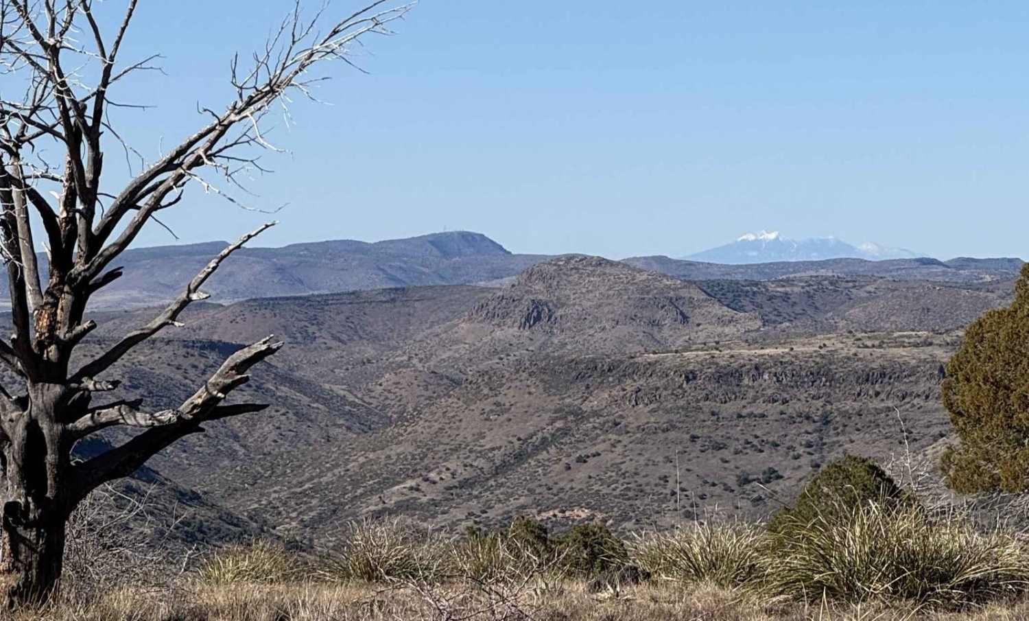
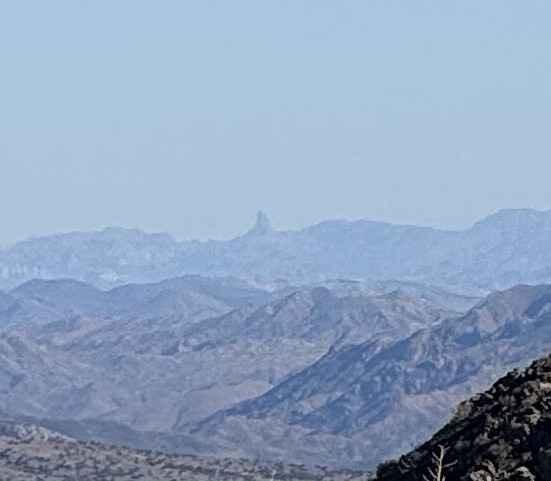
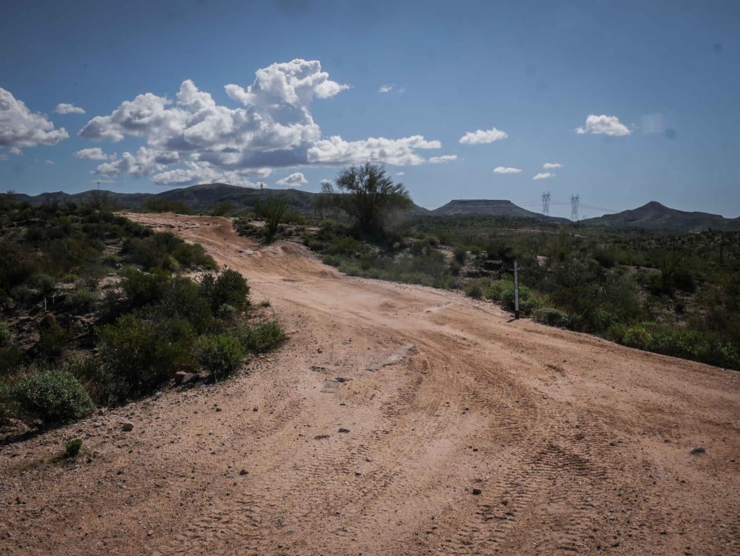
Hutch Mesa Trail is a slow, steady, and rocky climb from Bloody Basin Rd to a spectacular viewpoint on top of Hutch Mesa. From the top of Hutch Mesa, you can see the San Francisco Peaks in Flagstaff and Weaver's Needle SE of Phoenix! The Bradshaw Mountains to the west and the Mogollon Rim, Four Peaks, and Mazatzal Mountains to the east. Truly remarkable viewpoint at around 5,800ft elevation. Start on Bloody Basin Road, 15.6mi from I-17 if coming from the west. 8.5 miles from FR24 (Cave Creek and Bloody Basin Intersection) if coming from the east. You will then turn south on FR 58. First, you will find an old corral and the ruins of Wood Camp Cabin. This is a great place to camp with a concrete slab, a chimney, and lots of big shade trees. From there, you will climb up toward the mesa, and the first section has the worst obstacle in the form of a 14-inch ledge, which is on an already steep road. Once past that, while there are a few more difficult sections, it doesn't get any worse than the first ledge, with most of the rest a 2-3 difficulty rating. It is a 1,000ft climb over just 3.5 slow rocky miles. My transmission temps got pretty hot, and it was only 70 degrees out. There are a few places to stop, get out, and climb some hills to reach the truly amazing views. This trail continues until the end of Hutch Mesa. From there, the road continues on 5.7mi to a private ranch. The terrain on the rest of the road looks rougher based on the map, with a 1,800ft drop over only 5.7mi. That section is for another day when I have a friend along!
Photos of Hutch Mesa
Difficulty
There is one decent 14-inch ledge shown in the photo. There are a lot of rock gardens. Steep non-stop climb, watch your trans and engine temps!
Status Reports
Hutch Mesa can be accessed by the following ride types:
- High-Clearance 4x4
- SUV
- SxS (60")
- ATV (50")
- Dirt Bike
Hutch Mesa Map
Popular Trails
Birthing Place

Electric Whoops
The onX Offroad Difference
onX Offroad combines trail photos, descriptions, difficulty ratings, width restrictions, seasonality, and more in a user-friendly interface. Available on all devices, with offline access and full compatibility with CarPlay and Android Auto. Discover what you’re missing today!