FS 1380
Total Miles
1.9
Technical Rating
Best Time
Spring, Fall, Winter
Trail Type
Full-Width Road
Accessible By
Trail Overview
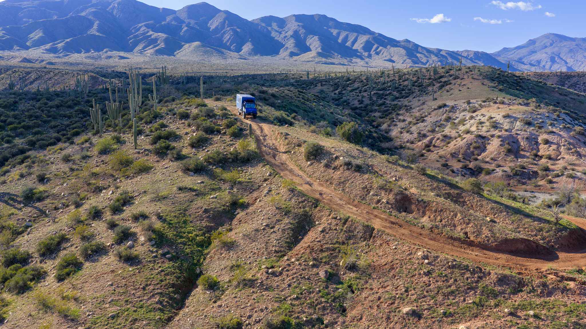
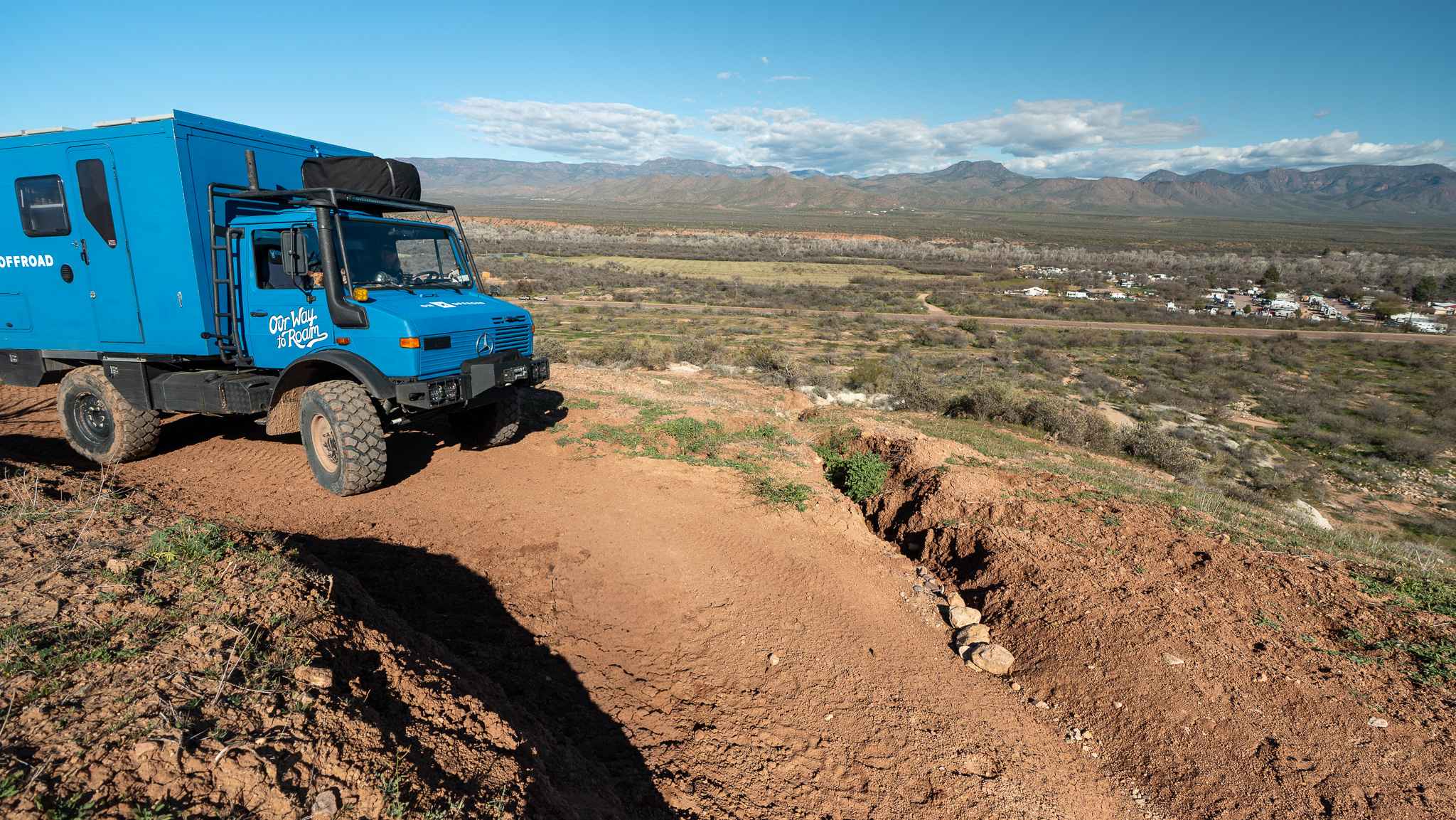
This trail begins with a short but steep climb that quickly wraps around a cliffside. The shelf road is somewhat narrow for full-size vehicles, and a few washouts add mild difficulty, though nothing overly technical. There is one particularly steep pitch right at the end of the initial climb as you crest the ridge. At the top, you enter a vast saguaro grove, and the road transitions into a gradual climb back toward the mountains through fairly open low desert scrub. Along the way, there are open flat areas with established fire rings that make for convenient camping. The road eventually dead-ends through a gate at a lollipop-style camp spot. On the drive back down, you are treated to beautiful views of Roosevelt Lake as the trail descends toward the highway.
Photos of FS 1380
Difficulty
This trail earns its moderate rating due to the narrow shelf road, scattered washouts, and the short but steep climb at the beginning that can challenge traction and clearance. High clearance is recommended, and drivers of full-size vehicles should be comfortable with tight sections and brief exposure along the cliffside.
Status Reports
FS 1380 can be accessed by the following ride types:
- High-Clearance 4x4
- SUV
- SxS (60")
- ATV (50")
- Dirt Bike
FS 1380 Map
Popular Trails
Indian Pass Overlook

Weird Power
Forest Service Road 112
The onX Offroad Difference
onX Offroad combines trail photos, descriptions, difficulty ratings, width restrictions, seasonality, and more in a user-friendly interface. Available on all devices, with offline access and full compatibility with CarPlay and Android Auto. Discover what you’re missing today!