Bullhead City AZPT
Total Miles
3.1
Technical Rating
Best Time
Spring, Summer, Fall, Winter
Trail Type
High-Clearance 4x4 Trail
Accessible By
Trail Overview
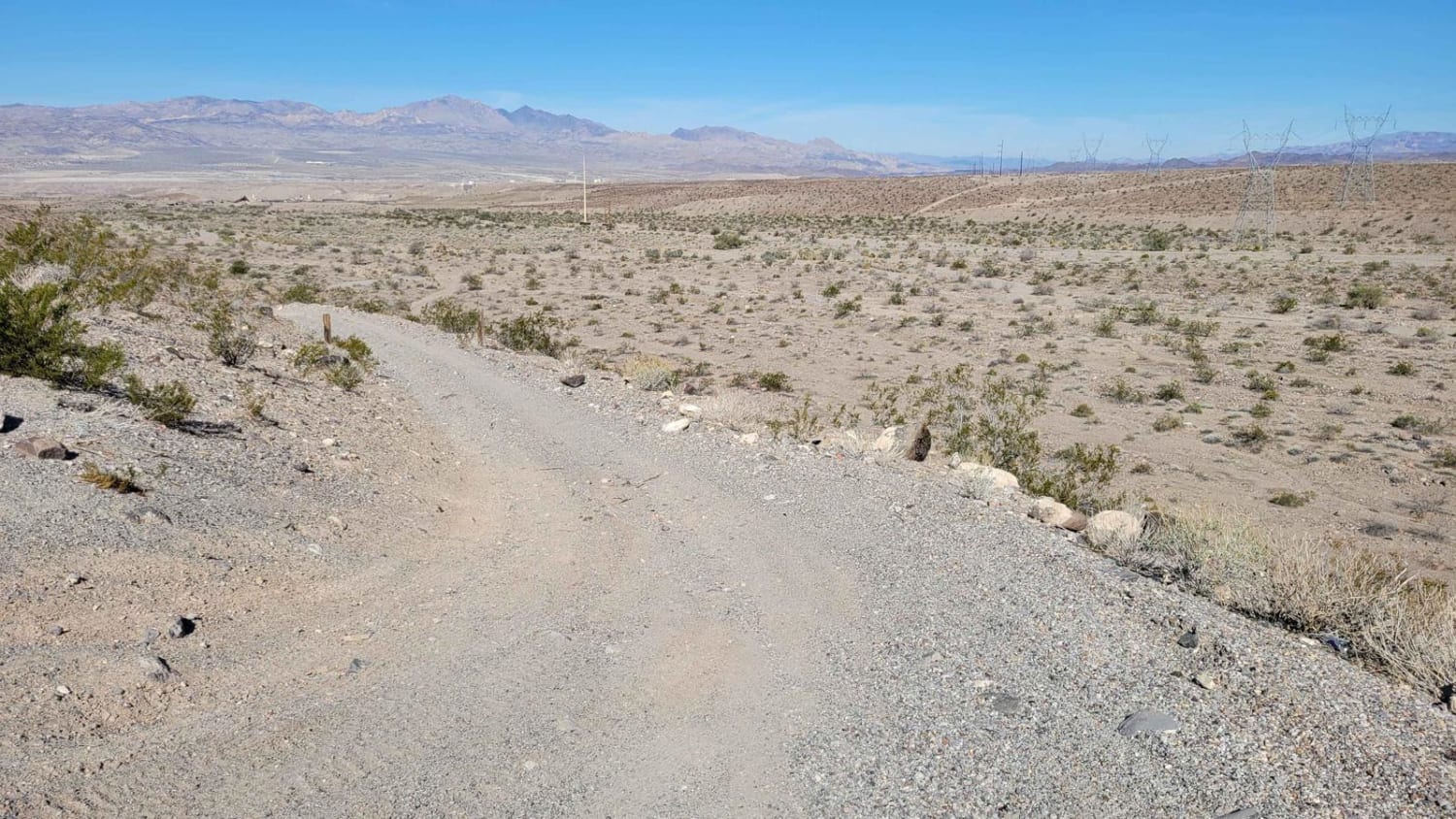
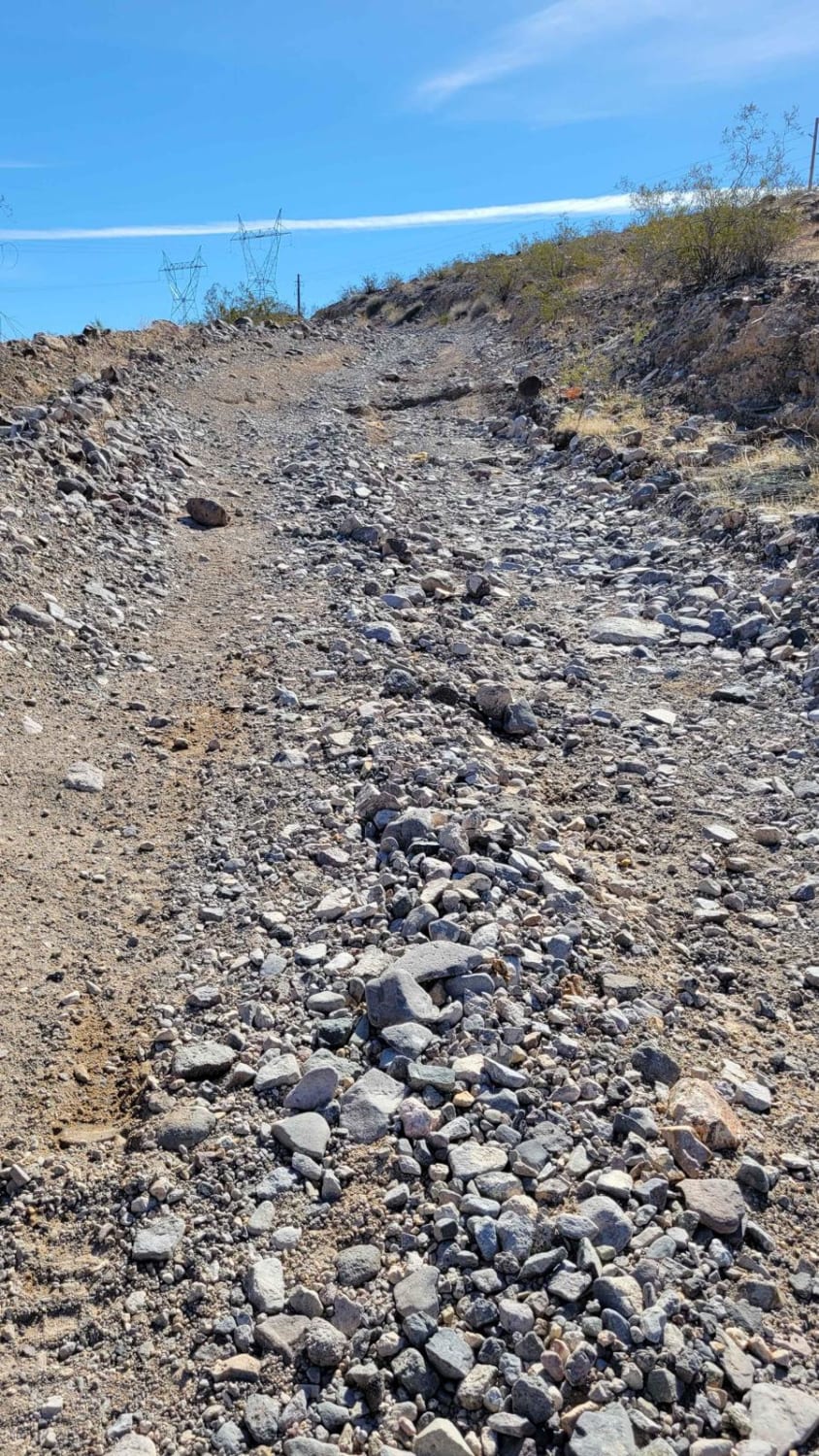
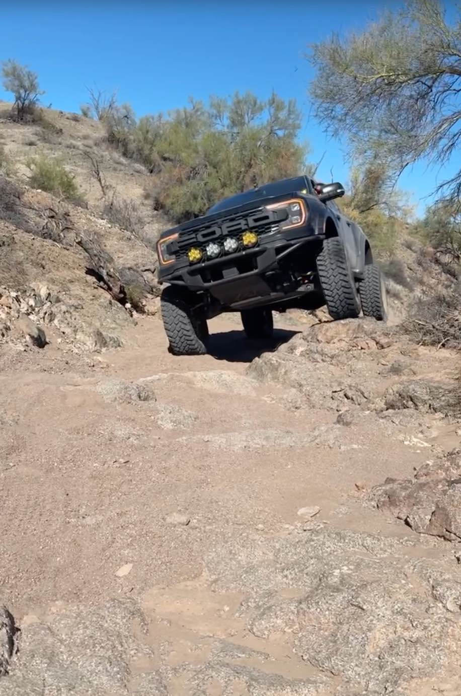
This 3-mile point-to-point stretch of the AZPT connects from Silver Creek Road (155) to Bullhead City, paralleling the Black Mountains to the east and the city to the west. The trail is like a desert rollercoaster, weaving through washes and climbing/descending several hills. The hills vary with difficulty--some are more steep than others, some have more loose rocks and erosion ruts/damage, while some are easy-going. There are plenty of alternate trails that all lead in the same direction, so feel free to pick your own adventure. The trail is most commonly ridden with SXS, but 4x4 rigs with clearance could certainly travel this trail. Once you reach the northern end, you can turn to the pavement to continue the AZPT trail system, or turn east and head up to see Slot Canyon Pass.
Photos of Bullhead City AZPT
Difficulty
The hills vary in difficulty; some are more steep than others, some have more loose rocks and erosion ruts/damage, while some are easy-going. There are plenty of alternate trails that all lead in the same direction, so feel free to pick your own adventure.
History
The Arizona Peace Trail is a nearly 700-mile off-highway vehicle trail loop system in Mohave, La Paz, and Yuma counties in western Arizona. The AZPT was first initiated by the Bureau of Land Management (BLM) and the Arizona Game and Fish Department (AZGFD) in July 2013. It is one of the longest signed and mapped OHV trail systems in the United States.
Status Reports
Bullhead City AZPT can be accessed by the following ride types:
- High-Clearance 4x4
- SxS (60")
- ATV (50")
- Dirt Bike
Bullhead City AZPT Map
Popular Trails

Pigeon Canyon Road-BLM1002
Boulder Gulch
Peterson Flat

Experimental and Rocky
The onX Offroad Difference
onX Offroad combines trail photos, descriptions, difficulty ratings, width restrictions, seasonality, and more in a user-friendly interface. Available on all devices, with offline access and full compatibility with CarPlay and Android Auto. Discover what you’re missing today!