
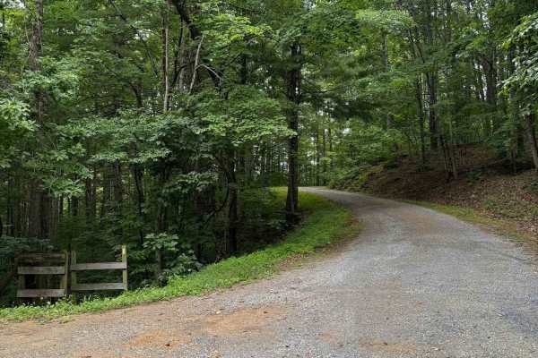
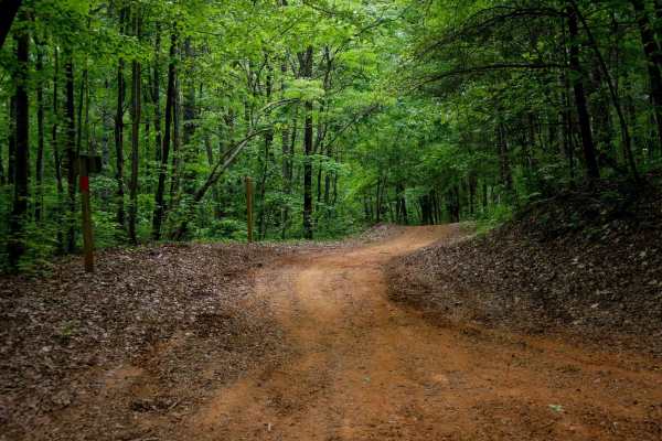
Off-Road Trails
Near Cliftondale Park, Virginia
Off-Road Trails Near Cliftondale Park, Virginia
Discover the best offroad trails near you. Browse trail maps, check difficulty ratings, and find your next adventure — whether you're looking for a quick ride or an all-day expedition.
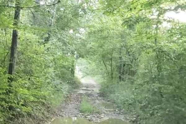
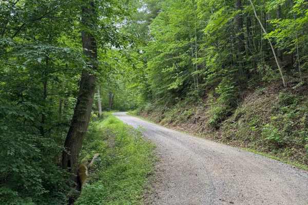
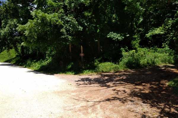
Pads Creek
Pads Creek Trail travels along Forest Service trails and an unmaintained state road. The eastern portion winds along the creek through gravel National Forest trails with ample camping opportunities. Bubbling Springs Day Use Area with hiking trails is located along the route. At the intersection of G...
Learn more about Pads Creek
Jordan Run
Jordan Run, designated as Forest Road 358, begins with a short section that is open year‑round. The remaining two‑thirds of the route is seasonally open from January 1 through January 31, April 1 through May 31, and September 1 through December 31.
The most challenging feature of the trail appears ...
Learn more about Jordan Run
Oi Road
Oi Road offers some nice views as it climbs up the ridgeline. Unlike Patterson Creek Road to the south, there are hardly any spots to get off the road, and any camping would be tight. Most of Oi Road is a gravel two-track with a few spots where you might have to back up to let another vehicle pass. ...
Learn more about Oi Road
The Grade
The Grade is a seasonal trail located in the Jefferson National Forest. It's a basic gravel forest service road that runs near Potts Mountain Jeep Trail. The upper part of the trail is in the national children's forest, which is dedicated to the children who helped replant the forest after a wildfir...
Learn more about The Grade
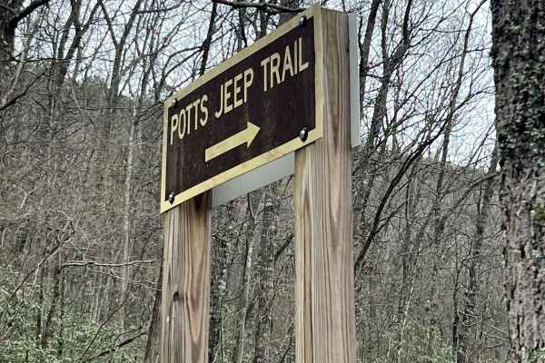
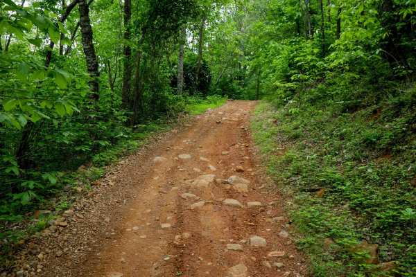
Potts Mountain Jeep Trail
Potts Mountain Jeep Trail is no joke! This was a very challenging trial for my Jeep with a 3.5" lift on 37's I drug and winched several times. Potts Mountain is rocks, rocks, and more rocks. Several obstacles were too big for my taste, and even the bypass areas were challenging. The trail starts ...
Learn more about Potts Mountain Jeep Trail

Patterson Creek
Patterson Creek Road is a great spot to find creek-side campsites. There are a half dozen sites scattered along this 7-mile route. Some are just off of the road, and a few are further off the track. You'll encounter several water crossings as well. Most are relatively short, but a couple on the nort...
Learn more about Patterson Creek
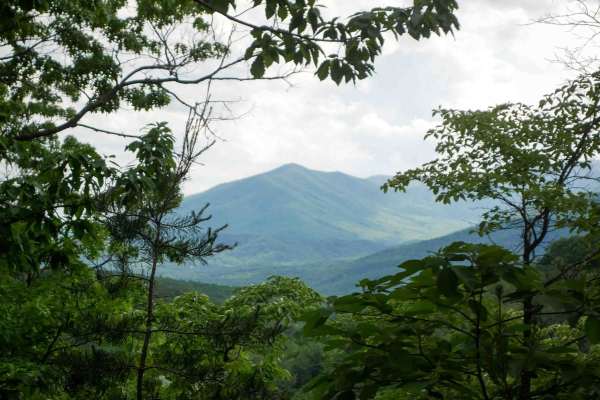
Parkers Gap
Parkers Gap trail is a gravel forest service road, running from Cave Mountain Lake to the Blue Ridge Parkway. The surface is gravel and pot hole strewn. Cell service is spotty throughout the area. Numerous side trails lead to camping spots and hiking trailheads. The scenery is beautiful during the f...
Learn more about Parkers Gap
Duncan Knob
Duncan Knob, designated as Forest Road 124, is a seasonally open trail with access windows from January 1 through January 31, April 1 through May 31, and September 1 through December 31. The route features a mix of gravel, dirt, and rocky terrain, with enough rutting to warrant a difficulty rating o...
Learn more about Duncan Knob
Gilmore Hollow
The Gilmore Hollow trail is comprised of three segments: Tank Hollow Road (FS 790) from the beginning until it branches into FS 280 (also named Gilmore Hollow) and Smith Tract (FS 3044). Together, these roads form a mostly maintained gravel route that follows the creek Back Run and leads to the Jame...
Learn more about Gilmore Hollow
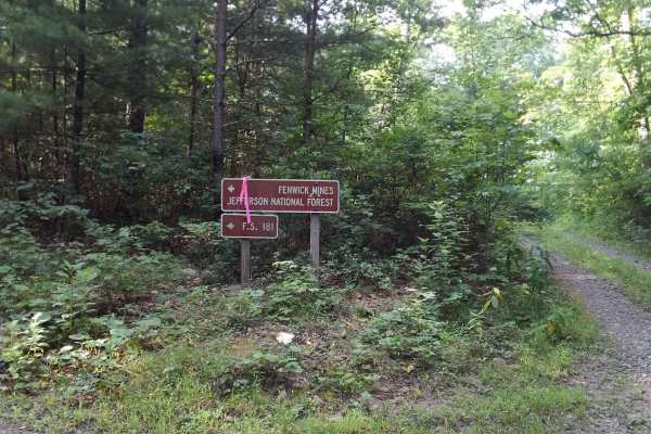
Fenwick Mines
Near the town of New Castle, VA, are the remnants of many small mining towns. This route passes by the Fenwick Mines area, which has a small recreation day-use area and hiking trails. The route runs along the top of a ridgeline with sweeping east and west views of the area. The surface is mostly nat...
Learn more about Fenwick Mines
Wilson Mountain
Wilson Mountain (FS 907) and Skillern Mountain (FS 316) form a continuous, well‑maintained gravel route that transitions seamlessly at the county line. The road surface is consistently smooth with only minor rutting, scattered small rocks, and light vegetation overgrowth. Overall difficulty remains ...
Learn more about Wilson Mountain
Colon Hollow
Colon Hollow, designated as Forest Service Road 782, begins directly across from the North Creek Campground. The trail starts at a historic log cabin, which serves as a notable landmark, though the structure is not open for entry. The route is easy overall, consisting of a well‑maintained gravel sur...
Learn more about Colon Hollow
Hidden Valley Road
Hidden Valley Road, designated as Forest Road 241, is a well‑maintained gravel road that travels through forested terrain and leads to Hidden Valley Campground at the southern end. The route is generally smooth, with the most notable obstacles being potholes on the northern end. A 4WD vehicle is not...
Learn more about Hidden Valley Road
Thomas Mountain
Thomas Mountain, designated as Forest Service Road 768, is a maintained gravel road open year‑round. The route climbs steadily up the mountain, connecting North Creek at the lower end to Parker Gap at the higher end. Rutting is minimal, vegetation overgrowth is low, and the corridor remains consiste...
Learn more about Thomas Mountain

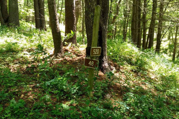
Walker Mountain
Walker Mountain, designated as Forest Road 387, is a seasonally open spur off Clayton Mill Road and is notably more challenging than the main route. The trail is open during three seasonal windows: January 1 through January 10, April 8 through May 13, and October 1 through December 31.
The route be...
Learn more about Walker Mountain

North Creek
North Creek, designated as Forest Service Road 59, begins where the pavement ends on North Creek Road. The route is open year‑round and remains an easy trail throughout, with a maintained gravel surface and low vegetation overgrowth. The most notable obstacles are potholes, all less than 6 inches de...
Learn more about North Creek
Star Chapel
Star Chapel, designated as Forest Road 401, is a seasonally open trail with access windows from January 1 through January 31, April 1 through May 31, and September 1 through December 31. For a seasonal route, it is surprisingly well-maintained, with a consistent gravel surface throughout.
The trail...
Learn more about Star Chapel
FS-394 Sugar Tree
FS-394/Sugar Tree is a 19-mile-long two-way gravel and dirt trail located in Virginia's George Washington National Forest about an hour west of Staunton. The trail provides outstanding views of the surrounding areas and is easy enough that most SUVs and trucks should be able to complete without the ...
Learn more about FS-394 Sugar Tree

Potts Mountain East
Potts Mountain East is a 7-mile trail that runs through the Jefferson National Forest near Potts Mountain Jeep Trail. The trail differs from typical forest roads in the area, in that it follows a ridgeline and lacks the switchbacks that are common for Virginia forest roads.
Potts East can be travele...
Learn more about Potts Mountain East
Powell's Gap
This is a gravel FS road leading to prime trout water. It's a scenic short path off the Blue Ridge Parkway. Go to the end of the road and take a left onto Jennings Creek. The trout water parallels the road for a few miles. The water is stocked and there are 2 nearby campgrounds off Jennings Creek Ro...
Learn more about Powell's Gap
ATV trails near Cliftondale Park, Virginia
Explore ATV-friendly trails near you. These trails are accessible for vehicles up to 50 inches wide, perfect for ATVs and smaller off-road machines.
Rattlesnake
Rattlesnake Trail is a 0.5-mile ATV trail that provides smooth, easy access from the large Rattlesnake Trailhead parking lot off State Highway 130 to the South Pedlar loop. It features large water bars and fast, flowy riding with rocks pushed to the sides. The trail winds through a scenic forest dom...
Learn more about Rattlesnake
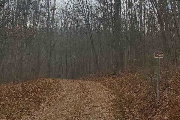
FS304B
This trail is an offshoot of Stillhouse Run Road (FS304). It is poorly, if at all maintained, and downed trees and overgrown limbs cut the trail short of what is shown as available on the map. SxS, dirt bikes, and ATVs may be able to complete the full length of the trail, but a saw would be required...
Learn more about FS304B
Lone Mountain
Lone Mountain Trail is a 1.8-mile easy connector that cuts across the South Pedlar ATV loop, allowing riders to create shorter route options. The trail winds gradually through a beautiful forest dominated by eastern hardwoods, with tight corners and meandering curves that offer a more enclosed, inti...
Learn more about Lone Mountain
Lasso
Lasso Trail is a 2.6-mile spur off the north end of the South Pedlar loop, forming a lasso-shaped route that adds a scenic extension to your ride. The trail is wide and smooth throughout, with well-spaced water bars and minimal obstacles, making it ideal for riders of all skill levels. It winds thro...
Learn more about Lasso
UTV/side-by-side trails near Cliftondale Park, Virginia
Find UTV and side-by-side trails near you. These trails accommodate vehicles up to 60 inches wide, ideal for UTVs, side-by-sides, and wider off-road rigs.
FS304B
This trail is an offshoot of Stillhouse Run Road (FS304). It is poorly, if at all maintained, and downed trees and overgrown limbs cut the trail short of what is shown as available on the map. SxS, dirt bikes, and ATVs may be able to complete the full length of the trail, but a saw would be required...
Learn more about FS304B
Cow Camp Road
This is a rocky fire road in the George Washington National Forest, connecting Highway 60 to Wiggins Hill Road. It is typically unmaintained after rain or snow and you may encounter shallow water crossings and obstacles under 12" on the trail, including small ledges. The road is typically one to two...
Learn more about Cow Camp Road
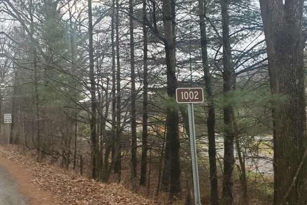
Monday Lick Rd (FS1002)
This forest road goes through part of the Monongahela National Forest and is an easy drive for any truck, small SUV, 4x4, or SxS. Beginning across the street from Stillwell Park, it shares an entrance with Stillwater Run Road (FS 304) but makes an immediate right fork following the Greenbriar River ...
Learn more about Monday Lick Rd (FS1002)
Hog Camp
Hog Camp Road provides access to a variety of hiking and camping opportunities in the George Washington National Forest. The south end is well traveled and easily passable, however north of the Mount Pleasant Scenic Area, expect more rugged terrain.
Learn more about Hog Camp
The onX Offroad Difference
onX Offroad combines trail photos, descriptions, difficulty ratings, width restrictions, seasonality, and more in a user-friendly interface. Available on all devices, with offline access and full compatibility with CarPlay and Android Auto. Discover what you're missing today!
Open Trail Map