Jamie Hurt
Jun 06, 2026
2022 Jeep Gladiator
Open
Normal
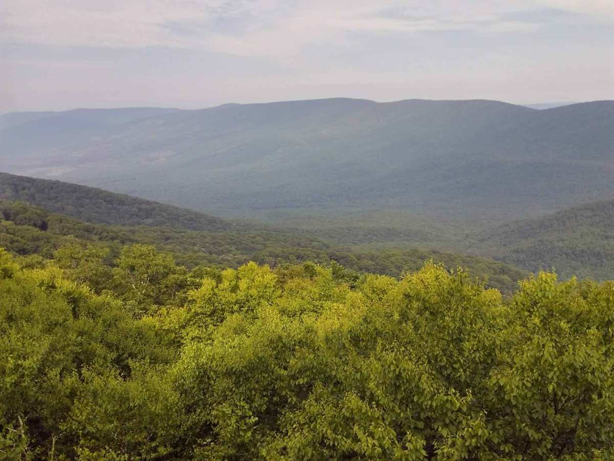
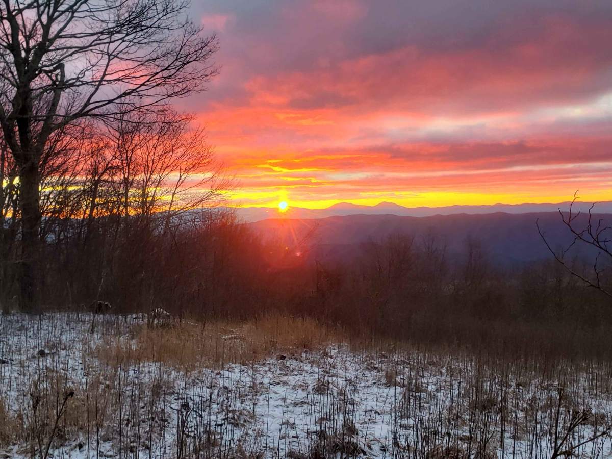
Fun little trail, pretty much had it to ourselves we only encountered a group of three adventure bike riders. The view at the top is amazing. The trial is beginner friendly but still a lot of fun. I can imagine this being a little more exciting after a few days of rain. Definitely air down to smooth out the rig
Michael Lilly
May 17, 2026
2024 Chevrolet Colorado
Open
Normal
This trail is truly a 3/10 but really only because of the type of rock/gravel. Would recommend a good all Terrain tire and airing down to avoid the need for replacement on the trail. Beautiful views up top. Worth the drive. Fun trail snd seems not crowded whatsoever.
Cabell Westbrook
Apr 25, 2026
Open
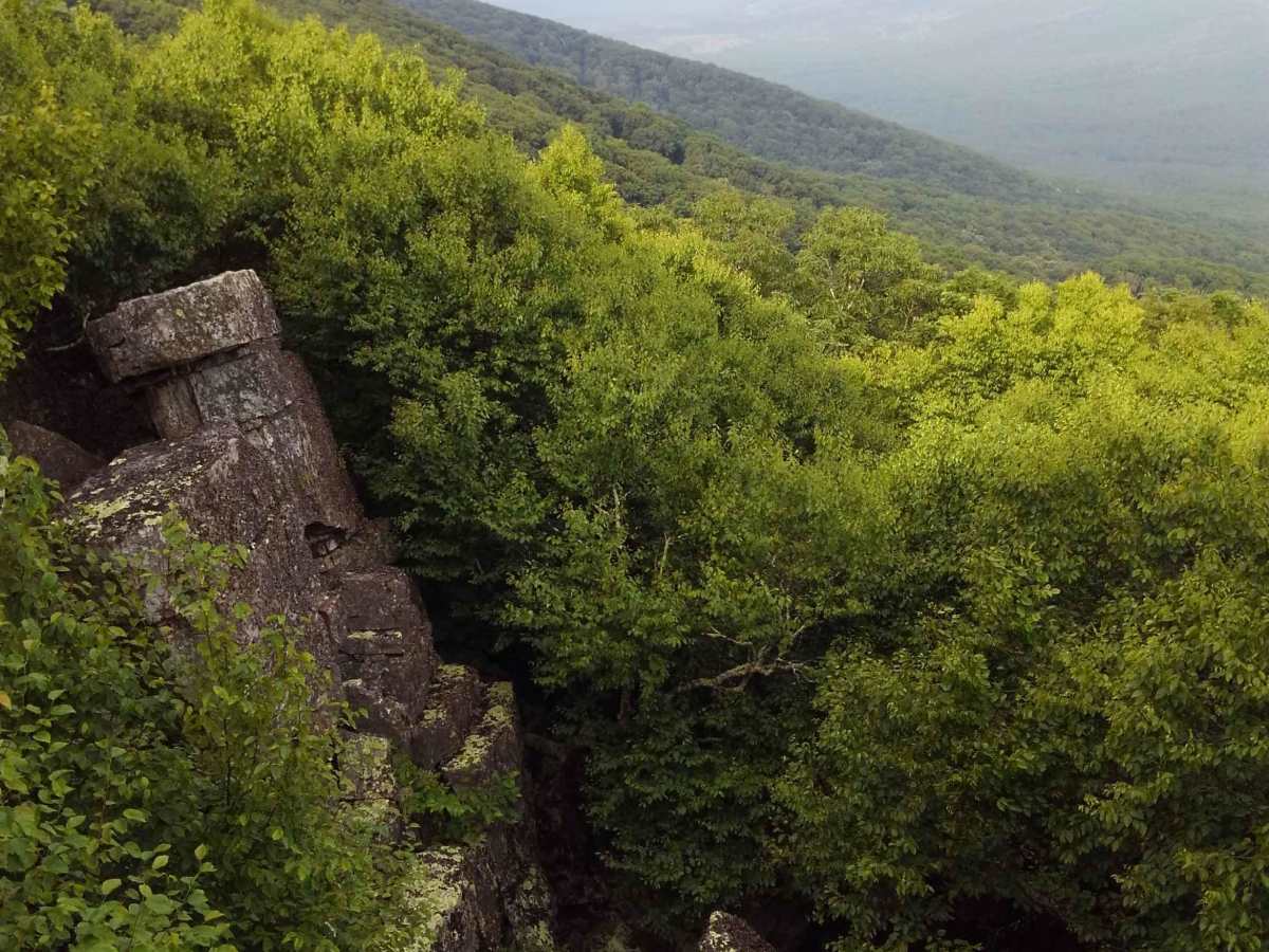
Dirt and rocky tight track that climbs into the mountains. Good views at the top with a few dispersed camping options.
Jen Wickham
Apr 12, 2026
Open
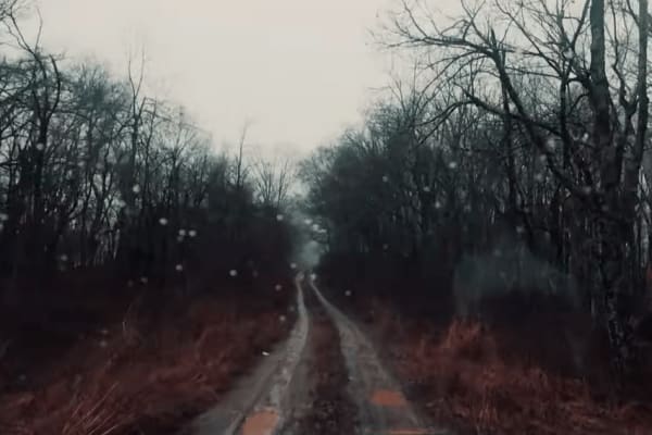
Muddy/WetRough/Deteriorated
Some hunters and dirt bikers on the trail. Burn scar is huge up there.
Daryl oldham
Nov 13, 2025
Open
Normal
Recent fires have gone through the mountain, some wood still smoking. But over all a great trail.
Thang Nguyen
Aug 30, 2025
2015 Toyota 4Runner
Open
NormalRough/Deteriorated
The views were stellar! The trail was phenomenal! Tight in some areas. Some sections you will need to be mindful of your wheel placement and line choice as small parts of the trail are washed out. Airing down isn’t necessary but would definitely make the ride more comfortable! I took bald mountain out and that trail was also very fun as well!
steve jolly
Jun 14, 2025
2019 Jeep Wrangler
Open
Normal
It had rained the night before, so there were some wet spots on the trail. Very nice morning lots of wildlife birds, turtles, and deer.
andy thomas
May 25, 2025
2015 Chevrolet Silverado
Open
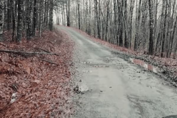
we started the trail off fsr 180 at the northern point of the trail. it'll go from maintained gravel to unmaintained rock and dirt. there are a few water holes 1.5-2' deep with rocky bottoms. there are great views at the top of the ridge and a few primitive campsites. towards the southern end are some deep washout ruts 2' deep crossing the trail that are unavoidable. the trail is typical virginia tight so expect pinstripes.
Michael Carpenter
May 24, 2025
Open
I almost didn't do this trail. Glad I did! Views were well worth it. Couple camp spots at the top. Definitely do it if in the area. Only 2 jeeps that were camping at the top. Killer views.
Christian Erickson
Apr 18, 2025
2014 Toyota Tundra
Open
Expect some pinstripes. Trail was 99% rocky with a few mud holes. Came up from peaceful valley Rd and exited down barbours creek Rd. Views are excellent.
Rickey Stokes
Oct 05, 2024
Open
NormalDustyRough/Deteriorated
Not a difficult trail. Seen a stock economy van come up the trail. Great views, really rocky, had one of our guys puncture a tire on a rock. But other than that great trail. Just make sure u have a good spare.
Austin Angell
Sep 22, 2024
1993 Jeep Cherokee
Open
Muddy/Wet
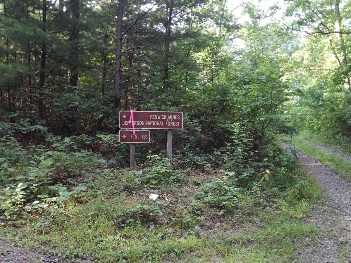
Ride this trail many times and it never gets old to drive though it. Road is closed at forest road 180(Lignite road) on the Oriskany side and Barbours Creek side. Have to turn around and either come back the same way you come in or what we did is take bald knob down to Peaceful Valley Road. Very nice drive and plenty of mud. Beware of some of the mud on the edges of the road, they may look shallow but one of them is far from it! Last two pictures of my jeep stuck were from May this year.
Preston Long
Jul 21, 2024
Open
Normal
First time here. Cool trail, great view. The road does dead end though. Both roads at the end were closer. Had to trek all the way back. Kinda disappointed.
Richard Slifkin
Jul 20, 2024
Open
Muddy/Wet
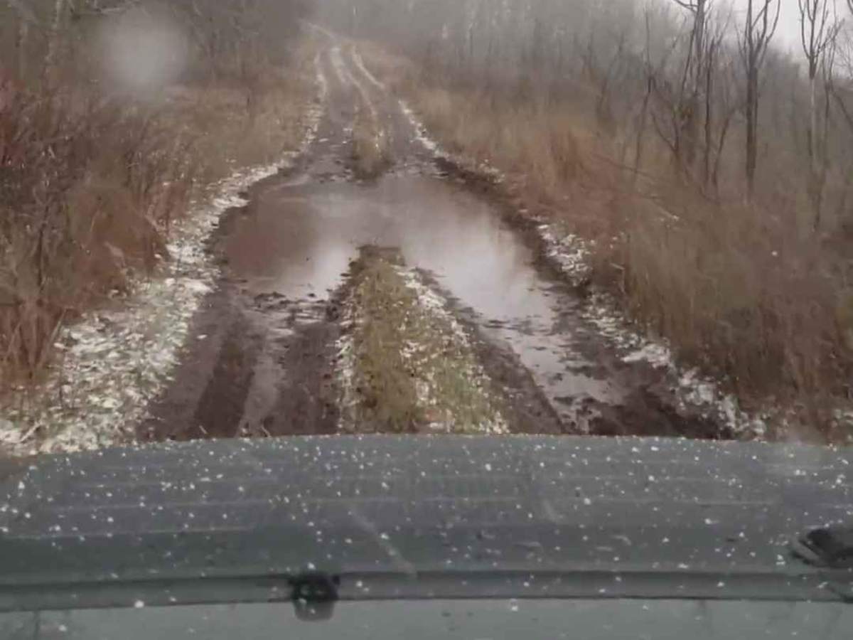
Drove this today in light rain. The trail was open all the way to the 'Y' split where 180 branches off to the left and and an unnamed trail to the right. Both of those were gated but this was after 6.4 miles of trail (from the Fenwick Mines Campground), which I believe is the full length. 3-4 car-length long mud puddle in the last mile of the trail was 4-5" deep.
Trevor Wright
Jul 16, 2024
2023 Chevrolet Colorado
Temporarily Closed
Closed GateTrail Restoration
The end near lignite mines is still blocked. Trail is pretty dry... One mudhole is still pretty wet. Blackberries are ripe so you can have your fill of those along the way. 👍