Punta San Carlos
Total Kilometers
63.1
Technical Rating
Best Time
Spring, Summer, Fall
Trail Type
Full-Width Road
Accessible By
Trail Overview
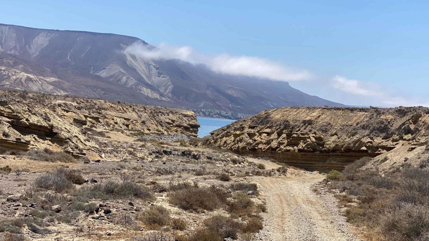
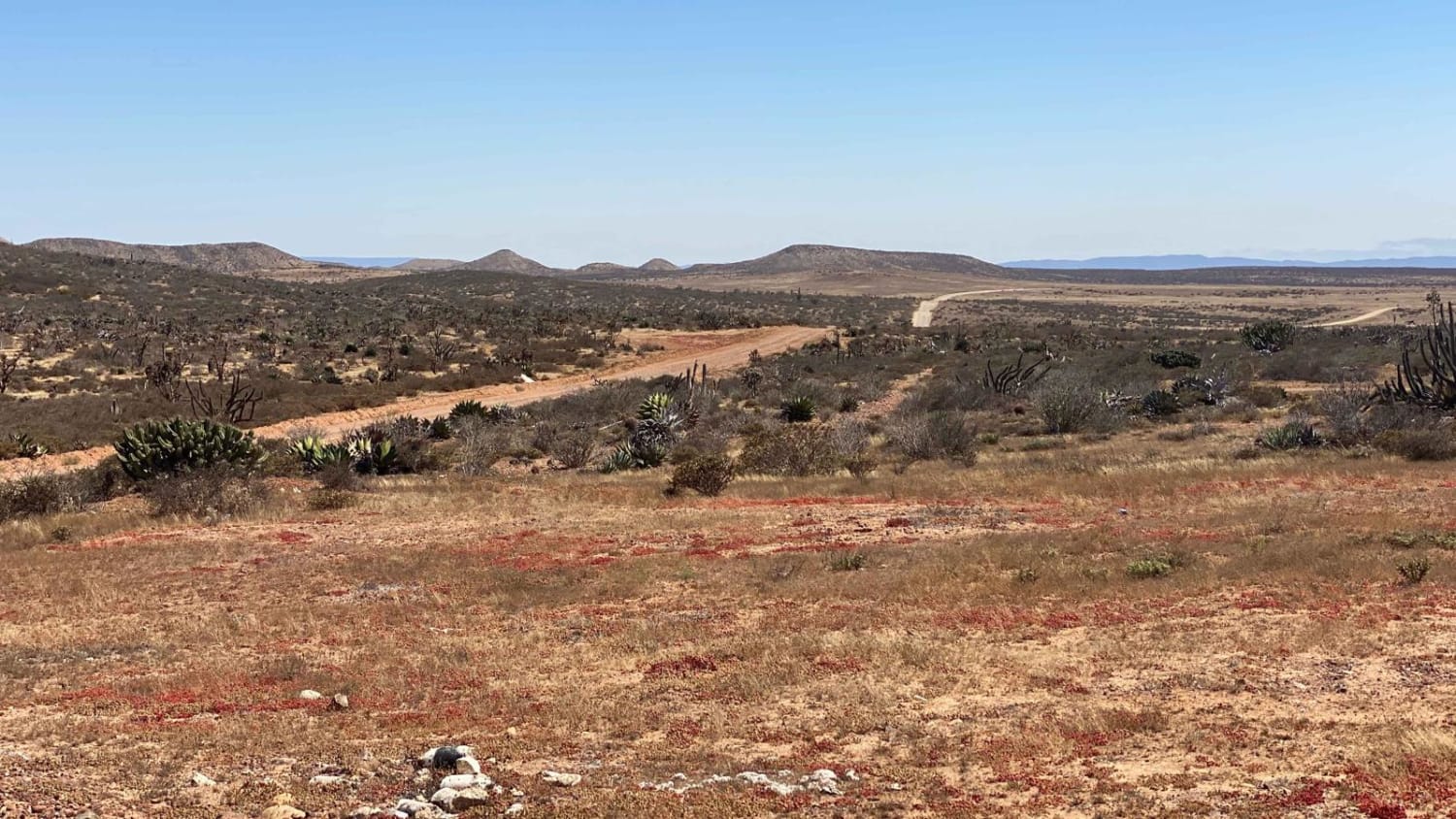
This route leads to one of the most secluded areas along the Pacific side of Baja, which is a popular spot for experienced wind and water sports athletes at the Expert or Pro level. It's a place where they can camp or fly in for their activities. It's important to be prepared for self-recovery and carry enough water and supplies for an extended period of time. Once you leave Highway One, the road transitions into a mixture of dirt and gravel, with some bumps and washboards, although it's not the roughest road you'll encounter in Baja. As you navigate the first half of the route, you may notice lighter-colored parallel tracks, which can often provide a smoother option for your journey. Most of this section is relatively flat, with some straight stretches that go on for a couple of miles.Your perseverance through the bumpy road will be rewarded when you arrive at the Giant Sahuaro Cactus forest, where you'll encounter cacti standing up to 40 feet tall. From here, the road becomes more enjoyable, with frequent changes in elevation, scenic vistas, and a smoother surface. The final ascent will take you to the top of the mesa, offering a breathtaking view of the ocean and the area where you're headed. When you spot the sign for camping and Solo Sports, avoid turning left towards the fishing village. The fishing village is private, gated, and guarded, and they do not allow visitors. There are no services available in the fishing village or along this route. Instead, continue straight past the sign, and you'll soon come across a few campers scattered over the next quarter mile or so, leading you eventually to the Solo Sports building. The entire oceanfront land in this area is owned by one person, who charges $5 USD per night for camping. Exercise caution when you reach Solo Sports, as there will be a runway to the right and airplane tie-downs to the left, with large steel spikes that could do tire damage.
Photos of Punta San Carlos
Difficulty
The difficulty rating of this route is applicable only under dry conditions. While a 2WD vehicle with sufficient clearance can navigate this route, it's important to note that self-recovery could be extremely challenging if you make a small mistake or deviate even slightly from the road without the assistance of a 4WD. Therefore, it's crucial to keep this in mind. Apart from the need to approach the remote location with seriousness, the drive itself is not particularly difficult.
Status Reports
Punta San Carlos can be accessed by the following ride types:
- High-Clearance 4x4
- SUV
- SxS (60")
- ATV (50")
- Dirt Bike
Punta San Carlos Map
Popular Trails

Mountains of Vicente Guerrero

Los Martires

Kenton Volcano Summit

El Hongo Prison Loop
The onX Offroad Difference
onX Offroad combines trail photos, descriptions, difficulty ratings, width restrictions, seasonality, and more in a user-friendly interface. Available on all devices, with offline access and full compatibility with CarPlay and Android Auto. Discover what you’re missing today!