Top of the World Highway
Total Kilometers
172.4
Technical Rating
Best Time
Summer
Trail Type
Full-Width Road
Accessible By
Trail Overview
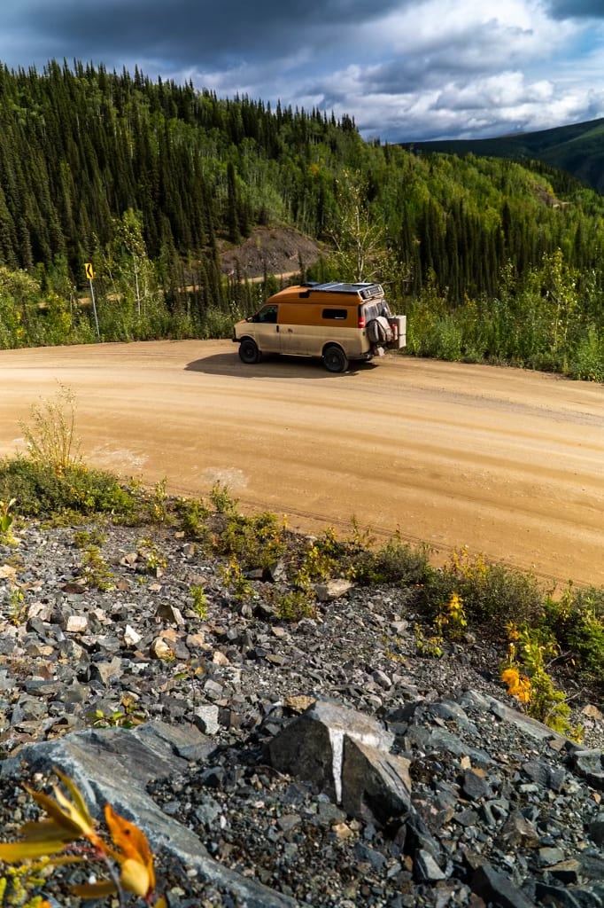
The Top of the World Highway is a breathtaking, remote road that stretches across the Yukon in Canada and into Alaska, USA. This scenic route runs for several kilometers and is known for its sweeping panoramic views, as it follows ridgelines high above the surrounding valleys, hence the name "Top of the World." Starting near the historic town of Dawson City, Yukon, the highway winds through rolling hills, alpine tundra, and vast wilderness, offering travelers a sense of isolation and beauty. Along the way, you'll encounter the small border town of Poker Creek, the highest border crossing between the U.S. and Canada, and eventually end in the town of Chicken, Alaska. The road is mostly gravel, and while it's passable for most vehicles, it can be rough, especially in poor weather conditions. It's typically only open from mid-May to September due to harsh winter conditions, and services along the route are sparse, so it's best to come well-prepared. Despite the ruggedness, the stunning vistas of untouched landscapes make the Top of the World Highway a favorite for adventurers seeking the road less traveled.
Photos of Top of the World Highway

Difficulty
This is an easy two-lane gravel road that is accessible by most well-equipped vehicles. Due to intense and changing weather conditions, the road conditions can vary from solid packed gravel with a few potholes to slippery and muddy. There are no services along the way, so make sure to have a full tank of gas as you can explore many side roads while on this route.
Status Reports
Top of the World Highway can be accessed by the following ride types:
- High-Clearance 4x4
- SUV
Top of the World Highway Map
Popular Trails
Top of the World Highway

North Canol
The onX Offroad Difference
onX Offroad combines trail photos, descriptions, difficulty ratings, width restrictions, seasonality, and more in a user-friendly interface. Available on all devices, with offline access and full compatibility with CarPlay and Android Auto. Discover what you’re missing today!