Caledonia Pike
Total Miles
23.3
Technical Rating
Best Time
Spring, Summer, Fall
Trail Type
Full-Width Road
Accessible By
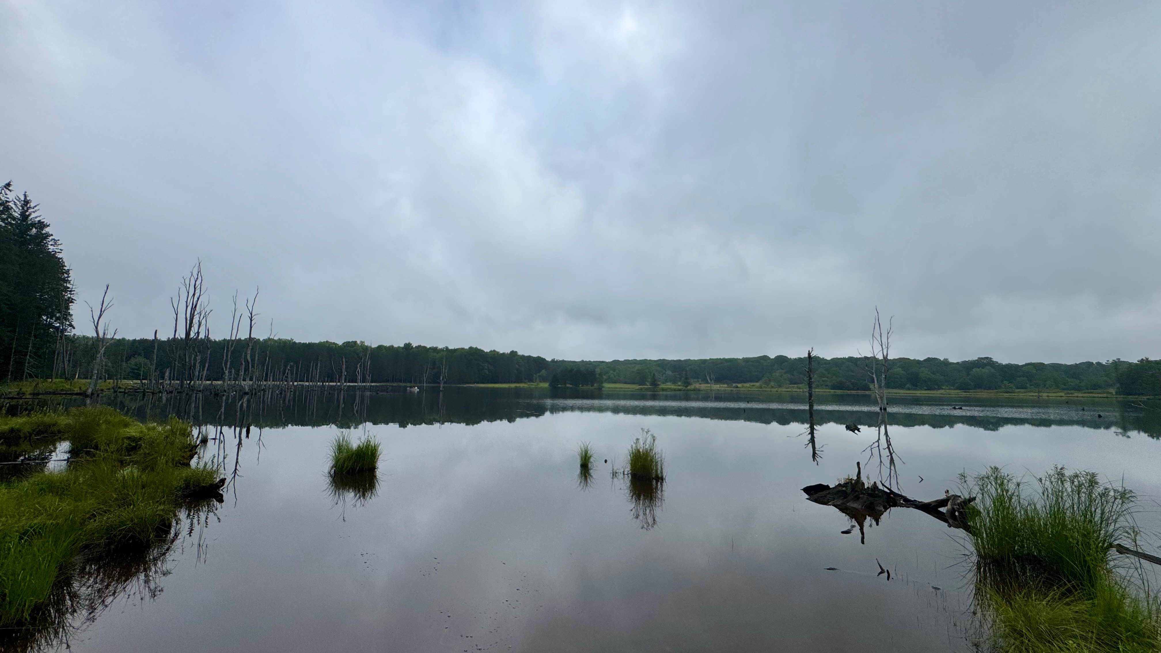
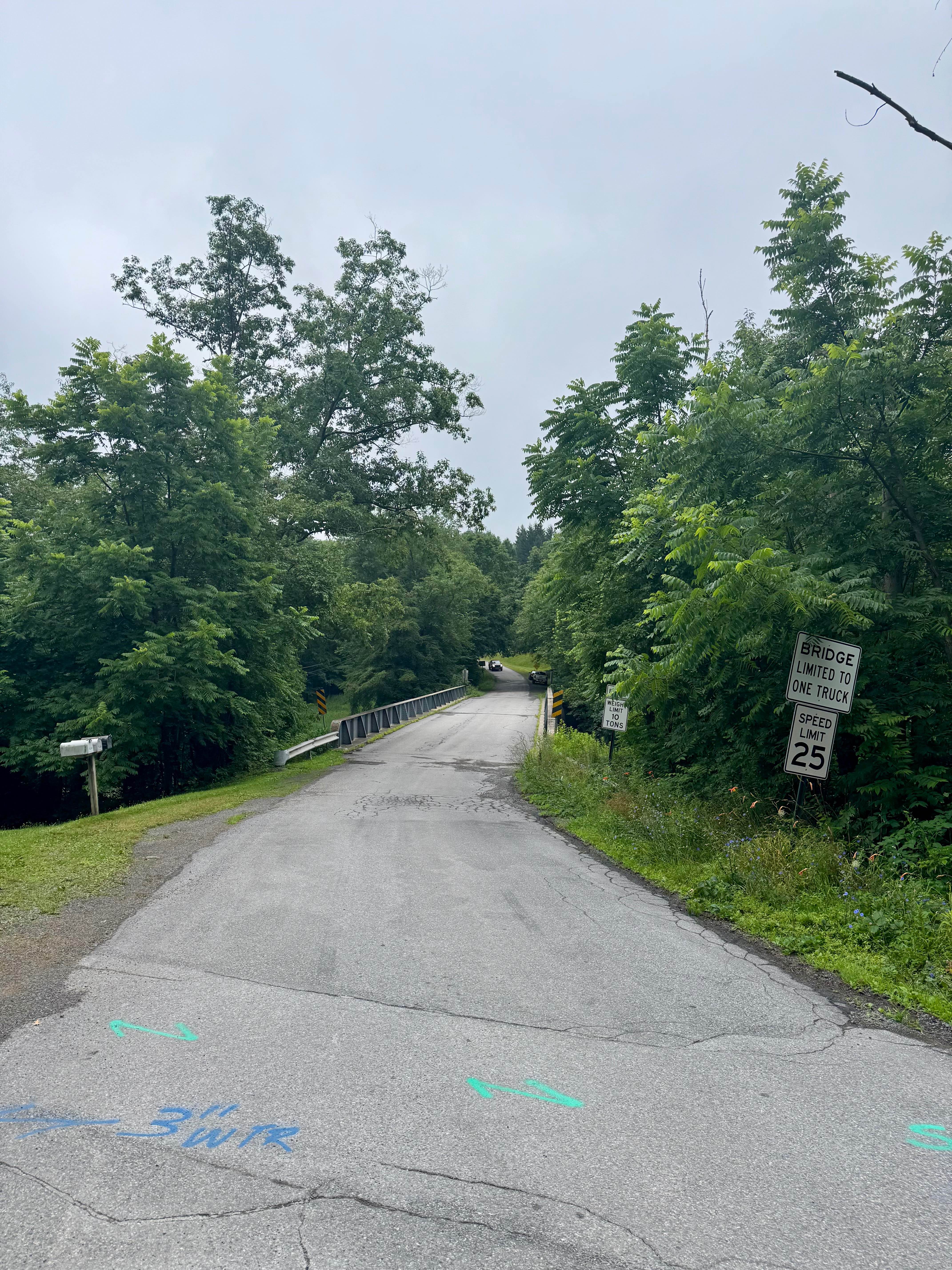
Trail Overview
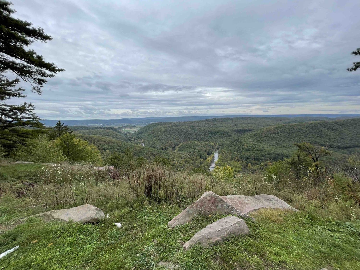
A lengthy unpaved route, Caledonia Pike runs east-to-west through the Pennsylvania Wilds south of the roughly parallel Quehanna Highway to the north. It connects the town of Caledonia to the town of Karthaus. It is primarily within Moshannon State Forest, though it passes through private land on both ends and a couple of small tracts near the middle of the route. It passes to the south of the legendary Quehanna Wild Area and provides access to the boat launch area for the small reservoir at Shaggers Inn Dam, which is one of the few nesting areas for Osprey in Pennsylvania. As a relatively wide and well-maintained unpaved road through this isolated area, it is often used to quickly move between parts of the forest. There are motorized campsites available to reserve on the Pennsylvania State Park reservation system on Reserve America. Expect to see some adventure bike traffic as a good portion is on the "PA Wilds BDR-X" route. Be on the lookout for elk as the herd has a pretty wide area of operation and can at times be this far south. Watch your gas, as fuel is really only available near the communities on either end. On the west side, Weedville and Benzette have services, and on the east side, Kylertown, down towards Interstate 80, is a good bet.
Photos of Caledonia Pike
Difficulty
This unpaved road is generally well-maintained, and other than occasional ruts or potholes, the trail is free from obstacles. In typical conditions, expect an easy-going route for basically any street-legal vehicle.
History
Caledonia Pike is notable for its early role in the development of the area that originally functioned as a toll road. This was a crucial part of the 19th-century road network in Pennsylvania. Unsurprisingly, it's linked to the logging activities in the area during that period. It provided overland access for lumber and supplies as river transport was becoming challenging.
Caledonia Pike can be accessed by the following ride types:
- High-Clearance 4x4
- SUV
Caledonia Pike Map
Popular Trails

Darkwater 8
The onX Offroad Difference
onX Offroad combines trail photos, descriptions, difficulty ratings, width restrictions, seasonality, and more in a user-friendly interface. Available on all devices, with offline access and full compatibility with CarPlay and Android Auto. Discover what you’re missing today!