Bronco Mine - FS 43273
Total Miles
2.7
Technical Rating
Best Time
Spring, Summer, Fall
Trail Type
Full-Width Road
Accessible By
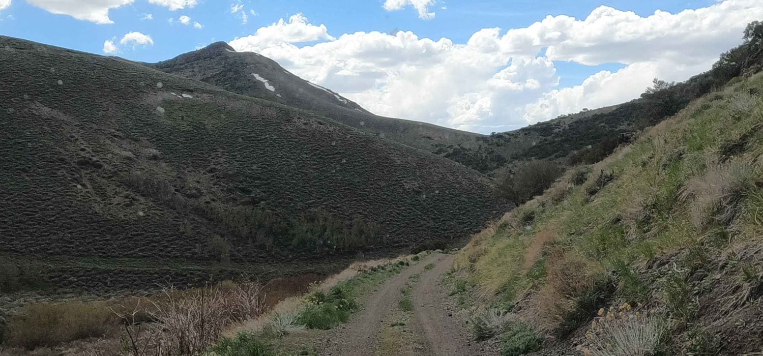
Trail Overview
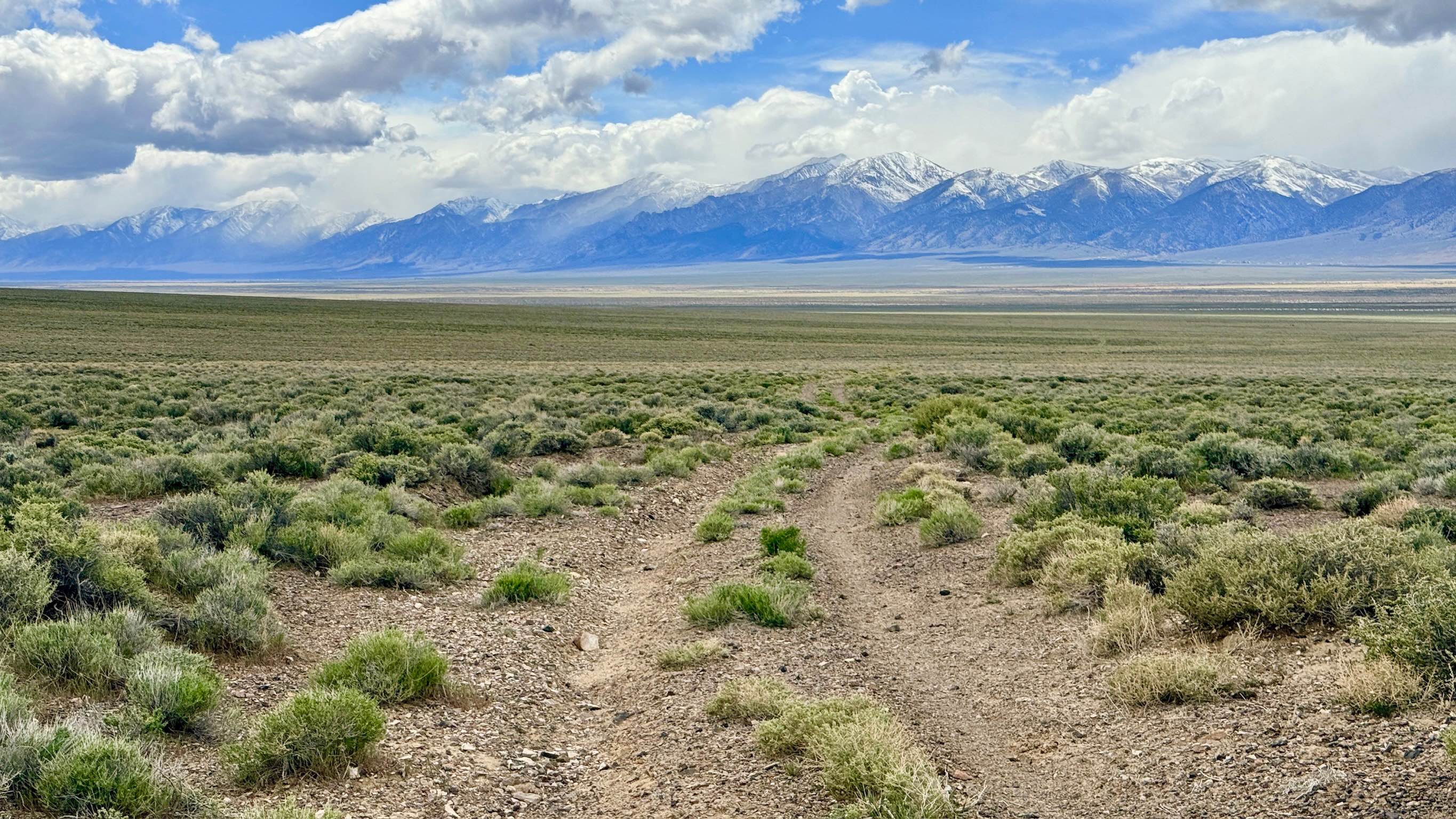
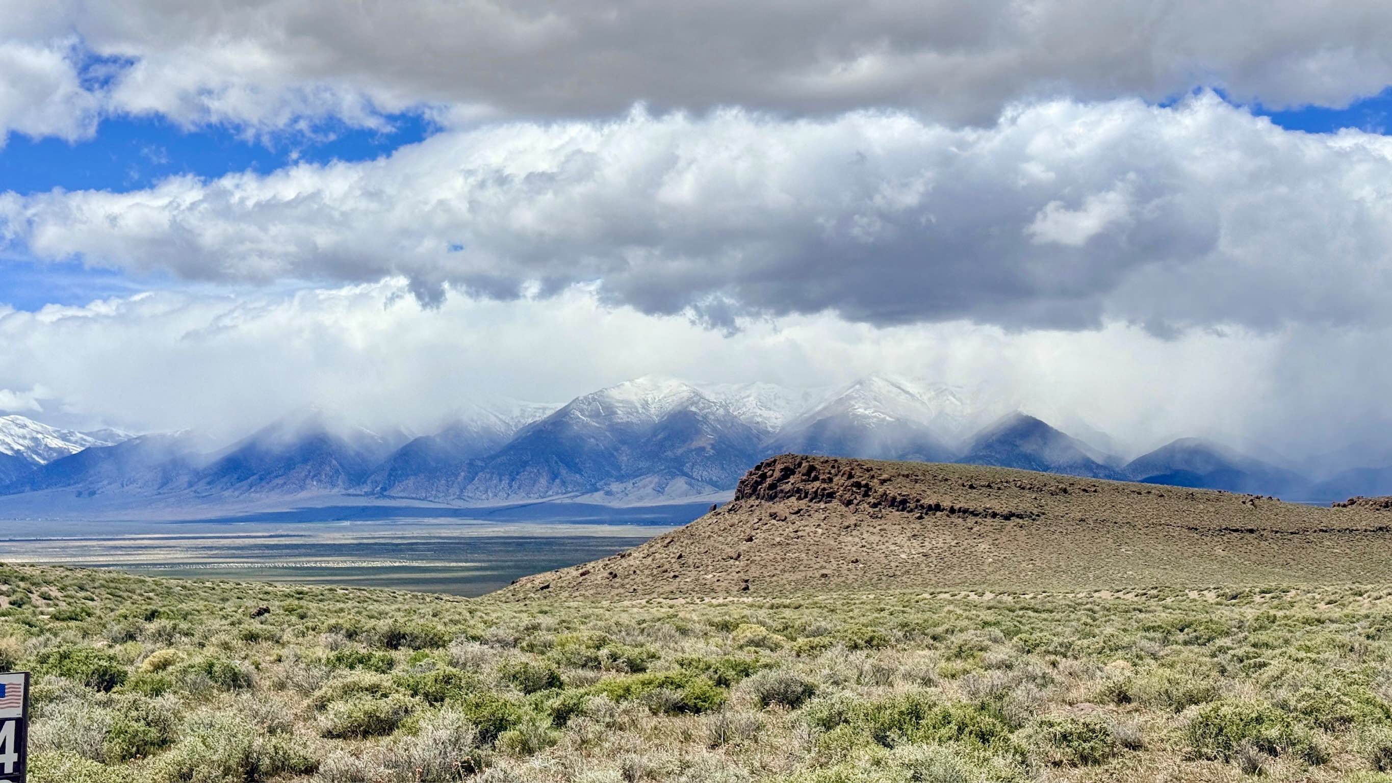
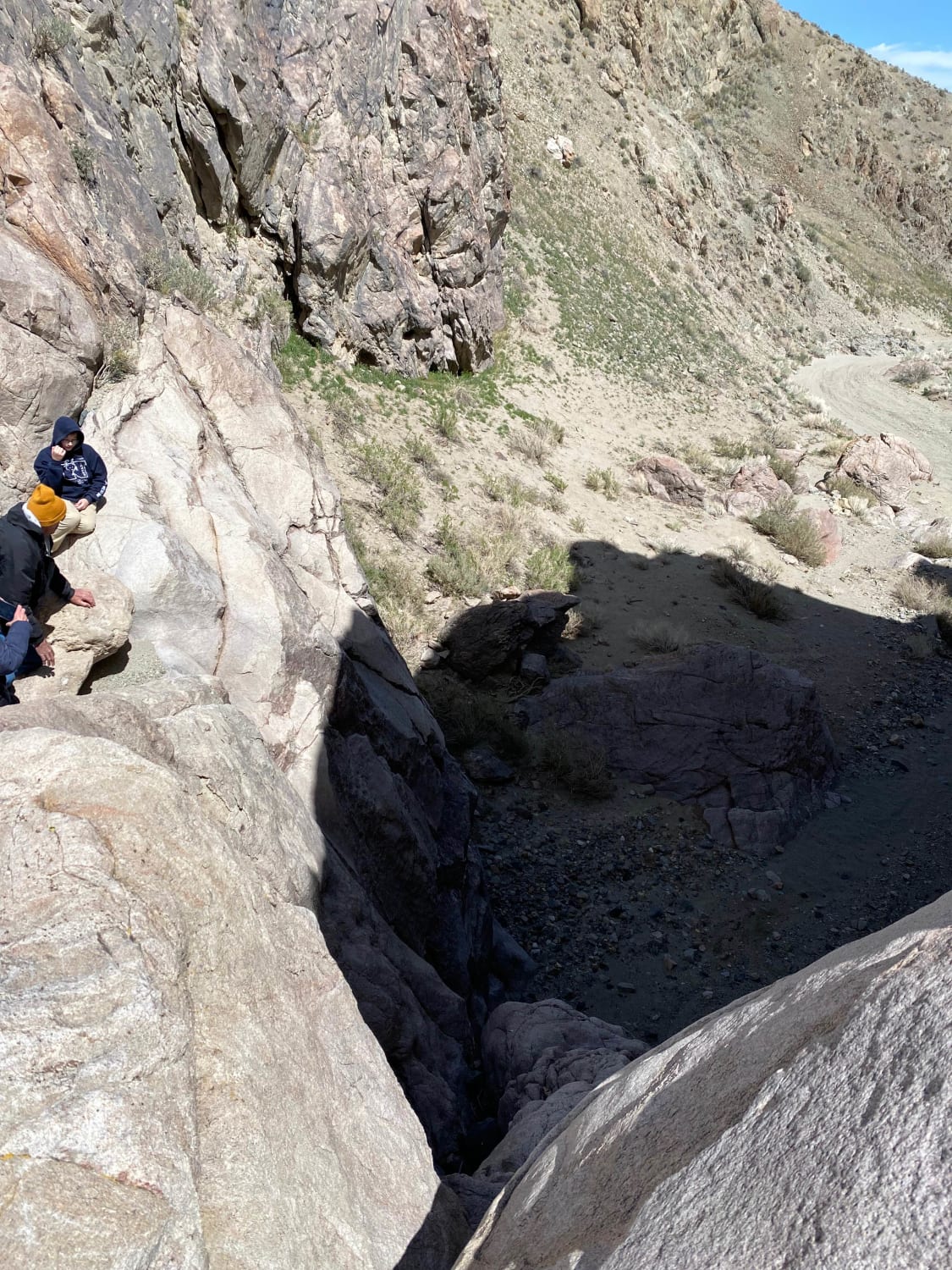
Bronco Mine is a scenic trail that skirts the expansive valley floor and climbs into the rugged interior foothills of the Toiyabe Range. The route offers a fantastic vantage point for experiencing the vastness of the Great Basin; as you climb, you are treated to spectacular, wide-angle views of the towering mountain peaks to the west and the sun-bleached valley floor. The trail is generally a pleasant, easy-going drive, but it is punctuated by a significant technical challenge: one very deep and complex washout that requires careful navigation and high clearance. This specific obstacle can easily catch a low-hanging front or rear bumper or a trailer hitch. Beyond this, the trail continues toward the historic Bronco mine site. Be aware of "Road Closed" signage near the end of this trail, which prevents further motorized progress. The historic Bronco Mine workings extend beyond the current motorized access point. Keep your binoculars ready, as this is prime territory for spotting Pronghorn Antelope racing across the sagebrush and wild burros wandering the lower slopes. While you may see a few very light LTE bars, coverage is extremely unreliable. Download offline maps before leaving the Austin area or the Bob Scott Campground.
Photos of Bronco Mine - FS 43273
Difficulty
Rated a 3 primarily due to the single, deep washout. A high-clearance 4x4 is recommended. Vehicles with low-hanging accessories or long rear overhangs should exercise extreme caution.
History
The Bronco Mine area represents the persistent spirit of the Reese River Mining District. Following the initial silver rush in the 1860s, miners fanned out into these foothills to follow the geological leads of the Toiyabe Range. The "Bronco" name is a nod to the wild and rugged nature of the horses and burros that were once the primary "motors" for these remote operations. Today, while the miners are gone, the descendants of their pack animals still inhabit these hills, serving as a living link to the area's industrial heritage.
Status Reports
Bronco Mine - FS 43273 can be accessed by the following ride types:
- High-Clearance 4x4
- SUV
- SxS (60")
Bronco Mine - FS 43273 Map
Popular Trails
Pine Grove Connector ATV
Boathouse Cove 97
Slippin N Scramblin
The onX Offroad Difference
onX Offroad combines trail photos, descriptions, difficulty ratings, width restrictions, seasonality, and more in a user-friendly interface. Available on all devices, with offline access and full compatibility with CarPlay and Android Auto. Discover what you’re missing today!