Southern Lucas Point
Total Miles
2.0
Technical Rating
Best Time
Spring, Summer, Fall
Trail Type
Full-Width Road
Accessible By
Trail Overview
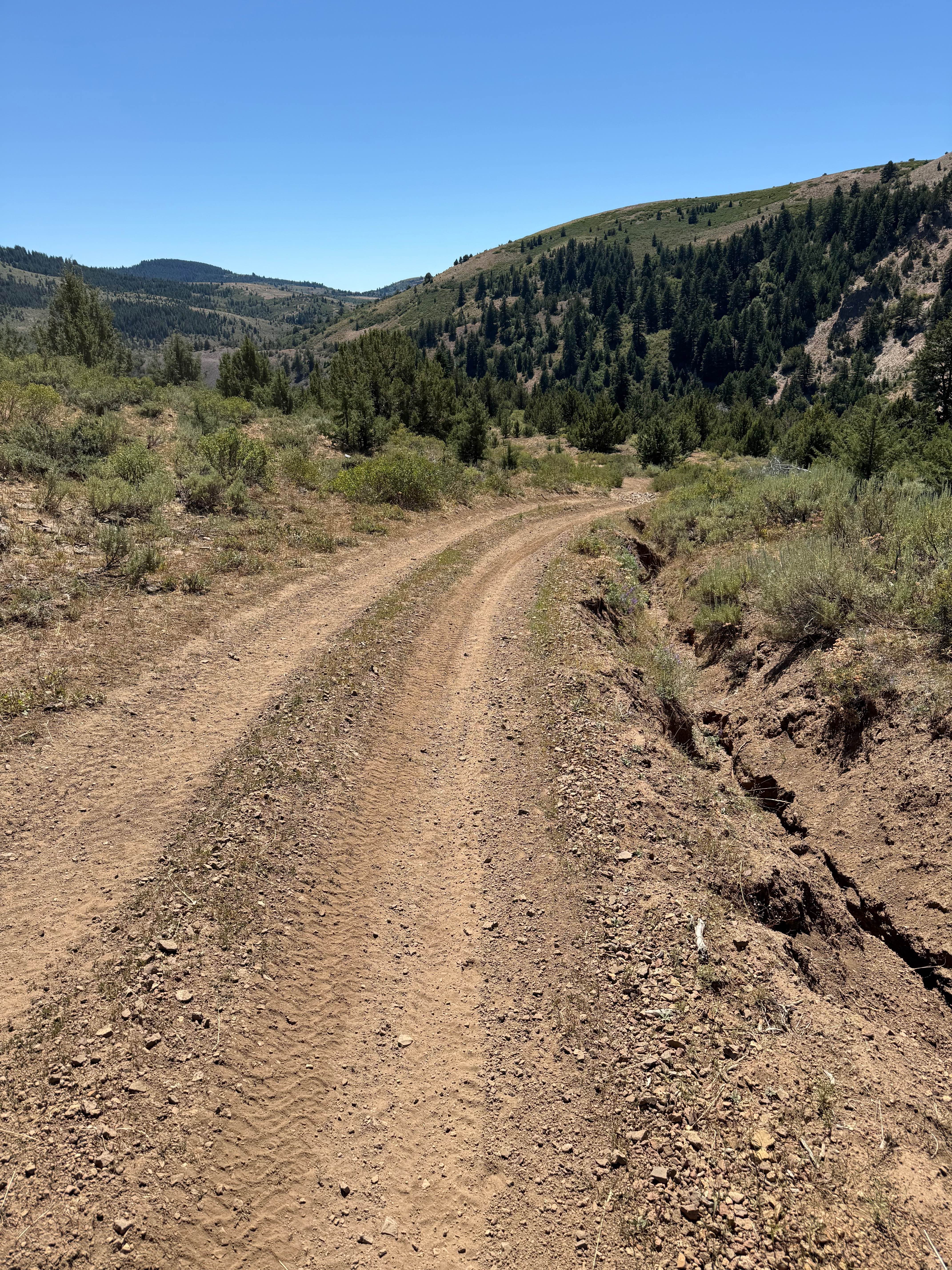
This is a nice, flat, out-and-back offshoot trail heading down to the Southern Lucas Point on Salmon Falls Creek Reservoir. To get to the beginning of the trail, take China Creek off of Jarbidge Road and Three Creek Road; it's a well-maintained wide dirt road. The trail to Southern Lucas Point begins as a nice smooth dirt road running through an open grazing area for range cattle. Expect to come across sections of electric fence that will have signage; you should be able to open them. Reclose any gates you come to. This first section of this dirt trail can be muddy and slick after a rainstorm. As the trail gets closer to the reservoir, it gets rockier. One might want to air down for comfort. The end of the trail to Southern Lucas Point has a couple of flat open areas with fire rings and stunning views in most directions of the reservoir. There is access down to the water from Southern Lucas Point. The hill down is steep and loose gravel; it shows use from vehicles but does not appear on the official trail. Depending on how low the water level is, there is a small fire ring down close to the edge of the water. Other activities here are fishing and bird watching.
Photos of Southern Lucas Point


Difficulty
This trail is mostly easy except for the end where the gravel gets loose and sandy.
Status Reports
Southern Lucas Point can be accessed by the following ride types:
- High-Clearance 4x4
- SUV
- SxS (60")
- ATV (50")
- Dirt Bike
Southern Lucas Point Map
Popular Trails

Weitas Creek
Wolf Lodge 202
The onX Offroad Difference
onX Offroad combines trail photos, descriptions, difficulty ratings, width restrictions, seasonality, and more in a user-friendly interface. Available on all devices, with offline access and full compatibility with CarPlay and Android Auto. Discover what you’re missing today!