
Dirt Bike Trails
Near Mill City, Oregon
Explore All Dirt Bike Trails Near Mill City, Oregon
Dirt Bike Trails Near Mill City, Oregon
Discover the best dirt bike trails near you. Browse trail maps, check difficulty ratings, and find your next adventure — whether you're looking for a quick ride or an all-day expedition.
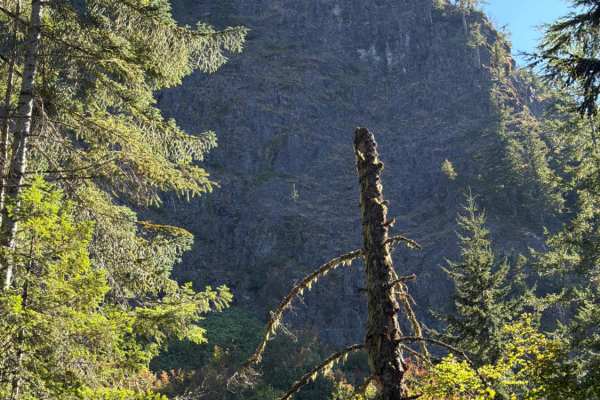
Upper Neal Creek Road
This is the route to get to Snow Peak. From the top, you will have to hike up approximately 1.5mi, or take another motorized route that will require a high-clearance 4WD. The road is larger gravel. It is very passable by 2WD, though a low-ground-clearance car is not recommended, as there are a fe...
Learn more about Upper Neal Creek Road
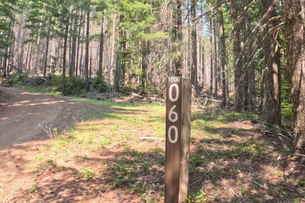
Beard Saddle - FS 1000060
Branching off Forest Service Road 1000, Beard Saddle - FS 1000060 is a quiet out-and-back woodland spur nestled within the Willamette National Forest. The route ascends steadily across the mountainside through a lush conifer forest filled with towering Douglas firs, western red cedars, and a vibrant...
Learn more about Beard Saddle - FS 1000060
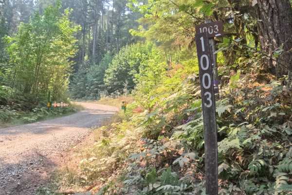
Tom Creek - FS 1003000
Connecting lower valley corridors with high-elevation mountain byways, Tom Creek Road - FS 1003 serves as a primary forest thoroughfare within the Willamette National Forest. The surrounding landscape delivers a dramatic visual shift, climbing from dense, shaded stands of mature Douglas fir and ceda...
Learn more about Tom Creek - FS 1003000
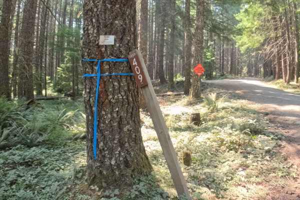
FS 1003409
Branching off FS 1003, FS 1003409 is a climbing mountain spur tucked within the Willamette National Forest. The corridor ascends steadily along the mountainside through a lush Pacific Northwest woodland characterized by towering Douglas firs, fragrant western red cedars, and a vibrant green understo...
Learn more about FS 1003409
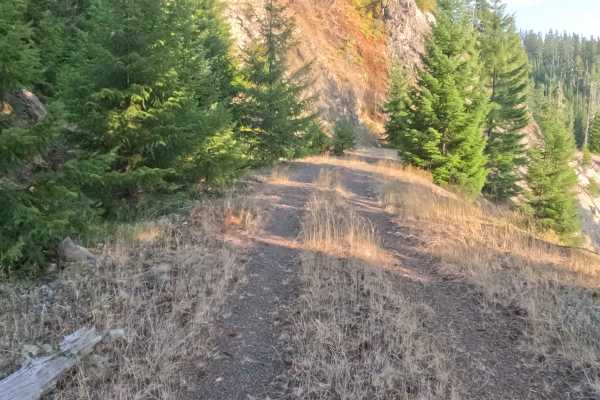
Bills Road - FS 1100855
Accessed directly from the pavement of Forest Road 11, Bills Road - FS 1100855 is a secluded 2.1-mile out-and-back spur carved neatly into the mountainside within a lush, densely timbered National Forest. Outdoor explorers and sightseers utilize this quiet woodland detour to escape the main paved ro...
Learn more about Bills Road - FS 1100855
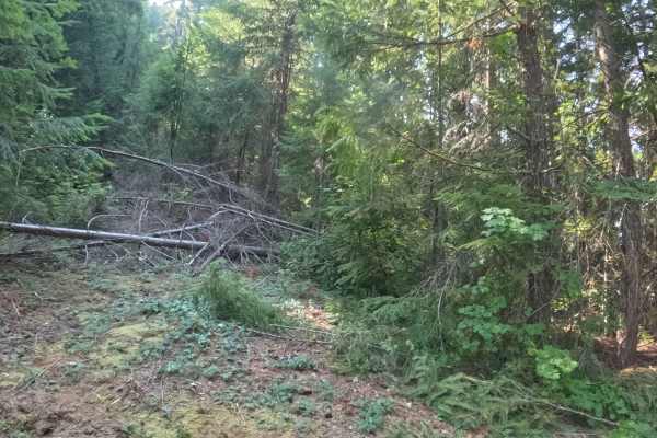
FS 2231721
Branching off Forest Service Road 2231 within the Willamette National Forest, Forest Service Road 2231721 is a quiet out-and-back mountain spur that ascends through the high timber. The corridor winds through a lush Pacific Northwest woodland dominated by tall Douglas firs, western hemlocks, and vib...
Learn more about FS 2231721
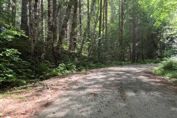
Fox Creek Ridge - FS 4698
Fox Creek Ridge - FS 4698 is a 6.3-mile graded gravel forest service road that provides an exceptionally peaceful backcountry transit. The wide, forgiving path weaves effortlessly through a beautiful, dense canopy of towering evergreen trees, offering ample shade with dappled sunlight filtering thro...
Learn more about Fox Creek Ridge - FS 4698
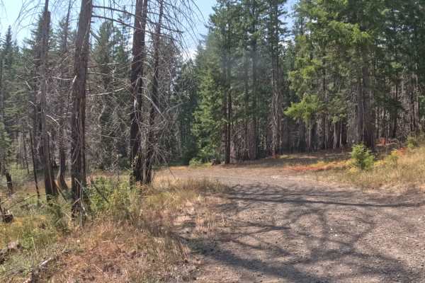
Divide Creek - FS 1011000
Branching off the primary regional road network above the Breitenbush and Detroit Lake basin, Forest Service Road 1011000 (Divide Creek) is a quiet out-and-back mountain spur within the Willamette National Forest. The corridor snakes along a steep hillside through a mixed-conifer landscape where den...
Learn more about Divide Creek - FS 1011000
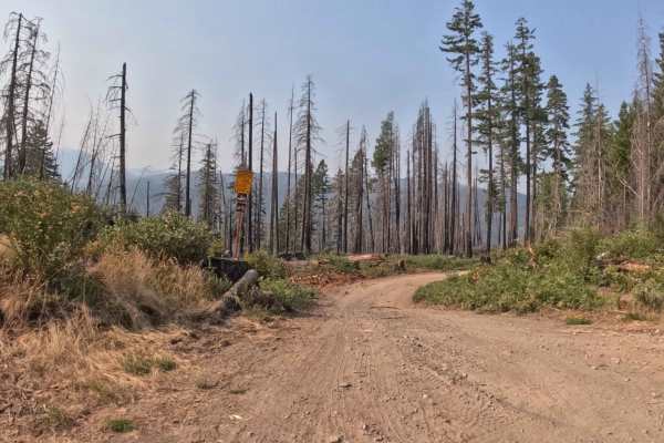
FS 2233505
Branching off FS 2233 within the Willamette National Forest, FS 2233505 is a scenic out-and-back woodland spur that winds down along the mountainside. The corridor navigates an open landscape actively regenerating with vibrant ferns, fresh ground cover, and tall timber snags left in the wake of the ...
Learn more about FS 2233505
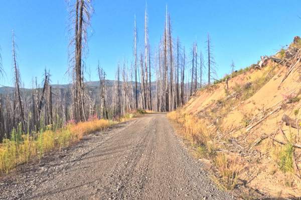
Cold Deck - FS 2234100
Winding its way out of the North Santiam River valley, Cold Deck - FS 2234100 is a beautifully scenic, well-traveled dirt and gravel route managed by the Willamette National Forest. The overall environment offers a striking journey through a landscape actively recovering from the historic 2020 Beach...
Learn more about Cold Deck - FS 2234100
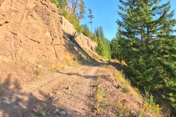
Upper Hawkins - FS 2236000
Branching directly off of Forest Road 1003, Upper Hawkins - FS 2236000 provides a remarkably scenic and lengthy ridgeline drive through the Willamette National Forest. The overall environment offers a striking visual contrast, beginning its steady mountain ascent through an open landscape actively r...
Learn more about Upper Hawkins - FS 2236000
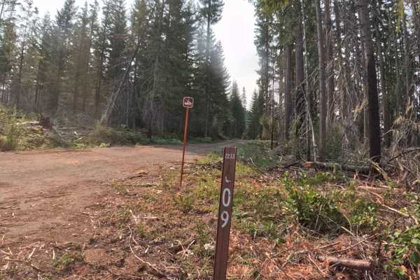
FS 2233609
Branching off FS 2233, FS 2233609 is a scenic out-and-back mountain spur located within the Willamette National Forest. The corridor winds through a striking mountainside environment that alternates between dense, vibrant green conifer pockets and standing timber snags recovering from the 2020 Lions...
Learn more about FS 2233609
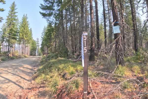
Bullfrog - FS 2233515
Connecting McCoy Creek Road - FS 2233000 with Pigeon Prairie - FS 2231810, Bullfrog - FS 2233515 serves as a vital backcountry connector within the Willamette National Forest. The corridor winds through a lush, verdant canopy dominated by towering Douglas firs, western hemlocks, and dense fern under...
Learn more about Bullfrog - FS 2233515
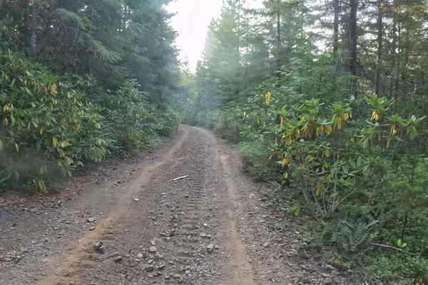
FS 1013190
Nestled within a lush, densely timbered conifer forest, FS 1013190 serves as a highly useful backcountry connector route. Linking Upper Hawkins FS 2236000 directly to Hawkins Creek - FS 1013000, this dirt and gravel track provides efficient throughput for explorers looking to traverse different part...
Learn more about FS 1013190
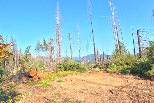
Homestead Road - FS 2200020
Branching directly off of Highway 22, Homestead Road - FS 2200020 offers a remarkably scenic and historically significant drive through the beautiful Willamette National Forest. The overall environment features an open, recovering landscape marked by towering silver snags and vibrant new undergrowth...
Learn more about Homestead Road - FS 2200020
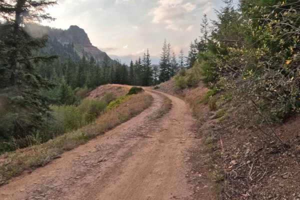
Coffin Mountain Road - FS 1168430
Branching off Coffin Mountain Road - FS 1168, FS 1168430 is a short out-and-back access spur tucked within the Willamette National Forest. The corridor climbs through a lush, mature Pacific Northwest conifer forest dense with towering Douglas firs, mountain hemlocks, and a healthy understory of fern...
Learn more about Coffin Mountain Road - FS 1168430
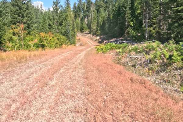
FS 2047774
Nestled within a sprawling, recently harvested clear-cut zone surrounded by dense timber in the National Forest, FS 2047774 offers a remarkably open and straightforward backcountry drive. Accessed via an unmarked junction off the primary forestry road network, this 1.8-mile out-and-back spur provide...
Learn more about FS 2047774
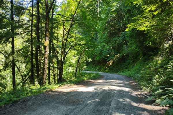
Moose Mountain- FS 2027
Moose Mountain Road, also known as FS 2027, is accessed from US Hwy 20 by turning at Moose Creek Road and crossing the bridge over the South Santiam River. This road is easy gravel, with some potholes and a few sections of larger loose rock. It is mostly single-lane with turnouts. The road passes th...
Learn more about Moose Mountain- FS 2027
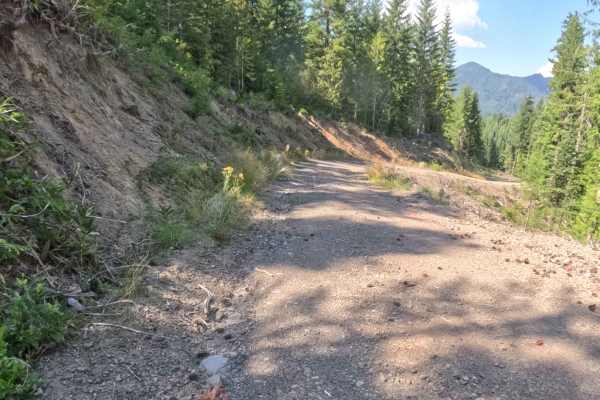
FS 2047772
Branching directly off of Deer Toe Road, FS 2047772 is a highly accessible out-and-back forest route set within a recently logged section of the National Forest. This 1.7-mile trail provides straightforward, scenic access into the surrounding mountain landscape, making it a popular choice for sights...
Learn more about FS 2047772
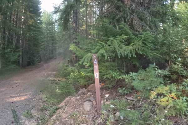
FS 1168470
Branching off Coffin Mountain Road - FS 1168, FS 1168470 is a secluded out-and-back mountain spur tucked within the Willamette National Forest. The corridor winds through a lush, mature Pacific Northwest conifer forest filled with towering Douglas firs, western hemlocks, and a vibrant green carpet o...
Learn more about FS 1168470
ATV trails near Mill City, Oregon
Explore ATV-friendly trails near you. These trails are accessible for vehicles up to 50 inches wide, perfect for ATVs and smaller off-road machines.
Upper Neal Creek Road
This is the route to get to Snow Peak. From the top, you will have to hike up approximately 1.5mi, or take another motorized route that will require a high-clearance 4WD. The road is larger gravel. It is very passable by 2WD, though a low-ground-clearance car is not recommended, as there are a fe...
Learn more about Upper Neal Creek Road
Beard Saddle - FS 1000060
Branching off Forest Service Road 1000, Beard Saddle - FS 1000060 is a quiet out-and-back woodland spur nestled within the Willamette National Forest. The route ascends steadily across the mountainside through a lush conifer forest filled with towering Douglas firs, western red cedars, and a vibrant...
Learn more about Beard Saddle - FS 1000060
Tom Creek - FS 1003000
Connecting lower valley corridors with high-elevation mountain byways, Tom Creek Road - FS 1003 serves as a primary forest thoroughfare within the Willamette National Forest. The surrounding landscape delivers a dramatic visual shift, climbing from dense, shaded stands of mature Douglas fir and ceda...
Learn more about Tom Creek - FS 1003000
FS 1003409
Branching off FS 1003, FS 1003409 is a climbing mountain spur tucked within the Willamette National Forest. The corridor ascends steadily along the mountainside through a lush Pacific Northwest woodland characterized by towering Douglas firs, fragrant western red cedars, and a vibrant green understo...
Learn more about FS 1003409
UTV/side-by-side trails near Mill City, Oregon
Find UTV and side-by-side trails near you. These trails accommodate vehicles up to 60 inches wide, ideal for UTVs, side-by-sides, and wider off-road rigs.
Upper Neal Creek Road
This is the route to get to Snow Peak. From the top, you will have to hike up approximately 1.5mi, or take another motorized route that will require a high-clearance 4WD. The road is larger gravel. It is very passable by 2WD, though a low-ground-clearance car is not recommended, as there are a fe...
Learn more about Upper Neal Creek Road
Beard Saddle - FS 1000060
Branching off Forest Service Road 1000, Beard Saddle - FS 1000060 is a quiet out-and-back woodland spur nestled within the Willamette National Forest. The route ascends steadily across the mountainside through a lush conifer forest filled with towering Douglas firs, western red cedars, and a vibrant...
Learn more about Beard Saddle - FS 1000060
Tom Creek - FS 1003000
Connecting lower valley corridors with high-elevation mountain byways, Tom Creek Road - FS 1003 serves as a primary forest thoroughfare within the Willamette National Forest. The surrounding landscape delivers a dramatic visual shift, climbing from dense, shaded stands of mature Douglas fir and ceda...
Learn more about Tom Creek - FS 1003000
FS 1003409
Branching off FS 1003, FS 1003409 is a climbing mountain spur tucked within the Willamette National Forest. The corridor ascends steadily along the mountainside through a lush Pacific Northwest woodland characterized by towering Douglas firs, fragrant western red cedars, and a vibrant green understo...
Learn more about FS 1003409
The onX Offroad Difference
onX Offroad combines trail photos, descriptions, difficulty ratings, width restrictions, seasonality, and more in a user-friendly interface. Available on all devices, with offline access and full compatibility with CarPlay and Android Auto. Discover what you're missing today!
Open Trail Map