
Dirt Bike Trails
Near Lake City, California
Explore All Dirt Bike Trails Near Lake City, California
Dirt Bike Trails Near Lake City, California
Discover the best dirt bike trails near you. Browse trail maps, check difficulty ratings, and find your next adventure — whether you're looking for a quick ride or an all-day expedition.

Warner Mountains
This area is part of Modoc National Forest. There are several obsidian collection areas that require a permit that can be obtained at the Alturas Forest Service building. Once you get into the range, the obsidian is everywhere, so beware of flat tires. The area is known for its pink and rainbow obsi...
Learn more about Warner Mountains
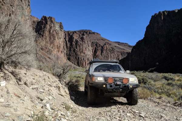
High Rock Canyon
High Rock Canyon is a rugged, two-track trail following the canyon floor and crossing High Rock Creek multiple times. It is accessed from the east via NV-8 at NV-34. This trail connects on its eastern end with Soldier's Meadow, where there is camping and hot/cold springs. From Soldier's Meadow, you ...
Learn more about High Rock Canyon
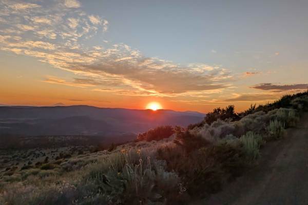
Mount Lively South Fork Mountain Road
This trail begins just off Highway 395 south of the village of Likely, starting on BLM land before transitioning in and out of Modoc National Forest. The first stretch is a recently graded dirt road with scattered loose and embedded rocks, surrounded by sagebrush and stands of pine. After about thre...
Learn more about Mount Lively South Fork Mountain Road
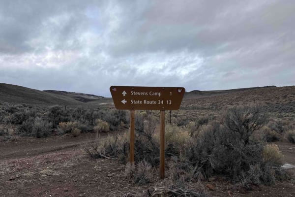
Stevens's Camp Back Door
This trail provides a back way to or from the top of High Rock Canyon trail/Stevens Camp out to County Road 34. There are a couple of large washes you cross and it is a bit rocky but other than that if the trail is dry it is pretty mellow. It is a very remote location as the BLM signs say you are on...
Learn more about Stevens's Camp Back Door
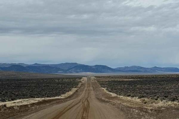
County Road 34
If you want to experience the Nevada backcountry at its finest, County Road 34 (CR 34) north of Gerlach is an excellent choice. This easy dirt road winds through rolling hills and wide-open stretches of the high Nevada desert, offering expansive views and a true sense of solitude. The drive is gener...
Learn more about County Road 34
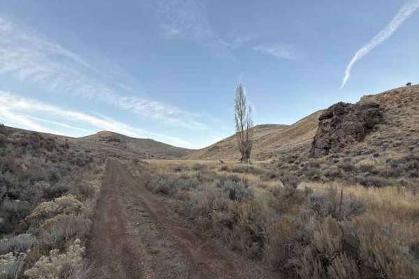
Miner's Draw Cabin - FS 6175, 6145, 6105
Forest Service Road 6175 offers a fun, easygoing route from Plush, Oregon, to the Sunstone Collection Area, making it a great option for anyone looking to explore Oregon’s high desert without tackling technical terrain. The road surface is generally well-graded gravel with stretches of compact dirt ...
Learn more about Miner's Draw Cabin - FS 6175, 6145, 6105
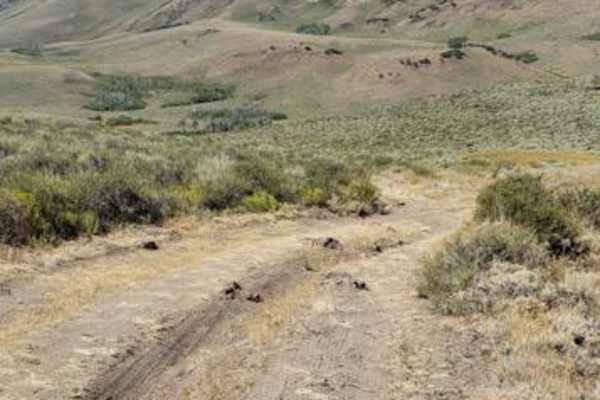
Barnhardy Rd
Barnhardy Road is usually open August thru December. The road runs between Hot Springs Campground and Guano Campground. It is mostly a nice two-track, but there are some rutted and rocky sections. You will also encounter several water crossings that are usually shallow, except after rainfall. Expect...
Learn more about Barnhardy Rd
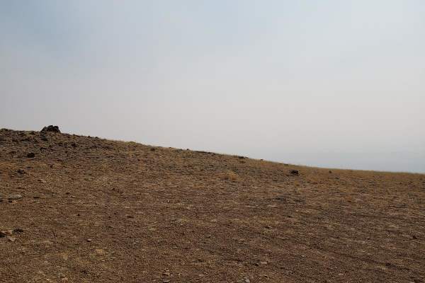
Skyline Drive Trail
Skyline Drive Trail is a scenic, moderately challenging overland route designed for high-clearance four-wheel-drive vehicles seeking sweeping views across Oregon's remote Hart Mountain National Antelope Refuge. This approximately eight-mile unmaintained trail climbs from Lookout Point at 6,184 feet ...
Learn more about Skyline Drive Trail
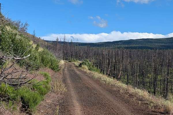
FS 44N23
This route serves as a significant transit line through the Modoc National Forest, traversing an area heavily impacted by the 2021 Antelope Forest Fire. While the fire's legacy is still clearly visible in the many standing dead trees throughout the landscape, the forest is beginning to recover with ...
Learn more about FS 44N23
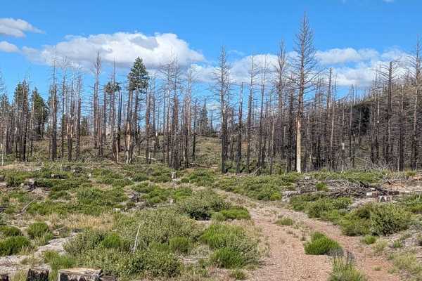
Roost Boundary - FS 44N54
This 2-mile point-to-point connector runs through the Modoc National Forest, linking Tennant Lava Bed Road (FS 44N28) to the FS 44N23 junction. Like much of the surrounding landscape, this route passes through the burn scar of the 2021 Antelope Forest Fire. The trail offers a window into the forest'...
Learn more about Roost Boundary - FS 44N54
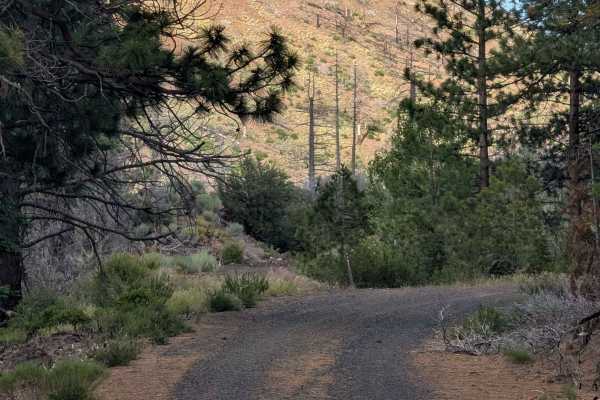
Tennant Lava Bed Road - FS 44N28
This 3-mile out-and-back trail provides a direct, accessible route starting and ending at Medicine Lake Road within the Modoc National Forest. The track cuts directly through a significant section of the 2021 Antelope Forest Fire burn scar, offering an immersive look at the landscape’s recovery. Whi...
Learn more about Tennant Lava Bed Road - FS 44N28
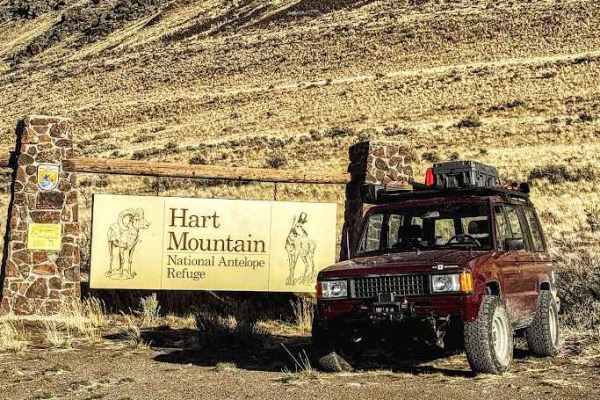
Flook Lake Bypass - Hart Mountain Antelope Refuge
This is a sensitive wildlife area. Please follow all posted signs, even if they direct you off this onX route. Stay on designated routes at all times. Camping is limited to designated areas and by permit only. Visit the official website for the latest access and conditions information: https://www.f...
Learn more about Flook Lake Bypass - Hart Mountain Antelope Refuge
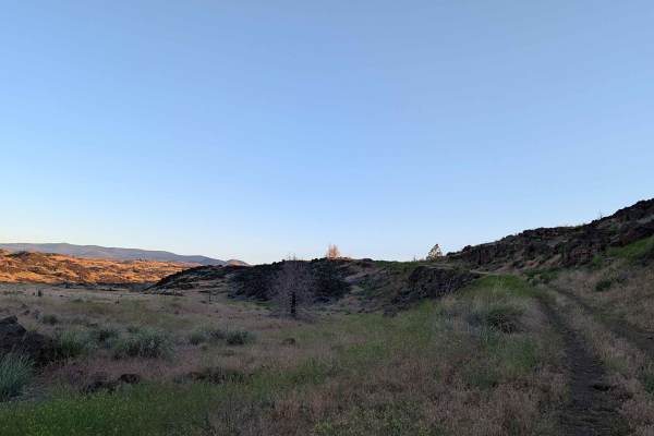
Gold Digger Pass - FS 46N21
This route begins on the east side, diverging from Hill Road within the bounds of the Lava Beds National Monument. The landscape is profoundly defined by ancient volcanic activity, with the trail winding through an environment dominated by sprawling lava rock formations interspersed with patches of ...
Learn more about Gold Digger Pass - FS 46N21
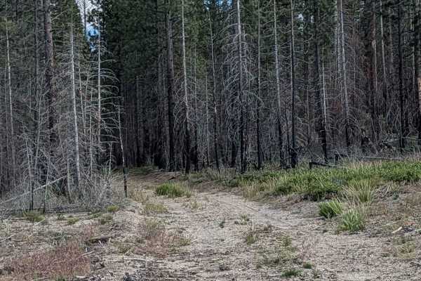
Railroad Grade - FS 44A51B
This short, functional connector trail provides a vital transition from the Medicine Road thoroughfare into the deeper forest, terminating at the South Cinder Monument (FS 44N51) junction. Situated within the Modoc National Forest, the route traverses a section of the 2021 Antelope Forest Fire burn ...
Learn more about Railroad Grade - FS 44A51B
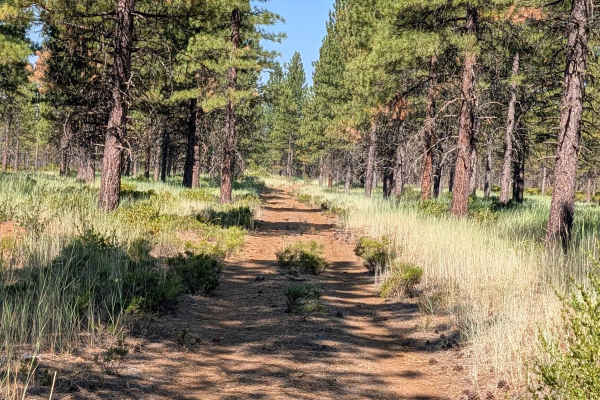
Red Cinder - FS 41N35Y
This 2.5-mile point-to-point trail connects Stud Hill North - FS 42N26 with Porcupine - FS 42N46, climbing almost 200 feet and dropping almost 100 feet, just enough elevation change to offer some views of the surrounding mountains in the distance. The route travels through new-growth pine forest wit...
Learn more about Red Cinder - FS 41N35Y
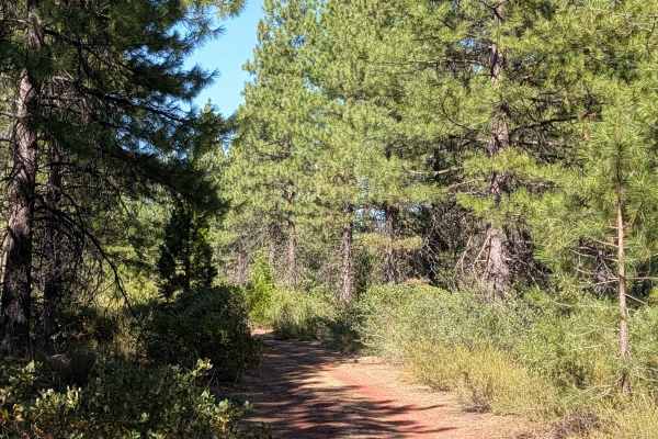
Obsdian - FS 42N35
This short trail connects Stud Hill North - FS 42N26 and Red Lava - FS 42N03, serving as a handy shortcut to get to the other side. It runs through young pine trees and lots of manzanita bushes, all within the Shasta National Forest. The surface is loose red dirt covered with old pine needles. Keep ...
Learn more about Obsdian - FS 42N35
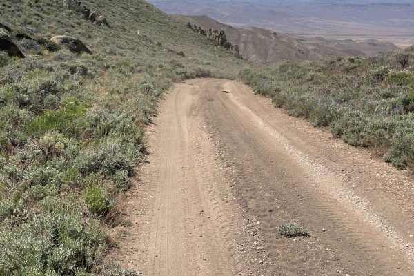
Knott Creek Reservoir North Access
The starting point is right near Gridley Lake and you will head east up the trail toward the mountains. There is mining activity in the area, so Knott Creek Road will have a bit of heavy truck traffic to at least be aware of. This trail will start off pretty mild, but there are a few areas to watch ...
Learn more about Knott Creek Reservoir North Access
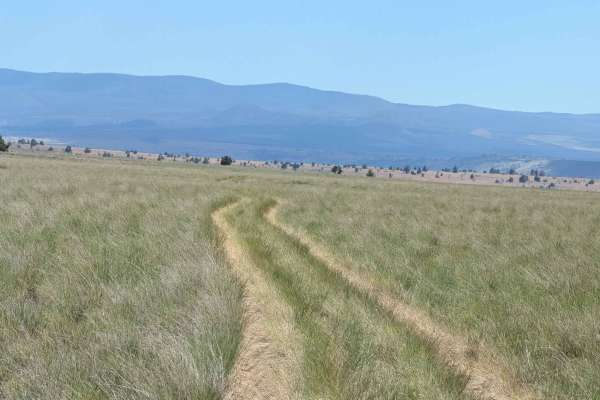
Sheep Camp Butte - FS 47N18
This trail serves as the main north-south route for this canyon, offering dramatic scenery as it travels through the region. The trail surface consists of dirt with small volcanic rocks, surrounded by short bushes and grasses, some of which grow tall along the trail median. Seasonally blooming wildf...
Learn more about Sheep Camp Butte - FS 47N18
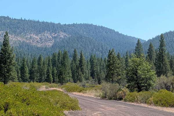
Old Camp Two - FS 41N03
This trail sits on the border of the Shasta and Lassen National Forests, with Lassen to the south and Shasta to the north. It functions as a great east to west route to connect with other trails in the area. The road starts as graded gravel before turning into a winding dirt road through the forest ...
Learn more about Old Camp Two - FS 41N03
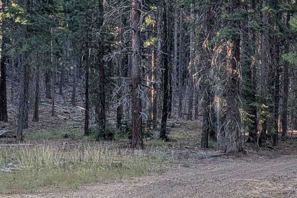
Antelope - FS 42N58
This 3-mile out-and-back route starts and ends at Black Lava FS42N23, beginning near large piles of volcanic rock. The route winds through a pine forest within the Shasta National Forest, climbing almost 400 feet over its length. The final stretch takes you up a hill on a shelf road offering views o...
Learn more about Antelope - FS 42N58
ATV trails near Lake City, California
Explore ATV-friendly trails near you. These trails are accessible for vehicles up to 50 inches wide, perfect for ATVs and smaller off-road machines.
Warner Mountains
This area is part of Modoc National Forest. There are several obsidian collection areas that require a permit that can be obtained at the Alturas Forest Service building. Once you get into the range, the obsidian is everywhere, so beware of flat tires. The area is known for its pink and rainbow obsi...
Learn more about Warner Mountains
High Rock Canyon
High Rock Canyon is a rugged, two-track trail following the canyon floor and crossing High Rock Creek multiple times. It is accessed from the east via NV-8 at NV-34. This trail connects on its eastern end with Soldier's Meadow, where there is camping and hot/cold springs. From Soldier's Meadow, you ...
Learn more about High Rock Canyon
Mount Lively South Fork Mountain Road
This trail begins just off Highway 395 south of the village of Likely, starting on BLM land before transitioning in and out of Modoc National Forest. The first stretch is a recently graded dirt road with scattered loose and embedded rocks, surrounded by sagebrush and stands of pine. After about thre...
Learn more about Mount Lively South Fork Mountain Road
Stevens's Camp Back Door
This trail provides a back way to or from the top of High Rock Canyon trail/Stevens Camp out to County Road 34. There are a couple of large washes you cross and it is a bit rocky but other than that if the trail is dry it is pretty mellow. It is a very remote location as the BLM signs say you are on...
Learn more about Stevens's Camp Back Door
UTV/side-by-side trails near Lake City, California
Find UTV and side-by-side trails near you. These trails accommodate vehicles up to 60 inches wide, ideal for UTVs, side-by-sides, and wider off-road rigs.
Warner Mountains
This area is part of Modoc National Forest. There are several obsidian collection areas that require a permit that can be obtained at the Alturas Forest Service building. Once you get into the range, the obsidian is everywhere, so beware of flat tires. The area is known for its pink and rainbow obsi...
Learn more about Warner Mountains
High Rock Canyon
High Rock Canyon is a rugged, two-track trail following the canyon floor and crossing High Rock Creek multiple times. It is accessed from the east via NV-8 at NV-34. This trail connects on its eastern end with Soldier's Meadow, where there is camping and hot/cold springs. From Soldier's Meadow, you ...
Learn more about High Rock Canyon
Mount Lively South Fork Mountain Road
This trail begins just off Highway 395 south of the village of Likely, starting on BLM land before transitioning in and out of Modoc National Forest. The first stretch is a recently graded dirt road with scattered loose and embedded rocks, surrounded by sagebrush and stands of pine. After about thre...
Learn more about Mount Lively South Fork Mountain Road
Stevens's Camp Back Door
This trail provides a back way to or from the top of High Rock Canyon trail/Stevens Camp out to County Road 34. There are a couple of large washes you cross and it is a bit rocky but other than that if the trail is dry it is pretty mellow. It is a very remote location as the BLM signs say you are on...
Learn more about Stevens's Camp Back Door
The onX Offroad Difference
onX Offroad combines trail photos, descriptions, difficulty ratings, width restrictions, seasonality, and more in a user-friendly interface. Available on all devices, with offline access and full compatibility with CarPlay and Android Auto. Discover what you're missing today!
Open Trail Map