
Dirt Bike Trails
Near Hoodsport, Washington
Explore All Dirt Bike Trails Near Hoodsport, Washington
Dirt Bike Trails Near Hoodsport, Washington
Discover the best dirt bike trails near you. Browse trail maps, check difficulty ratings, and find your next adventure — whether you're looking for a quick ride or an all-day expedition.
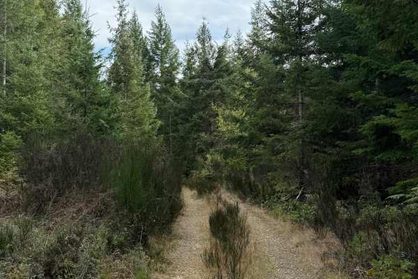
Plant Cave Trail
Plant Cave Trail is an easy, single-vehicle-width route traveling through dense vegetation on Washington DNR-managed land. Grass covers most of the trail surface, with plants and brush encroaching from both sides as you travel farther in. Overhanging branches reduce vertical clearance in several pla...
Learn more about Plant Cave Trail
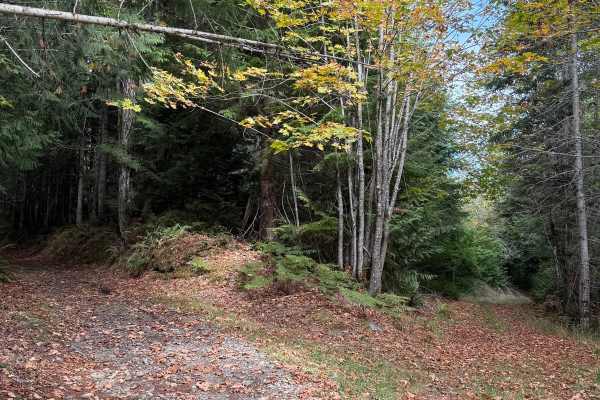
Powerline Connector Trail
Powerline Connector Trail is a single-vehicle-width route through forest and powerline corridors on Washington DNR-managed land. The trail consists primarily of firm hardpack dirt, transitioning to gravel in several sections. Dense vegetation lines both sides through the wooded portions, while the r...
Learn more about Powerline Connector Trail
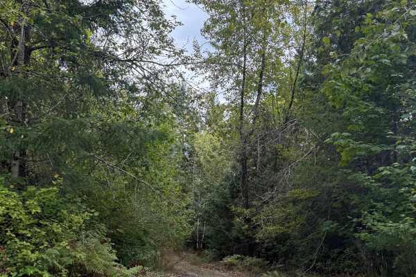
Forest Overgrowth Trail
Forest Overgrowth Trail is an easy route traveling through thick forest on Washington DNR-managed land. The trail begins on firm, hardpack dirt with sections of grass growing along the roadway and no significant technical obstacles. Dense trees and vegetation surround the route, creating a secluded ...
Learn more about Forest Overgrowth Trail
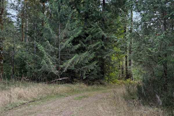
Dugout Ditch Trail
Dugout Ditch Trail is a single-vehicle-width route that begins as an easy hardpack trail through the forest. Around halfway through, conditions become rougher as several large dugout ditches cross or interrupt the trail, followed by a downed tree. Beyond the tree, additional dirt ditches and increas...
Learn more about Dugout Ditch Trail
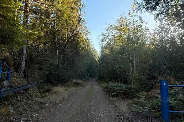
Prices Lake Road Extension
Prices Lake Road Extension is an easy, single-vehicle-width route that appears to continue directly from Prices Lake Road. A gate separates this trail from Prices Lake Road on the map. The route can be accessed from North Lake Cushman Road near Dow Creek, providing another way into the larger surrou...
Learn more about Prices Lake Road Extension
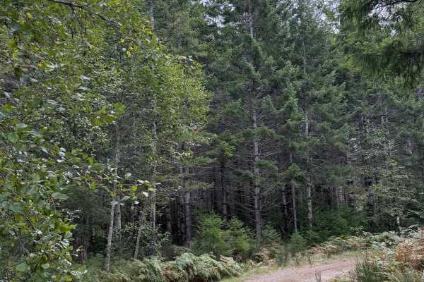
Hoodsport - North Cushman Connector
Hoodsport - North Cushman Connector is an easy, single-vehicle-wide route branching from Hoodsport Mainline on Washington DNR-managed land. The trail begins as single-vehicle-width hardpack dirt surrounded by thick forest, with a few shallow puddles and one small log hop providing minor obstacles. S...
Learn more about Hoodsport - North Cushman Connector
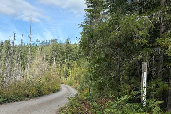
Saddle Mountain Road
Saddle Mountain Road is an easy, approximately 4.8-mile hardpack route on Washington DNR-managed land. The road is open to street-legal vehicles, including plated motorcycles. The roadway is approximately 60 inches wide and single-vehicle width, with a winding route through dense forest. Vegetation ...
Learn more about Saddle Mountain Road
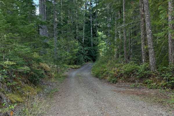
Lake Cushman View Trail
Lake Cushman View Trail is an easy single-vehicle-width route that loops from Price Lake Road back to Price Lake Road. The trail follows mostly firm hardpack dirt with approximately 450 feet of elevation change and no significant technical obstacles. A few potholes and uneven areas add minor bumps a...
Learn more about Lake Cushman View Trail
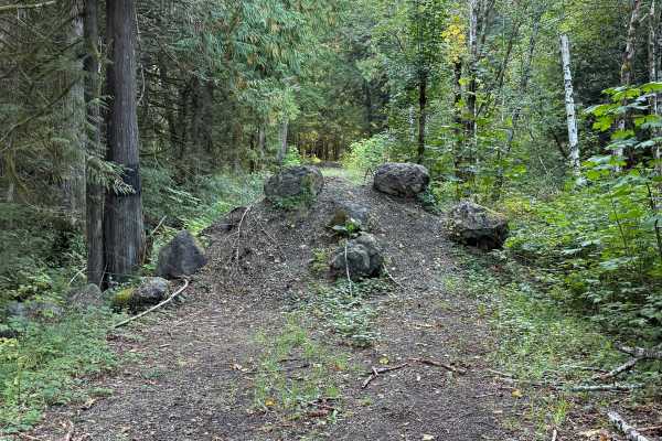
Prices Lake Road
Price Lake Road is an easy, single-vehicle-width hardpack route traveling through dense forest near Lake Cushman. Access from North Lake Cushman Road is currently blocked by constructed dirt mounds and large boulders, so vehicles should not attempt to enter from that end. The road itself consists pr...
Learn more about Prices Lake Road
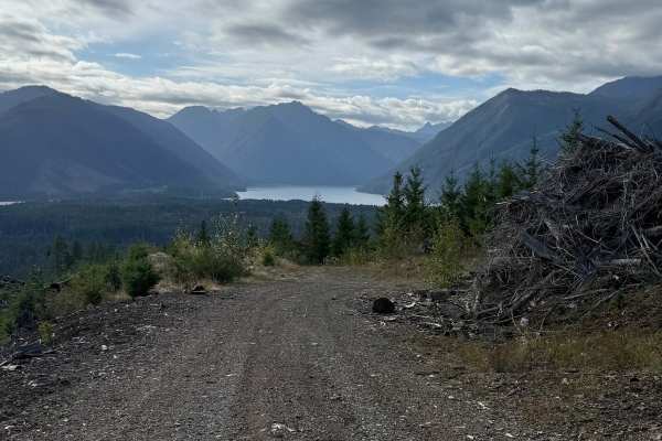
DNR Road 1263
DNR Road 1263 is an easy single-vehicle-width route on Washington DNR-managed land that takes you up Saddle Mountain. The road is open to street-legal vehicles, including plated motorcycles. The route follows winding hardpack dirt as it steadily climbs through dense forest, with several small spur r...
Learn more about DNR Road 1263
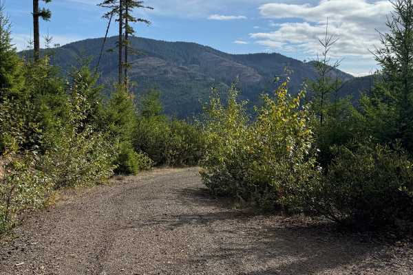
DNR Road 124
DNR Road 124 is an easy hardpack route on Washington DNR-managed land. The road is open to street-legal vehicles, including plated motorcycles. The trail is approximately 60 inches wide in places and generally provides room for one vehicle at a time. The surface is mostly firm hardpack with a few bu...
Learn more about DNR Road 124
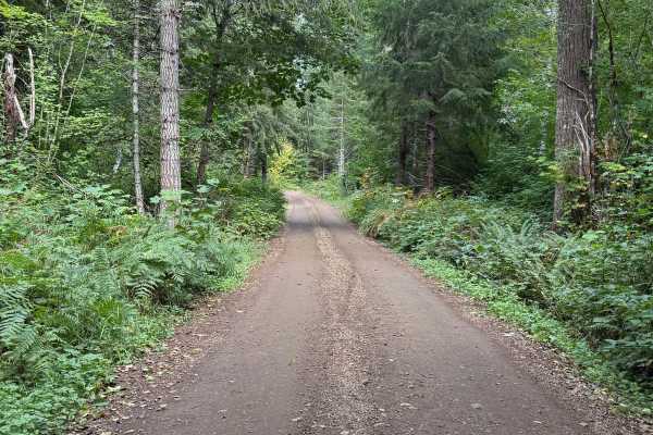
DRN Road 1240
DNR Road 1240 is an easy hardpack route on Washington DNR-managed land. The road is open to street-legal vehicles, including plated motorcycles. The route is approximately 60 inches wide, generally providing room for one vehicle at a time. It travels through dense forest with trees lining both sides...
Learn more about DRN Road 1240

NF 2419 - Mt Ellinor Th
Turning North off of Forest Road 24, this trail leads to Mt. Ellinor Lower Trailhead. The trail does not continue past the endpoint, as it appears on the map. Rather it ends at a parking lot for the Jefferson Pass Trailhead. The road up is nice and wide with the typical washboard sections - safe and...
Learn more about NF 2419 - Mt Ellinor Th

Nettleton/Forest Road 2441
This trail is pretty easy for the most part depending on which direction you go. If starting at Jorsted Creek Road, 2WD is all you need. The road has loose rock with washouts but easily traversed. If entering from the Jefferson Creek/Elk Lake side, 4WD will be required for the extremely loose rock, ...
Learn more about Nettleton/Forest Road 2441
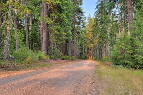
Planters Loop - FR 2340
Just southeast of Brown Creek Campground is where Planters Loop begins. You can run the loop in either direction and enjoy the beautiful forest scenery all the same. Sadly the view out and down the mountainside never quite opens up as the forest is dense throughout the trail. However, you will occas...
Learn more about Planters Loop - FR 2340
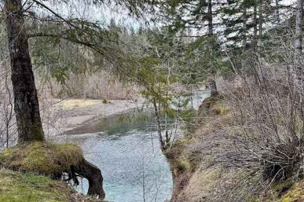
FS 220
This is a somewhat common trail with dispersed camping on the river. There is a gate at the main road that is usually open, but may be locked seasonally. At the river, there is abundant camping for multiple groups. Unfortunately, this area is easy to access, and users are leaving trash behind. A...
Learn more about FS 220

NF - 2464
Beginning trail from the West: what begins as a wide and easy shelf two-track trail slowly becomes more and more narrow with overgrowth. Full-size vehicles are highly discouraged and will certainly receive paint damage. Some sections were so narrow and tunnel-like that even on a moto bike the vegeta...
Learn more about NF - 2464
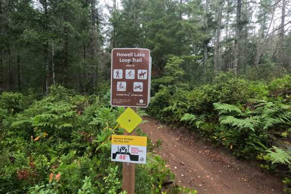
Howell Lake Loop
Howell Lake Loop is a 3.8-mile multi-use trail open to vehicles 48 inches wide and under. The trail winds through the Tahuya State Forest with flowing corners, moderately sized berms, loose rock, whoops, and occasional rutted sections. The eastern portion of the original loop is currently closed due...
Learn more about Howell Lake Loop
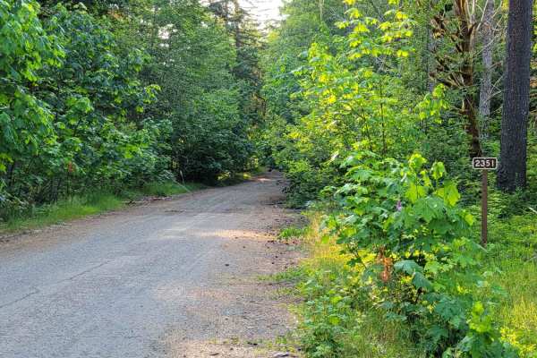
FR 2351
Paralleling Rock Creek (river), this trail climbs up the mountainside towards Rock Peak. There are a couple of offshoot trails from this one, as well as a few primitive camping spots along the way. Occasionally you can catch glimpses down the hillside at the surrounding forest. The trail is open to ...
Learn more about FR 2351

NF 2394
Forest Road 2394 leads to a hiking trailhead and passes the Le Bar horse camp. The trail progressively becomes more and more overgrown and was even narrow for a dirt bike further up. Low hanging/fallen trees exist over the trail, which may inhibit full-size vehicles. There were a few primitive campi...
Learn more about NF 2394
ATV trails near Hoodsport, Washington
Explore ATV-friendly trails near you. These trails are accessible for vehicles up to 50 inches wide, perfect for ATVs and smaller off-road machines.
Nettleton/Forest Road 2441
This trail is pretty easy for the most part depending on which direction you go. If starting at Jorsted Creek Road, 2WD is all you need. The road has loose rock with washouts but easily traversed. If entering from the Jefferson Creek/Elk Lake side, 4WD will be required for the extremely loose rock, ...
Learn more about Nettleton/Forest Road 2441
Planters Loop - FR 2340
Just southeast of Brown Creek Campground is where Planters Loop begins. You can run the loop in either direction and enjoy the beautiful forest scenery all the same. Sadly the view out and down the mountainside never quite opens up as the forest is dense throughout the trail. However, you will occas...
Learn more about Planters Loop - FR 2340
FS 220
This is a somewhat common trail with dispersed camping on the river. There is a gate at the main road that is usually open, but may be locked seasonally. At the river, there is abundant camping for multiple groups. Unfortunately, this area is easy to access, and users are leaving trash behind. A...
Learn more about FS 220
NF - 2464
Beginning trail from the West: what begins as a wide and easy shelf two-track trail slowly becomes more and more narrow with overgrowth. Full-size vehicles are highly discouraged and will certainly receive paint damage. Some sections were so narrow and tunnel-like that even on a moto bike the vegeta...
Learn more about NF - 2464
UTV/side-by-side trails near Hoodsport, Washington
Find UTV and side-by-side trails near you. These trails accommodate vehicles up to 60 inches wide, ideal for UTVs, side-by-sides, and wider off-road rigs.
NF 2419 - Mt Ellinor Th
Turning North off of Forest Road 24, this trail leads to Mt. Ellinor Lower Trailhead. The trail does not continue past the endpoint, as it appears on the map. Rather it ends at a parking lot for the Jefferson Pass Trailhead. The road up is nice and wide with the typical washboard sections - safe and...
Learn more about NF 2419 - Mt Ellinor Th
Nettleton/Forest Road 2441
This trail is pretty easy for the most part depending on which direction you go. If starting at Jorsted Creek Road, 2WD is all you need. The road has loose rock with washouts but easily traversed. If entering from the Jefferson Creek/Elk Lake side, 4WD will be required for the extremely loose rock, ...
Learn more about Nettleton/Forest Road 2441
Planters Loop - FR 2340
Just southeast of Brown Creek Campground is where Planters Loop begins. You can run the loop in either direction and enjoy the beautiful forest scenery all the same. Sadly the view out and down the mountainside never quite opens up as the forest is dense throughout the trail. However, you will occas...
Learn more about Planters Loop - FR 2340
FS 220
This is a somewhat common trail with dispersed camping on the river. There is a gate at the main road that is usually open, but may be locked seasonally. At the river, there is abundant camping for multiple groups. Unfortunately, this area is easy to access, and users are leaving trash behind. A...
Learn more about FS 220
The onX Offroad Difference
onX Offroad combines trail photos, descriptions, difficulty ratings, width restrictions, seasonality, and more in a user-friendly interface. Available on all devices, with offline access and full compatibility with CarPlay and Android Auto. Discover what you're missing today!
Open Trail Map