
Dirt Bike Trails
Near Cusick, Washington
Explore All Dirt Bike Trails Near Cusick, Washington
Dirt Bike Trails Near Cusick, Washington
Discover the best dirt bike trails near you. Browse trail maps, check difficulty ratings, and find your next adventure — whether you're looking for a quick ride or an all-day expedition.
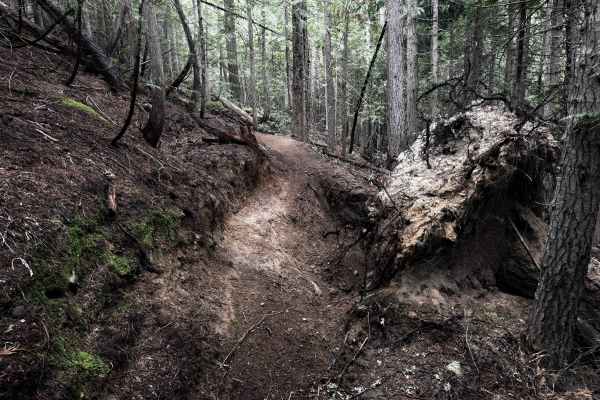
307
Trail #307 is a short singletrack in the Batey-Bould Trail System in the Colville National Forest in Washington. It starts directly from the Batey-Bould staging area and meanders through a dense wooded terrain for 1 mile, making frequent sharp zig-zagging turns up a steep hillside through lodgepole ...
Learn more about 307
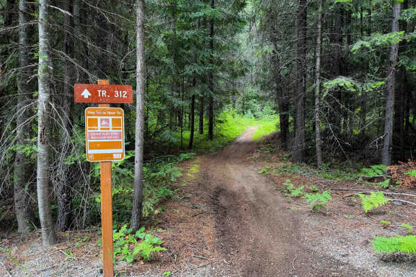
312
Trail #312 is a short singletrack in the Batey-Bould Trail System in the Colville National Forest in Washington. The trail goes through a dense wooded area of lodgepole pines and tall western red cedars. It’s mostly smooth, fast, and flowy dirt with only a bit of roots and loose rock. It has a road ...
Learn more about 312
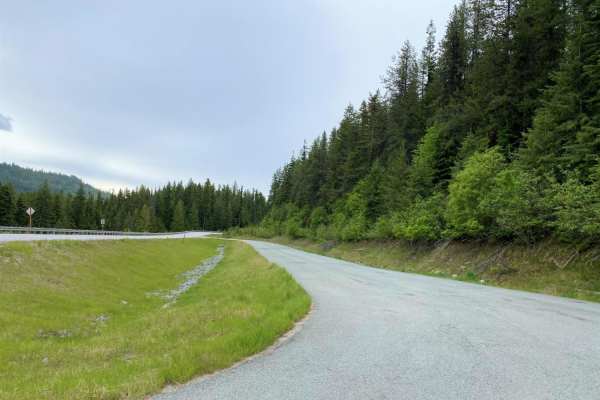
Cottonwood Divide
Cottonwood Divide offers an easy, highly scenic dirt and gravel route through the Colville National Forest, making it perfect for beginners, overland vehicles, and OHV riders looking for a relaxed mountain drive. Spanning approximately 34.5 miles, this loop transitions between the paved Flowery Trai...
Learn more about Cottonwood Divide
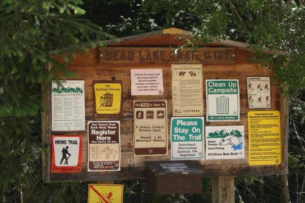
Bead Lake
The Bead Lake trail is an easy-going, scenic off-road loop ideal for beginners, families, and high-clearance vehicles looking for a relaxing day in the Colville National Forest near the Washington-Idaho border. Spanning approximately 28.7 miles, this route climbs from an elevation of 2,057 feet up t...
Learn more about Bead Lake
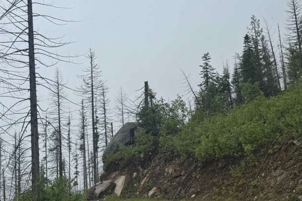
Mill Creek - FS 312
This trail starts as gravel-based but then transitions to dirt as it climbs. The trail climbs nearly 2,300 feet in elevation over 13.1 miles and takes you up to Pyramid Pass, where there are many other trails to explore. The road becomes a narrow, one-lane shelf road after transitioning to dirt with...
Learn more about Mill Creek - FS 312
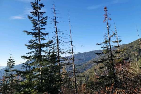
Sherlock Peak Byway
This Sherlock Peak Byway gives a slow steady drive with some washed-out areas of the road during Spring and Fall. Along this trail, you'll see great views and deep treed areas providing an enjoyable ride any time of the year. It also encompasses part of the Cottonwood Divide Trail and joins the Cott...
Learn more about Sherlock Peak Byway
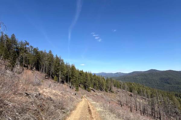
Eagle Mountain - FS 4300080
Easy-to-moderate trail near Chewelah, WA, with a steady climb and switchbacks. Mixed terrain of gravel, compact dirt, loose rock, grass, and ruts. Starts approachable, becoming more engaging as elevation builds. Rated 2 when dry but can shift to 3–4 in wet conditions. High-clearance AWD/4WD recommen...
Learn more about Eagle Mountain - FS 4300080
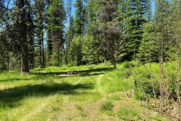
Hartill Meadows
Easy road ride. Mostly forested, with some open areas where you can view the valleys and mountains. Makes for a nice 2 hour excursion ride for family outing. Road may be rutted. Hartill Meadows is a small dispersed camping area.
Learn more about Hartill Meadows
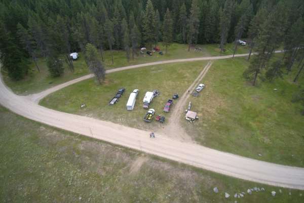
Fourth of July Mountain
Fourth of July Mountain is a scenic gravel and dirt route through the Colville National Forest that offers offroaders an easy, relaxing drive with beautiful mountain vistas. Suitable for high-clearance vehicles, SUVs, and SxSs, this route winds through dense forest and across ridges near Calispell P...
Learn more about Fourth of July Mountain
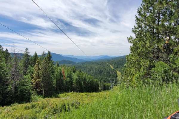
Chewelah Creek
This is a long scenic trail between Chewelah Creek Campground and Cusick, WA. It has multiple scenic viewpoints that present excellent photo opportunities. The majority of the trail is along well-maintained roads but narrows in a few locations. Cell service is limited, so plan ahead. There are sever...
Learn more about Chewelah Creek
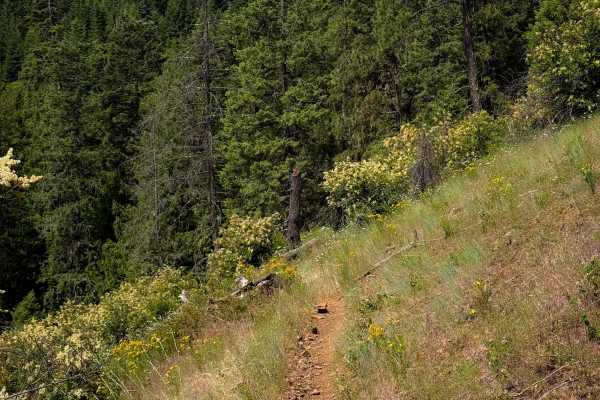
Steep Creek
Steep Creek is a dirt bike trail open to vehicles 40 inches or less. The west end starts off very wide, meandering through a flat forest floor, on smooth dirt, through a forest of hemlocks. Eventually it narrows up, turning into a true single track that is more exposed on the hillsides. It follows t...
Learn more about Steep Creek
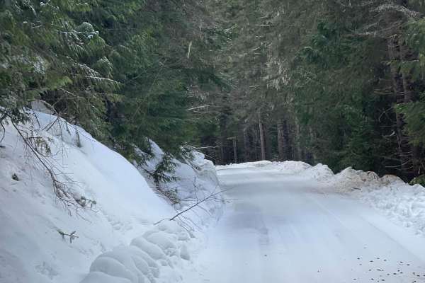
Quartz Creek 416
This is a two-way Forest Service Road. Great way to get to other trails fast or back to the highway. Lots of pine trees and mountain views. In the wintertime, this trail can be icy but it does get plowed.
Learn more about Quartz Creek 416
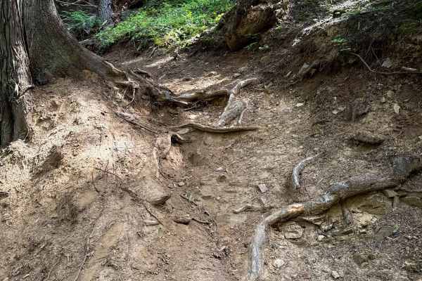
Quartz View
The north end of Quartz View starts out with a bridge crossing over the Steep Creek, and then it immediately starts climbing up a series of 10+ tight and moderately technical switchbacks. A few of the switchbacks have dug out roots across the trail on the inside corner, making them more difficult. T...
Learn more about Quartz View
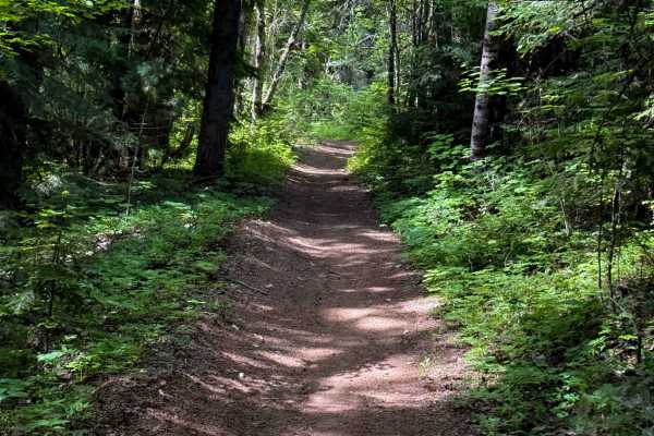
John Wayne Loop
The John Wayne Loop trail is a fun and easy trail for ATVs. The north end departs from the Pee Wee ATV trail, and it goes south through the Kaniksu National Forest towards Forest Service Road 1334. From the north end, it drops down to a couple of small bridges over muddy creeks; one of the bridges i...
Learn more about John Wayne Loop
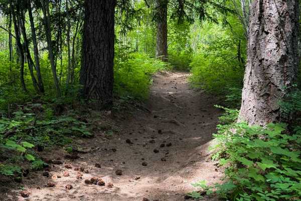
John Wayne A Spur
The John Wayne A Spur is a short ATV trail that connects John Wayne back to Pee Wee over 1 mile. It gains about 400 feet in elevation from south to north, with a few steep spots, but is generally very easy and gradual. The trail stays on a wide path, appropriate for 50-inch vehicles, on smooth dirt ...
Learn more about John Wayne A Spur
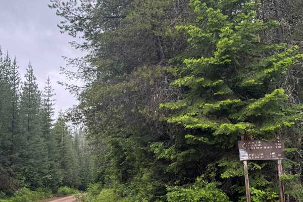
Lamb Creek Connector - FS 219
This is a dirt-based forest road in the National Forest. It connects trail systems and is approximately 5 miles long. Along this trail, you will have good views of the mountains and ridges around you, and camping is allowed along the entire trail with multiple pre-existing dispersed campsites. There...
Learn more about Lamb Creek Connector - FS 219
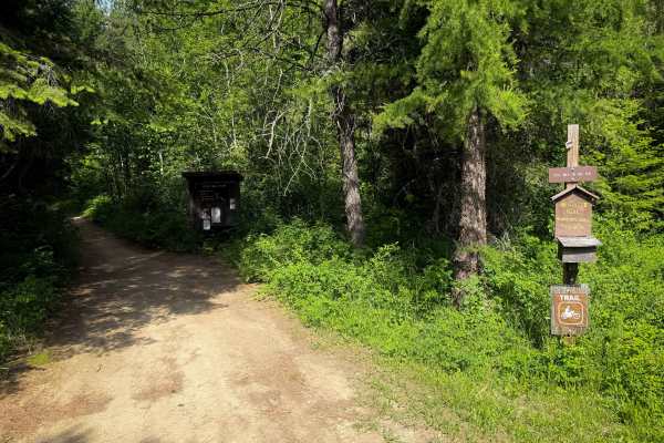
Pee Wee
Pee Wee is a moderately easy ATV trail in the Kaniksu National Forest near Priest River, Idaho. The south end starts at the Pee Wee Trailhead, which is a large dispersed camping and staging area. It winds through the forest for 4.2 miles up and over small hills, with several steeper climbing section...
Learn more about Pee Wee
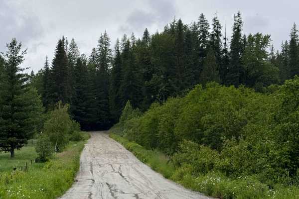
Lamb Creek Road - FS 310
This trail starts wide and gravel-based, passing through private property. You will begin to gradually climb and navigate switchbacks as you enter the National Forest. The trail gains over 2,800 feet of elevation as it climbs to the top of Gleason Mountain. The road narrows to one lane with places t...
Learn more about Lamb Creek Road - FS 310
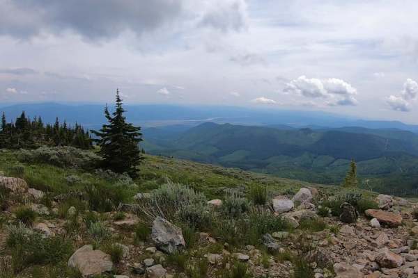
Calispell Peak
Calispell Peak is a scenic 50-mile loop starting from Chewelah, Washington, designed for offroaders seeking a rewarding mountain excursion with expansive views of the Colville National Forest. Starting as a paved route out of town, this trail quickly transitions to maintained gravel roads as it clim...
Learn more about Calispell Peak
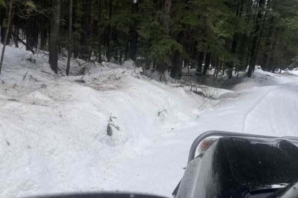
Gleason McAbee 334
The trail starts down a residential dirt road for about 3 miles. Be prepared as in the winter it will only be plowed for the 3 miles. You will drive along Priest River for most of the trail. There is wildlife to be seen as well as golden eagles.
Learn more about Gleason McAbee 334
ATV trails near Cusick, Washington
Explore ATV-friendly trails near you. These trails are accessible for vehicles up to 50 inches wide, perfect for ATVs and smaller off-road machines.
Cottonwood Divide
Cottonwood Divide offers an easy, highly scenic dirt and gravel route through the Colville National Forest, making it perfect for beginners, overland vehicles, and OHV riders looking for a relaxed mountain drive. Spanning approximately 34.5 miles, this loop transitions between the paved Flowery Trai...
Learn more about Cottonwood Divide
Bead Lake
The Bead Lake trail is an easy-going, scenic off-road loop ideal for beginners, families, and high-clearance vehicles looking for a relaxing day in the Colville National Forest near the Washington-Idaho border. Spanning approximately 28.7 miles, this route climbs from an elevation of 2,057 feet up t...
Learn more about Bead Lake
Mill Creek - FS 312
This trail starts as gravel-based but then transitions to dirt as it climbs. The trail climbs nearly 2,300 feet in elevation over 13.1 miles and takes you up to Pyramid Pass, where there are many other trails to explore. The road becomes a narrow, one-lane shelf road after transitioning to dirt with...
Learn more about Mill Creek - FS 312
Sherlock Peak Byway
This Sherlock Peak Byway gives a slow steady drive with some washed-out areas of the road during Spring and Fall. Along this trail, you'll see great views and deep treed areas providing an enjoyable ride any time of the year. It also encompasses part of the Cottonwood Divide Trail and joins the Cott...
Learn more about Sherlock Peak Byway
UTV/side-by-side trails near Cusick, Washington
Find UTV and side-by-side trails near you. These trails accommodate vehicles up to 60 inches wide, ideal for UTVs, side-by-sides, and wider off-road rigs.
Cottonwood Divide
Cottonwood Divide offers an easy, highly scenic dirt and gravel route through the Colville National Forest, making it perfect for beginners, overland vehicles, and OHV riders looking for a relaxed mountain drive. Spanning approximately 34.5 miles, this loop transitions between the paved Flowery Trai...
Learn more about Cottonwood Divide
Bead Lake
The Bead Lake trail is an easy-going, scenic off-road loop ideal for beginners, families, and high-clearance vehicles looking for a relaxing day in the Colville National Forest near the Washington-Idaho border. Spanning approximately 28.7 miles, this route climbs from an elevation of 2,057 feet up t...
Learn more about Bead Lake
Mill Creek - FS 312
This trail starts as gravel-based but then transitions to dirt as it climbs. The trail climbs nearly 2,300 feet in elevation over 13.1 miles and takes you up to Pyramid Pass, where there are many other trails to explore. The road becomes a narrow, one-lane shelf road after transitioning to dirt with...
Learn more about Mill Creek - FS 312
Sherlock Peak Byway
This Sherlock Peak Byway gives a slow steady drive with some washed-out areas of the road during Spring and Fall. Along this trail, you'll see great views and deep treed areas providing an enjoyable ride any time of the year. It also encompasses part of the Cottonwood Divide Trail and joins the Cott...
Learn more about Sherlock Peak Byway
The onX Offroad Difference
onX Offroad combines trail photos, descriptions, difficulty ratings, width restrictions, seasonality, and more in a user-friendly interface. Available on all devices, with offline access and full compatibility with CarPlay and Android Auto. Discover what you're missing today!
Open Trail Map