
Beginner Off-Road Trails
Near Toms Brook, Virginia
Explore All Beginner Trails Near Toms Brook, Virginia
Beginner Off-Road Trails Near Toms Brook, Virginia
Discover the best beginner-friendly off-road trails near you. These easier, lower-rated trails are a great place to start — browse trail maps, check difficulty ratings, and find your next adventure.
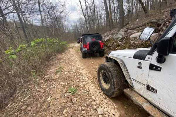
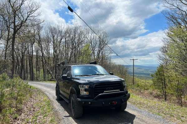
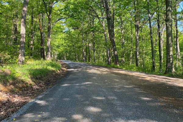
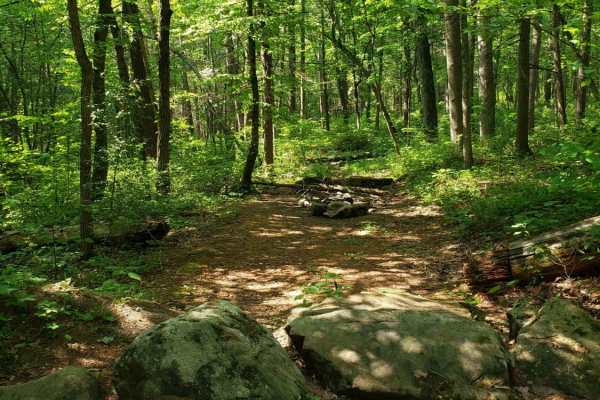
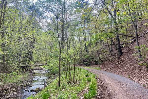
Peters Mill Run
Peters Mill Run is an easy point-to-point trail near Fort Valley, Virginia. The trail is stock-friendly and is a great spot for those new to off-roading. The trail can be entered from either the north or south end, with the southernmost two miles being the most challenging. Woodstock Tower near the ...
Learn more about Peters Mill Run
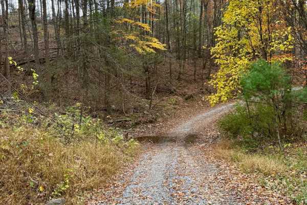
Woodstock Tower Road
This is a steep, windy road leading up to the Woodstock Observation Tower. This tower offers amazing views of the surrounding valleys and mountains. This road is mainly loose gravel with switchbacks and steep inclines. This can be driven in 2WD, but use caution if snow or ice is present. Peters Mill...
Learn more about Woodstock Tower Road
Vances Cove
Vances Cove trail is a meandering gravel road starting at Cold Spring Gap. Descending into the valley along cold spring creek. The road can become washed out in some areas after heavy rain, as the trail so closely follows it. Tight and narrow, the trail winds down to an intersection at Vances Cove, ...
Learn more about Vances Cove
Hawk
Hawk Run is a meandering forest road that crosses through some private property as it climbs Spring Mountain along the border of Virginia and West Virginia. The road is mostly gravel with some dirt and clay in good condition with a few potholes and washouts. It crests at an elevation of over 2,000ft...
Learn more about Hawk
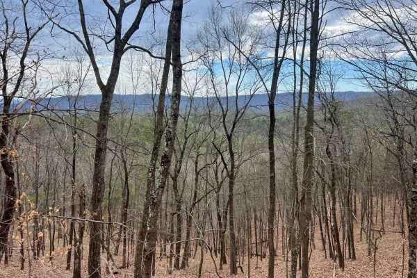
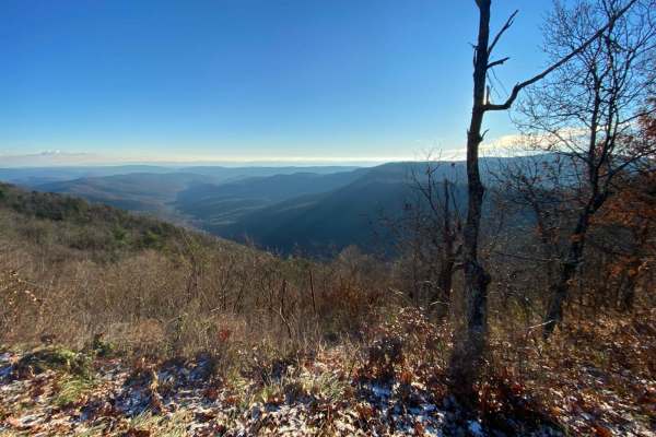
Dry Gap Ridge
Dry Gap is a short step, out and back trail climbing along a ridge leading to a cell tower. The beginning climb is the most challenging part due to its steep nature; 4WD is recommended. The sweeping views from the ridge are incredible when no leaves are on the trees following the border of Virginia ...
Learn more about Dry Gap Ridge
Hornet
Hornet descends out the back forest of George Washington National Forest to Hawk Campground. Many dispersed campsites can also be found past the Hawk Recreation and Picnic area. The road down is mostly gravel with many washouts of clay and mud exposing ruts and rocks. This is a scenic and secluded a...
Learn more about Hornet
Squirrel Gap Road
This is a gravel road with many primitive camping spots and beautiful views of the mountains around you. It's not technical, but it's a great trail to be out in nature and even find time to camp along the trail. There is a small creek that you'll see in the beginning.
Learn more about Squirrel Gap Road
Devils Hole Road
Devils Hole Road, or RT 691 Gravel Road, is an adventure weaving through the heart of the George Washington National Forest. Rocky in sections, with winding forest roads, leads to breathtaking mountain overlooks. Surrounded by towering hardwoods and remote wilderness, the trail delivers a perfect mi...
Learn more about Devils Hole Road
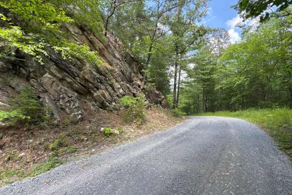
Edinburg Gap
Edinburg Gap is a minimally maintained Forest Service Road located in the George Washington National Forest. The road is one vehicle wide with plenty of space to pass and can be accessed by either end. The road passes through one shallow stream and an area of rockier terrain but is still accessible ...
Learn more about Edinburg Gap
Chrisman Hollow - FS 274
The Chrisman Hollow Trail, also known as FS 274, connects US 211 at the south end and State Road 674 at the north end of the trail. It takes you to several trailheads, including the Lion's Tale Trail, which offers an ADA-accessible, half-mile trail along the Passage Creek. There are several primitiv...
Learn more about Chrisman Hollow - FS 274
Emerald Pond
Dead end route to a mountain pond. This route gradually climbs the mountain and ends at multiple locked gates. The route has some exposed base stone and muddy sections but generally maintained gravel forest service route. The route follows a creek with several dispersed camping areas along the creek...
Learn more about Emerald Pond
Gauley Ridge Forest Road
This trail offers scenic views of the mountains as you travel along the ridge. There are several dispersed campsites large enough to fit multiple vehicles with existing fire rings and great views. The trail is relatively smooth and can be driven in fair weather by most vehicles. The connection to Ve...
Learn more about Gauley Ridge Forest Road
Cub Run
Maintained gravel forest service road. This route includes numerous hiking trailheads. The southern portion of the route has very spotty cell service, which improves in the northern portion. The northern portion includes many dispersed camping areas located along a small creek. The route is well-tra...
Learn more about Cub Run
Mitchell Knob Trail
This is a seasonal trail, open from 10/1 to 1/15. This scenic point-to-point trail in the George Washington National Forest runs along Trail ID 152 in West Virginia. Mitchell Knob trail offers climbs and descents, scenic views of the mountains and valleys, and several switchbacks. Dispersed camping ...
Learn more about Mitchell Knob Trail
Vepco Road
This route follows along a power line for the most part with lots of scenic views. The lower elevation section is mainly gravel or a natural stone base. The upper section to the intersection at Broad Run Road becomes narrow, steeper, and much rockier. There are several dispersed camping areas along ...
Learn more about Vepco Road
FSR 72 Long Run Road
This Forest Service road has beautiful views of the Appalachian Mountains and 4WD is not required to see them. You will see several campsites right off the road, but there's one with a spectacular view of the mountains at 38.58666, -79.05788. This campsite is large enough for several rigs to set up ...
Learn more about FSR 72 Long Run Road
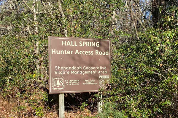
FSR #85-2 Hall Spring Road
This route will take you along the side of the mountain with beautiful views of Appalachia. This trail feels like an East Coast shelf road since it is mainly single track with only a few places to pass oncoming vehicles. This road follows the WV-VA border and is only accessible 10/01-01/15.
Learn more about FSR #85-2 Hall Spring Road
Fort Seybert Trail
This trail offers climbs and descents, scenic views of the mountains and valleys, and several switchbacks. In the lower West Virginia area of the trail, there are multiple stream crossings that offer breathtaking scenery of the forest, rocky streams, and natural mossy growth. There is one good-sized...
Learn more about Fort Seybert Trail
Feedstone Mountain
This out-and-back trail leads to a quiet spot near a rocky stream, offering a peaceful place to relax or camp. A campsite is located partway up Feedstone Mountain, though the surrounding grass can be tall. The route is not especially difficult and is suitable for most four-wheel drive vehicles, but ...
Learn more about Feedstone Mountain
Westside Road
Westside Road travels along the western slope of Shenandoah mountain in WV. Be respectful while travelling through private property, from WV Co Route 34 to the National Forest boundary. The route is generally dirt with crushed stone in high erosion areas with some exposed natural rock. The route inc...
Learn more about Westside Road
Beginner ATV trails near Toms Brook, Virginia
Explore ATV-friendly trails near you. These trails are accessible for vehicles up to 50 inches wide, perfect for ATVs and smaller off-road machines.
Devils Hole Road
Devils Hole Road, or RT 691 Gravel Road, is an adventure weaving through the heart of the George Washington National Forest. Rocky in sections, with winding forest roads, leads to breathtaking mountain overlooks. Surrounded by towering hardwoods and remote wilderness, the trail delivers a perfect mi...
Learn more about Devils Hole Road
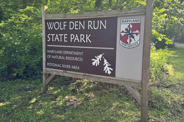
Parking Road
The Parking lot road is a green trail located within the Potomac River Riding Area of Wolf Den Run State Park. This is the main trail into the primary parking area for the Potomac River Riding Area. Potomac River is the southernmost of the three riding areas at Wolf Den Run. Potomac River has a goo...
Learn more about Parking Road
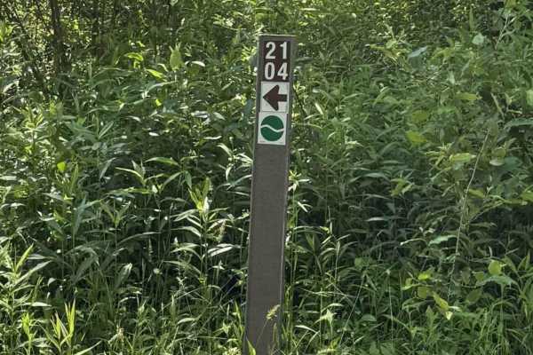
2104 Green
Trail 2104 is a green trail located within the Potomac River Riding Area of Wolf Den Run State Park. The Potomac River is the southernmost of the three riding areas at Wolf Den Run. Potomac River has a good mix of green and blue, and black trails. It also has a slag pile playground. There are also a...
Learn more about 2104 Green
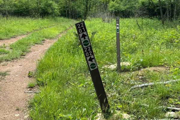
2202 Green
Trail 2202 is a green trail located within the Potomac River Riding Area of Wolf Den Run State Park. The Potomac River is the southernmost of the three riding areas at Wolf Den Run. Potomac River has a good mix of green and blue, and black trails. It also has a slag pile playground. There are also a...
Learn more about 2202 Green
Beginner UTV/side-by-side trails near Toms Brook, Virginia
Find UTV and side-by-side trails near you. These trails accommodate vehicles up to 60 inches wide, ideal for UTVs, side-by-sides, and wider off-road rigs.
Devils Hole Road
Devils Hole Road, or RT 691 Gravel Road, is an adventure weaving through the heart of the George Washington National Forest. Rocky in sections, with winding forest roads, leads to breathtaking mountain overlooks. Surrounded by towering hardwoods and remote wilderness, the trail delivers a perfect mi...
Learn more about Devils Hole Road
FSR #85-2 Hall Spring Road
This route will take you along the side of the mountain with beautiful views of Appalachia. This trail feels like an East Coast shelf road since it is mainly single track with only a few places to pass oncoming vehicles. This road follows the WV-VA border and is only accessible 10/01-01/15.
Learn more about FSR #85-2 Hall Spring Road
Parking Road
The Parking lot road is a green trail located within the Potomac River Riding Area of Wolf Den Run State Park. This is the main trail into the primary parking area for the Potomac River Riding Area. Potomac River is the southernmost of the three riding areas at Wolf Den Run. Potomac River has a goo...
Learn more about Parking Road
2104 Green
Trail 2104 is a green trail located within the Potomac River Riding Area of Wolf Den Run State Park. The Potomac River is the southernmost of the three riding areas at Wolf Den Run. Potomac River has a good mix of green and blue, and black trails. It also has a slag pile playground. There are also a...
Learn more about 2104 Green
The onX Offroad Difference
onX Offroad combines trail photos, descriptions, difficulty ratings, width restrictions, seasonality, and more in a user-friendly interface. Available on all devices, with offline access and full compatibility with CarPlay and Android Auto. Discover what you're missing today!
Open Trail Map