
Beginner Off-Road Trails
Near Greenback, Tennessee
Explore All Beginner Trails Near Greenback, Tennessee
Beginner Off-Road Trails Near Greenback, Tennessee
Discover the best beginner-friendly off-road trails near you. These easier, lower-rated trails are a great place to start — browse trail maps, check difficulty ratings, and find your next adventure.
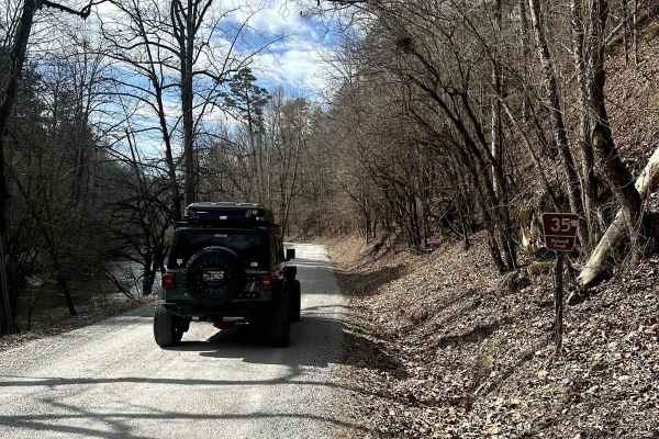
Citico Creek North
This route is located in the Cherokee National Forest, following the banks of Citico Creek. The road is primarily a two-lane gravel path that occasionally narrows to one lane. It is an easy drive, suitable for any 2-wheel drive vehicle. The main hazards to be aware of are flash flooding, which is si...
Learn more about Citico Creek North
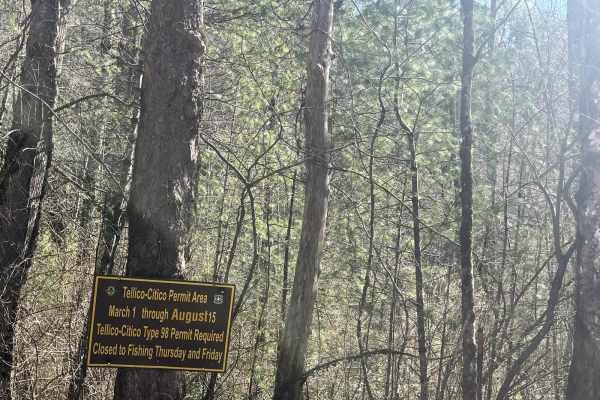
Citico Creek South
Citico CRreekNorth (FSR 35-1) is a well-traveled gravel/ rocky road. This trail will take you down to the beautiful Citico Creek. Citico Creek is well known for its fishing, However, if you want a scenic easy trail, it makes a peaceful afternoon drive. Cell service is hard to come by so make sure yo...
Learn more about Citico Creek South
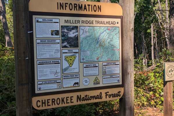
Bark Camp- Lost Cove- Miller's Ridge
This is a super easy two-track seasonal trail. This trail is only open from 10-1 to 12-18. Double-check the rules for this trail with Tellico Ranger District. It was open today with some off-shoots open as well. We didn't encounter any challenges really. The hunters run this trail both ways so be mi...
Learn more about Bark Camp- Lost Cove- Miller's Ridge
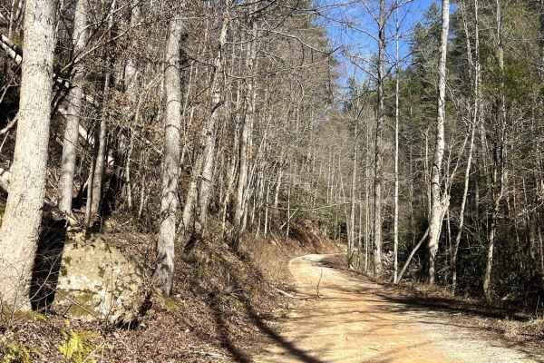
Double Camp
Double Camp Road (FSR 2659) is a rocky trail that winds up the mountain to the Farr Gap trailhead. Along the trail, you will find yourself traveling along the scenic Double CampCreekk. It's a great place to stop for lunch and enjoy the sounds of the rushing water. Further up the trail, you will sepa...
Learn more about Double Camp
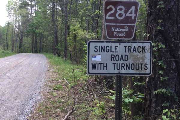
Rafter Road
Rafter Road is a well-maintained 2-vehicle-wide gravel road with several residences throughout. There are some beautiful views of the mountains on the west end, and a nice creek crossing about halfway on this section. You may encounter potholes or downed trees while traveling this road, but most veh...
Learn more about Rafter Road
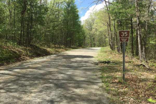
Citico Creek South
Citico Creek South (35) is a maintained gravel road that intersects with Indian Boundary Road from the east, Rafter Road in the middle, and turns into Turkey Creek Road from the west. There may be a few potholes, ruts, or downed trees along the way, but it can be traveled by any high clearance 2WD o...
Learn more about Citico Creek South
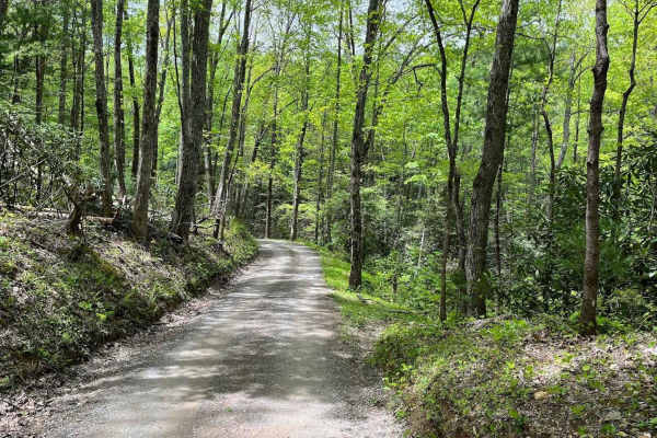
Parson Branch Road
Parson Branch is a full gravel, one-way, scenic route that leads through the Smoky Mountains. The road is maintained, however, you may find the occasional tree down after heavy storms. This is usually not a problem. There are also many shallow water crossings, all less than 1ft deep. 4WD is not need...
Learn more about Parson Branch Road
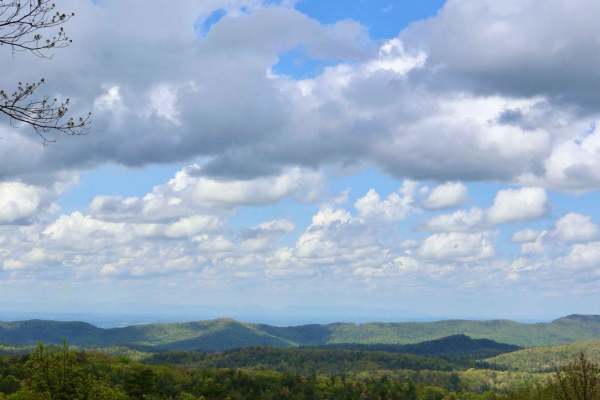
Rich Mountain Road
Rich Mountain Road is 6.6 miles and runs through the Smoky Mountain National Park and heads North out of the park. The trail is composed of loose gravel and has several twists and turns up and down the mountain. It is one way, but watch for State Park vehicles in addition to animals on the trail.
Learn more about Rich Mountain Road
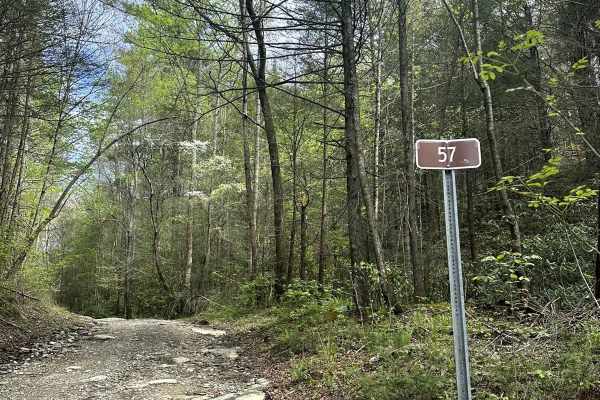
Cane Creek Road - FS 57
FS Road 57 is a gravel route suitable for high-clearance 2WD or 4WD vehicles. While there are some potholes and muddy spots along the way, they shouldn't pose significant issues for capable vehicles. The road can be accessed from the south via the Cherohala Skyway, connecting to Hemlock Road and the...
Learn more about Cane Creek Road - FS 57
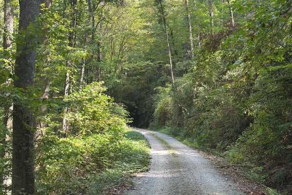
Slickrock Road
Slickrock Road is a gravel route that winds through the Nantahala National Forest. It is primarily one vehicle wide, though there are plenty of areas with room to pass. The road begins at Tapoco Road at an elevation of 1,277 feet and climbs to 3,062 feet over the course of seven miles. At the summit...
Learn more about Slickrock Road
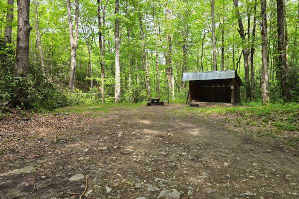
Deep Creek Road
Deep Creek Road - FS 445 is a freshly graded and well-maintained forest road that takes you right to one of the nicest campsites in the region alongside a small stream. The spot comes with a solid wood shed, making it super convenient for longer stays and keeping your firewood dry (it is often fully...
Learn more about Deep Creek Road
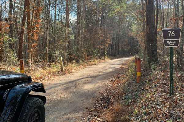
Old Furnace Road FSR 76
This road begins right across from Tellico Beach, which is a great place to eat if you're in the Tellico area. The road starts with an easy climb with great views of the surrounding mountains and valleys. There are several level pull-offs along the road where you can disperse camp. There's cell sign...
Learn more about Old Furnace Road FSR 76
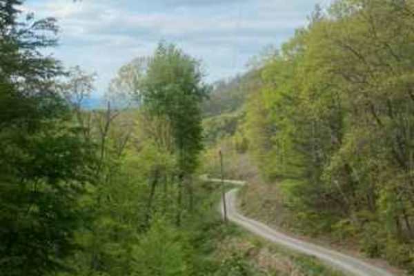
FR126 Waucheesi Bald
The trail to Waucheesi Bald is a gravel trail. The trail has been recently re-graveled. It is a two-way road so make sure you watch for oncoming traffic. The road will take you along Bald River and at the top of Waucheesi Bald is spectacular views, where we had lunch and spent the afternoon. For th...
Learn more about FR126 Waucheesi Bald

Mad Dog
This trail runs from North River Rd Shortcut - 216 to the Cherohala Skyway in the Cherokee National Forest. This trail is mainly dirt with some small rocks. It winds through clearings and forest. Beware that pinstriping is very likely in the spring-fall months. At around 2 miles in, you come across ...
Learn more about Mad Dog
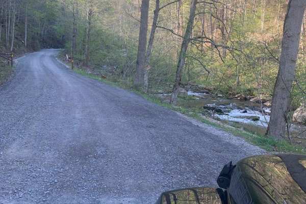
North River Shortcut - 216
This is a very easy and recently maintained gravel road. Safe for most 4WD and high-clearance 2WD vehicles. Lots of places to camp but you are required to camp in designated areas. There is no cell service (Verizon). There is a designated burn in the area so the smoke could be an issue. There is an ...
Learn more about North River Shortcut - 216
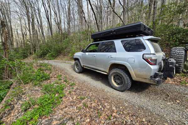
Swan Cabin - FS 807
This is a short spur to the Swan historical cabin which you can reserve for camping through the USFS. Trail is rated a 2/10 only for deep dips built for water control but is otherwise graded and gravel for easy access. This is a worthwhile side-trip to see an impressive two story cabin that has been...
Learn more about Swan Cabin - FS 807
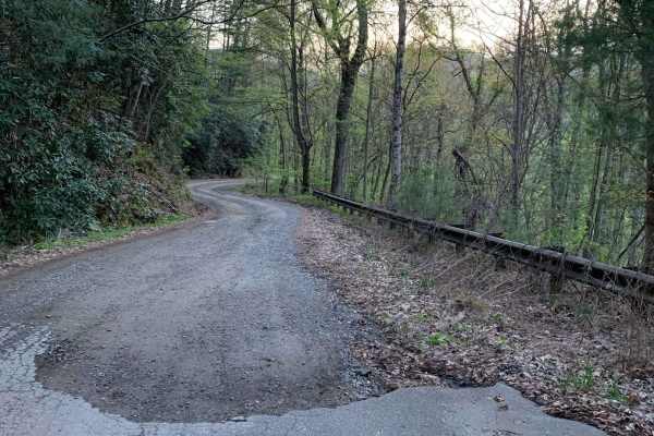
Upper Santeetlah - 81
This is a very easy and maintained gravel road. Safe for most 4WD and high-clearance 2WD vehicles. There are lots of places to camp but you are required to camp in designated areas...we saw some very large campers towards the end of the trail. The road runs next to Santeetlah Creek and there are lot...
Learn more about Upper Santeetlah - 81
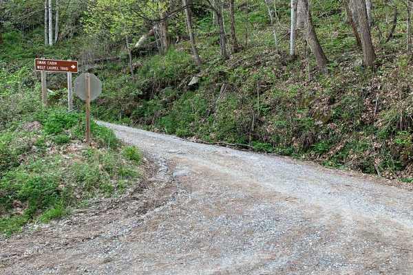
Wolf Laurel - 81F
This trail is not too bad but can be rutted in places and loose gravel on steep grades. The views from this trail are great, especially in the winter when the leaves are off the trees. There is a cabin along the trail called Swan Cabin that can be rented through the recreation.gov website. There are...
Learn more about Wolf Laurel - 81F
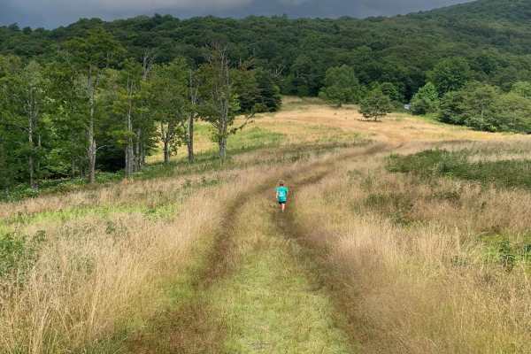
Wigg Meadow
Forest Service Road that starts along Tellico's North River. This is a beautiful small river home to some of the best fly fishing around. This road will take you up to a truly breathtaking view of the Tellico mountains and into the valleys below. You will be able to see Tellico Lake from up here on ...
Learn more about Wigg Meadow
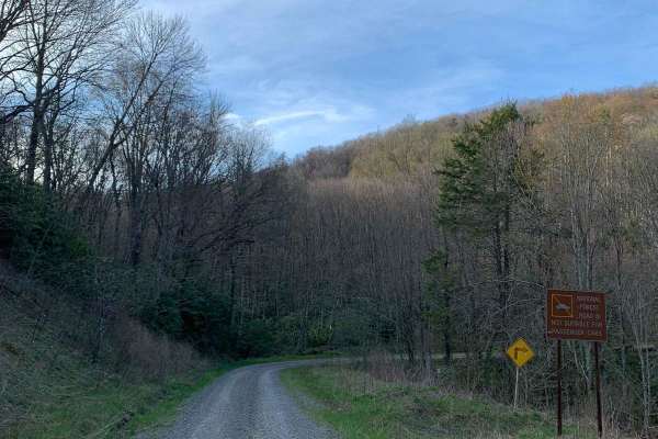
North River Rd to Upper Santeetlah - 81
This trek starts at North River which is a well-maintained gravel road and then transitions to the Upper Santeetlah(81) trail which is less maintained. The Upper Santeetlah is not too bad and can be navigated by 2WD vehicles but you would need to go slow...make note that it is narrow in places. Lots...
Learn more about North River Rd to Upper Santeetlah - 81
Beginner ATV trails near Greenback, Tennessee
Explore ATV-friendly trails near you. These trails are accessible for vehicles up to 50 inches wide, perfect for ATVs and smaller off-road machines.
Bark Camp- Lost Cove- Miller's Ridge
This is a super easy two-track seasonal trail. This trail is only open from 10-1 to 12-18. Double-check the rules for this trail with Tellico Ranger District. It was open today with some off-shoots open as well. We didn't encounter any challenges really. The hunters run this trail both ways so be mi...
Learn more about Bark Camp- Lost Cove- Miller's Ridge
Slickrock Road
Slickrock Road is a gravel route that winds through the Nantahala National Forest. It is primarily one vehicle wide, though there are plenty of areas with room to pass. The road begins at Tapoco Road at an elevation of 1,277 feet and climbs to 3,062 feet over the course of seven miles. At the summit...
Learn more about Slickrock Road
Old Furnace Road FSR 76
This road begins right across from Tellico Beach, which is a great place to eat if you're in the Tellico area. The road starts with an easy climb with great views of the surrounding mountains and valleys. There are several level pull-offs along the road where you can disperse camp. There's cell sign...
Learn more about Old Furnace Road FSR 76
Mad Dog
This trail runs from North River Rd Shortcut - 216 to the Cherohala Skyway in the Cherokee National Forest. This trail is mainly dirt with some small rocks. It winds through clearings and forest. Beware that pinstriping is very likely in the spring-fall months. At around 2 miles in, you come across ...
Learn more about Mad Dog
Beginner UTV/side-by-side trails near Greenback, Tennessee
Find UTV and side-by-side trails near you. These trails accommodate vehicles up to 60 inches wide, ideal for UTVs, side-by-sides, and wider off-road rigs.
Bark Camp- Lost Cove- Miller's Ridge
This is a super easy two-track seasonal trail. This trail is only open from 10-1 to 12-18. Double-check the rules for this trail with Tellico Ranger District. It was open today with some off-shoots open as well. We didn't encounter any challenges really. The hunters run this trail both ways so be mi...
Learn more about Bark Camp- Lost Cove- Miller's Ridge
Parson Branch Road
Parson Branch is a full gravel, one-way, scenic route that leads through the Smoky Mountains. The road is maintained, however, you may find the occasional tree down after heavy storms. This is usually not a problem. There are also many shallow water crossings, all less than 1ft deep. 4WD is not need...
Learn more about Parson Branch Road
Slickrock Road
Slickrock Road is a gravel route that winds through the Nantahala National Forest. It is primarily one vehicle wide, though there are plenty of areas with room to pass. The road begins at Tapoco Road at an elevation of 1,277 feet and climbs to 3,062 feet over the course of seven miles. At the summit...
Learn more about Slickrock Road
Old Furnace Road FSR 76
This road begins right across from Tellico Beach, which is a great place to eat if you're in the Tellico area. The road starts with an easy climb with great views of the surrounding mountains and valleys. There are several level pull-offs along the road where you can disperse camp. There's cell sign...
Learn more about Old Furnace Road FSR 76
The onX Offroad Difference
onX Offroad combines trail photos, descriptions, difficulty ratings, width restrictions, seasonality, and more in a user-friendly interface. Available on all devices, with offline access and full compatibility with CarPlay and Android Auto. Discover what you're missing today!
Open Trail Map