
Beginner Off-Road Trails
Near Barbourville, Kentucky
Explore All Beginner Trails Near Barbourville, Kentucky
Beginner Off-Road Trails Near Barbourville, Kentucky
Discover the best beginner-friendly off-road trails near you. These easier, lower-rated trails are a great place to start — browse trail maps, check difficulty ratings, and find your next adventure.
High Ridge Towers
This trail intersects with 16 Creeks trail and runs out a long stretch of high ridges with some excellent views of the surrounding area. The east side of the trail goes to several cell/radio towers that allow you to look over the town of Middlesboro and even see the tunnels at Cumberland Gap into Te...
Learn more about High Ridge Towers

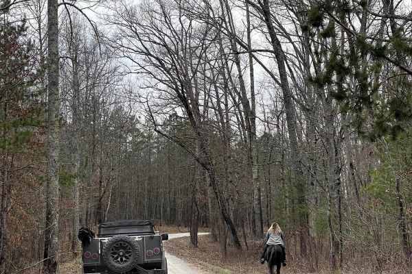
Mary's Wild Horse Trail
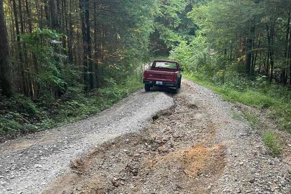
This is a gravel/dirt road uphill to a large open field with roads. The property includes open range horses and cattle, and there are lots of side trails to adventure onto. The trail can be reached off Highway 221 in Pineville, Kentucky. There's a railroad crossing as well as old gas wells on the pr...
Learn more about Mary's Wild Horse Trail
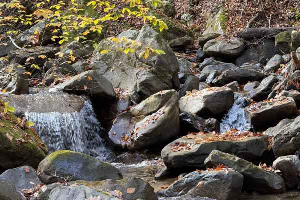
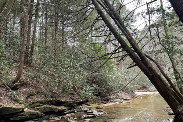
Dog Slaughter (FSR 195)
One of the best waterfall hikes in Kentucky lies along this well-maintained gravel forest road. Dog Slaughter Tail connects to Cumberland Falls Trail, with a great view coming along the bottom of the falls towards the State Park. There is a very heavy vehicle presence all along this road for hiking...
Learn more about Dog Slaughter (FSR 195)
Curd Garden (FSR 193)
This is a scenic and well-maintained Forest Service road that is also a part of the Kentucky Adventure Trail Main 2 Route. This road leads south of the Laurel Lake area and into some of the great waterfall hikes around the Cumberland Falls area. It's an absolutely gorgeous area any time of the year.
Learn more about Curd Garden (FSR 193)
DBNF 4005
4005 is a mostly well-maintained Forest Service road, with large gravel for around three quarters of the road. Past that is a less-maintained but in good condition dirt trail. Access to 4005A is at the end of this trail. It would appear that some small cabins are being built towards the end of the r...
Learn more about DBNF 4005
Dog Branch to Rooks Road
This road starts as a gravel road and leads to Rooks Road, which is slightly tighter. Part of the Scenic Kentucky Adventure Trail Main Section 2, this road has a beautiful waterfall to see, a pair of natural arches, and a shallow creek crossing. This portion of the KAT really offers a lot of beautif...
Learn more about Dog Branch to Rooks Road
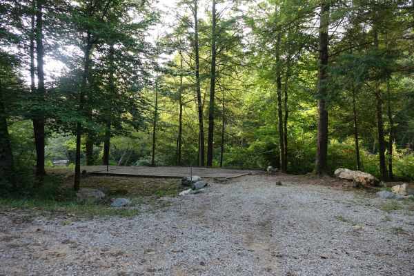
Wolf Knob
Wolf Knob is an 8.2 mile out and back trail that ends at a closed forest service gate with a grassy road extending a ways beyond it. There is one nice campsite close to the eastern terminus in the shadow of a large rock overhang. This site has room for several trucks and/or tents. At this campsite, ...
Learn more about Wolf Knob
Jellico Creek Road
Jellico Creek Road, aka Rock Creek Road, connects to Angel Mountain Road and Little Rock Road to the west and then transitions to pavement to the east. Along the 2.75 mile route, you'll find several creekside campsites. During holiday weekends they can be very popular so be prepared for the possibil...
Learn more about Jellico Creek Road
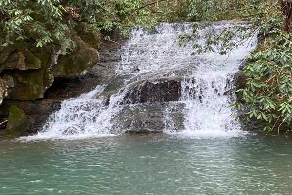
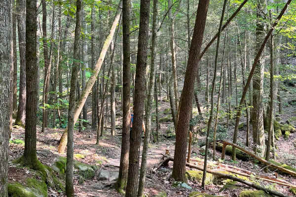
Sandlick Trail
The Sandlick Trail is an easy trail ride that navigates through thick Tennessee mountain laurel, crosses several small streams along the way, and has a beautiful waterfall called No Business. This trail is one of the biggest feeder trails in the Tackett Creek area, with several trails branching off ...
Learn more about Sandlick Trail
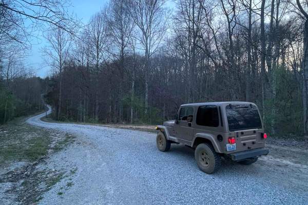
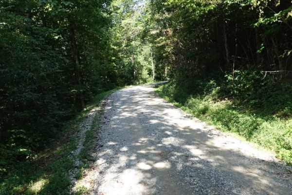
Stone Gap Road
Stone Gap Road is a graveled county road that runs through the Daniel Boone National Forest. There isn't anything on this route as far as obstacles. You will find shallow ruts and mud holes less than six inches deep. It follows along a dried-up creek bed that is fed when it rains.
Learn more about Stone Gap Road
Angel Mountain
Angel Mountain Road is a short out and back that intersects with Jellico Creek Road and Little Rock Road. Along the route, you'll find several small rock overhangs and outcroppings, locally known as "rock houses". At the top of the road, a short steep embankment leads to a small dirt road that conti...
Learn more about Angel Mountain
Little Rock Road
Little Rock Road connects Stephens Knob Road with Jellico Creek and Angel Mountain. The northern portion is mostly gravel and better maintained the southern portion where you'll find a few water crossings and rocky sections. Along this road, there are a few waterfalls accessible by either walking al...
Learn more about Little Rock Road
Ryans Mountain Road
Ryans Mountain Road is a well-maintained gravel route that's two vehicles wide for the majority of its nearly six-mile length. It climbs from Kentucky State Highway 1470 before dropping back down from the ridgeline in the last mile or so. Unfortunately, there are only a few small pull-offs along the...
Learn more about Ryans Mountain Road
Bear Creek Falls (5138)
Access to a beautiful waterfall into the Rockcastle River. Characteristics of an old Forest Service Road. Large gravel, dirt, and shallow water crossings. Some washouts around one foot deep. Beautiful drive through a less-trafficked area of Daniel Boone National Forest. There is a possibility of dow...
Learn more about Bear Creek Falls (5138)
Wagoners Branch Road
This is a semi-maintained county road that takes you along a nice creek ride. In some areas, you may encounter natural and loose terrain. There is plenty of space to pass along this route as well. There are a couple of washouts that may require some extra caution when crossing. Very pretty ride
Learn more about Wagoners Branch Road
Rockcastle Exploring River Bypass
Rockcastle Exploring River Bypass is an easy, scenic gravel route ideal for beginners, families, and history buffs looking to explore the beautiful woodlands of Laurel County. Winding through the dense canopy of Kentucky’s mountainous terrain, this trail offers a relaxed driving experience accessibl...
Learn more about Rockcastle Exploring River Bypass
Cromer Ridge - 909
Cromer Ridge Road or Rockcastle River Forestry Road is a gravel, rock, and dirt trail road that is somewhat maintained by the forest service. This road runs along some ridge lines with good views as well as goes down into some low hollers as well, ending at the Rockcastle River.
Learn more about Cromer Ridge - 909
Wood Creek Lake - FS 4094
Wood Creek Lake - FS 4094 trail is off of Cromer Ridge Road or Rockcastle River Forestry Road is a gravel, rock, and dirt trail road that is somewhat maintained by the forest service. This road runs along some ridge lines with good views as it goes down into some low hollers as well, ending at Wood ...
Learn more about Wood Creek Lake - FS 4094
Newfound Road
Newfound Road is a nine-mile country gravel road that runs along the south fork of the Kentucky River. Most of the trail, you can find room for passing; however, there are some stretches that are very narrow, and passing is impossible. You won't find much more than shallow mud puddles along this tra...
Learn more about Newfound Road
Stephens Knob
Stephens Knob is relatively unassuming for the majority of its 7.7-mile length. It's a very well-maintained gravel road. During the winter, nice views are available off of the north side. There's a split at the end of the gravel, and both options lead back to a small grassy campsite. Cell service is...
Learn more about Stephens Knob
Beginner ATV trails near Barbourville, Kentucky
Explore ATV-friendly trails near you. These trails are accessible for vehicles up to 50 inches wide, perfect for ATVs and smaller off-road machines.
High Ridge Towers
This trail intersects with 16 Creeks trail and runs out a long stretch of high ridges with some excellent views of the surrounding area. The east side of the trail goes to several cell/radio towers that allow you to look over the town of Middlesboro and even see the tunnels at Cumberland Gap into Te...
Learn more about High Ridge Towers
Mary's Wild Horse Trail
This is a gravel/dirt road uphill to a large open field with roads. The property includes open range horses and cattle, and there are lots of side trails to adventure onto. The trail can be reached off Highway 221 in Pineville, Kentucky. There's a railroad crossing as well as old gas wells on the pr...
Learn more about Mary's Wild Horse Trail
Sandlick Trail
The Sandlick Trail is an easy trail ride that navigates through thick Tennessee mountain laurel, crosses several small streams along the way, and has a beautiful waterfall called No Business. This trail is one of the biggest feeder trails in the Tackett Creek area, with several trails branching off ...
Learn more about Sandlick Trail
Stone Gap Road
Stone Gap Road is a graveled county road that runs through the Daniel Boone National Forest. There isn't anything on this route as far as obstacles. You will find shallow ruts and mud holes less than six inches deep. It follows along a dried-up creek bed that is fed when it rains.
Learn more about Stone Gap Road
Beginner UTV/side-by-side trails near Barbourville, Kentucky
Find UTV and side-by-side trails near you. These trails accommodate vehicles up to 60 inches wide, ideal for UTVs, side-by-sides, and wider off-road rigs.
High Ridge Towers
This trail intersects with 16 Creeks trail and runs out a long stretch of high ridges with some excellent views of the surrounding area. The east side of the trail goes to several cell/radio towers that allow you to look over the town of Middlesboro and even see the tunnels at Cumberland Gap into Te...
Learn more about High Ridge Towers
Mary's Wild Horse Trail
This is a gravel/dirt road uphill to a large open field with roads. The property includes open range horses and cattle, and there are lots of side trails to adventure onto. The trail can be reached off Highway 221 in Pineville, Kentucky. There's a railroad crossing as well as old gas wells on the pr...
Learn more about Mary's Wild Horse Trail
Dog Branch to Rooks Road
This road starts as a gravel road and leads to Rooks Road, which is slightly tighter. Part of the Scenic Kentucky Adventure Trail Main Section 2, this road has a beautiful waterfall to see, a pair of natural arches, and a shallow creek crossing. This portion of the KAT really offers a lot of beautif...
Learn more about Dog Branch to Rooks Road
Sandlick Trail
The Sandlick Trail is an easy trail ride that navigates through thick Tennessee mountain laurel, crosses several small streams along the way, and has a beautiful waterfall called No Business. This trail is one of the biggest feeder trails in the Tackett Creek area, with several trails branching off ...
Learn more about Sandlick Trail
The onX Offroad Difference
onX Offroad combines trail photos, descriptions, difficulty ratings, width restrictions, seasonality, and more in a user-friendly interface. Available on all devices, with offline access and full compatibility with CarPlay and Android Auto. Discover what you're missing today!
Open Trail Map