
Beginner Off-Road Trails
Near Argonne, Wisconsin
Explore All Beginner Trails Near Argonne, Wisconsin
Beginner Off-Road Trails Near Argonne, Wisconsin
Discover the best beginner-friendly off-road trails near you. These easier, lower-rated trails are a great place to start — browse trail maps, check difficulty ratings, and find your next adventure.
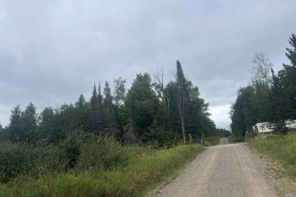
FS 2387
FS 2387 is a large, mostly two-lane gravel forest road that runs from its intersection with Dick Samz Road to its northern intersection with FS 2166. This forest road is mostly straight with only a couple of small curves; however, there is a good mix of gentle rolling elevation changes that add a lo...
Learn more about FS 2387
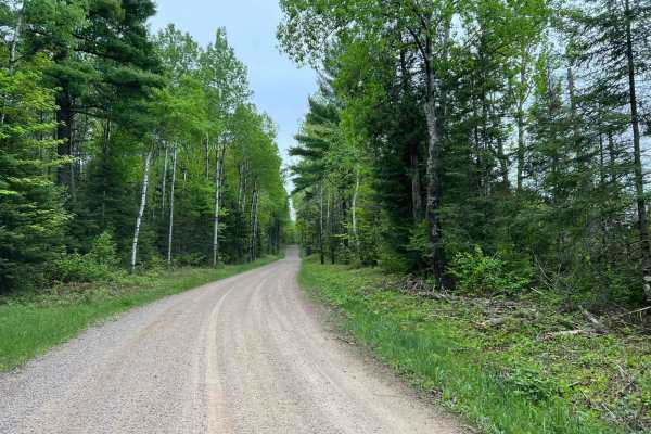
Wolf River Road Trail
This trail is a great multi-purpose trail accessible by both ATV/ SxS and full-size vehicles. This trail is a great access point to the north woods trails, as well as trails and forest roads contained within the Nicolet National Forest. The trail is a good mix of gradual rolling hills, as well as wi...
Learn more about Wolf River Road Trail
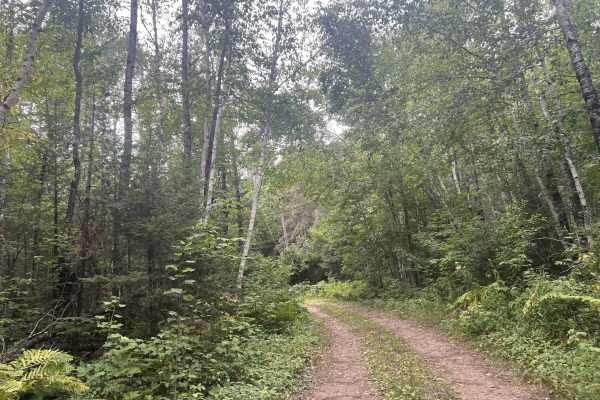
Big Ridge Road - FS 2388
Forest Road 2388 is a two-track, there-and-back style trail perfect for anyone looking to do some remote dispersed camping or for someone looking for a mildly rugged trail to ride. This trail starts and ends at its intersection with FS 2387. The trail navigates across a large ridge, there are no sce...
Learn more about Big Ridge Road - FS 2388
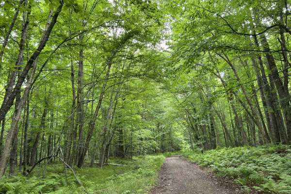
FS 2379
FS 2379 begins at its intersection with FS 2378 and navigates north to its intersection with Peshtigo River Road. This is a narrow, low-overhead clearance two-track trail. The trail's surface is mostly dirt with some small to medium-sized rocks protruding through the surface. There are several trees...
Learn more about FS 2379
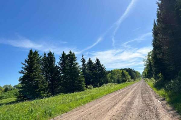
Double Bend FR 2166
This route runs from Highway 55 just north of the town of Argonne to the town of Newald, where the Nicolet National Trail intersects it (ATV/SxS use only). Entering this trail from Highway 55, this trail starts as straight wide-open gravel lanes. There are good elevation changes and sight lines are ...
Learn more about Double Bend FR 2166
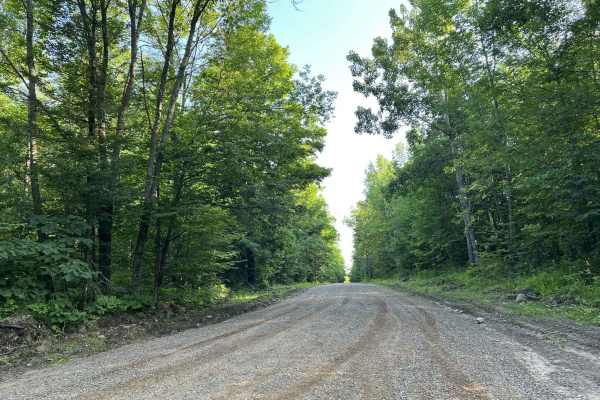
Johnson Road
Johnson Road begins at its intersection with Lundt Road and travels north to its intersection with County Road P. This is a moderately maintained county gravel forest road. The hard-pack gravel does a good job of mitigating washboard, as well as mud holes on the trail. The trail is very tame and has...
Learn more about Johnson Road
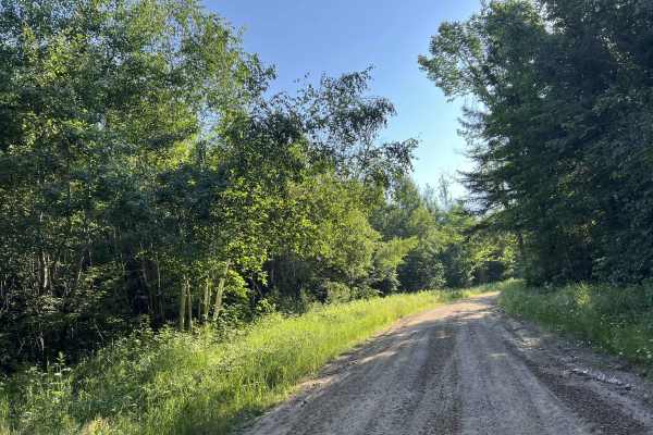
Northwoods Drive
Northwoods Drive navigates from its intersection with Johnson Road to its intersection with Otter Creek Road. This county forest road has a dirt base that is mostly hard-packed, but a few areas on the trail tend to break up and become loose. The trail is one to two vehicles wide for most of its leng...
Learn more about Northwoods Drive
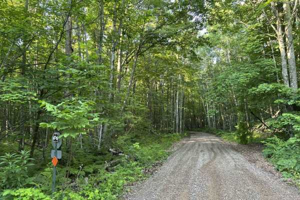
Fireside Market and Station Access Trail
This is the only trail available for ATV and SxS traffic to access the Fireside Market and Gas Station. This trail navigates from Bug Lake Road to Fireside Market. The trail is well-maintained, as it has a firm gravel base. The trail is not wide enough for two SxS's to pass each other at a high rate...
Learn more about Fireside Market and Station Access Trail
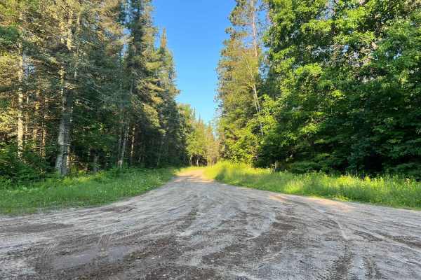
Spring Pond Road
Spring Pond Road Navigates from its intersection with Otter Creek Road to its intersection with Johnson Road. This is a moderately maintained dirt county forest road. The trail is just over one vehicle wide, but does have grassy trail sides which allow for simpler passing of oncoming vehicles. The t...
Learn more about Spring Pond Road
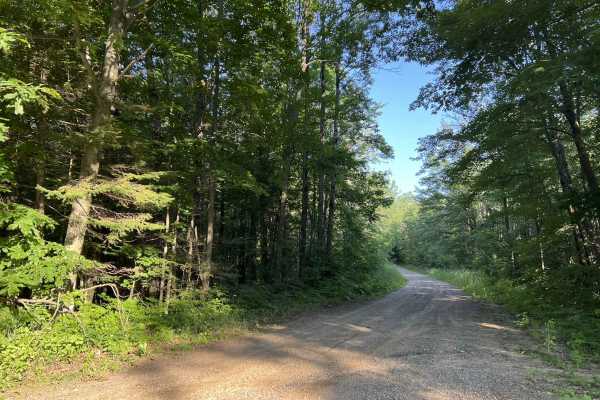
Bug Lake Road
Bug Lake Road is a multi-use trail open to ATVs, SxSs, and vehicles. This dirt road travels from its intersection with Lund Road, East to where the paved portion of Bug Lake Road begins. This trail is most popular with ATVs and SxSs as the access trail to the Fireside Market and gas station is locat...
Learn more about Bug Lake Road
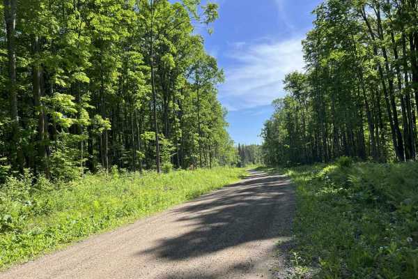
FR 2183 Eastern Section
This trail is the eastern portion of Forest Road 2183. This trail is wide with mostly long flowing corners. Elevation changes are subtle, noticeable, and enjoyable with a few larger elevation changes mixed in as well. This trail remains wide with exceptional sight lines throughout. The trail surface...
Learn more about FR 2183 Eastern Section
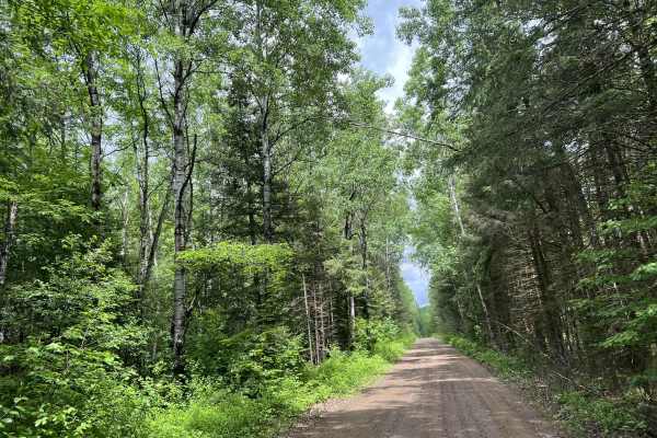
FS 2378
FS 2378 begins at its intersection with Otter Creek Road and navigates north to its end point at its intersection with County Road G. This trail is a moderately maintained forest road, with a mix of gravel and dirt for the base. The trail changes width several times, but there are a few sections of ...
Learn more about FS 2378
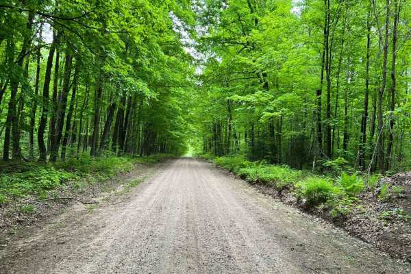
Forest Road 2183 Western Section
This route will navigate to or from the southern portion of the Seven Hour Plane Crash Trail. It's open to ATVs, SxSs, and all licensed road vehicles. This trail will also navigate the southern edge of the nonmotorized Argonne Experimental Forest. This trail is great for anyone looking for a peacefu...
Learn more about Forest Road 2183 Western Section
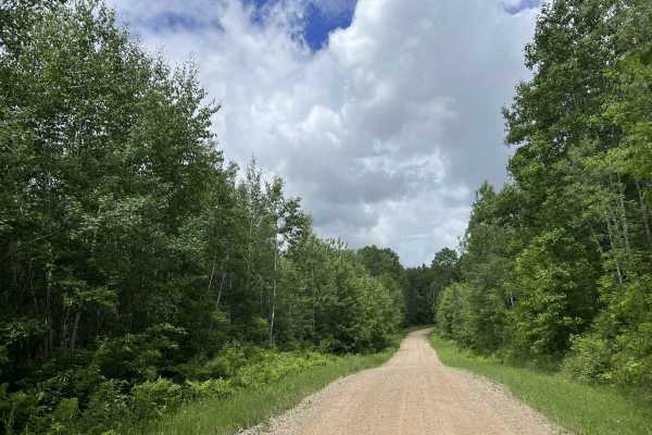
Otter Creek Road
Otter Creek Road/ Peshtigo River Road begins at its intersection with Highway 8 and runs south to north to its intersection with County Road P. This is a moderately maintained dirt/ gravel road which varies in width but is on average between 1 and 2 vehicles wide. Most areas of the trail will requir...
Learn more about Otter Creek Road
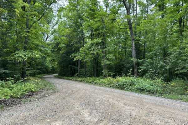
Experimental Road - FS 2184
Experimental Road - FS 2184 is a gentle, rolling gravel forest road that navigates from its southern intersection with Highway 32 to its northern intersection with FS 2183. This trail is just under 2 vehicles wide for its entire length and has similar terrain and features to other trails in the area...
Learn more about Experimental Road - FS 2184
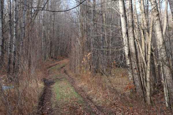
FR 2408B
This trail is two miles out and two miles back with mixed gravel, dirt, and mud. The road was recently graded up to the 1.5-mile marker, after which it narrowed down to a very tight two- track. There are a couple of very gradual hills on this route but is overall a flat trail.
Learn more about FR 2408B
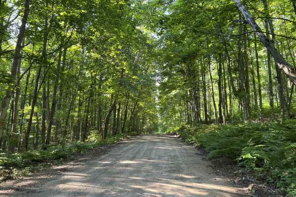
Brady Lake Road
Brady Lake Road navigates from its intersection with Fire Tower Lane to its intersection with North Shore Drive. This is a mild, gravel county forest road that navigates along the west side of Lake Lucerne. The trail surface is hard in most areas, and holds up well to traffic. Sections of the trail ...
Learn more about Brady Lake Road
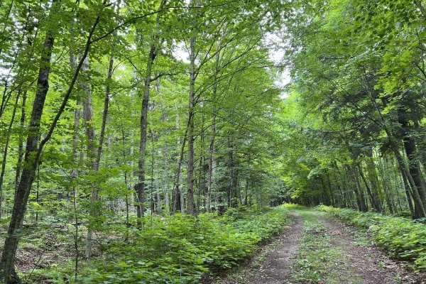
FS 3924
Forest Road 3924 runs from its intersection with FS 3903 to its intersection with FS 3905. This is one of the few two-track dirt trails in Forest County that is open to ATV and SxS traffic, rather than just 4x4 and full-size traffic like many others. While this trail is not super technical, it does ...
Learn more about FS 3924
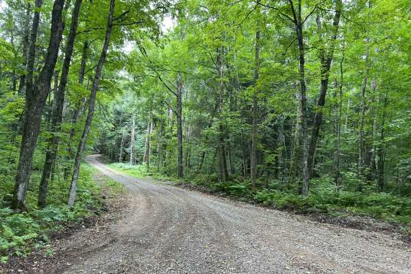
Loop Rd - FS 3903
Loop Road - FS 3903 runs from its intersection with Experimental Road - FS 2184 to its intersection with the southern section of 2184. This is a fun trail that navigates through a section of the Argonne Experimental Forest. The views offered by the quick, rolling elevation changes as well as long sw...
Learn more about Loop Rd - FS 3903
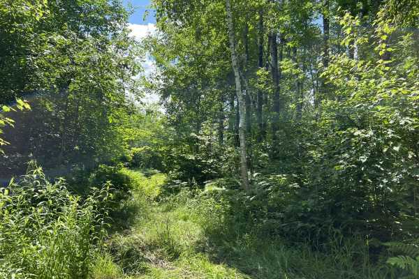
Forest County ATV/ SxS 8 Mile Loop Trail 1 Bypass
The Trail 1 bypass connects the north and south sides of Trail 1. This trail is especially useful for the individual looking to further explore this trail network, or for someone who is looking to avoid the mud holes located at the west end of Trail 1. This is a relatively new, untraveled trail, so ...
Learn more about Forest County ATV/ SxS 8 Mile Loop Trail 1 Bypass
Beginner ATV trails near Argonne, Wisconsin
Explore ATV-friendly trails near you. These trails are accessible for vehicles up to 50 inches wide, perfect for ATVs and smaller off-road machines.
FS 2387
FS 2387 is a large, mostly two-lane gravel forest road that runs from its intersection with Dick Samz Road to its northern intersection with FS 2166. This forest road is mostly straight with only a couple of small curves; however, there is a good mix of gentle rolling elevation changes that add a lo...
Learn more about FS 2387
Wolf River Road Trail
This trail is a great multi-purpose trail accessible by both ATV/ SxS and full-size vehicles. This trail is a great access point to the north woods trails, as well as trails and forest roads contained within the Nicolet National Forest. The trail is a good mix of gradual rolling hills, as well as wi...
Learn more about Wolf River Road Trail
Double Bend FR 2166
This route runs from Highway 55 just north of the town of Argonne to the town of Newald, where the Nicolet National Trail intersects it (ATV/SxS use only). Entering this trail from Highway 55, this trail starts as straight wide-open gravel lanes. There are good elevation changes and sight lines are ...
Learn more about Double Bend FR 2166
Johnson Road
Johnson Road begins at its intersection with Lundt Road and travels north to its intersection with County Road P. This is a moderately maintained county gravel forest road. The hard-pack gravel does a good job of mitigating washboard, as well as mud holes on the trail. The trail is very tame and has...
Learn more about Johnson Road
Beginner UTV/side-by-side trails near Argonne, Wisconsin
Find UTV and side-by-side trails near you. These trails accommodate vehicles up to 60 inches wide, ideal for UTVs, side-by-sides, and wider off-road rigs.
FS 2387
FS 2387 is a large, mostly two-lane gravel forest road that runs from its intersection with Dick Samz Road to its northern intersection with FS 2166. This forest road is mostly straight with only a couple of small curves; however, there is a good mix of gentle rolling elevation changes that add a lo...
Learn more about FS 2387
Wolf River Road Trail
This trail is a great multi-purpose trail accessible by both ATV/ SxS and full-size vehicles. This trail is a great access point to the north woods trails, as well as trails and forest roads contained within the Nicolet National Forest. The trail is a good mix of gradual rolling hills, as well as wi...
Learn more about Wolf River Road Trail
Double Bend FR 2166
This route runs from Highway 55 just north of the town of Argonne to the town of Newald, where the Nicolet National Trail intersects it (ATV/SxS use only). Entering this trail from Highway 55, this trail starts as straight wide-open gravel lanes. There are good elevation changes and sight lines are ...
Learn more about Double Bend FR 2166
Johnson Road
Johnson Road begins at its intersection with Lundt Road and travels north to its intersection with County Road P. This is a moderately maintained county gravel forest road. The hard-pack gravel does a good job of mitigating washboard, as well as mud holes on the trail. The trail is very tame and has...
Learn more about Johnson Road
The onX Offroad Difference
onX Offroad combines trail photos, descriptions, difficulty ratings, width restrictions, seasonality, and more in a user-friendly interface. Available on all devices, with offline access and full compatibility with CarPlay and Android Auto. Discover what you're missing today!
Open Trail Map