
Beginner Off-Road Trails
Near Akron, Michigan
Explore All Beginner Trails Near Akron, Michigan
Beginner Off-Road Trails Near Akron, Michigan
Discover the best beginner-friendly off-road trails near you. These easier, lower-rated trails are a great place to start — browse trail maps, check difficulty ratings, and find your next adventure.
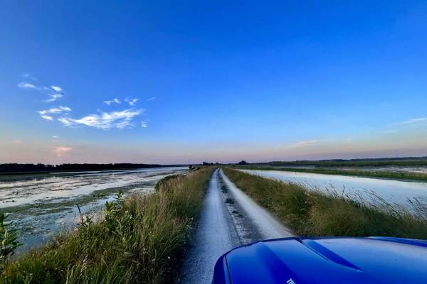
Wildlife Drive
Wildlife Drive, located in Schiawasse National Wildlife Refuge, is a scenic, flat dirt road designed for a leisurely drive in a clockwise direction. Take your time to enjoy the stunning views, hiking trails, and beautiful sunrises and sunsets. You can spot plenty of wildlife here, including birds, d...
Learn more about Wildlife Drive
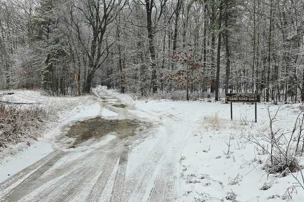
Old Sand Road
As the name implies, this is a sandy trail located primarily on public ground. This is the closest thing to a "trail" in Huron County. There are several whooped-out areas that require moderate ground clearance to pass without bottoming out. Most of the trail is dry, unless a recent rain event has oc...
Learn more about Old Sand Road
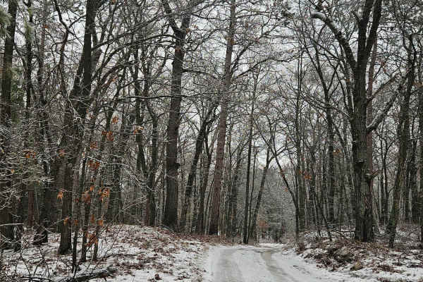
Rush Lake Access
This is a primarily sand two-track that leads back to the public access site of Rush Lake. The trail itself is passable with a vehicle having moderate ground clearance. There are some small holes along the way, but no major water holes on the trail itself. The area is all public land with rustic cam...
Learn more about Rush Lake Access
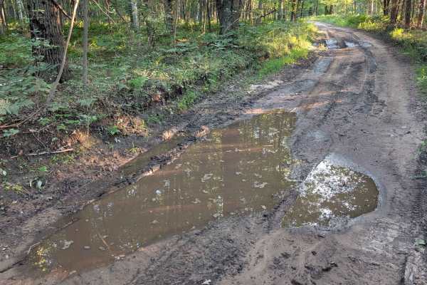
Stelmach Trail
This Trail is an out-and-back trail that no longer connects to Steimech Road at the south. Even though this Trail isn't going anywhere specific, it will still make for a good time. The dead end at the south end is in a wooded area that is a wetland. With that said, along the way you will find mult...
Learn more about Stelmach Trail
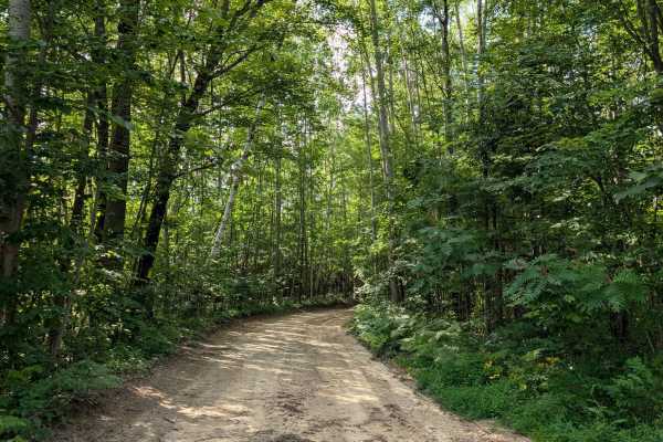
Walker Road
This seasonal road runs between Main Street Road and Maple Ridge Road and makes its way through a beautiful mature forest. The terrain varies from gravel to hard pack, sand, and dirt with shallow mud holes. This route gets groomed & makes for easy/fast travel. There are little to no elevation ch...
Learn more about Walker Road
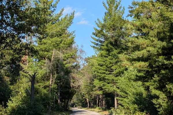
Michigan Road / Jose Road
Near Omer, this track is a seasonal road that has different names at each end. Jose to the West and Michigan to the east. It all leads you to an area called the flats towards the north. This area dead ends on the Rifle River. This is a less-known area to use the river as it's a couple-mile drive ba...
Learn more about Michigan Road / Jose Road
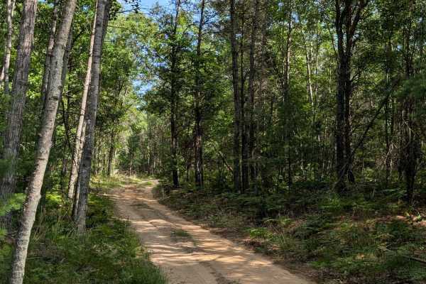
Plains Creek Trail
This track is a very enjoyable one that takes you between Knight Road and Main Street. If you're looking for an engaging ride through Michigan nature, this trail is for you. The trail's vegetation is very well maintained & is easily passable with any full-sized vehicle. The terrain is packed sand...
Learn more about Plains Creek Trail
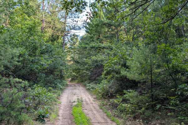
Walker Spur Trail
This track takes you off the seasonal Rd into the forest & back again. The trail width remains at least 1 full-size vehicle wide the entire way. Drivers will find a few slight elevation changes as they travel. They will also see many areas that could be used for small dispersed campsites. As well a...
Learn more about Walker Spur Trail

Sterling Truck Trail
Sterling Truck Trail is a seasonal road that is a great connector trail for many of the trails in the Gladwin area. The terrain is sandy and flat, and it is easily wide enough for two vehicles. It is very easy in difficulty, but it is unmaintained during rain or snow. During dry summer months, this ...
Learn more about Sterling Truck Trail
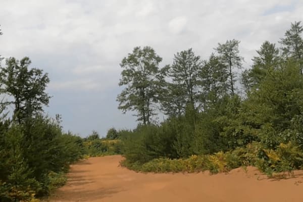
Gladwin Forest Baja
This is a fun, sandy trail with multiple whoops providing the opportunity to test out your high-speed suspension. The trail is two vehicles wide when entering from Grim Road, but narrows to just over one vehicle wide as the trail winds through a clear-cut forest. There are opportunities for other sa...
Learn more about Gladwin Forest Baja
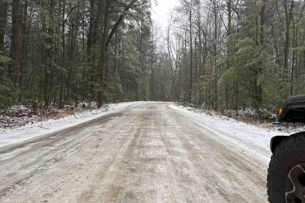
Center Fireline Trail
Center Fireline Trail is a part of the Gladwin Scramble, a mixed-use riding area in the Gladwin Forest Management Unit. This trail is a two-lane dirt trail with mixed access and cross-traffic. You can expect a graded dirt road with sand and mud. This trail will lead you into the historical town of H...
Learn more about Center Fireline Trail
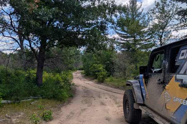
Cranberry Trail
This in-and-out sandy track starts and finishes on Jack Pine Road and is sure to show you a fun time. If you enjoy high-banked corners that invite you to drive fast, this spur is for you. You will find the width to be snug for a full-sized vehicle as it is only 1 vehicle wide most of the way. The...
Learn more about Cranberry Trail
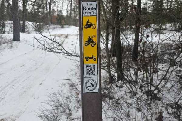
Gladwin ORV Route
Michigan DNR ORV Route is open to full-size, 50-inch, and motorcycles with ORV permits and Trail permit stickers. This is a small ORV Route but is surrounded by many more miles of 50-inch trails. The trail itself is fairly flat, with rolling whoops through a wooded area.
Learn more about Gladwin ORV Route
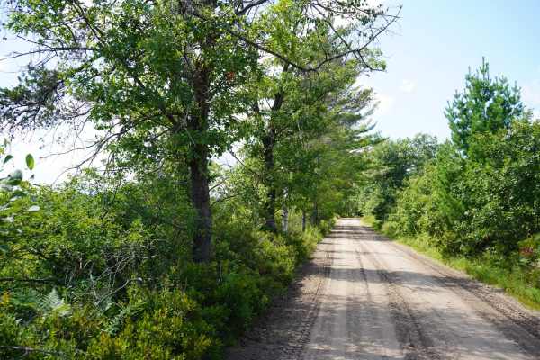
East Fireline Trail
A simple sandy trail in the Gladwin ORV area with the most beautiful wetland views. This trail has thick sand, many turns and curves, and is relatively flat, but the various wetland views along it will catch your attention. Take your time along this trail to enjoy the views and the nature. It is unm...
Learn more about East Fireline Trail
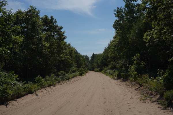
Mosquito Alley Truck Trail
Mosquito Alley Truck Trail is a flat and sandy trail that parallels the Molasses River. It is a wide trail that easily accommodates both directions of traffic, and it is an easy, non-technical trail during the dry summer season; however, this trail is known to become more difficult during the spring...
Learn more about Mosquito Alley Truck Trail
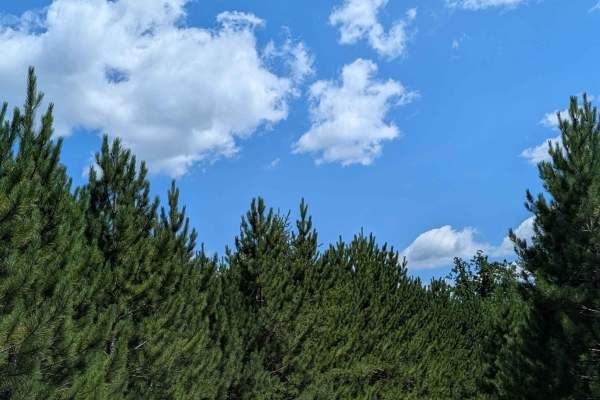
Jackpine Trail
This route is part of a small riding area south of Jack Pine Rd. It takes you through a new growth forest that will keep you on your toes as it twists tightly through certain sections of the woods. The trail width ranges from a tight 1 full-size vehicle width to 2 vehicles wide. There is not much...
Learn more about Jackpine Trail
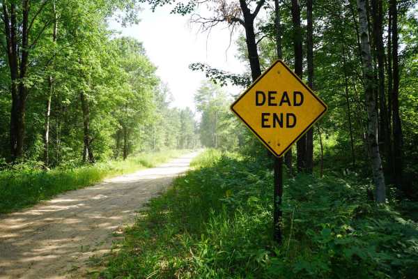
North Wildwood Road
This stretch of Wildwood Road is a narrow, sandy, and unmaintained road. It is easy in difficulty, and its only obstacle during the summer season is some whoops. The surrounding scenery varies between dense woods and wetlands. It crosses Mosquito Alley Truck Trail and dead ends at the Molasses River...
Learn more about North Wildwood Road

North Sterling Truck Trail
This connector trail runs north and south between Lame Duck Truck Trail and Sterling Truck Trail. It can drastically vary in difficulty depending on trail conditions. On a dry summer day after the groomer has passed through, it is very easy. But in the spring or after heavy rain, this trail can get ...
Learn more about North Sterling Truck Trail
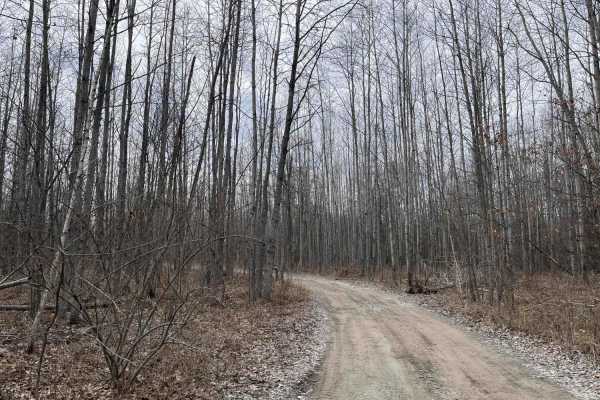
West Isabella Bypass
A scenic, easy-going trail through the woods in the Gladwin Forest area west of Midland. One of the few dry trails in the area, especially in the spring. The trail winds through woods and wetland. There has been some logging on the trail. The trail is mostly one vehicle wide, though there are severa...
Learn more about West Isabella Bypass

Lame Duck Truck Trail
Lame Duck Truck Trail is a seasonal road that borders the north edge of the Lame Duck wetland area. The terrain is sandy and flat. It is very easy in difficulty, but it is unmaintained during rain and snow, which could make it more challenging at times. During the dry summer months, this trail is ve...
Learn more about Lame Duck Truck Trail
Beginner ATV trails near Akron, Michigan
Explore ATV-friendly trails near you. These trails are accessible for vehicles up to 50 inches wide, perfect for ATVs and smaller off-road machines.
Old Sand Road
As the name implies, this is a sandy trail located primarily on public ground. This is the closest thing to a "trail" in Huron County. There are several whooped-out areas that require moderate ground clearance to pass without bottoming out. Most of the trail is dry, unless a recent rain event has oc...
Learn more about Old Sand Road
Rush Lake Access
This is a primarily sand two-track that leads back to the public access site of Rush Lake. The trail itself is passable with a vehicle having moderate ground clearance. There are some small holes along the way, but no major water holes on the trail itself. The area is all public land with rustic cam...
Learn more about Rush Lake Access
Stelmach Trail
This Trail is an out-and-back trail that no longer connects to Steimech Road at the south. Even though this Trail isn't going anywhere specific, it will still make for a good time. The dead end at the south end is in a wooded area that is a wetland. With that said, along the way you will find mult...
Learn more about Stelmach Trail
Plains Creek Trail
This track is a very enjoyable one that takes you between Knight Road and Main Street. If you're looking for an engaging ride through Michigan nature, this trail is for you. The trail's vegetation is very well maintained & is easily passable with any full-sized vehicle. The terrain is packed sand...
Learn more about Plains Creek Trail
Beginner UTV/side-by-side trails near Akron, Michigan
Find UTV and side-by-side trails near you. These trails accommodate vehicles up to 60 inches wide, ideal for UTVs, side-by-sides, and wider off-road rigs.
Old Sand Road
As the name implies, this is a sandy trail located primarily on public ground. This is the closest thing to a "trail" in Huron County. There are several whooped-out areas that require moderate ground clearance to pass without bottoming out. Most of the trail is dry, unless a recent rain event has oc...
Learn more about Old Sand Road
Rush Lake Access
This is a primarily sand two-track that leads back to the public access site of Rush Lake. The trail itself is passable with a vehicle having moderate ground clearance. There are some small holes along the way, but no major water holes on the trail itself. The area is all public land with rustic cam...
Learn more about Rush Lake Access
Stelmach Trail
This Trail is an out-and-back trail that no longer connects to Steimech Road at the south. Even though this Trail isn't going anywhere specific, it will still make for a good time. The dead end at the south end is in a wooded area that is a wetland. With that said, along the way you will find mult...
Learn more about Stelmach Trail
Plains Creek Trail
This track is a very enjoyable one that takes you between Knight Road and Main Street. If you're looking for an engaging ride through Michigan nature, this trail is for you. The trail's vegetation is very well maintained & is easily passable with any full-sized vehicle. The terrain is packed sand...
Learn more about Plains Creek Trail
The onX Offroad Difference
onX Offroad combines trail photos, descriptions, difficulty ratings, width restrictions, seasonality, and more in a user-friendly interface. Available on all devices, with offline access and full compatibility with CarPlay and Android Auto. Discover what you're missing today!
Open Trail Map