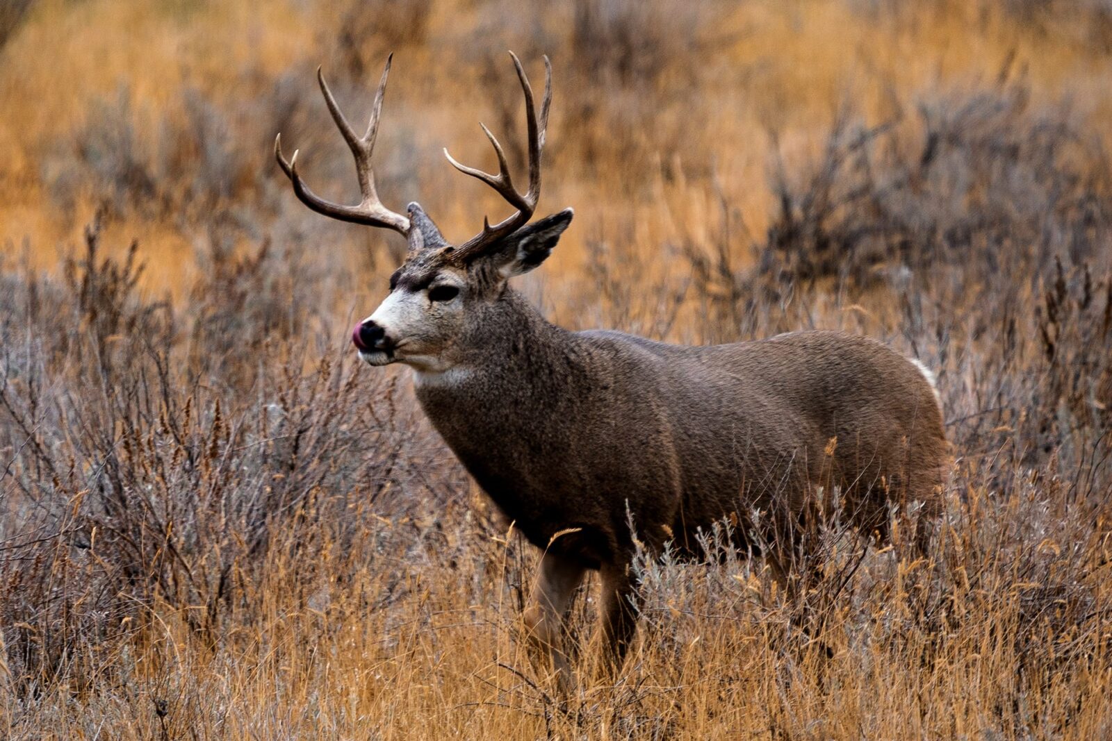
Indigenous to western North America, mule deer are found west of the 100th meridian from 23 degrees to 60 degrees N. Larger than whitetail deer, a buck mule deer can weigh between 130 and 280 pounds. Its name is derived from having large ears that resemble that of a mule’s.
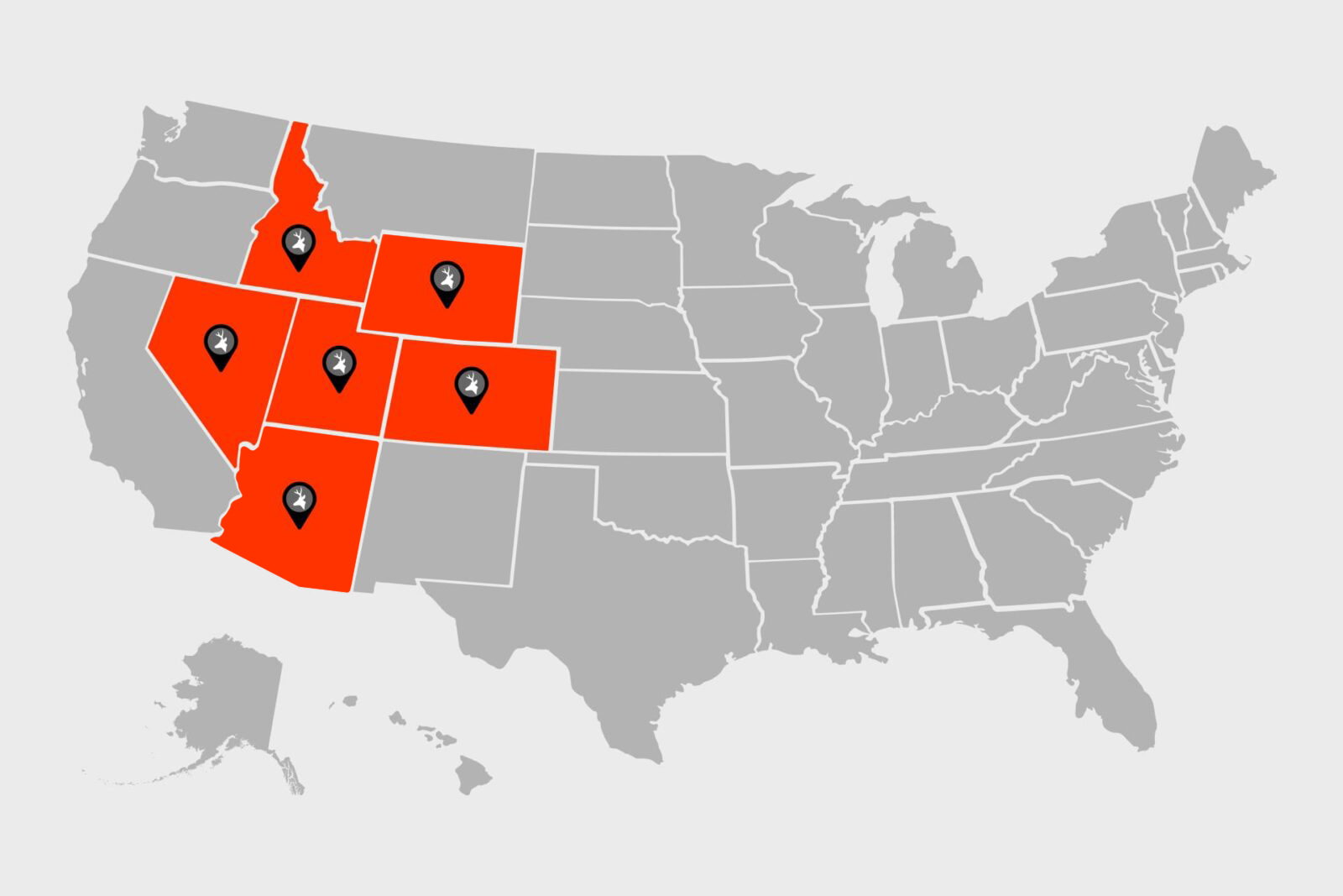
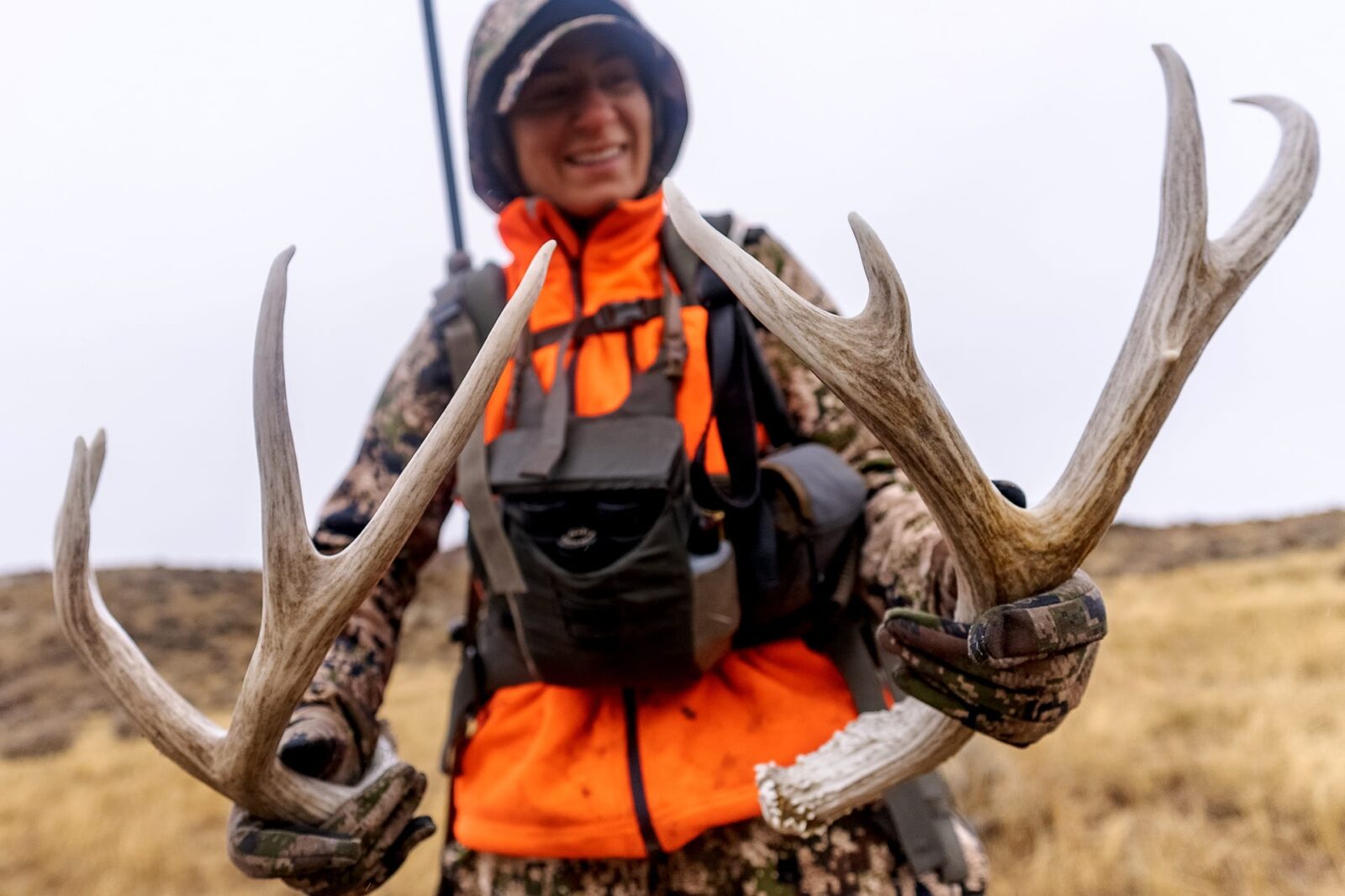
Considering only the number of hunters who pursue mule deer, they are not as popular as whitetails, but given their size and the ruggedness of the terrain in which they live, mule deer are widely regarded as an ultimate North American trophy. With that in mind, we’ve researched and compiled a handful of western states that offer some of the best mule deer hunting opportunities available.
TL;DR: Mule deer (larger than whitetails, 130–280 lb bucks) range across western North America and are a bucket-list hunt for many because of the rugged country they inhabit and their trophy potential. Colorado is an all-around leader (largest herds and most recent B&C entries), Utah offers ample places to hunt with strong numbers, Idaho, with no points system and vast public land, is great for new muley hunters, Nevada rewards point builders with quality desert hunts, Arizona shines for OTC archery opportunity and world-class “Arizona Strip” trophies, and Wyoming—though recovering from recent winters—retains deep trophy history and broad access frameworks. Success hinges on smart apps (onX Hunt + Hunt Research Tools), realistic draw strategies, fitness, and fundamentals: scout early, glass patiently, use terrain and wind, and time your hunt to weather and the rut.
Best All-Around State for Mule Deer Hunting: Colorado
When we asked our partners at Boone and Crockett Club (B&C) about stand-out states for hunting mule deer, we got a quick answer about how stellar the Centennial State is for typical and non-typical mule deer harvests.
Looking over the last eight-plus years of data (2016-2024) collected as part of B&C’s Big Game Records Live feature, we see that Colorado stands head and shoulders above all other states. Since 2016, B&C has recorded 77 typical mule deer trophies from Colorado. The second-closest state in the U.S. is Utah, with 24 records (Saskatchewan has more but the province only issues tags to residents). When combined with non-typical harvests, Colorado stands at 97 records. That’s an average of 12 record mule deer per year over the last eight seasons, and the world’s record typical was taken in 1972, scoring 226 4/8.
Colorado is a top state for mule deer, in large part, because of the size of the deer population there. An estimated 375,000 mule deer inhabit the state. Colorado operates on a preference point system, which means one preference point is awarded to each applicant who qualifies for and doesn’t draw their first-choice limited license. Once a hunter has three regular preference points and fails to draw a first choice license, that hunter will receive a weighted preference point.
So Colorado is a top place to start applying and building points if you want to go after a nice muley buck.
In addition to its abundance of mule deer, Colorado also stands out above the rest because it has mule deer all over the state. From its 10,000-foot peaks to its rolling sage foothills, Colorado has a diverse summer and fall range for these deer. And with seasons that allow for archery, muzzleloader, and rifle, you’ll be able to pursue them from early September until early November.
However, per the National Deer Association’s 2026 Report, there may be reason to temper expectations: The latest available data—for 2024—showed an 11% year-over-year decline in mule deer harvest and a 17% decline from the prior two-year average.
Colorado Hunt Research Tools Tip
There are no General (over-the-counter) deer tags in Colorado. To obtain a deer license in Colorado, you must go through either the Primary or Secondary draws, or potentially get one through the leftover process. Hunt Research Tools can help you find units you can realistically draw with zero or few points and know how many points you may need to collect for units holding trophy bucks.
Draw Deadline: April 7, 2026
Take a closer look at Colorado:
- Colorado Mule Deer Season Regulations
- Review Colorado’s Draw Info
- Use Hunt Research Tools To View Draw Odds (Elite Membership Required)
Best State for Ample Places To Hunt: Utah
According to B&C, Utah is second in the U.S. for the number of record typical mule deer taken since 2016, but something else that helps the Beehive State stand out is how much of the state offers great hunting opportunities.
While it can be a lot harder to draw a non-resident mule deer tag than in other states for the most coveted districts (we’re looking at you, Henry Mountains), Utah has a lot of mule deer all over the state, and with those come opportunities to find them in any district. Nearly 335,000 mule deer live there, so if you do get a tag and the weather cooperates, you might just be in for a mule deer hunt of a lifetime.
Utah also happens to be the headquarters for the Mule Deer Foundation, an organization dedicated to the conservation of mule deer, black-tailed deer, and their habitat.
NDA’s 2026 Report shows Utah is one of the states experiencing more mule deer buck harvests year-over-year, and they’re up 5% from their prior two-year average.
Utah Hunt Research Tools Tip
Utah has two separate and distinct drawings for mule deer: Limited-Entry and General. The Limited-Entry hunts are managed for more mature bucks overall and are typically more difficult to draw. The General hunts are available in a different group of units and generally provide for more draw opportunities. The two drawings work a little differently, so check the resources on Hunt Research Tools to better understand your options.
Draw Deadline: April 23, 2026
Take a closer look at Utah:
- Utah Mule Deer Regulations
- Review Utah’s Draw Info
- Use Hunt Research Tools To View Draw Odds (Elite Membership Required)
Best State for New Mule Deer Hunters: Idaho
With just over 230,000 mule deer in the Gem State and millions of acres of public land on which to chase them, Idaho is a top destination for any dedicated mule deer hunter. Moreover, Idaho does not operate on a points system, so there’s always a chance of drawing a great tag the first year you apply. And should you find yourself in Idaho on opening day, you might find a big buck, given that one-quarter of the 20 all-time records for typicals came from Idaho. That means there are good genetics and quality habitat for monster muleys.
With all this promising information don’t think hunting in Idaho is a sure thing, though. The terrain where hunters find mule deer ranges from dry, high-desert foothills to rugged, mountainous alpine zones, all of which take serious effort to cover, so make sure your fitness level matches the challenge.
NDA’s 2026 Report shows good news for Idaho mule deer hunters, too: Their year-over-year mule deer harvest is up 12% and up 8% from its prior two-year average.
Idaho Hunt Research Tools Tip
Idaho deer hunters have the option of a “Regular” season tag or a “White-tailed deer.” The regular season tag allows hunters the option of both mule deer and white-tailed deer, but typically only during October (pre-rut most of the time). A “White-tailed deer” tag limits hunters to harvesting only whitetails but offers a longer and later season during prime time in November. If you’re willing to hunt only whitetails, this may be a better option for anyone looking for a mid-rut or longer hunting window.
Draw Deadline: June 5, 2026
Take a closer look at Idaho:
- Idaho Mule Deer Regulations
- Review Idaho’s Draw Info
- Use Hunt Research Tools To View Draw Odds (Elite Membership Required)
Best State for Building Up Points: Nevada
Like most of the best mule deer hunting states covered so far, Nevada operates on a point system for its best tags, but what the Silver State has going for it is the chance of drawing one of the many mid-tier regions for big muleys in a matter of a few short years of applying.
In Nevada, you won’t find the massive herds happening elsewhere. The total population is only around 68,000 animals, but Nevada wildlife officials are doing good work managing what they’ve got, so connecting to a nice mule deer buck is even more of an opportunity here.
As a testament to the management work happening in Nevada, NDA reports that Nevada’s mule deer harvest is up 6% from its prior two-year average.
Nevada Hunt Research Tools Tip
Although the aridness of the region limits the overall deer population, Nevada offers some quality opportunities to hunt trophy Mule Deer in some stunning desert landscapes. Additionally, there are Nevada deer seasons available beginning in August and extending into late December in some areas. Explore your options on Hunt Research Tools to find a hunt that works best for your hunt calendar.
Draw Deadline: May 13, 2026
Take a closer look at Nevada:
- Nevada Mule Deer Regulations
- Review Nevada’s Draw Info
- Use Hunt Research Tools To View Draw Odds (Elite Membership Required)
Best State for Archery Hunting Mule Deer: Arizona
If you’re a bowhunter looking for a muley, the Grand Canyon State should grab your attention. As for licensing and seasons, Arizona is generous with both, even to non-residents. Archery tags are available over-the-counter, and there are at least three seasons for mule deer per year in most units that cover multiple biological patterns (think hunting summer range and rut).
Arizona is a hot, dry place, and recent droughts have impacted the overall mule deer population, which hovers between 85,000 and 100,000 animals. Despite the tough climate, NDA reports mule deer harvests are up 12% from its prior two-year average.
In the mule deer hunting world, Arizona has earned a nickname for regions 13A and 13B, which is called the “Arizona Strip.” Much like the Vegas Strip in nearby Nevada, hunters might hit the jackpot should they draw a rifle tag or book an outfitter in this 5,074 square mile section of northwestern Arizona. They say it is not uncommon to see several 230+ bucks come off the “Arizona Strip” in a normal year.
“When most fall hunting seasons have wrapped up, the mule deer and Coues deer hit peak rut in December and January in the state of Arizona. Grab your bow and an over-the-counter tag and hunt big deer in the deserts of Arizona during the so-called ‘off-months’ of Dec/Jan.” Steven Drake, Anyone’s Hunt
Arizona Hunt Research Tools Tip
The Arizona Strip in the northwest part of the state is famous for its trophy Mule Deer genetics and is one of the premier hunt experiences in all of North America. Although those tags can be difficult to draw, the Arizona draw system does make it possible for even the first-time applier to get lucky. Find out more about how Arizona’s draw system works on Hunt Research Tools.
Draw Deadline: June 2, 2026
Take a closer look at Arizona:
- Arizona Mule Deer Regulations
- Review Arizona’s Draw Info
- Use Hunt Research Tools To View Draw Odds (Elite Membership Required)
Down but Not Out: Wyoming
Wyoming’s winters of 2021-2022 and 2022-2023 (along with habitat loss and other factors) have hurt the mule deer populations here. The population went from an estimated 30,000-strong to only 11,000 after February 2023. For that reason, Wyoming needs time to rebound. We are keeping it here because it should not be forgotten, as it was once the best state for trophy animals.
Per NDA’s 2026 Report, Wyoming’s mule deer hunting landscape may be showing positive signs: Harvests are up 12% year-over-year, yet still even with the prior two-year average. More time is needed to see the true trendline.
Trophy Mule Deer History in Wyoming
Four of the top 20 B&C mule deer of all time were harvested in Wyoming, including the #3 and #5 world record muleys.
Wyoming operates on a point system, but some hunts can be drawn without any points. Additionally, hunters in Wyoming should know that federally designated wilderness areas are off-limits to non-resident big game hunters unless they hire a licensed outfitter. But if you’re looking for a lot of public land to roam, the western half of Wyoming is where you’ll want to start scouting. Still, many good tracts of private land in Wyoming are accessible as Walk-In Hunting Areas (learn about onX Hunt’s Walk-In Map Layers). Because of these areas and the state’s Hunter Management Areas, you can get access to mule deer in every unit and region in Wyoming.
Wyoming Hunt Research Tools Tip
In addition to unit-specific draw hunts for mule deer, Wyoming also offers General deer tags that are valid for a group of units inside 17 larger defined regions. The General deer tags are over-the-counter for residents but are only issued via drawing for nonresidents. Hunt Research Tools can help you find, research, and compare the latest draw odds for both General deer tags and unit-specific hunts.
Draw Deadline: June 1, 2026
Take a closer look at Wyoming:
- Wyoming Mule Deer Regulations
- Review Wyoming’s Draw Info
- Use Hunt Research Tools To View Draw Odds (Elite Membership Required)
- Mule Deer Fawn Recruitment in Wyoming’s Red Desert
Choosing Where To Hunt Mule Deer
Ready to chase muleys and need help choosing where to hunt mule deer? Let’s review some factors to consider:
- Travel Logistics: If you don’t live in a state with huntable mule deer populations, you’ll have to decide just how far you’re willing to travel, and with that, will you drive or fly?
- Tag Availability: Does the state you want to hunt have tags available? Remember, many mule deer tags are draw only, and tags can be more difficult to draw as a non-resident. Factor in that you might need to apply and earn points for multiple years before you have a chance to draw a tag. There are a few states, however, that offer over-the-counter (OTC) tags for muleys. Arizona, for instance, offers OTC mule deer tags for archery. Idaho sells a limited number of OTC deer tags to residents and non-residents in December, typically, for the following year.
- Fitness: It’s best not to underestimate the fitness one needs to chase mule deer in the mountains or across the plains, especially if you’re traveling from a relatively low-altitude home base. Many destinations feature intense elevation gains and losses—are your skills and body ready for backcountry mountain hunts? If you’re unsure, focusing your plans around foothills could be a better option.
- Timing: Special consideration should be given to mule deer seasons and how they might factor into your travel or your home state’s seasons. Would you be giving up hunting time at home to travel to a good mule deer locale? When you can make it to your destination, will you be hunting early-season, peak or rut season, or late-season when weather and weary deer might make things more challenging?
Focus on spotting small movements or parts of the deer, like antlers or a flicking tail, instead of looking for the whole animal.
Mule Deer Hunting Tips
We’ve put together five essential mule deer hunting tips to help increase your chances of success in the field.
1. Scout Early and Often, If You Can
Scouting can be mission-critical for understanding mule deer behavior and movement patterns. Use trail cameras, glassing techniques, and onX Hunt to locate feeding areas, water sources, and bedding grounds. Pre-season scouting allows you to pinpoint high-traffic areas, while mid-season scouting helps you adjust to changing conditions and deer movement.
2. Glass Effectively
Mule deer are often found in open, rugged terrain, making glassing a critical skill. Invest in quality optics (binoculars and spotting scopes) and take your time scanning distant ridges, slopes, and basins. Early morning and late afternoon are the best times to glass, as deer are more active during these periods. Focus on spotting small movements or parts of the deer, like antlers or a flicking tail, instead of looking for the whole animal.
3. Use Terrain to Your Advantage
Mule deer often bed down in areas with good vantage points and escape routes, so use the terrain to stay hidden. Use Hunt’s 3D maps to your advantage. Approach from downwind and use ridges, trees, or rocks to stay out of sight as you stalk. When glassing or stalking, position yourself where you can see a large area but remain concealed. Moving slowly and deliberately through steep terrain can get you within range without spooking the deer.
4. Be Patient and Persistent
Patience is key when hunting mule deer. Often, it takes time to locate a buck worth pursuing. Once you’ve found a deer, wait for the right moment to make your move. If conditions aren’t ideal (e.g., wind direction, distance), stay put and wait for an opportunity. Persistence and patience often separate successful hunts from missed opportunities.
5. Adapt to Weather and Rut Timing
Mule deer behavior changes with the seasons, especially during the rut and in different weather conditions. Bucks become more active during the rut, which typically occurs in late October to November. In cooler, post-rut weather, mule deer may be more mobile during daylight hours. Keep an eye on weather patterns—overcast, cool days, or after a storm can get deer moving, making it an excellent time to hunt.
FAQs
Bucks commonly weigh 130–280 lb and are recognized by their large, “mule-like” ears.
Colorado—largest mule deer herd, statewide abundance, broad distribution, and leading recent Boone & Crockett entries. Seasons span archery, muzzleloader, rifle (Sept–Nov).
Heads-up: No OTC deer tags; you must use the Primary/Secondary draws or leftovers. Draw deadline: First Tuesday in April.
Utah—~335,000 mule deer and quality across many units. Two drawings: Limited-Entry (older age class, tougher draw) and General (more access). Draw deadline: Last week of April.
Arizona—OTC archery options and multiple season windows (including Dec/Jan rut in some units). The famed Arizona Strip (13A/13B) produces giants, though rifle tags are hard draws. Draw deadline: First week of June.