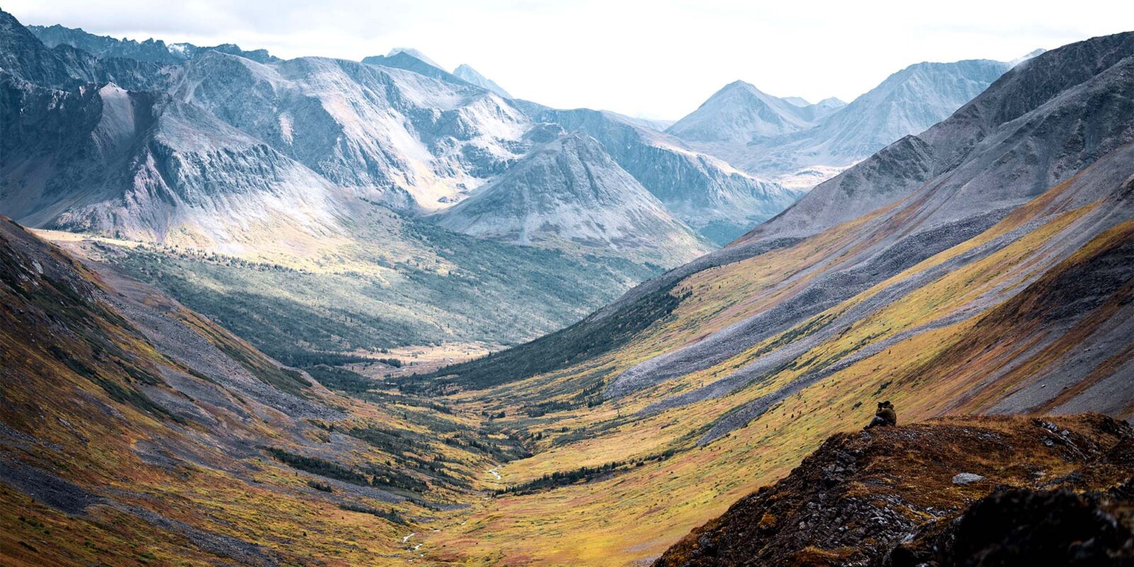

Navigate the Unknown With Certainty
This is more than a map. It’s a guide into the unglassed, the unpressured, and the unknown. With the onX Hunt app, you see more—so every decision in the field is grounded in confidence.

LIDAR
Read the Ridge Like a Local
Lidar lets you cut through tree cover and reveals the true shape of the land. Find bedding areas, secluded saddles, and tiny drainages others miss. It’s topography with clarity—built for those who go deeper, farther, and harder.

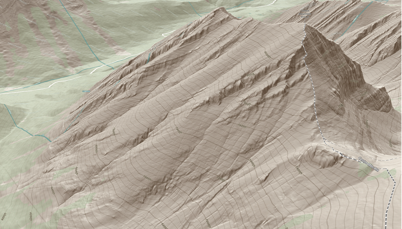
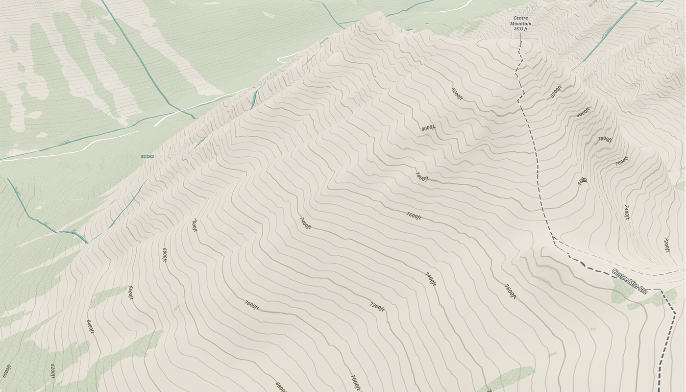
With
Without
![]()
3D Exaggeration
Clarity That’s Measured in Elevation
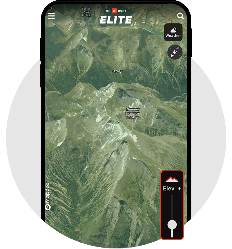
Subtle rises become ridgelines. Shallow dips become game trails. 3D Exaggeration makes terrain easier to understand and faster to assess. When the hunt comes down to how well you read the land, this is the feature that brings it into focus.
![]()
Slope Angle Layer
Know What You Can Climb—And What They Won’t
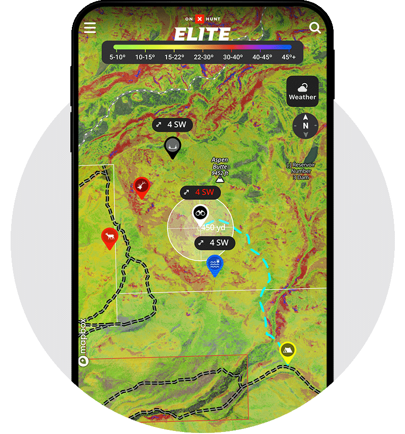
Slope Angle adds color-coded intel to your map, revealing steep grades, traversable benches, and escape terrain big game prefers. It’s the tool for safer routes, smarter stalks, and better plans when the country gets vertical.
![]()
Imagery Basemap
Scout Like You’re Already There
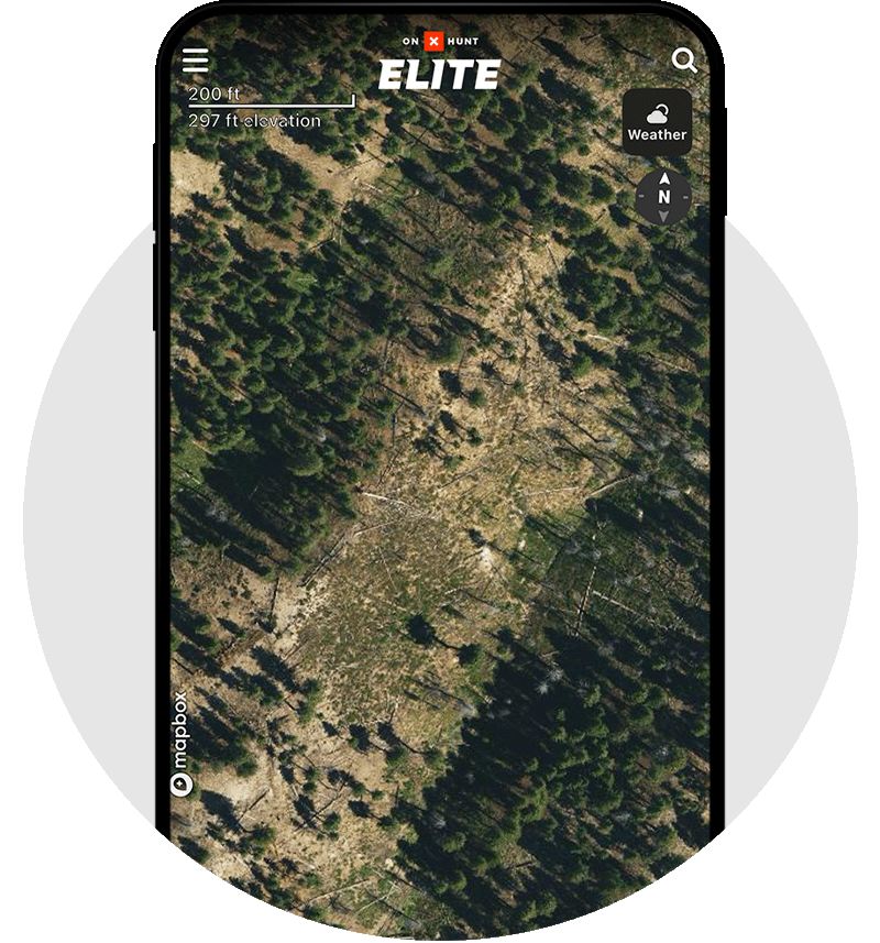
Our high-resolution Basemap imagery gives you boots-on-the-ground clarity—without the boots. See trails, burns, game trails, and glassing points. Make confident decisions before you ever lace up.
![]()
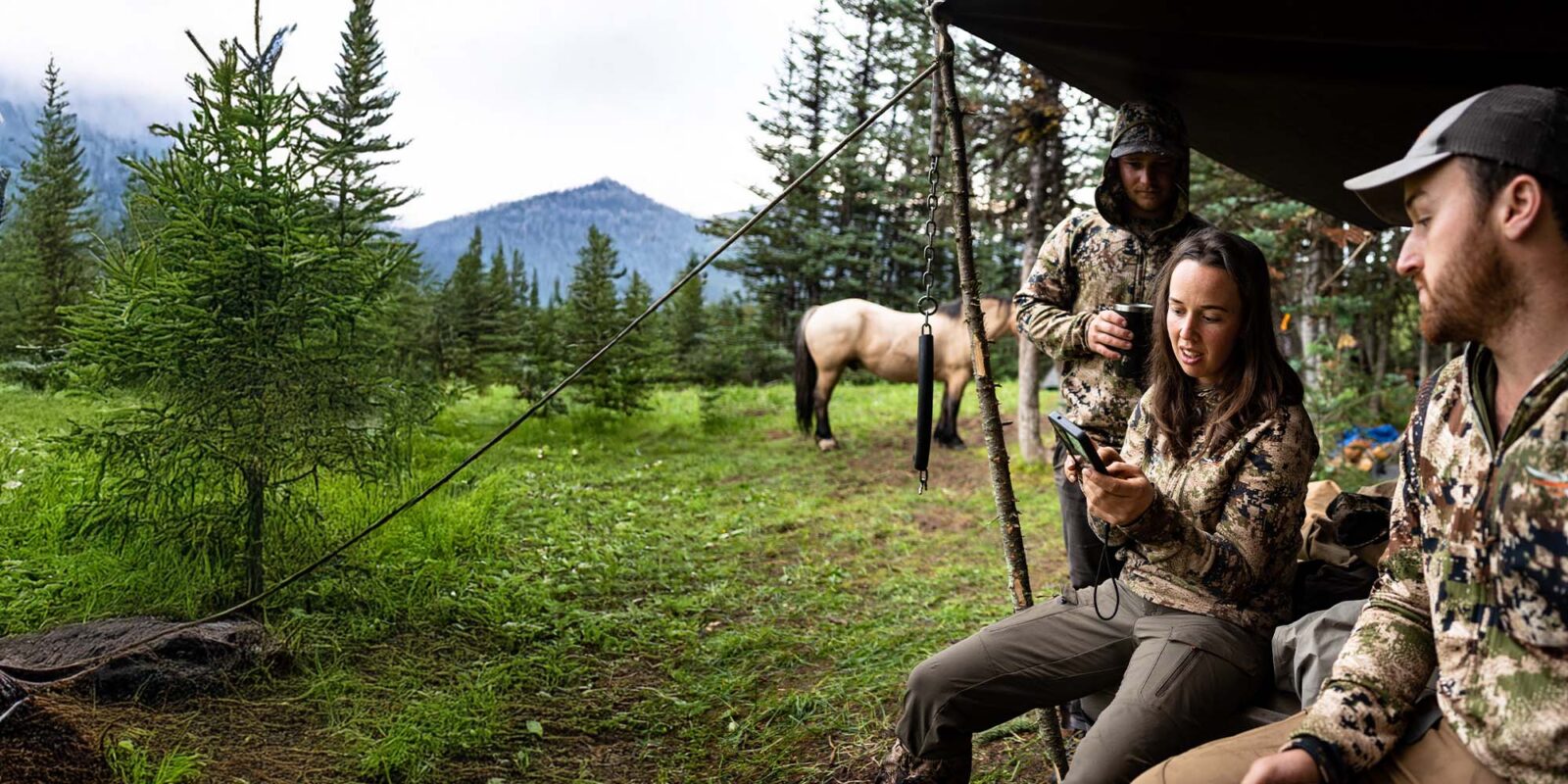
The GPS Platform Built for Western Hunts
Whether you’re swapping Waypoints around the campfire or tracking bulls solo at dawn, onX Hunt keeps you in sync and on point. This isn’t just a map—it’s your edge, your plan, and your hunt in one place.

Mark the Moments That Matter
From bugles to blood trails, Waypoints let you capture the details that define a hunt. Color-code, add notes, drop photos—then return to those places with purpose. This isn’t just where you were. It’s where the story happened.
Every Step Saved. Every Pattern Revealed.
Whether it’s your pre-dawn route to a glassing point or a day-long stalk across ridgelines, Tracker logs your exact path. Review it. Rerun it. Use it to find your way back to camp safely in the dark or find where animals consistently travel so next time, you’re already one step ahead.

Build a Better Plan Together
Draw up the game plan with your crew, whether you’re across the tent or across the country. Share Waypoints, access routes, and now, with Collaborative Folders, everyone can contribute intel to the same map—adding tracks, Waypoints, and Areas in one shared space. It keeps your crew organized, aligned, and ready—because success isn’t solo. It’s strategic.

No Signal? No Problem.
When you lose service deep in the backcountry, Offline Maps keep you on track. Save detailed maps ahead of time so you can scout, navigate, and mark critical intel without ever needing a signal. Stay connected to your plan—even when the bars disappear.
Mark It Before You Lose It
Compass Mode lets you precisely mark distant targets—glassing knobs, bugling bulls, or a shot site—before fog, darkness, or terrain erase your visual. It’s your line-of-sight locked in, even when the view’s long gone.

Turn Directions Into Decisions
The all-new onX Hunt Navigation turns your route into a plan. Get turn-by-turn directions to trailheads, camps, and access points. From road to ridge, onX Hunt keeps your path clear and your focus on the hunt.