
onX Hunt Free Trial Features
Try all onX Hunt features for free, including Elite tools like Route Builder, Recent Imagery, Lidar Maps, Trail Camera Analysis, and Deer Movement Forecast.
Try all onX Hunt features for free, including Elite tools like Route Builder, Recent Imagery, Lidar Maps, Trail Camera Analysis, and Deer Movement Forecast.
Free Public and Private Property Lines
Free with onX Hunt App 7-day trial.
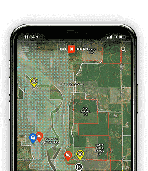
Looking for an app that shows property lines that’s easy to use, reliable, and works offline? Stay on the right side of the line—and the law—with comprehensive public and private land boundaries.

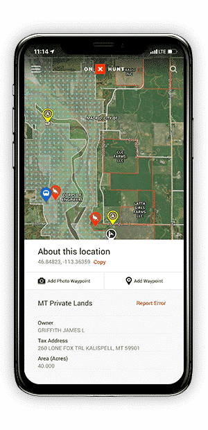
Free Land Ownership Maps
Free with onX Hunt App 7-day trial.
Identify landowners by name and address, and use the information to ask for permission to access their land.

Free Offline Maps With Customizable Layers
Free with onX Hunt App 7-day trial.
Turn your phone into a fully functioning GPS by saving Offline Maps for full access to all layers and property boundaries even when cell service is miles behind you.

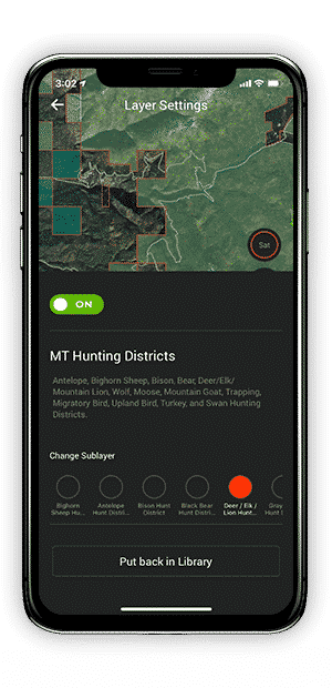
Hunting Zone Maps and Game Management Unit Boundaries
Free with onX Hunt App 7-day trial.
See state-specific hunting unit information and easily refine units by your target species.

Free Hunting Maps—Find Places To Hunt on Public Land
Get all Elite features Free with an onX Hunt App 7-day trial.
Scout new areas and find new hunting spots with state-specific hunting layers like Public Land, Landowner Names, Hunting Zones, Possible Access, Walk-In Areas, Historic Wildfires, Timbercuts, Roadless Areas, and more.
Start Your Free 7-Day Trial
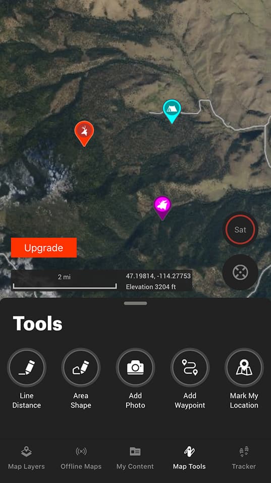
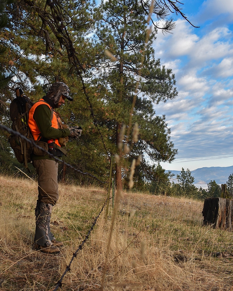
Mark Locations and Attach Photos With Customizable Waypoints
onX Hunt’s customizable Waypoints allow you to select the Waypoint icon and color. Additionally, you can upload photos to specific Waypoints so you don’t forget the location of that perfect turkey hide when approaching your spot in the predawn darkness.
Free GPS Tracking
Finding your way back after losing the trail couldn’t be easier. Start a Track when you start your journey, and onX Hunt will drop breadcrumbs along the way.
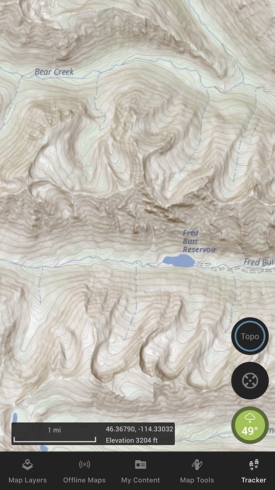
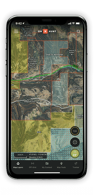
Free Topographic Maps
Knowing the lay of the land is critical for identifying game animal habitat and planning travel routes through varied terrain, and onX Hunt’s nationwide topographic maps are always at your fingertips.
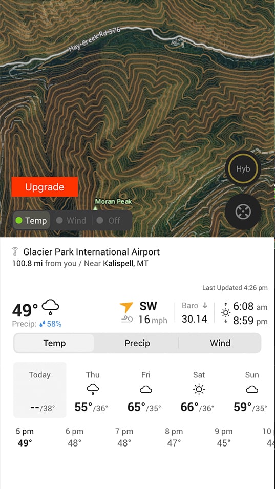
Free Hunting Weather and Wind Forecasts
Access up-to-the-minute weather and long-range forecasts, and plan your hunt around wind direction, barometric pressure, and more.
High-Resolution Satellite Imagery
Having high-resolution satellite imagery means better understanding the locations of recent timber cuts and other features that indicate prime habitat.
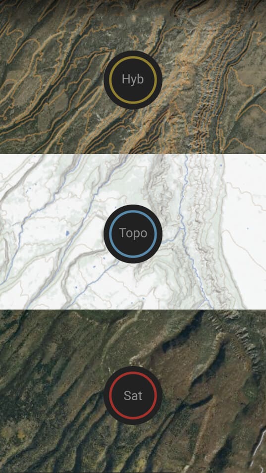
Free Topo/Sat Hybrid Basemap
onX Hunt’s Hybrid Basemap combines satellite imagery and topographic lines to put all the information you need in one place.
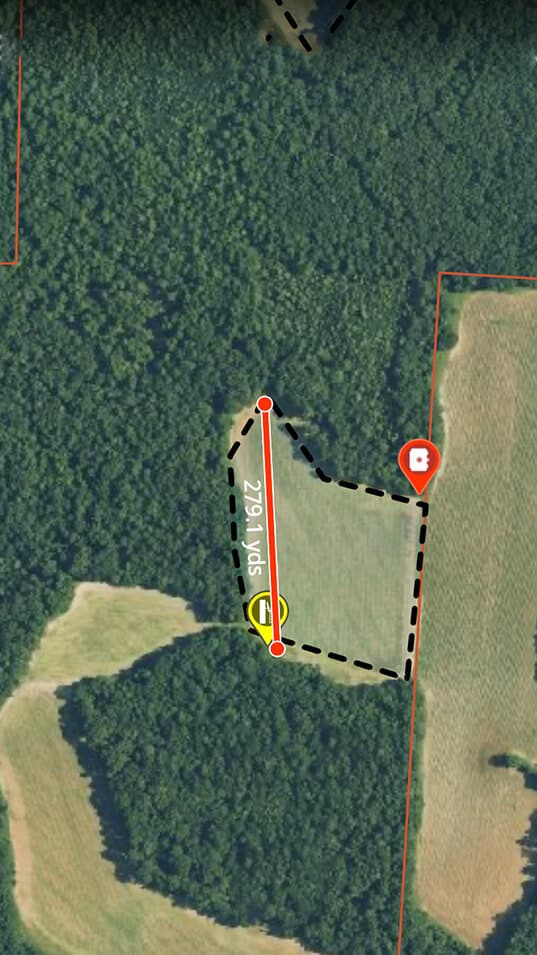
Measure Distances With the Line Distance Tool
Use the Line Distance tool to plan decoy spreads, determine the distance to an animal before a stalk, and more.
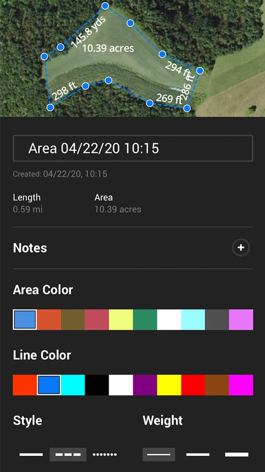
Measure Areas With the Area Shape Tool
Particularly useful as a land management aid, the Area Shape tool allows you to quickly determine the size of a particular spot by outlining the area.
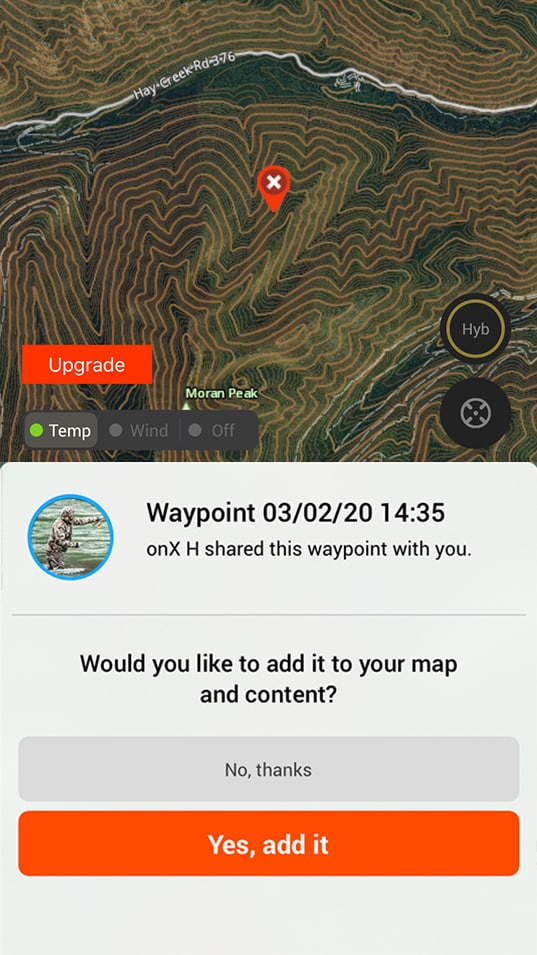
Share Info With Hunting Partners
All Map Markups—Waypoints, Lines, Shapes, Tracks, etc.—can be shared with your friends from within the Hunt App via text, email, or Bluetooth sharing (helpful for when you have no service).
Free for 7 Days
Try all features for free, including Elite features like Route Builder, Recent Imagery, Lidar, and Deer Movement Forecast.