Rocky Mountain National Park

Beacon Guidebooks has partnered with onX Backcountry. Find guidebook quality content for backcountry adventures in Rocky Mountain National Park. Rocky Mountain National Park has 14 zones to explore and 92 routes.

Total Zones
14

Publisher

Beacon Guidebooks

Rocky Mountain National Park Overview

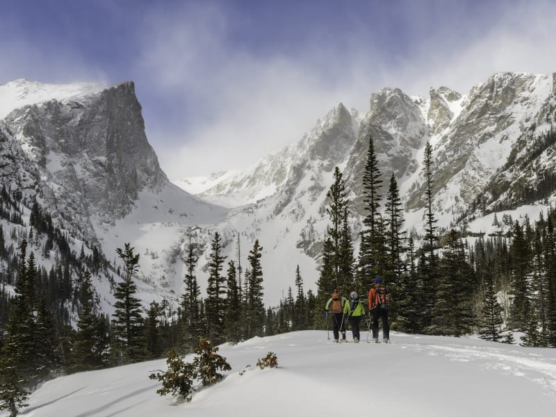
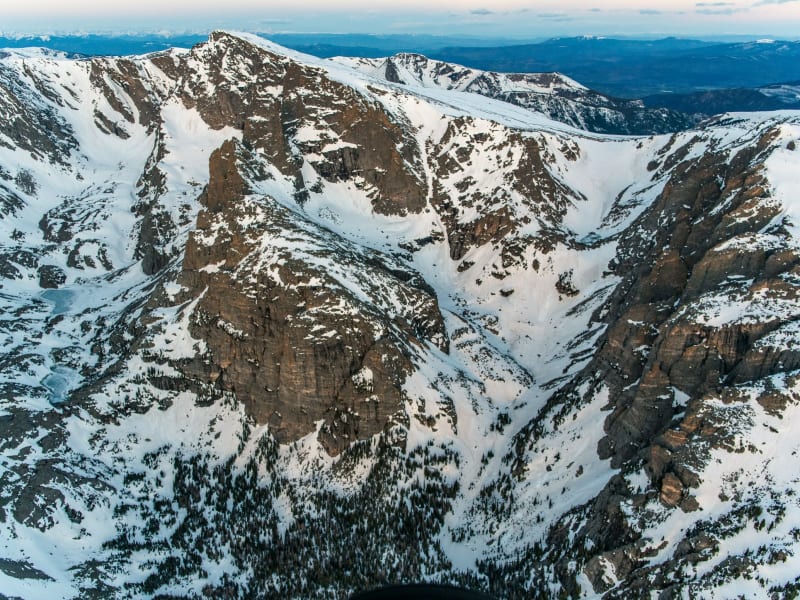
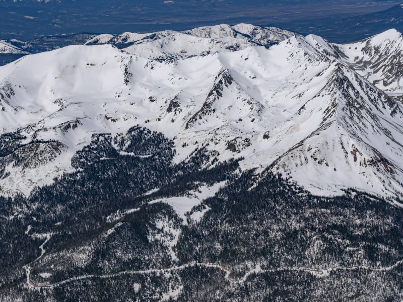
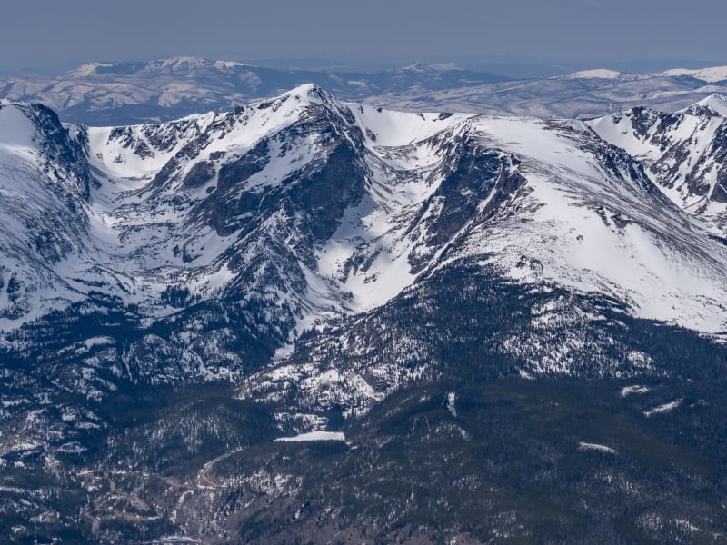
Welcome to Rocky Mountain National Park. “The Park,” as locals know it, is home to some of the most diverse, accessible ski terrain on the Colorado Front Range. The Continental Divide creates a North-South backbone through the Park, and the glacier-carved east side offers long valleys of leeward terrain all the way to timberline. The Park holds the highest concentration of ski mountaineering terrain in the Front Range. Steep, dramatic scenery awaits as soon as you break into the alpine. Here, you will find options from entry-level to expert, from couloirs to alpine bowls. When the challenging midwinter weather or shallow early-season snowpack keeps you below the Continental Divide, fear not. Near- and below-timberline glades and gullies offer adventures in every valley, limited only by your curiosity for exploration. If you’re up for a more social affair, take a lap or two at Hidden Valley, a now-defunct ski area (1955–1991) which has become a gathering spot for everyone from new visitors and families to locals and skimo trainers. The spring months bring a deeper snowpack, more favorable weather, and the opening of Trail Ridge Road, which happens on Memorial Day Weekend in typical snow years. Topping out at over 12,000’, this is the highest paved road in Colorado and gives spring and early summer skiers great access to high alpine terrain. Mount Cumulus, Flattop Mountain, Hallett Peak, Longs Peak, McHenrys Peak, and many others offer classic high summit ski descents for a range of ability levels. April and May are often prime months for these objectives; you can still ski from the parking lot and often have the choice between cold snow or corn. In this first edition, we’ve compiled a list of the classic tours and descents the Park is known for, and included a few lesser-known objectives to spark the veterans’ curiosity. Routes and descriptions have been ground-truthed, vetted for accuracy, and supported by photography in order to provide a reliable planning and decision-making tool for your adventures. Enjoy! The author and publisher acknowledge that the land described in this atlas is the ancestral home of the Hinono’eiteen (Arapaho) and Núutsi-u (Ute) peoples, who lived on these lands for thousands of years before the arrival of Europeans. The Arapaho traveled from the plains to and from what is now the east side of RMNP, while the Ute tribe lived along the west side and around what is now Grand Lake. They would also make seasonal trips back to the plains, traveling over the Continental Divide using what we now call the Ute Trail. Oliver Toll’s Arapaho Names and Trails is a great resource for learning more about the history of this land.

Zones Covered

Andrews Creek
Routes
4
ATES Level
3
General Aspect
N,NE,E,SE,S
Andrews Creek splits from the Sky Pond Trail just west of The Loch and leads you to another world of glacier-carved cirques and dramatic towers.
Routes
  • Andrews Glacier
  • Andrews Creek Approach
  • The Gash
  • Andrews Creek Exit
Chaos Canyon
Routes
8
ATES Level
2
General Aspect
N,NE,E,SE,S
Chaos Canyon is framed by Hallett Peak to the north and Otis Peak to the south. It is named for the number of erratic boulders that litter the valley, sometimes making it difficult to navigate. Its centerpiece is Lake Haiyaha, which is surrounded by ski touring options from mellow glades to steep couloirs.
Routes
  • Hallett Peak - South Face
  • Chaos Canyon Approach
  • Elevator Shaft
  • Chaos Canyon Exit
  • Chaos Couloir
  • Mario Gully
  • Otis Couloirs
  • Easy Alleys (aka Otis Glades)
Colorado River Trailhead
Routes
6
ATES Level
2
General Aspect
NE,S,SE
The west side of RMNP sees little winter visitation. Access and amenities are limited, and the town of Grand Lake focuses on ice fishing and snowmobiling as its main forms of recreation. If you don’t mind making the long drive around the Divide, it’s a great place to go ski touring. Expect a more adventurous outing. Late winter into mid-spring is the ideal time to catch these lines in condition, although there’s still plenty of snow once Trail Ridge Road opens in late spring.
Routes
  • Mount Cirrus - NE Face
  • Howard Mountain - SE Face
  • Mount Cumulus - East Bowl
  • Colorado River Trailhead Approach
  • Howard Mountain - NE Couloir
  • Colorado River Trailhead Exit
Fall River North
Routes
8
ATES Level
3
General Aspect
E,SE,S
To the north of Fall River, you’ll find classic ski mountaineering objectives off the Mummy Range summits of Mount Chiquita, Ypsilon Mountain, and Fairchild Mountain. These objectives are characterized by difficult access, complex route-finding, and numerous objective hazards.
Routes
  • Cumbre Couloir
  • Mount Chiquita - Banana Peel Couloir
  • Fairchild Mountain - South Face
  • Ypsilon Mountain - Y Couloir
  • Y Left
  • Ypsilon Donner Ridge Approach
  • Spectacle Lakes Approach
  • Fall River North Exit
Fall River South
Routes
6
ATES Level
2
General Aspect
N,NE,E
On the south side of Fall River lies Sundance Mountain. With the exception of Hanging Valley, its north and east slopes are most commonly accessed in late spring, after the opening of Trail Ridge Road. Midwinter adventure is accessed via Hidden Valley. Sundance’s North Face offers a long, sustained fall line that often holds snow well into June. The Northeast Couloirs are shorter excursions that require a hike back out to your vehicle on Trail Ridge. Old Fall River Road usually opens to vehicles around the beginning of July, often too late for bottom-up or car shuttle excursions. However, the April 1 opening for bicycles offers some room for creativity.
Routes
  • Fall River South Approach
  • Hanging Valley
  • Sundance NE Couloir Approach
  • Sundance North Face
  • Sundance NE Couloirs
  • Fall River South Exit
Lion Lake
Routes
3
ATES Level
3
General Aspect
N,NE,E
Mount Alice is a secluded wilderness gem, and the Rabbit Hole Couloir is a fine summit ski route worth a weekend trip.
Routes
  • Lion Lake Approach
  • NE Couloir (aka Rabbit Hole)
  • Lion Lake Exit
Loch Vale
Routes
6
ATES Level
3
General Aspect
N,NE,E,SE,S
Loch Vale is a dramatic cirque that provides classic steep skiing—almost entirely above timberline and in expert terrain. Conditions often come into shape here in March and good snow coverage can last well into May.
Routes
  • Taylor East Face Ramp
  • Taylor Headwall (aka Sky Couloir)
  • Taylor SE Couloir
  • Powell Peak - North Face
  • Loch Vale Approach
  • Loch Vale Exit
Longs and Meeker South
Routes
6
ATES Level
3
General Aspect
S,SW
The south/southwest faces of Longs and Mount Meeker rise out of Wild Basin for 3,000+ uninterrupted vertical feet. This places them near the top of the list for longest snow routes in the Front Range. Access is challenging and conditions are fickle. It’s not uncommon for these lines to be completely dry in April, only to get filled in by a couple of May upslope storms.
Routes
  • Dragon's Egg Couloir
  • Keplinger's Approach
  • Dragon's Egg Approach
  • Longs and Meeker South Approach
  • Keplinger's Couloir
  • Longs and Meeker Exit
Longs Peak
Routes
6
ATES Level
3
General Aspect
N,NE
The east side of Longs Peak is frequented by alpinists and rock climbers, but less often by ski mountaineers. Much of the peak is windswept and dry for most of the year, but each spring yields a short window for riding its high slopes. May to early June is the time to watch; keep an eye on the Longs Peak webcam to track coverage.
Routes
  • Lambs Slide Couloir
  • Flying Dutchmen Couloir
  • Chasm Lake Approach
  • Longs Peak - North Face (aka Cables Route)
  • Longs Peak Approach
  • Longs Peak Exit
Lower Hidden Valley
Routes
6
ATES Level
1
General Aspect
N,NE,E
“The Lowers” includes any terrain below Trail Ridge Road, including Columbine, Aspen, Lift Line, and Spruce runs. Although many more ski runs were cut in the past, most have grown over to the point of being unskiable. The runs listed below are still reasonably clear and provide nice ascent routes or mellow turns below timberline.
Routes
  • Aspen
  • Lift Line
  • Columbine Approach
  • Spruce
  • Columbine Exit
  • Lower Hidden Valley Exit
Odessa Gorge
Routes
11
ATES Level
3
General Aspect
N,NE,E,SE,S
Odessa Gorge is the valley framed by the north side of Flattop Mountain and the south side of Notchtop Mountain. It offers skiing at all elevation bands and levels of difficulty, with fairly easy access from the Bear Lake Trailhead. Due to the shape and location of the drainage relative to the prevailing weather, expect amplification of wind speed here, especially above treeline.
Routes
  • Hourglass
  • Notchtop Couloir
  • West Couloir
  • Ptarmigan Glacier
  • Flattop North Face
  • Flattop Gully
  • Rock Garden
  • Banana Bowl
  • East Couloir
  • Odessa Gorge Approach
  • Odessa Gorge Exit
Tyndall Gorge
Routes
9
ATES Level
3
General Aspect
N,NE,E,SE,S
Tyndall Gorge serves as a main artery for ski tours in the Bear Lake zone. The North Buttress of Hallett Peak and South Face of Flattop Mountain provide a beautiful backdrop for intermediate and expert ski tours. This is a popular destination for winter backcountry enthusiasts, including hikers and snowshoers. Please be considerate when using the hiking trails and slow down or yield for uphill travelers.
Routes
  • Tyndall Glacier
  • Dead Elk Couloir
  • Dream Chutes Approach
  • Corral Couloir
  • Dragontail Couloir
  • Terrain Park
  • Hallett North Couloir
  • Tyndall Gorge Approach
  • Tyndall Gorge Exit
Upper Glacier Gorge
Routes
8
ATES Level
3
General Aspect
N,NE,E,SE,S
The Glacier Gorge Trailhead offers year-round access to Loch Vale, Andrews Creek, Solitude Lake, and upper Glacier Gorge itineraries.
Routes
  • The Trough
  • Royal Ramp Couloir
  • Solitude Lake Approach
  • McHenry's Notch Couloir
  • McHenrys Peak - SE Face
  • Stoneman Pass
  • Green Lake Approach
  • Upper Glacier Gorge Exit
Upper Hidden Valley
Routes
6
ATES Level
2
General Aspect
N,NE,E
The Upper Bowl includes the Windows, Main, Upper Main, and Big Basin runs and is the most popular and accessible above timberline ski terrain in RMNP. It’s a great area to quietly practice your craft, or to enjoy celebrating a pow day with half of the Front Range. There are plenty of options above Trail Ridge Road; go poke around!
Routes
  • Main
  • Windows
  • Upper Main
  • Columbine Approach
  • Big Basin Ascent
  • Upper Hidden Valley Exit