Loveland Pass

Beacon Guidebooks has partnered with onX Backcountry. Find guidebook quality content for backcountry adventures in Loveland Pass. Loveland Pass has 17 zones to explore and 108 routes.

Total Zones
17

Publisher

Beacon Guidebooks

Loveland Pass Overview

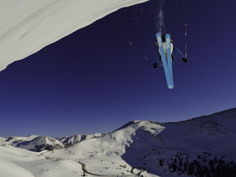
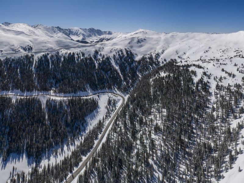
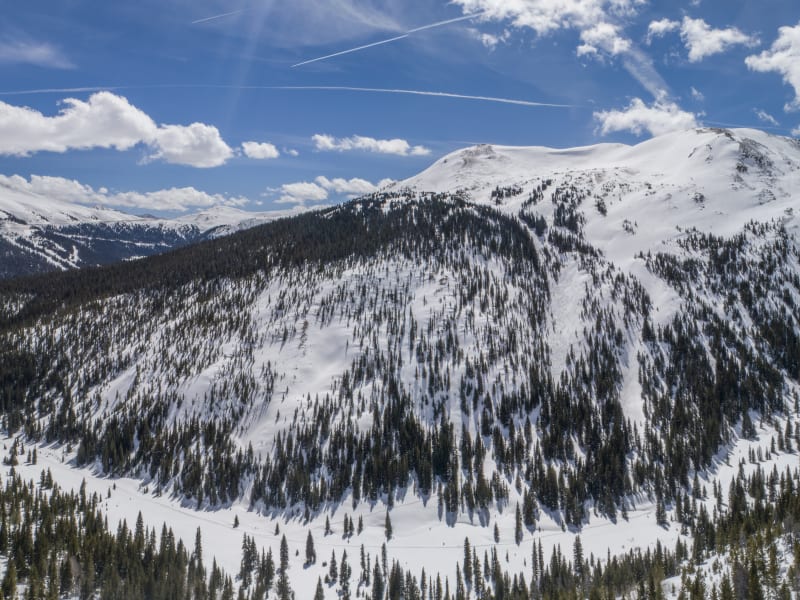
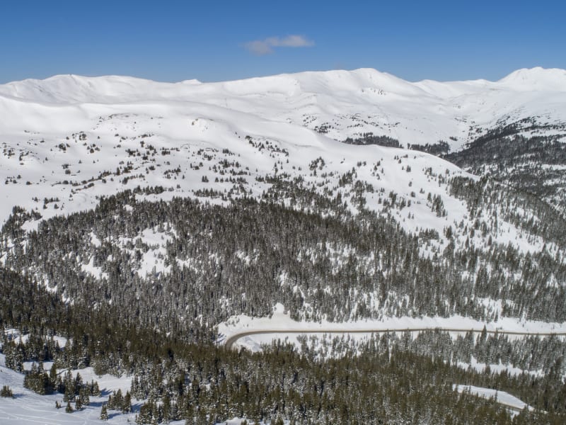
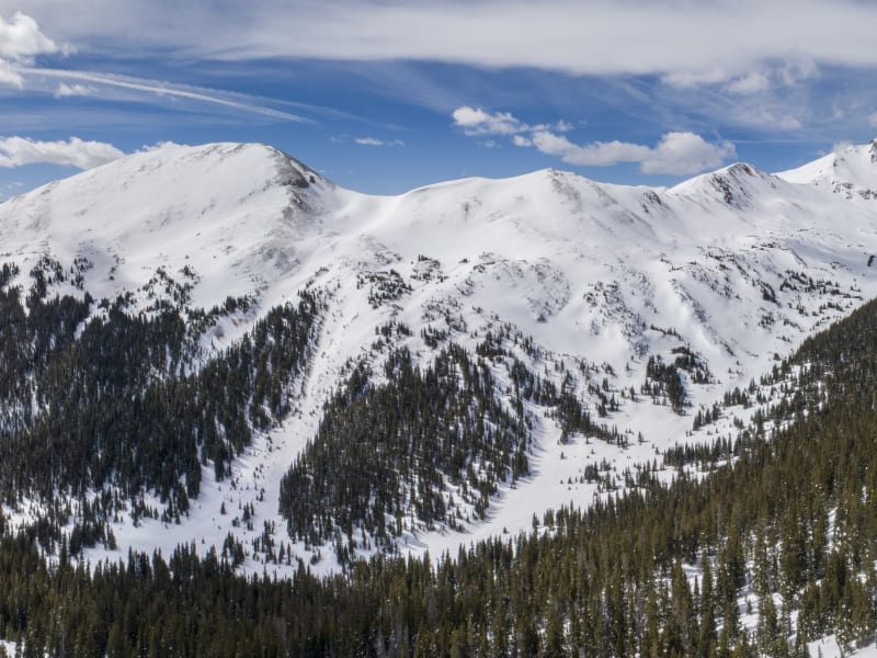
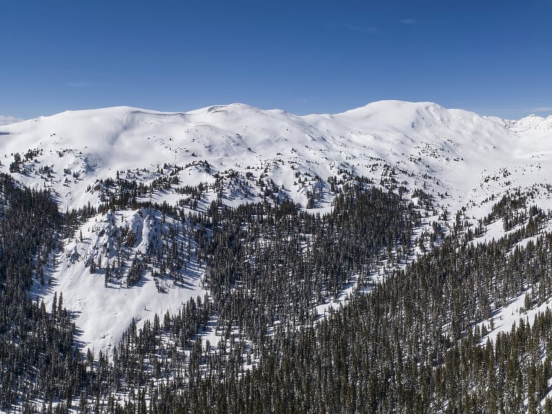
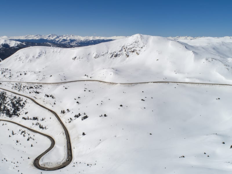
For nearly one hundred years, skiers and snowboarders have cemented Loveland Pass's reputation as a backcountry destination by driving up and skiing down. In the 1930's, early ski area explorers went deeper into the basins surrounding the Pass, hoisting mechanical rope tows to get up the slopes. Loveland Ski Area opened on the north side of the pass in 1936, and Arapahoe Basin began operations on the southside in 1946. In the 1980's and 1990's, snowboarders pioneered jumps on Loveland Pass classics like Main Line and Ironing Board long before terrain parks existed at ski resorts. Fast forward to today, and you can find a full terrain park here, including kickers and imported rails. Many Front Range and Summit County sliders had their first backcountry experience at Loveland Pass. Most folks view Loveland Pass backcountry as simply the drop-in terrain at the top of the Pass. This backcountry ski guidebook reveals opportunities to go beyond the hustle and bustle of the Pass. Spanning Watrous Gulch to Porcupine Gulch, we follow US HWY 6 as it climbs dramatically to the Continental Divide at 11,990 feet; providing trailhead access to glacial valleys holding a lifetime of backcountry exploration. From all day winter ski tours, to car shuttling, to a sampling of spring ski mountaineering on thirteen thousand foot peaks, Loveland Pass has an adventure for all skill levels. Embrace the craziness of the Pass and become part of the history of Colorado backcountry skiing. Have fun, but keep it real in avalanche terrain.

Zones Covered

Black Mountain
Routes
9
ATES Level
3
General Aspect
SW,W
Black Mountain is the dark and ominous peak looming over Arapahoe Basin ski area. The west face of this aptly-named mountain is a dark place and it’s cliffs are etched with stunning couloirs. This terrain has steep skiing test pieces like the famous Shit for Brains couloir. Climbing and skiing these routes is best done during the spring mountaineering season. This is because the spring snowpack is consolidating and becomes frozen and more predictable. Specialized mountaineering skills and equipment are needed to reduce the high alpine hazards and to climb steep and frozen snow. Due to the west facing aspect, the sun does not begin to defrost many of these routes until later in the morning.
Routes
  • Black Mountain Approach
  • Fleas Approach
  • Fleas Right
  • Fleas Left
  • Dog Leg
  • Dog Shit
  • Shit For Brains
  • Mexican Hat
  • Black Mountain Exit
Herman Gulch North
Routes
4
ATES Level
1
General Aspect
S
Herman Gulch is a beautiful glacial valley that climbs northwest from Interstate 70 and ends at the high peaks of the Continental Divide. Surrounded by mountains, the valley leads to Pettingell Peak (13,553') and the Citadel (13,294'). This is very popular with hikers in the summer and winter's snow brings a quiet and slower pace to the valley. A ski tour up the valley itself is a worthy objective and a fun day trip. Backcountry skiers entering Herman Gulch should come prepared with food and gear for a full day of skiing. The forest slopes on the north side of Herman Gulch holds excellent mid-winter tree skiing. The snow conditions on this south-facing aspect can be influenced by the sun and conditions can become quickly crusty. Ski this just after a storm in the coldest months of winter.
Routes
  • Herman Gulch North Approach
  • West Trees
  • East Trees
  • Herman Gulch North Exit
Hippie Trees
Routes
5
ATES Level
2
General Aspect
NE,E
Hippie Trees is one of the famous backcountry zones of Loveland Pass. The namesake line of this area can be seen from Arapahoe Basin. There are numerous lines descending from this ridge into No Name Gulch and there is an established skintrack that is helpful for skiing multiple laps during a tour. All of the descents are steep and require advanced tree skiing and backcountry navigation skills. Unlike the quick access of the terrain directly around Loveland Pass, getting into Hippie Trees requires an ascent and descent to access the skintrack climb up the ridge. Be prepared for a full day in this steep skiing zone. The view from the top of the ridge includes the entirety of No Name Gulch and No Name Bowl. To the south are views of The Beavers terrain on Arapahoe Basin.
Routes
  • Shadow Land/Hippie Trees Exit
  • Hippie Trees Approach
  • Hippie Cliffs
  • Middle Hippie Trees
  • Hippie Trees
Loveland Pass Bowl
Routes
6
ATES Level
2
General Aspect
NW,N,NE,E
Loveland Pass’s proximity to the urban Front Range and Summit County attracts backcountry skiers and snowboarders from both sides of the Continental Divide at 11,990 ft above sea level. The Atlantic side of Loveland Pass is a diverse center of Front Range backcountry skiing and snowboarding. The winding path Highway 6 takes from the Eisenhower Tunnel to the top of Loveland Pass provides accessible winter skiing. There is often a large crowd of people enjoying the Pass even on weekdays. Hitchhiking and car shuttling is the most common way to ski and snowboard this side of Loveland Pass. Despite this accessibility, the terrain ranges from moderate slopes to dangerous avalanche terrain. Mainline and Short Laps require almost no hiking and can be skied directly from the drop off at the top of the Pass. You will find a variety of man-made features and jumps on Mainline and Ironing Board. Snowboarders pioneered jumps here long before parks existed at the ski resorts. Contrast this near-urban riding with long hike and avalanche prone terrain of Loveland Ridge. In the Loveland Pass bowl you need to be prepared for every type of backcountry terrain and hazard. Because of the popularity of this area the human hazards can be high. Be very careful when driving through this area as there are frequently hitchhikers and cars pulling off the road to shuttle. If you are car shuttling, use the designated pull off and parking areas otherwise your car may be towed. If you are passing through Loveland Pass on your way to Summit County consider pulling over at the trailhead to pick up a hitchhiker and you will be rewarded with karma points.
Routes
  • Loveland Pass Bowl Approach
  • Short Laps
  • Mainline
  • Old Reliable and Ironing Board
  • Loveland Ridge
  • Loveland Pass Bowl Exit
Lower Dry Gulch
Routes
7
ATES Level
2
General Aspect
N,NE
Lower Dry Gulch is a popular backcountry zone accessed from the same trailhead as Mount Trelease. This area is more committing than Mount Trelease as the gullies and tree descents are far away from Interstate 70 on the north slopes of the mountain. The mid-winter routes offer great vertical. The convoluted terrain serves up uniquely shaped descents that navigate a series of gullies. There was an old fire in this area and this has thinned out the trees in many spots. Lower Dry Gulch is in the Loveland Ski Area special use permit area. Although Loveland is not using this terrain at this time the most recent Loveland master plan calls for guided backcountry and snowcat tours in this area.
Routes
  • Lower Dry Gulch Approach
  • 140 Acre
  • Right Tube
  • Left Tube
  • 130 Acre
  • Trelease Bowl
  • Lower Dry Gulch Exit
Lower No Name Bowl
Routes
5
ATES Level
2
General Aspect
E,SE,S
Lower No Name Bowl holds some of the best mid-winter tree skiing on Loveland Pass. This backcountry ski zone has a combination of good snow and low ski traffic because it is challenging to access and exit. To access this stash you must be prepared for a long approach from Loveland and a demanding descent through low elevation forest onto Highway 6. Lower No Name Bowl has two distinct landmarks that are good for route finding. The first landmark is The Castle. This large cliff splits Upper and Lower No Name Bowl in half. The second landmark is the large clearing below The Curl. This huge flat area is where all Lower No Name descent routes finish.
Routes
  • Lower No Name Bowl Approach
  • The Castle
  • The Curl
  • Curlicue Trees
  • Lower No Name Bowl Exit
Mine Dumps
Routes
7
ATES Level
2
General Aspect
N,NE,E,SE
Mine Dumps is the extension of Loveland Pass’s bowl with terrain rolling north along Highway 6. The two zones share the same trailhead but are very different backcountry experiences. Accessing the goods of Mine Dumps requires climbing equipment like skins or snowshoes to ascend the slopes. This means the hustle and bustle of East Corner are quickly left behind. This zone holds excellent moderate tree skiing and is a great choice for someone who is learning about backcountry climbing and descending.
Routes
  • Mine Dumps Approach
  • East Corner Trees
  • Mine Dump Trees
  • Mine Dumps 2
  • Mine Dumps
  • Borland's Folly
  • Mine Dumps Exit
Mount Bethel Saddle
Routes
5
ATES Level
2
General Aspect
N,NE
The northeast facing slopes of Mount Bethel Saddle are well positioned for winter powder skiing. The northeast aspect is conducive to snow loading during winter storms and shaded from the heating influence of the sun. The skintrack that serves this area can be very steep and you may need to use your highest climbing riser on this ascent. Come prepared for a full day of skiing in Herman Gulch. A long tour up the glacial valley, passing multiple avalanche paths descending from Mount Machebeuf, leads to Mount Bethel Saddle and the center of Herman Gulch.
Routes
  • Mount Bethel Saddle Approach
  • Half Gully
  • North Slide Path
  • Rose Garden
  • Bethel Saddle Bowl
Mount Trelease
Routes
10
ATES Level
2
General Aspect
E,SE,S
Mount Trelease is one of the most popular backcountry ski areas on Loveland Pass primarily due to the ease of access from Interstate 70. You can get a good view of the Boulevard on Mount Trelease when driving down the north side of Loveland Pass. The descent options consist of below tree line winter skiing and a high alpine bowl in the spring. There are numerous nooks and crannies to explore and the opportunity to ski multiple laps in one visit. Although this area is highly accessible it can be dangerous. The Boulevard appears benign but it sits below the Pat’s Knob bowl. There are telltale signs of infrequent but large avalanches that can start in this bowl and sweep down the Boulevard. The entirety of Mount Trelease is in the Loveland Ski Area special use permit. Although Loveland is not using this terrain at this time, the most recent Loveland master plan calls for guided backcountry and snowcat tours in this area. Finally, Mount Trelease is the site of the tragic 1970 Wichita State Football team plane crash. The ruins of the plane crash are on the lower flanks of the mountain. If you encounter these ruins, please be respectful of this site.
Routes
  • Mt. Trelease Approach
  • Boulevard Right
  • The Boulevard
  • Quakie Bowl
  • Creek Bed
  • Airplane Glades
  • Rock Bowl
  • Aim For The Fences
  • Pat's Knob
  • Mt. Trelease Exit
No Name Peak
Routes
7
ATES Level
2
General Aspect
E,SE,S
The primary attraction in this zone is the spring skiing of the south aspect of No Name Peak. The east ridge of No Name Peak is a great mountaineering introduction to snow and ridge climbing. The ridge has minor route finding challenges in that there are multi-directional cornices on the ascent. There is a great view of the south side of No Name Peak from Arapahoe Basin. In mid-winter the small bowls and tree shots of Lower No Name can be combined with routes further down the bowl such as The Castle and The Curl. Combining these routes can lead to a long day but this valley is hard to get into so you might as well make the most of it with a multi-lap day!
Routes
  • No Name Peak Approach
  • South Flank
  • Cabbage Patch
  • No Name Bowl West
  • Lower No Name
  • Upper No Name Bowl Exit
  • No Name Bowl Exit
Porcupine Gulch
Routes
9
ATES Level
2
General Aspect
E,SE,S
Porcupine Gulch has a reputation for being a bushwhack nightmare but if you can time the snow and approach right there are ways to efficiently navigate the valley. The trailhead is at a low elevation on Highway 6 but the upper gulch holds long ski tours and excellent tree skiing. It is best to wait until there is significant snowpack in this valley before venturing in. A good base helps to reduce the bushwhack challenge. Be prepared for a full day of touring. As with many of the valleys described in this guide, there are mid-winter and spring descents. The Franklin Bowl area has some of the best low-angle tree skiing on Loveland Pass. We cover several descent routes in the Porcupine Gulch's Franklin Bowl and Cirque. This is the western bowl of Porcupine Peak, to the north of this valley are Interstate 70 and the Straight Creek. To the east of Point 11,830 is the eastern bowl of Porcupine Gulch which shares several 12,000 foot peaks with Loveland Ski Area. In his book Powder Ghost Towns, Peter Bronski detailed the adventures of the Ski Club Zipfelberger in Porcupine Gulch. In the 1930s and 1940s they skied in Porcupine Gulch using a rope tow and called it the Little Sweden Freezer Company.
Routes
  • 11804 Approach
  • Franklin Approach
  • Porcupine Gulch Approach
  • 11804 Glades
  • 11804
  • Franklin Bowl
  • 12382
  • Franklin Cirque
  • Porcupine Gulch Exit
Shadow Land
Routes
6
ATES Level
2
General Aspect
S,SW
This is the upper portion of No Name Gulch. No Name Bowl is to the west and sits below No Name Peak. There is a route called No Name Bowl East located within the Shadow Land Zone. The terrain around Shadow Land is often skied on the way to somewhere else. This zone does hold worthwhile terrain, but with the exception of Shadow Land, it is hard to ascend for multiple laps. The descent routes range from mid-winter powder trees to spring skiing chutes.
Routes
  • Loveland Pass Bowl Approach
  • Shadow Land
  • No Name Bowl East
  • Pacific Gully
  • Escape Gully
  • Shadow Land/Hippie Trees Exit
Summit
Routes
8
ATES Level
3
General Aspect
E
Summit Zone holds the steep expert skiing terrain that is easily viewed from Loveland Pass. The ridge line that follows Highway 6 south of the Pass is speckled with cliffs, cornices and steep faces. The terrain is located in the high alpine and enormous cornices develop along the ridge line between Summit and Kitchen Wall. Access is relatively straightforward and direct from Loveland Pass. Accessibility, combined with a large expanse of steep, open terrain and avalanche starting zones, requires skiers to make smart decisions here. This is high stakes ski terrain.
Routes
  • Summit Approach
  • Outward Bound
  • Summit
  • Kitchen Wall
  • Summit Ridge
  • Pass Lake
  • Kitchen Sink
  • Summit Exit
Upper Dry Gulch
Routes
6
ATES Level
2
General Aspect
E,SE
Like many of the zones in this guide, Upper Dry Gulch has two different types of terrain. The first includes mid-winter tree skiing on the forested apron descending from the base of Citadel Bowl to the valley floor. This serves up excellent powder skiing after a cold winter storm. The second type is the high alpine, spring skiing terrain of the East Bowl of Citadel itself. The down valley view from the top of the routes present the entire valley. This is a good place to look into the Tubes and 130 Acre on Lower Dry Gulch and inspect this convoluted terrain from afar.
Routes
  • Upper Dry Gulch Approach
  • West Lake Trees
  • East Lake Trees
  • Citadel Trees
  • Citadel East Bowl
  • Upper Dry Gulch Exit
Watrous Gulch
Routes
4
ATES Level
1
General Aspect
SE
Winter backcountry skiing in Watrous Gulch is a great way to escape the crowds of Loveland Pass. Few skiers venture up this gulch in the winter as most backcountry users at Herman Gulch trailhead go up that namesake gulch. The winter terrain is primarily glade skiing and there are great vantages to plan spring ski mountaineering on nearby Mount Machebeuf (12,805') and Woods Mountain (12,940'). Due to the southern and southeast slope aspects it can take a substantial base of snow for the skiing conditions to be good. The hardest part about skiing in Watrous Gulch is the challenging ascent and descent of the hiking trail below 10,800 feet.
Routes
  • Watrous Gulch Approach/Exit
  • Upper Watrous Glades
  • Lower Watrous Glades
  • Watrous Gulch Exit
West Corner - Dave's Wave
Routes
7
ATES Level
2
General Aspect
SE,S,SW
The West Corner zone is a mix of quick hitchhiking runs and mountaineering descents. The terrain surrounding Parking Lot Drop and West Corner is as popular as the drop-in terrain on Loveland Pass Bowl. This area has served as the take off and landing zone for many backcountry booters. Farther up the ridge is Loveland Pass Peak at 12,915 feet above sea level, beyond this is Cupid at 13,117 feet. This ridge climb, combined with committing descents into Shockley's and Overlook, are a great area for an introduction to spring ski mountaineering. Within eyesight of Loveland Pass, this zone that can help teach newcomers about climbing with crampons, sun hit effects on snow, and corn snow descents.
Routes
  • Dave's Wave Approach
  • Parking Lot Drop
  • West Corner
  • Shockley's
  • Overlook
  • Dave's Wave
  • Dave's Wave Exit
Widowmaker
Routes
5
ATES Level
3
General Aspect
SE,S,SW
Widowmaker Zone spans the steep skiing terrain across Highway 6 from Arapahoe Basin Ski & Snowboard Area. The southeast aspect creates challenging ski conditions because the slopes face into the sun, this exposure can frequently create hard snow surfaces and layers. The Professor is the most famous of these routes, descents here are on display for the guests of Arapahoe Basin Ski Area across the valley. Widowmaker itself is more famous for avalanche mitigation than for skiing. CDOT frequently bombards this slope to reduce the direct avalanche threat to Highway 6. Devil’s Tool is a test piece for Loveland Pass backcountry skiers but catching this dangerous route in skiable conditions is rare.
Routes
  • Widowmaker Approach
  • Little Professor
  • Widowmaker
  • Devil's Tool
  • Widowmaker Exit