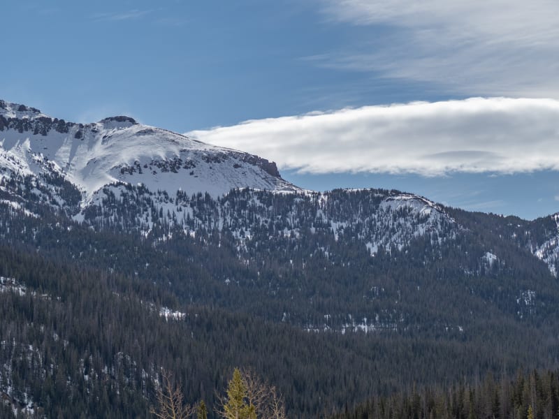
Cameron Pass

Beacon Guidebooks has partnered with onX Backcountry. Find guidebook quality content for backcountry adventures in Cameron Pass. Cameron Pass has 21 zones to explore and 119 routes.

Total Zones
21

Publisher

Beacon Guidebooks

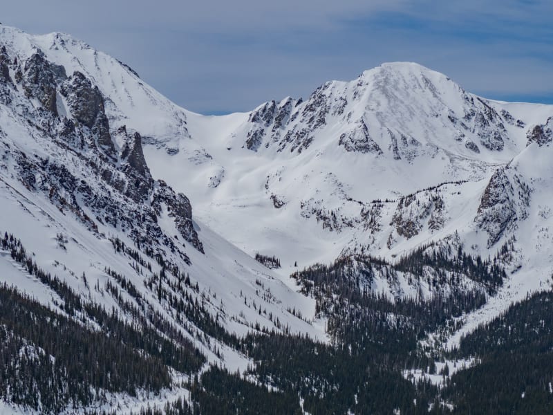
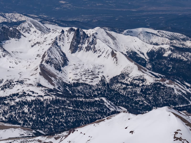
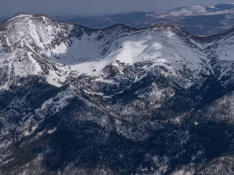
Cameron Pass Overview

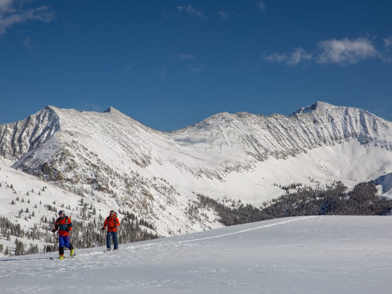
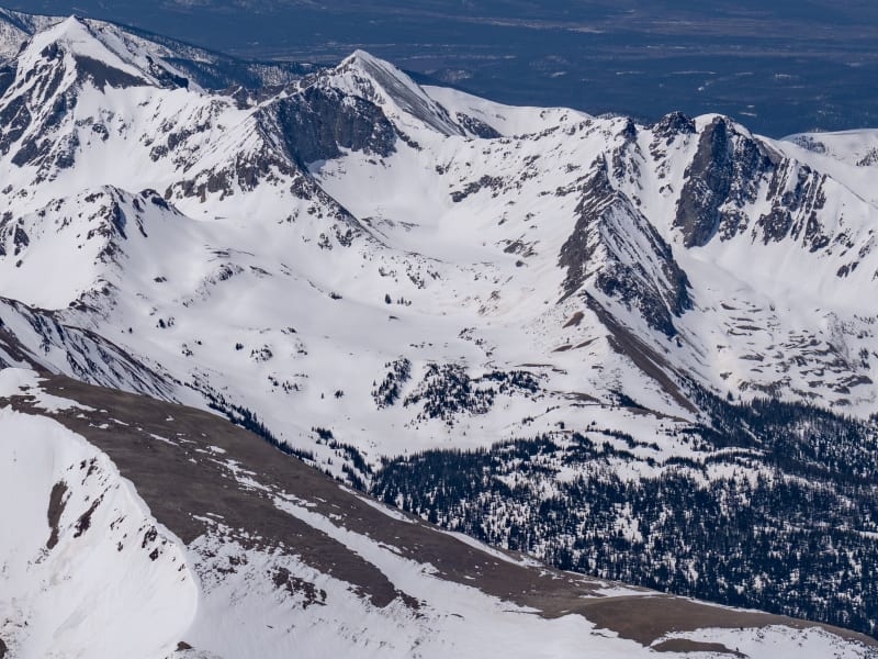
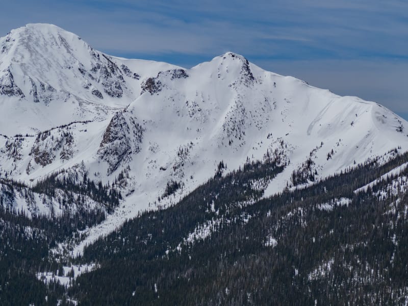
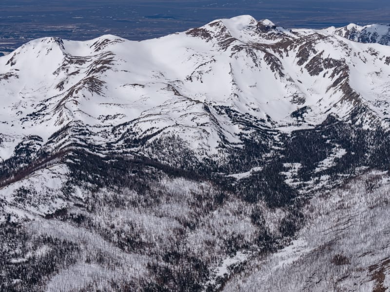
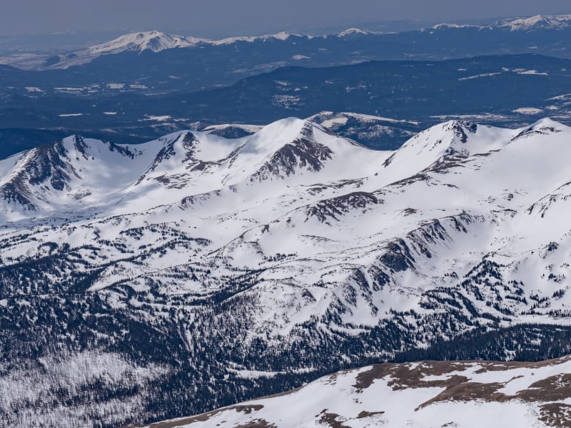
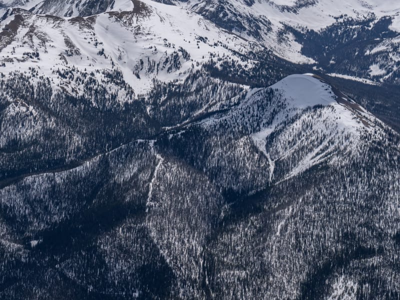
Cameron Pass provides a unique Colorado backcountry skiing experience. Remote and undeveloped, “Cam Pass” also receives a generous amount of snow each winter; good skiing often extends into May. Colorado State Hwy.14, a well-maintained all-weather road over the pass, provides access from east and west. Although Cameron Pass does not cross the Continental Divide, it is the only year-round highway north of Berthoud Pass accessing the western slope. Just 65 miles from Fort Collins and 90 miles from Steamboat Springs, Cameron Pass is a straightforward day trip from many areas in Colorado. During the winter, facilities such as lodging, gas stations, and restaurants are scarce. Cell service on Cameron Pass is spotty to non-existent: only on higher ridges with good line of sight is cell service possible. The Moose Visitor Center, located 9 miles west of Cameron Pass, remains open year-round, providing restrooms and visitor services. At the time of publication, no wifi or cell service exists at this location. Administratively, the area is managed by Arapaho & Roosevelt National Forest east of Cameron Pass and by Colorado Parks and Wildlife (CPW) on the west side of the pass. Parking and access on the west side of the pass require a CPW Parks Permit. Currently, the National Forest does not require a daily use fee for the eastern side.The author and publisher acknowledge that the land described in this atlas is the ancestral home of the Hinono’eiteen (Arapaho) and Núutsi-u (Ute) peoples, who lived on these lands for thousands of years before the arrival of Europeans.

Zones Covered

American Lakes South
Routes
6
ATES Level
2
General Aspect
N
The long approach makes this the best snowmobile-assisted ski option in State Forest State Park. For skiers, the snowmobile trail is the quickest approach into the final sweeping bowl dominated by Thunder Mountain, Lulu Mountain, and Static Peak. Adventurous skiers can drop south from Thunder Pass into Rocky Mountain National Park for a few laps before returning to the snowmobile trail exit. Note: Snowmobiles are not permitted in Rocky Mountain National Park at this location.
Routes
  • Tesla
  • Low Voltage
  • Lulu's Lemons
  • Approach to American Lakes
  • Edison
  • American Lakes South Exit
Braddock Peak East
Routes
5
ATES Level
2
General Aspect
NE,E
Dominating the west side of the Lake Agnes area, this peak is best ascended by its north ridge, accessed by piecing together old logging roads. Under ideal snow conditions, the slopes can be bootpacked to the summit. The premier line is the Z Couloir, which drops from the summit directly to the summer trailhead.
Routes
  • Braddock Face
  • Agnes Glades
  • Approach Braddock Peak NE
  • Z Couloir
  • Braddock Peak East Exit
Braddock West
Routes
5
ATES Level
2
General Aspect
W
The west side of Braddock Peak includes several challenging runs into the drainage east of Seven Utes Mountain. While the upper reaches are often wind-scoured, the trees below hold good snow with gladed tree runs. Three prominent gullies form a large “W” on the forested slope and are known as the Wolf Gullies.
Routes
  • Wolf
  • Fox
  • Approach Braddock Peak NE
  • Coyote
  • Braddock West Exit
Clark Peak
Routes
5
ATES Level
2
General Aspect
N,NE,E
Skiing this area requires a lengthy approach, starting with 2 miles of flat road skiing. For those willing to make the effort, the upper bowls of Clark Peak offer dramatic alpine skiing with few other skiers. The skiing above timberline can be challenging due to wind-affected snow, but once below timberline, snowed-in trees and glades lead toward Fall Creek.
Routes
  • Sacred Trees
  • Cook City
  • Approach to Clark East
  • Alternative Approach Sacred Trees
  • Clark Peak Exit
Enchanted Forest aka Taliban Trees
Routes
5
ATES Level
2
General Aspect
W,NW,N
The Enchanted Forest offers a welcome change from the more crowded Diamond Peaks area. This broad, bowl-shaped basin offers skiing on most aspects for a variety of snow and terrain options. The most traveled aspect is the south side of the bowl, where it tucks up against the imposing cliffs of Iron Mountain.
Routes
  • The Finger
  • Never Summer Drop
  • Taliban Trees
  • Enchanted Forest Approach
  • Enchanted Forest Exit
Hot Dog Bowls
Routes
7
ATES Level
2
General Aspect
N,NE
These bowls occupy a sheltered spot tucked in behind the most northern remnants of the Never Summer Range. The bowls offer modest glade skiing on the east side, gradually, steepening to the west where more challenging and avalanche prone terrain lies. Good tree skiing for the adventurous drops directly off the north end.
Routes
  • Hot Dog East
  • Hot Dog West
  • Hot Dog Approach
  • Hamburger Trees
  • Optional Hot Dog Approach
  • Big Mac
  • Hot Dog Bowls Exit
Iron Mountain West
Routes
4
ATES Level
2
General Aspect
W
In the early 20th century, it was widely believed that Iron Mountain was the remnants of an ancient caldera. While these rocks have been influenced by igneous geologic activity, they are not actual volcanic cliffs.The broad, forested slopes of west Iron Mountain were heavily logged fifty years ago, providing numerous old roads that lead to timberline. The drainages and gullies tend to offer the best snow, but sparsely treed slopes can be skied all the way to the Michigan Ditch.
Routes
  • Lucy's Draw
  • Approach to Iron Mountain West
  • Iron Mountain Glades
  • Iron Mountain West Exit
Kelly Ridge
Routes
6
ATES Level
2
General Aspect
W
Viewed from North Park, Colorado, the rampart of the Medicine Bow Range is impressive and continuous. One inconspicuous feature is the ridge immediately west of Kelly Lake. Topping out at over 11,660’, this ridge stretches 2 miles with multiple descents to the scattered forests below. The approach is a steep, lengthy skintrack, which explains the relatively few tracks seen on the face. The eastern side of Kelly Ridge has not been explored in the winter, but would yield dramatic (if short) ski runs into the Kelly Lake basin. An ideal basecamp to explore this area is the North Fork Canadian Yurt, operated by Never Summer Nordic.
Routes
  • Big Elk
  • Top Down
  • Magic Line
  • Alternate Approach Kelly Ridge
  • Direct Approach
  • Kelly Ridge Exit
Lake Agnes
Routes
5
ATES Level
3
General Aspect
N,NE
Lake Agnes was named for the youngest daughter of John Zimmerman, an early European immigrant to the area. According to Ansel Watrous’ 1910 book A History of Larimer County, this lake was believed to be the crater of a recently dormant volcano. The lengthy approach limits the winter use of the beautiful cirque above Lake Agnes. Flanked by the Nokhu Crags, Static Peak, Mount Richthofen, Mount Mahler, and Braddock Peak, the view is a remarkable sight. When the summer road opens in late June, these mountains offer great spring skiing.
Routes
  • Lake Agnes Exit
  • X Couloirs
  • Y Couloirs
  • Fourth of July Bowl
  • Approach Lake Agnes Bowl
Montgomery Pass - Bowls
Routes
8
ATES Level
2
General Aspect
NE,E
The most popular, easy-to-access sector on Cameron Pass is the Montgomery Bowls area, not to be confused with Montgomery Pass itself. The Montgomery Bowls feature trees that reach to the ridgeline and collect plentiful snow in low-risk avalanche terrain. For more serious descents and steeper runs, move south along the ridgeline.
Routes
  • Cookie Cutter Chutes
  • Montgomery Bowl Right
  • Mr. Big
  • Montgomery Bowl Approach
  • East Face of Point
  • Explorer's Glades
  • Montgomery Bowl Left
  • Montgomery Pass - Bowls Exit
Montgomery Pass - North
Routes
7
ATES Level
2
General Aspect
N,NE,E,SE,S
Often used as an alternative to the more crowded ski/ride scene of the Montgomery Bowls, this sector offers many descents from the ridgeline down easterly aspects. Immediately east of the ridgeline sits the high point locally known as The Pimple (10,990’), which offers tree glades off the north side.
Routes
  • Scar Face
  • Drop Zone
  • Radio Tower
  • Maxwell House Trees
  • Montgomery North Approach
  • Jules
  • Montgomery Pass - North Exit
Nokhu Crags North
Routes
4
ATES Level
3
General Aspect
N
Next to South Diamond, this area is the most impressive face of Cameron Pass when viewed from the highway. The west side is thoroughly scoured by wind and rarely holds sufficient snow to interest skiers. But the north-facing side reveals steep chutes that offer long, continuous ski runs.
Routes
  • Shanty Run
  • Approach to Paradise Bowl Crags East
  • The Longest Run
  • Nokhu Crags North Exit
North Diamond Peak
Routes
5
ATES Level
2
General Aspect
E
The North Diamond Peak sector sees less ski traffic than the nearby areas, even though the snow and terrain are arguably as good. Descent from the summit of North Diamond places the skier into steep trees, which can be skied down to Hwy. 14. Alternatively, by holding a high traverse, it’s possible to return to the South Diamond exit routes.
Routes
  • North Diamond Approach
  • North Diamond Trees
  • Whiskey River
  • The Weasel
  • North Diamond Peak Exit
Paradise Bowl
Routes
8
ATES Level
3
General Aspect
N,NE,E
The Nokhu Crags were locally called Sawtooth Crags until the 1920s. The current name is believed to derive from the Arapaho word for “Eagles Nest.” The name Nokhu Crags appears on maps from 1900. The east side of the Nokhu Crags offers exciting and accessible backcountry runs for skiers and riders. The eastern cirque towers over 1,000 feet; be cautious of the loose rock. At least one fatality has occurred scrambling on the upper towers. The most impressive features are the steep couloirs concentrated in the NE headwall of the Nokhu Crags. Less committing bowls, glades, and trees can be found on other aspects.
Routes
  • Short Boi
  • Grand Central Couloir
  • Breakfast Couloir
  • Nokhouloir
  • Approach to Paradise Bowl Crags East
  • Three Sisters
  • Nokhu Glades
  • Paradise Bowl Exit
Ruby Jewel Cirque
Routes
7
ATES Level
2
General Aspect
ALL
After the installation of Ruby Jewel Yurt in 1985, this area received significant attention from early backcountry skiers (mostly old-school Telemarkers on 3-pin bindings). Three separate drainages can be accessed via the summer jeep road; the area has moderate tree skiing and several couloirs and slopes located at and above timberline.
Routes
  • Little Japan
  • Ghost Trees
  • Jewel Lake Glades
  • Approach to Ruby Jewel - Margy's Knoll
  • Lynx Couloirs
  • Margy's Knoll
  • Ruby Jewel Cirque Exit
Sawmill Creek
Routes
5
ATES Level
3
General Aspect
NE,E
The Sawmill Creek drainage offers a rugged backcountry experience despite a relatively easy approach. At the end of the drainage, the five craggy points, locally known as the Bird Peaks, are all above 12,000’. The lower half of this area was clear-cut in the 1960s; remnants of logging roads abound in this area. Higher up, the drainage enters the Rawah Wilderness—and a more pristine forest.
Routes
  • Sawmill Approach
  • Wild Blue
  • Dave's Way
  • The Bird
  • Sawmill Creek Exit
Seven Utes - East
Routes
7
ATES Level
3
General Aspect
N,NE,E
Most of this sector is hidden from view from the highway, but quickly offers up challenging terrain when entered on the east side. Near the end of the drainage, an impressive headwall of steep chutes and tree glades awaits. This approach allows for the shortest route to summit Seven Utes Mountain via the east ridge. Seven Utes Mountain was named by a group of Arapaho who, in 1914, visited the area to record the original Indigenous names in the Cameron Pass area. Their history relates that seven Utes were killed here in an encounter with members of the Arapaho nation. (See Oliver W. Toll’s Arapaho Names and Trails, published in 1962.)
Routes
  • Northeast Glades
  • Headwall Glades
  • Central Gully
  • Mahler Glades
  • Approach Seven Utes West
  • Seven Utes Chutes
  • Seven Utes- East Exit
Seven Utes - West
Routes
5
ATES Level
3
General Aspect
N
Several proposed ski areas on this aspect attest to the steep, snowy terrain Seven Utes Mountain offers. While the ski area proposals are long gone, the north face offers a variety of steep slopes, couloirs, and tree skiing. Most of this face is visible from Hwy. 14.
Routes
  • Arrow Chutes
  • Northwest Ridge
  • North Face
  • Seven Utes West Approach
  • Seven Utes - West Exit
Snow Lake Ridge
Routes
4
ATES Level
3
General Aspect
S
The long approach makes this the best snowmobile-assisted ski option in State Forest State Park. For skiers, the snowmobile trail is the quickest approach into the final sweeping bowl dominated by Thunder Mountain, Lulu Mountain, and Static Peak.
Routes
  • Snow White
  • Approach to American Lakes
  • Seven Dwarfs Area
  • Snow Lake Ridge Exit
South Diamond Peak
Routes
9
ATES Level
2
General Aspect
NE
South Diamond Peak is the towering symbol of backcountry skiing and riding at Cameron Pass. The entire east face dominates the highway view for the last mile when approaching from Fort Collins. This area attracts significant attention for the quick access and dramatic runs.
Routes
  • Main Face
  • Alternate Approach South Diamond
  • Ptarmigan Face
  • The Wave
  • Taster's Choice
  • Approach to South Diamond Peak
  • The Gash
  • Pabst
  • Exit Line from South Diamond
Zimmerman Lake
Routes
5
ATES Level
1
General Aspect
N
Zimmerman Lake is a popular destination for cross-country skiing and snowshoeing. But beyond the lake are numerous low-angle backcountry ski options for those willing to approach the north side of Iron Mountain. This windswept sector offers several slopes, gullies, and high mountain traverses.
Routes
  • Ally
  • Pinnacle Face
  • Zipper Trees
  • Approach to Zimmerman Lake
  • Zimmerman Lake Exit