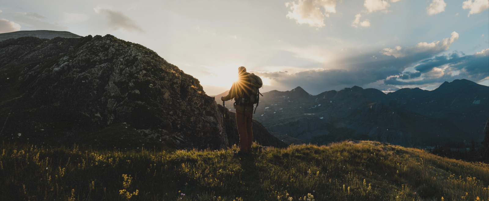

Better Maps For The Backcountry
 Download Your Map for Offline Use
 Create and Share Custom Routes and Waypoints
 Pinpoint-Accurate Weather
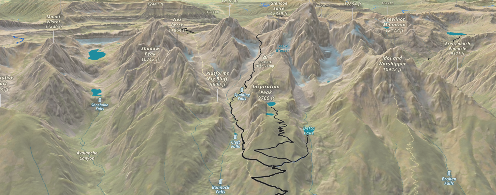
 Discover New Trails and Routes
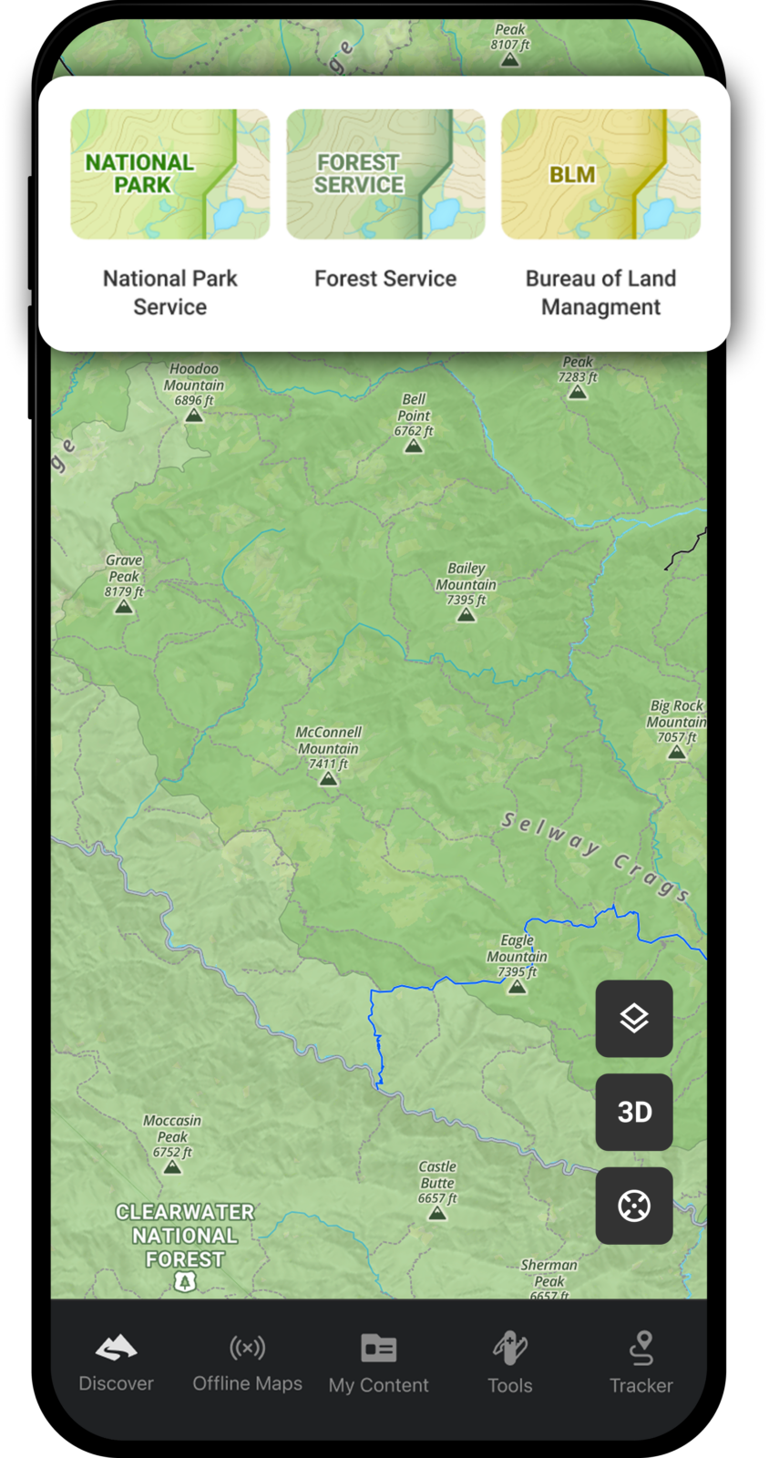
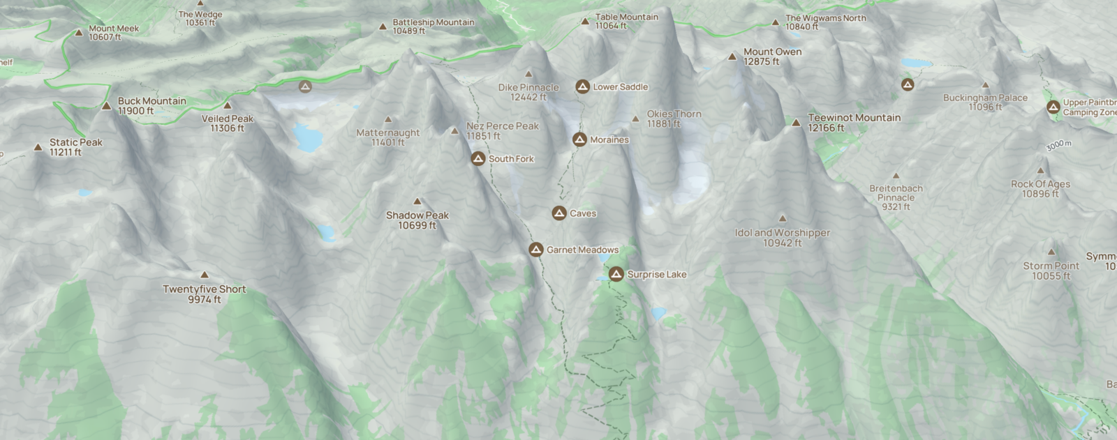
![]() The Most Accurate Government Lands Data
The Most Accurate Government Lands Data
 Active and Historic Wildfire Layers
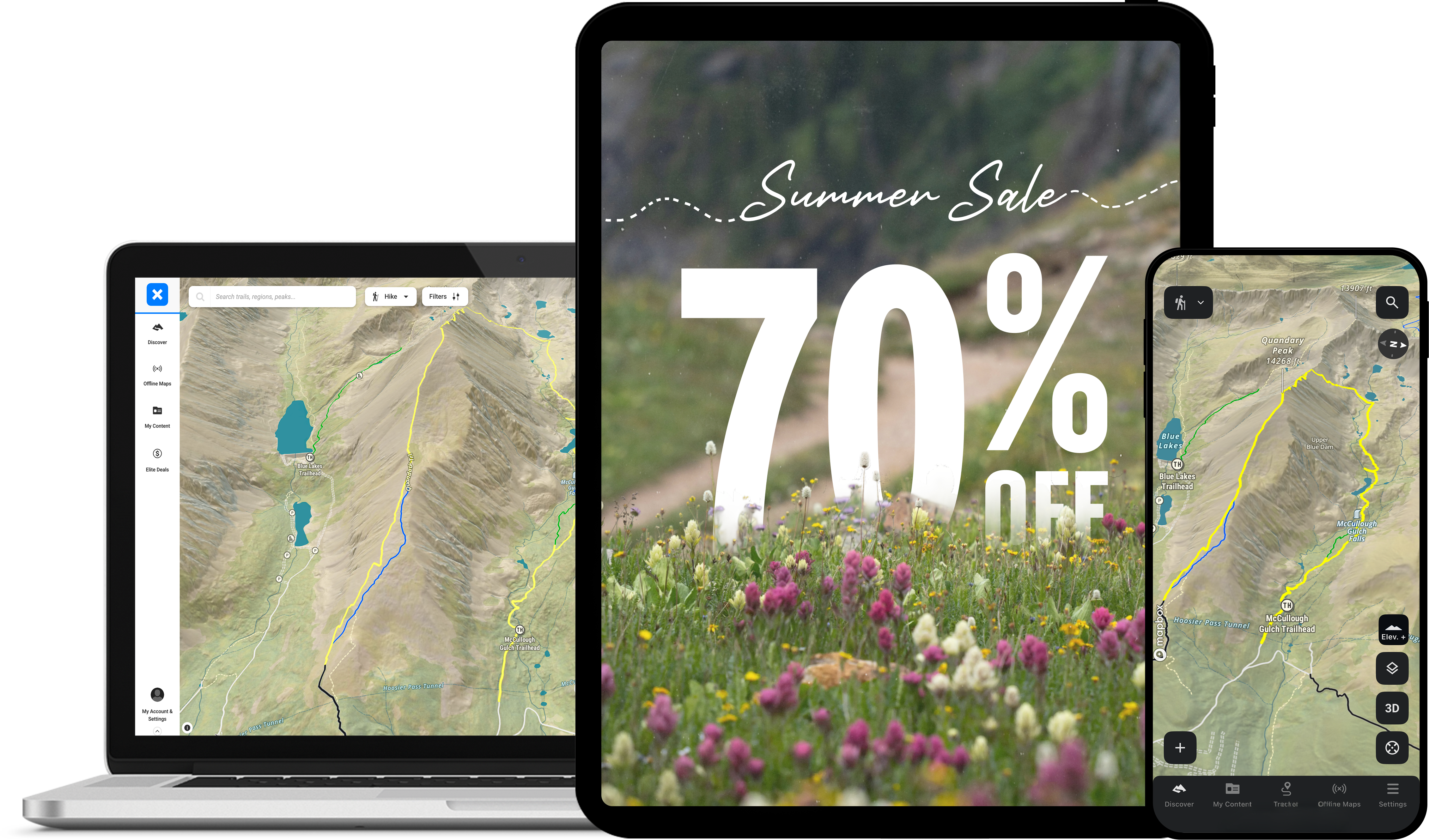
Better Days Start With A Better Map.
Get the most detailed, dynamic, and reliable outdoor maps 70% off for a limited time.
Go Even Further with Elite
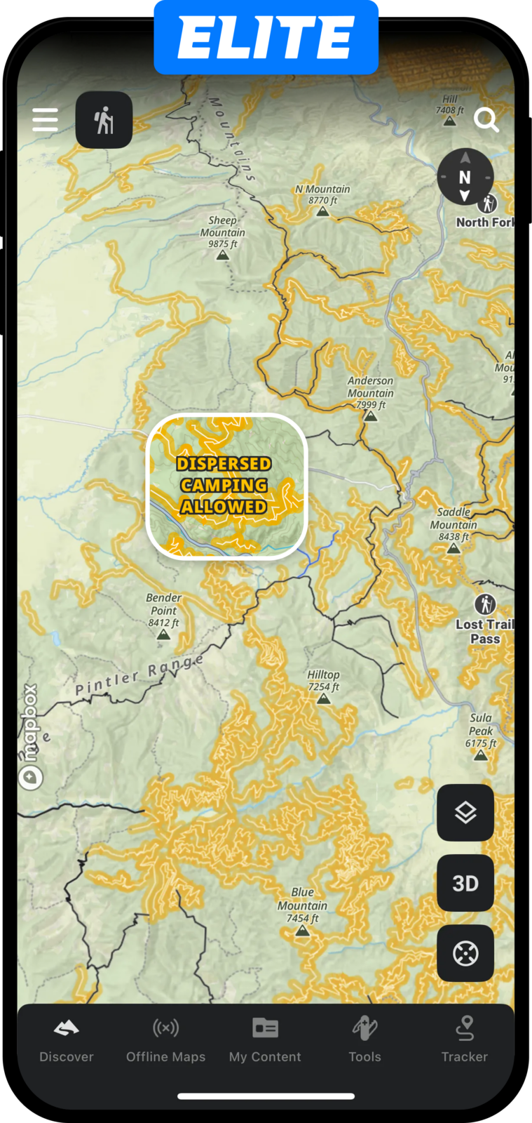
 Dispersed Car Camping Layer
 Recent Satellite Imagery
![]() Land Ownership and Access
Land Ownership and Access
More Detail. More Confidence. More Time Outside.
See how our hiking trail maps compare to top competitors.
With
Without

Compare Memberships
Learn more about what’s included with Free, Premium, and Elite.
| Basic | Premium | Elite | |
|---|---|---|---|
| Dispersed Camping Maps | |||
| Private Land Boundaries and Landowner Names | |||
| Recent Satellite Imagery | |||
| Elite Partner Discounts | |||
| Avalanche Terrain Exposure Scale (ATES) | |||
| Avalanche Simulator and Potential Release Areas | |||
| Offline Access to 3D Maps, Layers, Waypoints, Tracking | |||
| Custom Route Building | |||
| Local Expert-Curated Guidebooks | |||
| Precise SNOTEL Weather Station Data | |||
| Conditions Layers (Slope Angle, Slope Aspect, and Active Wildfires and more…) | |||
| Public Land Boundaries and Designations | |||
| Thousands of Hike, Mountain Bike, and Ski Tour Routes | |||
| Detailed Climbing Area Information | |||
| Recreation Points (campgrounds, boat launches, etc.) | |||
| Topographic, Satellite and, Hybrid Map Layers | |||
| Avalanche Forecasts, Historic Fatalities & Observations | |||
| Pinpoint Weather Forecasts |
What are you waiting for?
If you’ve been putting off locking in your summer adventures, this is your sign. This is the last chance to unlock the full onX Backcountry experience at 70% off an annual subscription.
What Members Are Saying
Nailed It
Great app for backcountry adventures with no service. Being able to download detailed 3D maps offline is great. I use this app multiple times a week for ski touring, mountain biking, and hiking.
Great app for backcountry adventures with no service. Being able to download detailed 3D maps offline is great. I use this app multiple times a week for ski touring, mountain biking, and hiking.
If You Hike/Backpack…You Need This App
Incredible app. Provides the best information you’ll need whether taking a small hike on a local trail, to a multi-day backpacking adventure. You can feel safe that you’ll be provided the best of the best information…
Read more
Incredible app. Provides the best information you’ll need whether taking a small hike on a local trail, to a multi-day backpacking adventure. You can feel safe that you’ll be provided the best of the best information when you use the app
Simply the best
I’ve tried virtually every single GPS app and this is hands down the best one! Planning, navigating, and researching an adventure must be precise! That’s exactly what OnX brings to the table!
I’ve tried virtually every single GPS app and this is hands down the best one! Planning, navigating, and researching an adventure must be precise! That’s exactly what OnX brings to the table!