B75
Total Miles
0.6
Technical Rating
Best Time
Fall, Spring, Summer, Winter
Trail Type
High-Clearance 4x4 Trail
Accessible By
Trail Overview
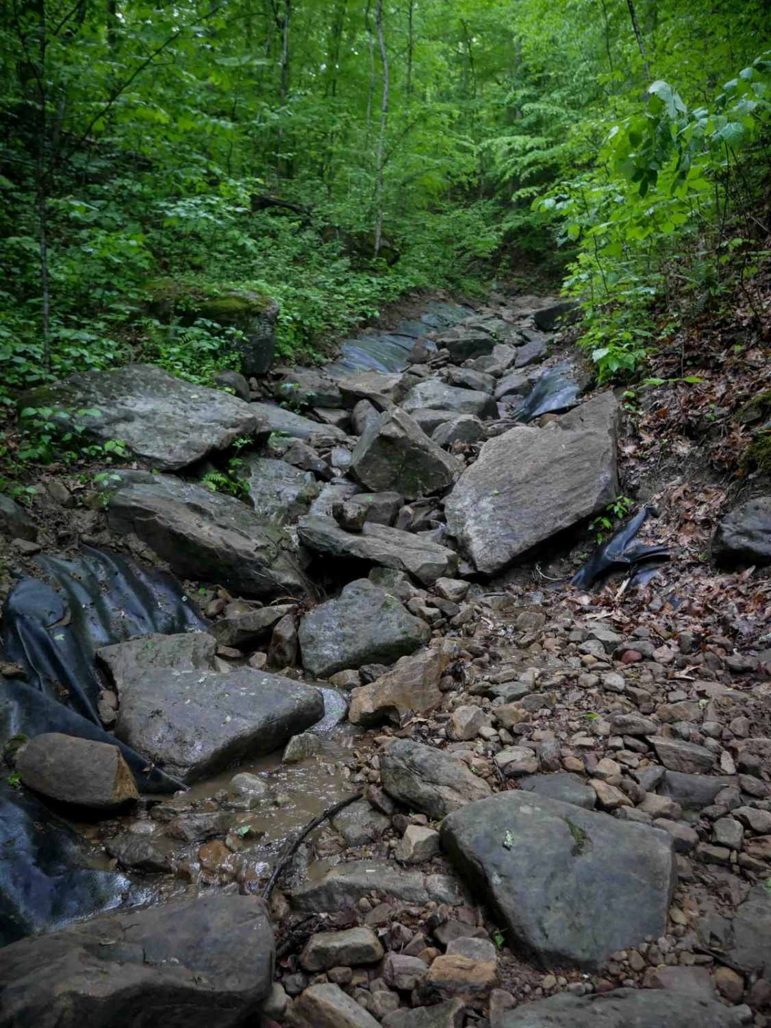
This 0.7-mile advanced trail drops immediately into a rocky ravine and stays technical the entire way. From the north end, drivers will encounter a very steep descent over giant loose rock, deep ruts, and scattered downed logs. The trail is tight and narrow, lined closely by trees--including some growing directly in the ravine--with visible scrapes where vehicles have brushed past. Large boulders and big drop-offs appear throughout, with slick surfaces adding to the challenge. The terrain resembles a long, uneven trough filled with huge loose and embedded rock, and the obstacles don't let up. This is one of the longer and steeper advanced routes in the area and will take time, patience, and skill to complete.
Photos of B75

Difficulty
This is a more advanced trail in a really steep rocky ravine, with rock obstacles. This is considered Extreme by Hatfield McCoy's rating system.
Status Reports
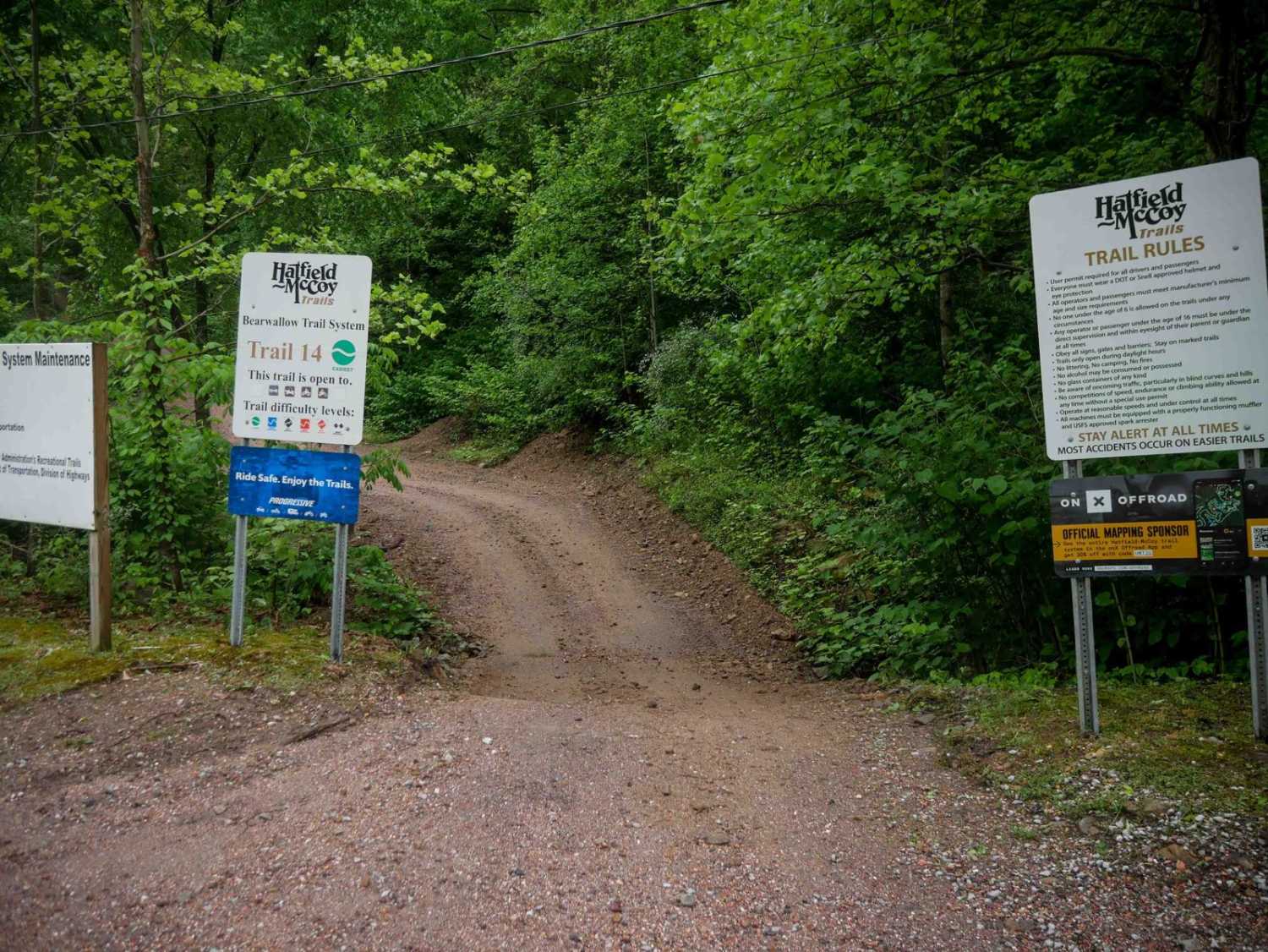
B75 can be accessed by the following ride types:
- High-Clearance 4x4
- SxS (60")
- ATV (50")
- Dirt Bike
B75 Map
Popular Trails


The onX Offroad Difference
onX Offroad combines trail photos, descriptions, difficulty ratings, width restrictions, seasonality, and more in a user-friendly interface. Available on all devices, with offline access and full compatibility with CarPlay and Android Auto. Discover what you’re missing today!