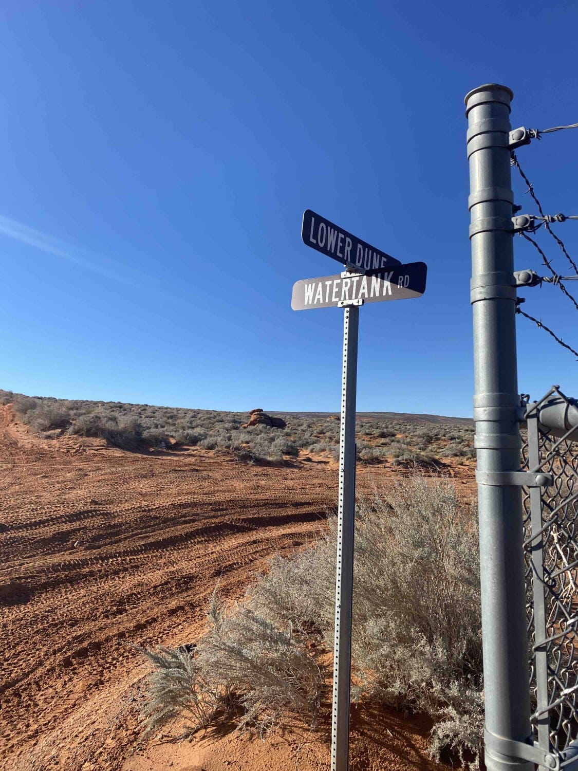
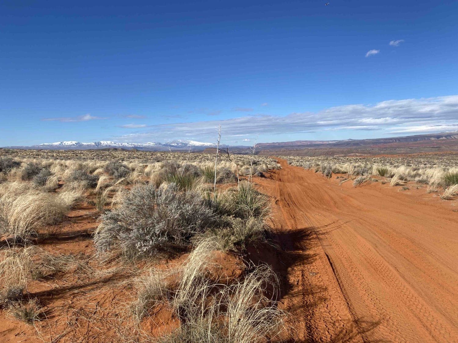
Lower Dunes Road
Total Miles
1.2
Technical Rating
Best Time
Spring, Summer, Fall, Winter
Trail Type
Full-Width Road
Accessible By
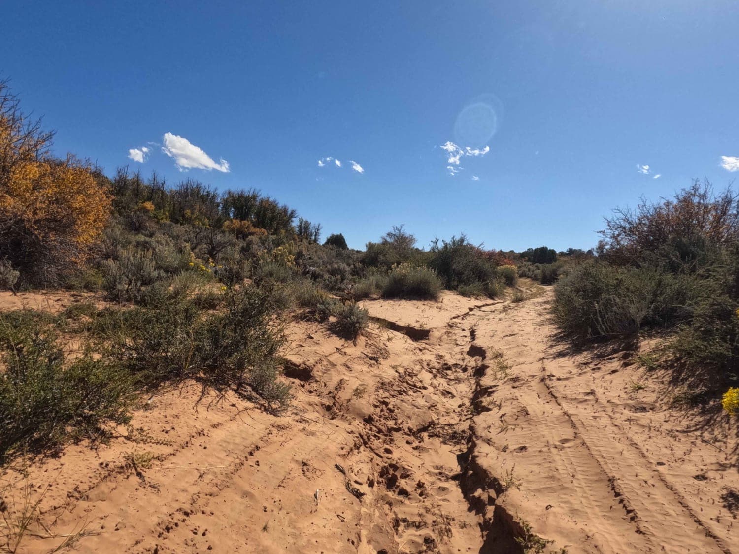
Trail Overview
Lower Dunes Road is a connector trail between Water Tank Road and West Frontage Road along the Lower Dunes Road. You can access John's Trail, Sliplock Gultch, and Dixie Springs Cutoff. The surface is primarily soft sand, and there are opportunities for views of Sand Hollow Reservoirs and red rock formations. This road is less traveled than the West Frontage Road, making it a good route for crossing the Sand Mountain Riding Area when moving East or West.
Photos of Lower Dunes Road
Difficulty
The sand can be very soft in hotter parts of the year.
Status Reports
Lower Dunes Road can be accessed by the following ride types:
- High-Clearance 4x4
- SUV
- SxS (60")
- ATV (50")
- Dirt Bike
Lower Dunes Road Map
Popular Trails
Silver Meadows - FS 70174
35158 - Pleasant Cr Trail
Fin Little Wash
Left Hand Fork Trail
The onX Offroad Difference
onX Offroad combines trail photos, descriptions, difficulty ratings, width restrictions, seasonality, and more in a user-friendly interface. Available on all devices, with offline access and full compatibility with CarPlay and Android Auto. Discover what you’re missing today!