Trail Overview
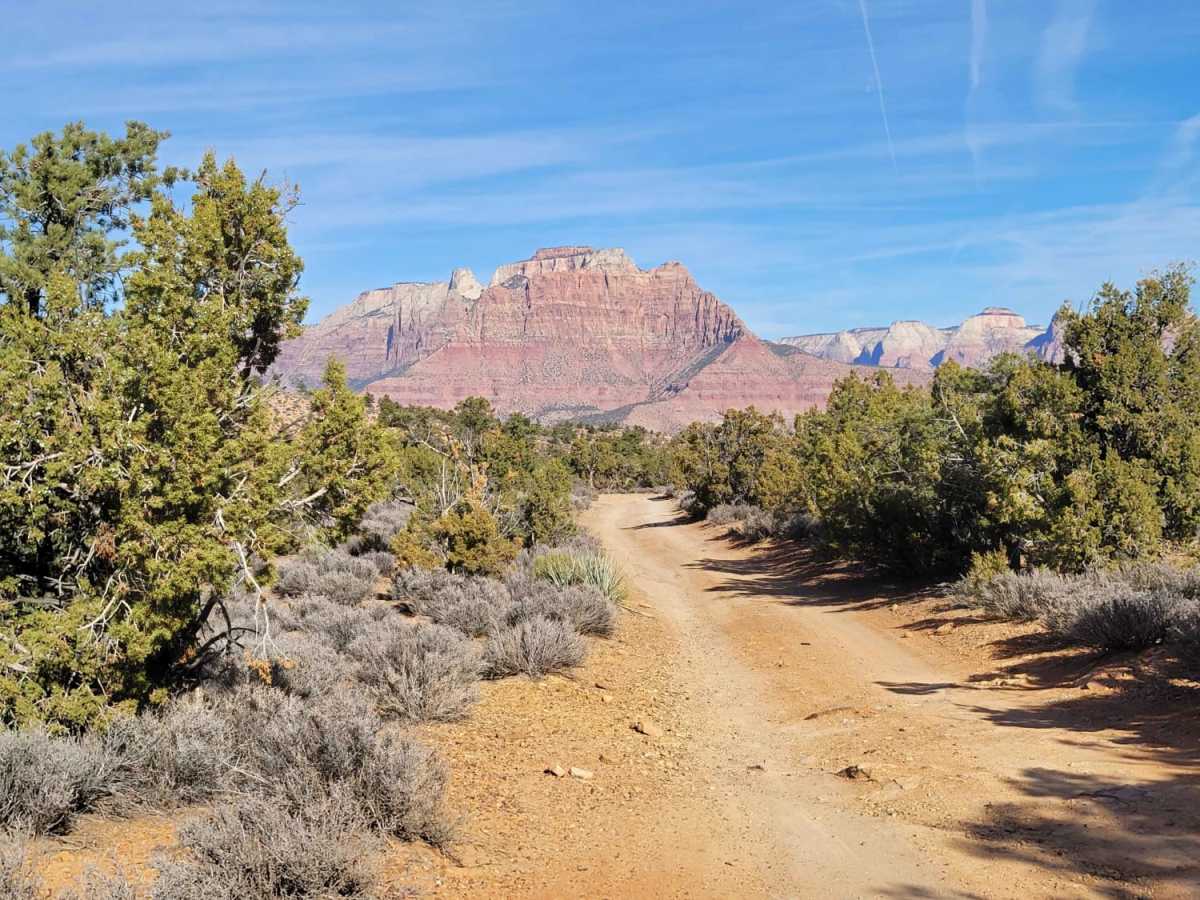
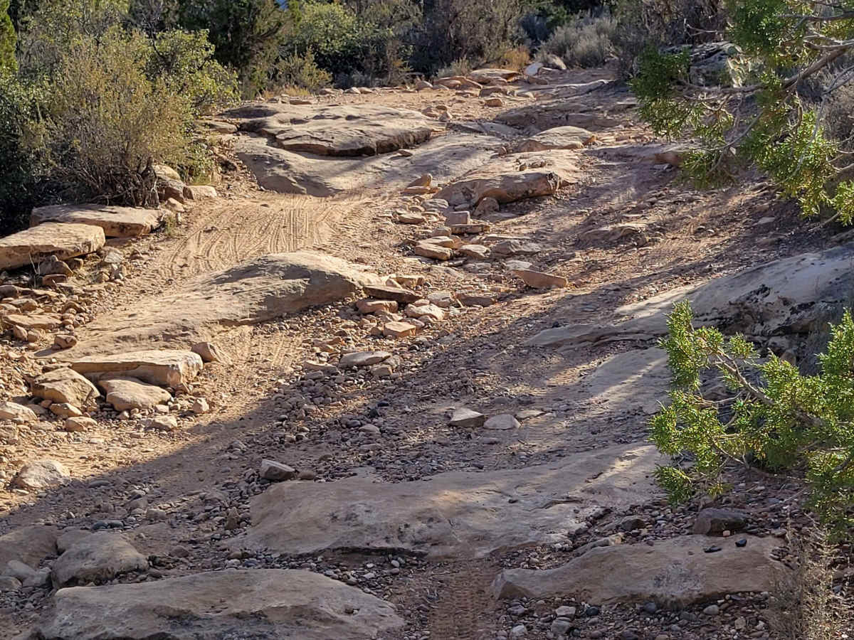
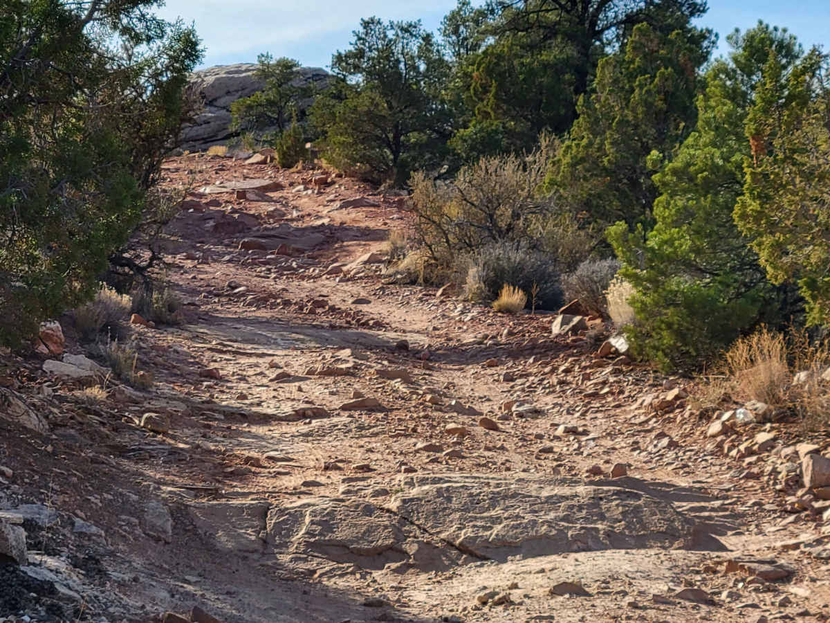
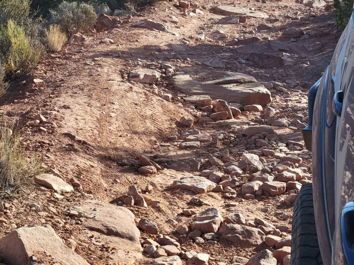
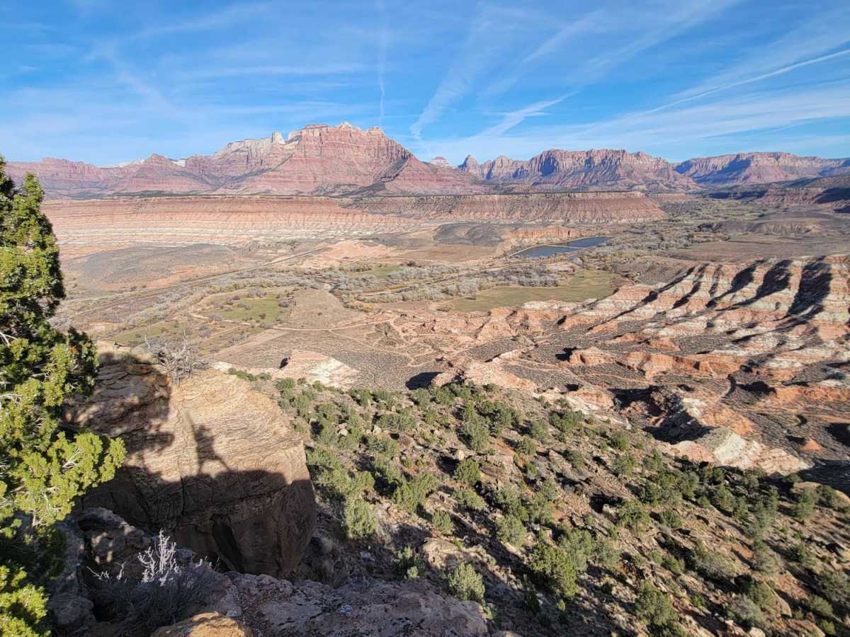
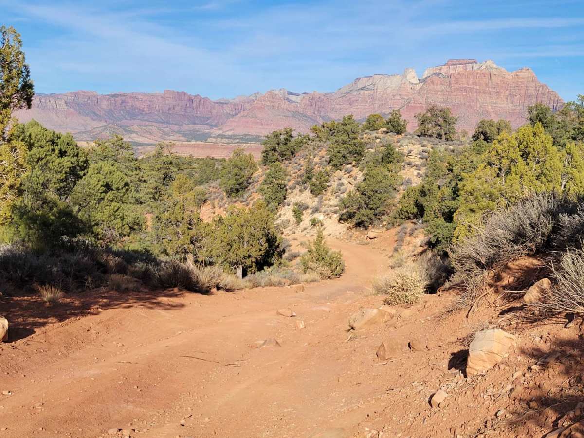
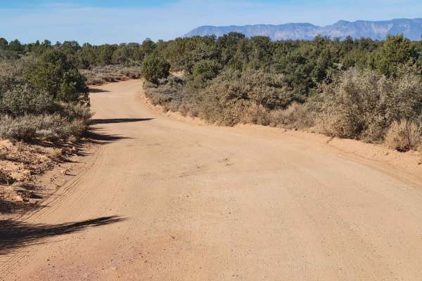
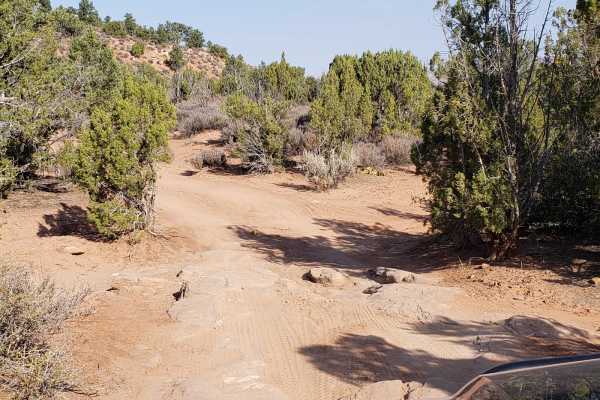
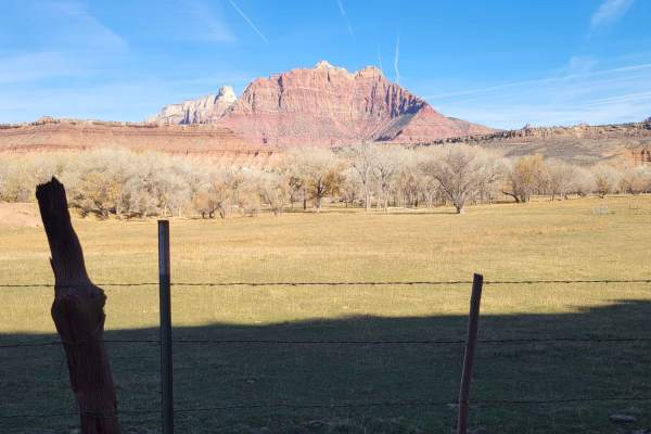
This trail is definitely one of the more challenging ones in the area, especially for vehicles. At the entrance is the Grafton Mesa trailhead. Mountain bikers and hikers use this trail as well. For vehicles, it's a narrow, out-and-back trail. The first mile or so is easy with a few primitive camp spots tucked in the trees. Beyond that, it becomes much more technical, with several steep grades and large rocky ledges to navigate. High clearance and 4WD are required. The trail dead-ends at the plateau's edge, with stunning overlooks of the Southside of Zions National Park canyon. Summer months will reach triple-digit temperatures - plan accordingly with plenty of water.
History
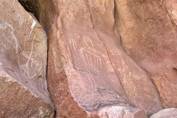
Grafton Mesa is an old hunting area for the original inhabitants of the town of Grafton and the various Indian tribes that lived in the area. This is an area rich in history from the original Mormon settlers that came down from Salt Lake City to expand their footprint and to establish the Cotton Mission for the church. Their tales of hardship and sacrifice in settling the area are exceptionally interesting. As you progress toward the end of the mesa there are multiple opportunities to stop and enjoy the views of the back of Zion National Park and the Virgin River Valley. Don't miss going back and taking a tour of the old town of Grafton which has its own history of the attempts to grow cotton in the area as well as a rich movie history including the first talking motion picture (The Cisco Kid) and the infamous Butch Cassidy and the Sundance Kid.Graon Talking PointsIn 1849 Elder Parley P. Prat led the first Mormons into southwestern Utah, describing it as "a country...turned inside out, upside down, by terrible convulsions in some former age." Of the 25/26 communies later establish by Elder Prat 23 of them are sll inhabited.In 1851, Brigham Young established the Iron Mission to the north near Cedar City and the Coton mission in 1859 near the Virgin River. These missions were to produce materials in short supply needed by the growing LDS communies. It was believed that the numerous gorges and other nearby features could be used as protecon from raiding Indian pares as just a few men would be able to hold off much larger atacking pares.1859 five families were led up river from Virgin to inhabit a new area called Graon. The idea was to build families and community.In 1861, as the Civil War began, the vision of Brigham Young started to bear fruit. In fact, the over zealous farmers planted so much coton that they forgot to plant enough food to sustain them during the winter. This was corrected the following year.The problem with the flat sites needed to irrigate and grow coton along the Virgin River was they were also suscepble to the numerous floods that occurred. The irrigaon dams were destroyed 2-3 me per year. In addion, the canals used to transport the water needed constant maintenance as they filled with the sandy sediment being carried by the river.The severe thunderstorms and heavy spring runoffs sent huge amounts of water down the Virgin River. In January 1862 these floods totally destroyed Graon. The town was moved approximately one mile up river and rebuilt at the current site.In 1886 the started hauling mber from the Mount Trumbull area and that with nearby clay was used to build and cover the buildings such as the school/church. The new Graon was self-sufficient as setlers harvested cherries, peaches, grapes, apples, pears, and grain. The economy was growing. There was also a growing catle industry in the area. Conflicts started to arise more frequently between the setlers and indigenous tribes.Along with the flooding issues the setlers were compeng with the indigenous people who also occupied these ferle fields for their crops and catle. This resulted in the Graon community being abandoned twice for mulple years when the tensions between the two groups would boil over. There are many reports of both local Indians, as well as Navajo from the south, killing setlers in the area. In 1866 the area had to be abandoned.To increase the available land for farming a large canal was constructed into the Hurricane area. Local Graon pioneers helped with the construcon of that canal. This spelled the demise of Graon as the safety issues of floods and Indians pushed them to larger communies for safety. Graon slowly became a ghost town.Hollywood resurrected Graon as a backdrop to numerous films. In 1929 the first talking movie filmed outdoors was filmed. In Old Arizona, stared Warner Baxter as the Cisco Kid got an Academy Awards. Other films including Butch Cassidy and the Sundance Kid were also shot here. Paul Newman rode a bicycle along the streets with Katherine Ross on the handle bars. Nowadays, when we talk about leaving coins on graves, we are most likely referring to the graves of soldiers. While this is an ancient tradition, it adapted to new needs and practices. If you have a loved one who was buried at Arlington National Cemetery, you've likely seen these piles of shiny coins yourself. So what do they mean? Different meanings behind this military practice floated around social media platforms for years. However, they're all connected by a similar practice of respecting those who served in the armed forces. When you see a coin on the grave of a serviceman or woman, this is a sign that another member of the military paid their respects recently. According to tradition, there is a meaning behind each type of coin. Here is a simple breakdown: Penny--A penny at the gravesite means you visited. You have no formal relationship with the deceased, but you honor their service and their family.Nickel--A nickel is left if you and the deceased person trained at boot camp together. Dime--In the case of a dime, you served with the deceased person in some capacity. Quarter--Finally, a quarter indicates you were with the deceased when he or she died. This language of coins is a way for active servicemen and women to communicate with the families of those who served. Since they might not have the opportunity to speak in person, this is a way to pay respects without overstepping boundaries.