Bullion Falls Access
Total Miles
0.8
Technical Rating
Best Time
Spring, Summer, Fall
Trail Type
High-Clearance 4x4 Trail
Accessible By
Trail Overview
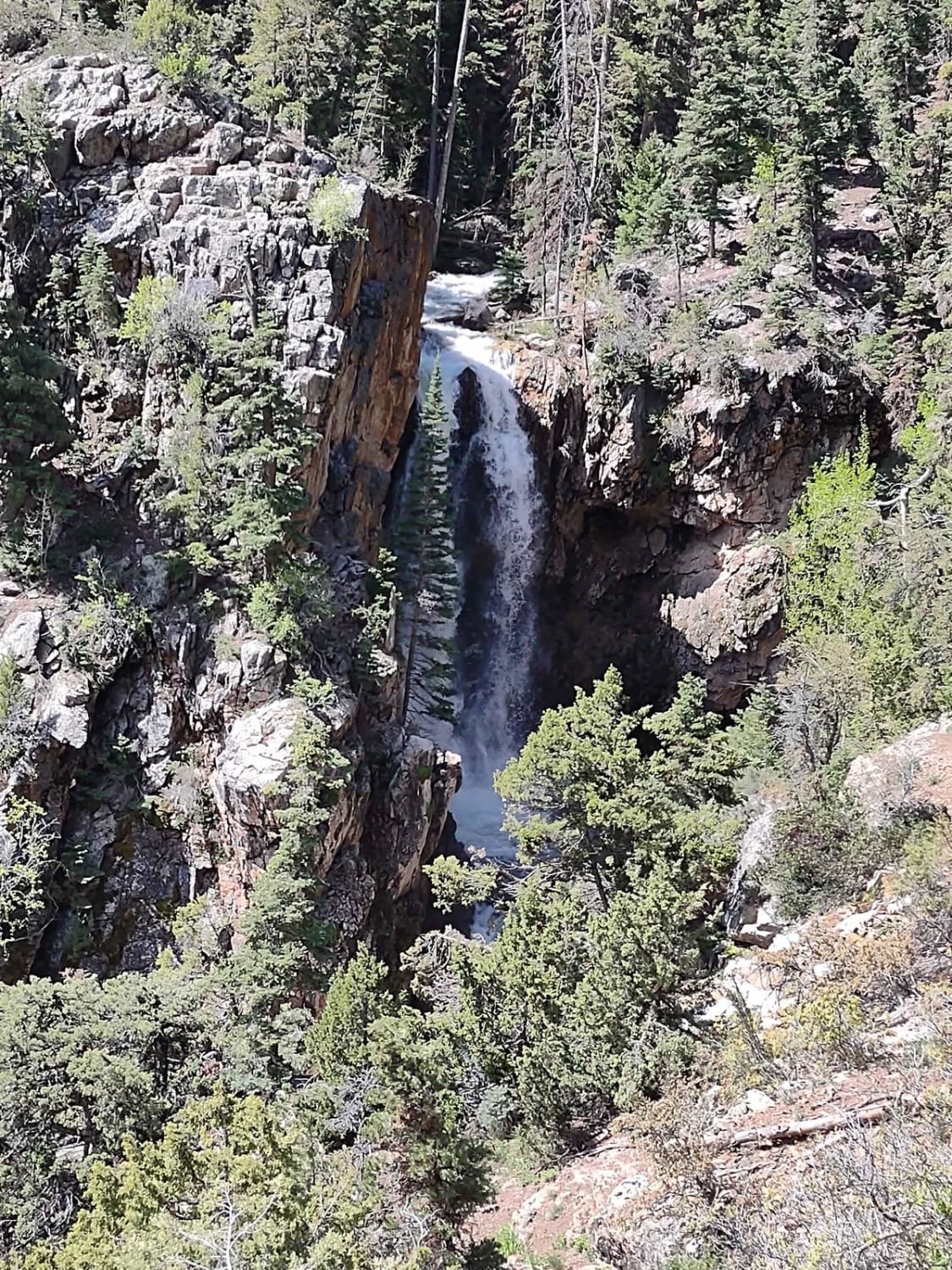
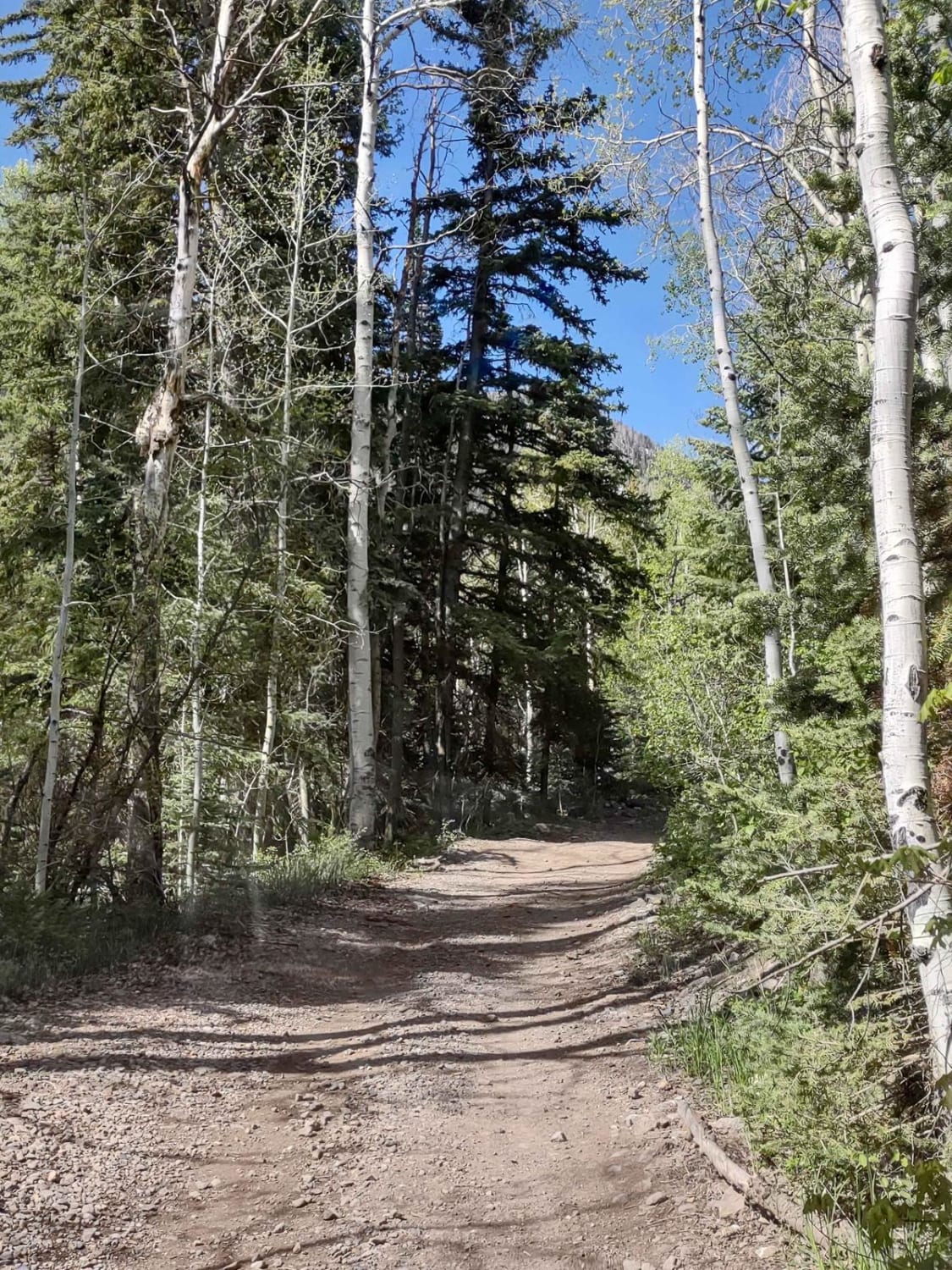
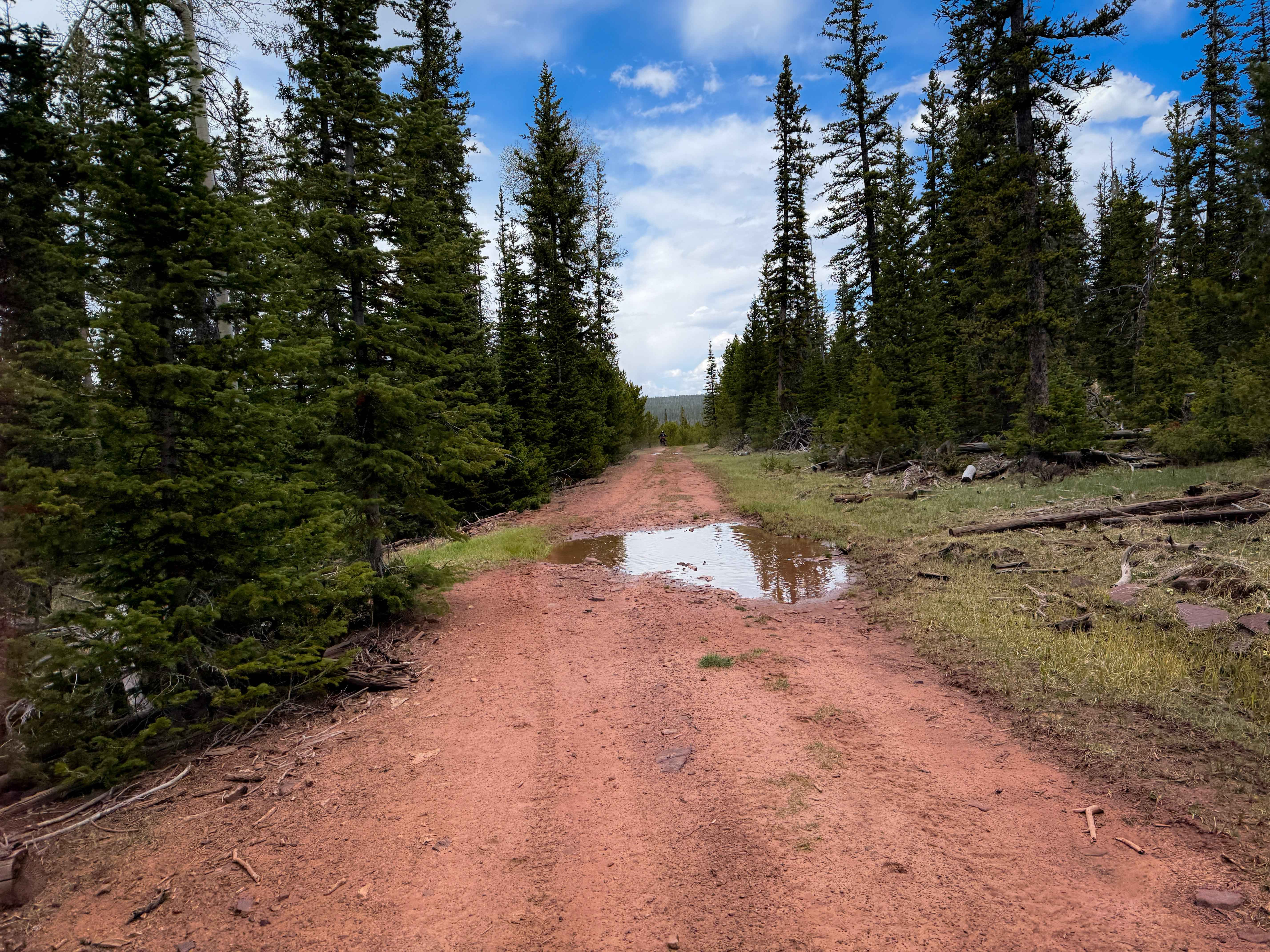
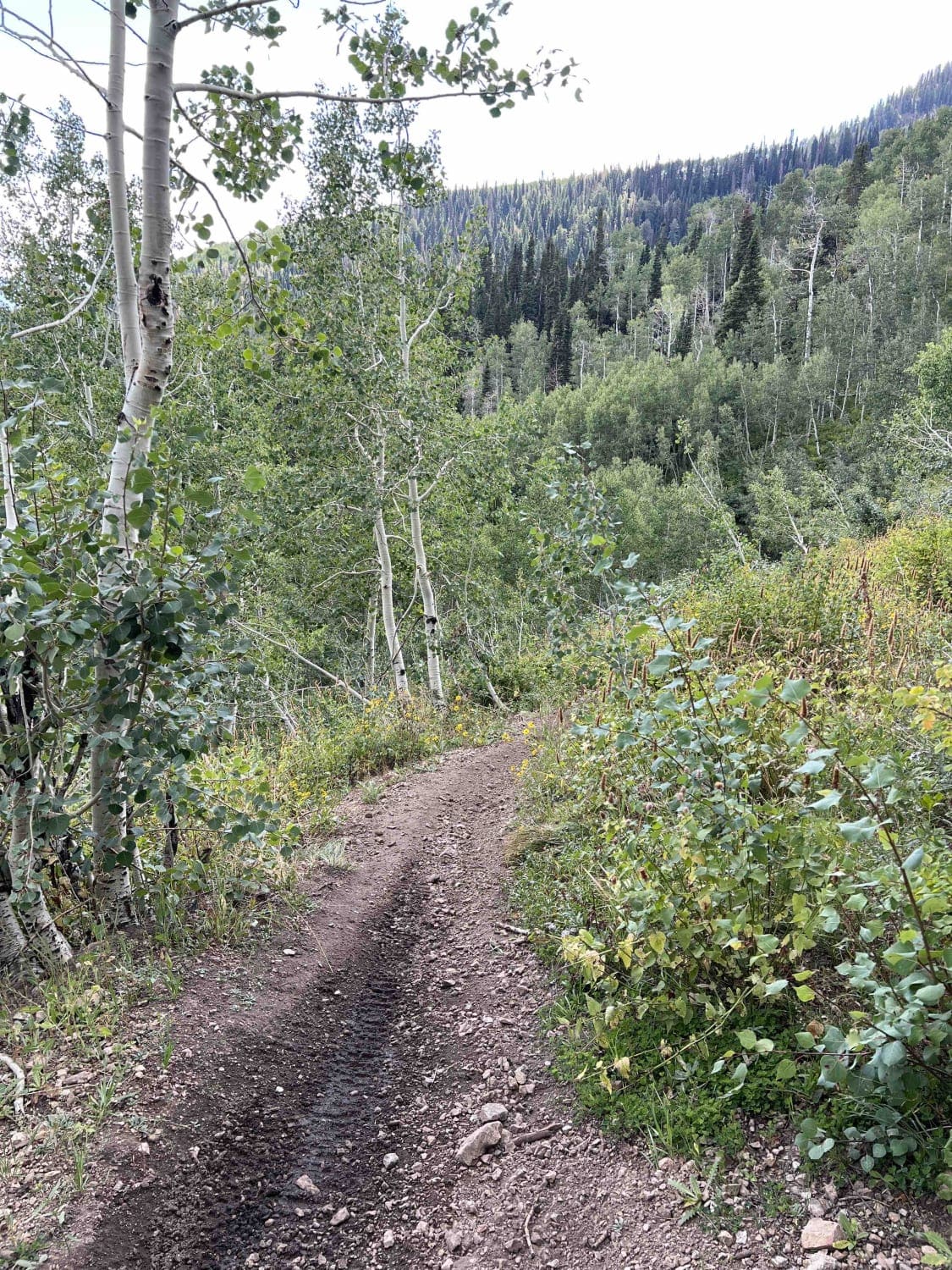
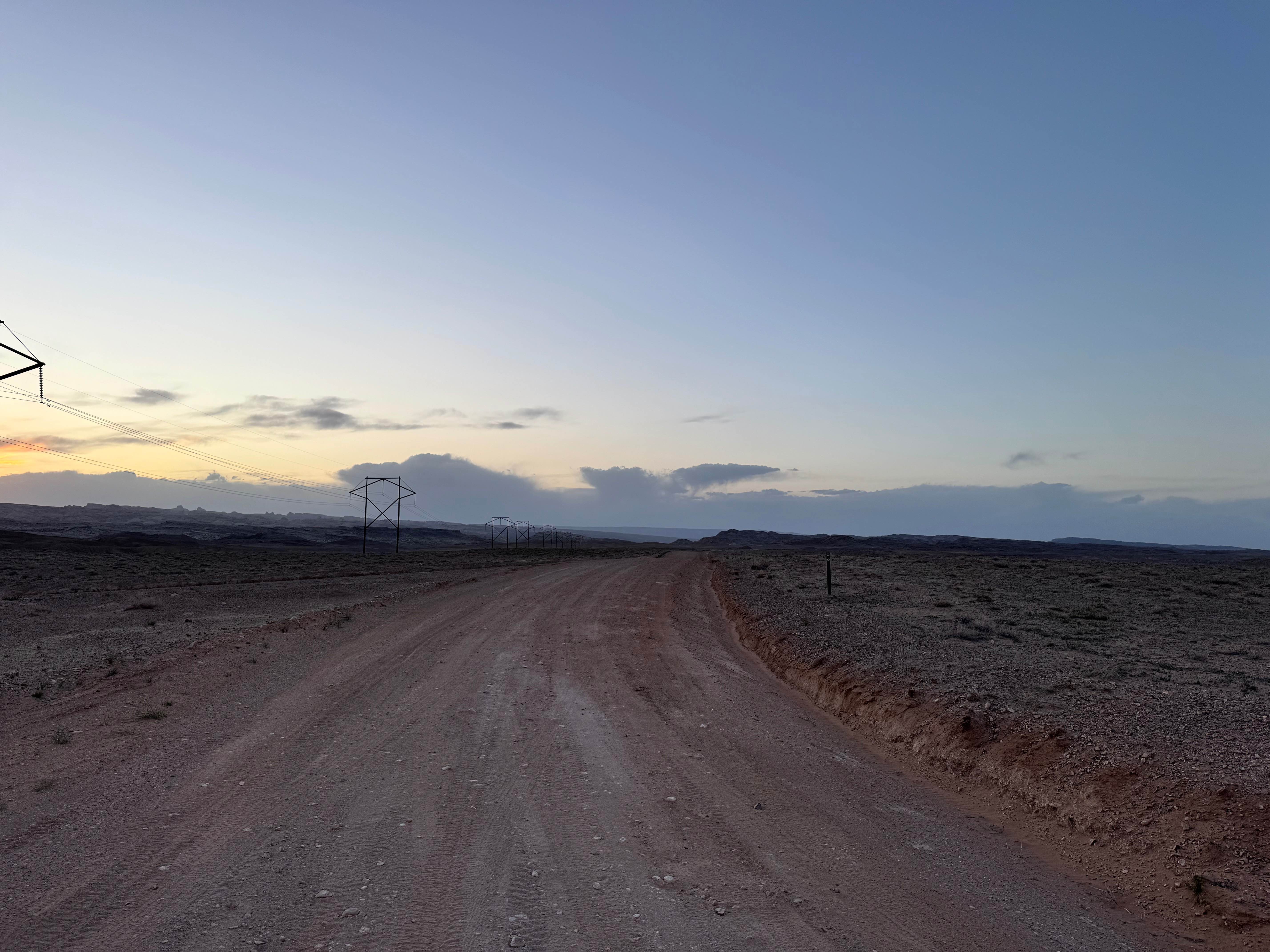
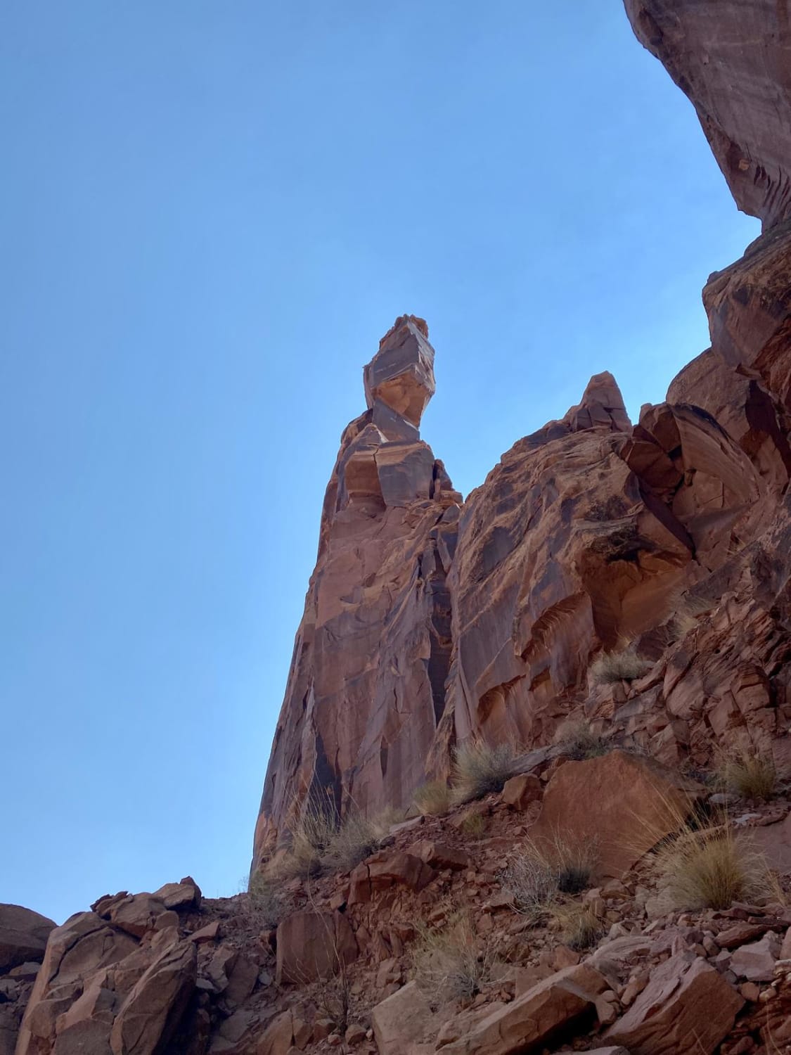
Bullion Falls Access is also called Miners Park Access on the BLM /Forest Service maps. Another name for it is Bullion Canyon Road. But the best part of this trail is the access you get to the Bullion Falls Hiking Trail. Just a short .13 miles beyond the end of this trail you get a wonderful view of the falls. The trail is very narrow...if you meet another SXS, someone is going to have to back up. A quad and SXS will be able to pass in some areas. You do cross a creek running down off of Copper Belt Peak in the Fishtail National Forest, but we rode it in early June and the creek was crossable on foot or in our SXS. There are hikers on this road too, so be careful of them. Once you reach the trailhead, at just over 8230 feet, there is a small parking area. Max of 5 SXSs could fit there, with barely enough room to turn around. Park there and hike the .13 miles to the Falls overlook. There are longer hikes, too, for the truly adventurous. From the overlook area down to the falls is a steep, muddy slope. You don't have to do that part of the trail to get the view. On the trail, you pass by another waterfall on your left, across the valley. In February of 2023, Utah began enforcement of a new law, which requires an online education course for all off-roaders. The free course is available online. Google "Utah OHV Education Course," and the free test will pop up. It's an easy test that will only take 15-30 minutes, and it's required for all off-roaders, Jeeps, SXSs, dirt bikes, and ATVs. Kids under the age of 18 will have to take the Youth Education Test at the same site. After completing the test, print out the certificate to carry with you which shows you completed the course. We have taken it, and it's really no big deal. Good reminders about trail etiquette and trail preservation.
Photos of Bullion Falls Access
Difficulty
The trail is narrow, there are a couple of sharp U-turns, and there is an area where you cross a rock slide and one water crossing. Very little off-camber and no obstacles other than the water crossing.
History
The Paiute Trail System was formed by connecting old roads and trails crossing the Fishlake National Forest with intervening BLM-administered lands. A few sections of the trail were constructed to complete the loop. The main trail is 275 miles long, with over 1000 miles of marked side trails and 1500+ estimated miles of forest side roads and trails.
Status Reports
Bullion Falls Access can be accessed by the following ride types:
- High-Clearance 4x4
- SxS (60")
- ATV (50")
- Dirt Bike
Bullion Falls Access Map
Popular Trails
Big Park Lake Park #212
Pot Hollow (2037)
Smith Camp Road
The onX Offroad Difference
onX Offroad combines trail photos, descriptions, difficulty ratings, width restrictions, seasonality, and more in a user-friendly interface. Available on all devices, with offline access and full compatibility with CarPlay and Android Auto. Discover what you’re missing today!